
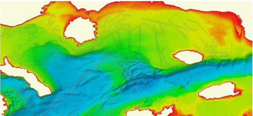
NEW version of European Bathymetry Digital Terrain Model out now!
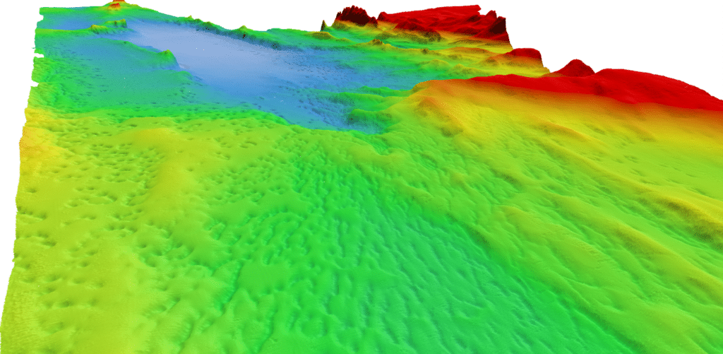
The European Marine Observation and Data Network (EMODnet) High Resolution Seabed Mapping Project, which has been running since 2009, has released an update of its Digital Terrain Model (DTM), which now includes greater coverage across European Seas and beyond.
“We are releasing the EMODnet Bathymetry 2020 DTM product, at the dawn of the United Nations Decade of Ocean Science for sustainable development, as a clear proof of the European contribution to the world seabed mapping effort. With this upgraded version of the EMODnet Bathymetry DTM, we allow users to have an easy and free access to high quality bathymetric data which can drastically improve their work.”, declared Thierry Schmitt from SHOM (Service Hydrographique et Océanographique de la Marine).
The EMODnet Bathymetry portal aims to provide a single access point to bathymetric products, Digital Terrain Models (DTM) and data (survey data sets and composite DTM).
OceanWise is a full partner in EMODnet and is proud to lead the UK contribution on this auspicious project. OceanWise’s role is to process large volumes of sometimes overlapping hydrographic survey data from a variety of sources and to create a seamless seabed or bathymetric surface, or DTM, of the whole of the UK Continental Shelf. A high-resolution version of the DTM is included in the OceanWise Marine Themes Marine Mapping data product and Web Map Tile Services (WMTS), while a sub-sampled lower resolution version is submitted to EMODnet for inclusion in the European Seas DTM which then also contributes to GEBCO and the Seabed 2030 project. Other partners in EMODnet adopt a similar approach. As well as the DTM, OceanWise processes and corrects large volumes of metadata and outputs this in a format compatible with the SeaDataNet project. The metadata is linked to the DTM, so the source or provenance of the data is always apparent and maintained.
For more information visit: www.oceanwise.eu/news.

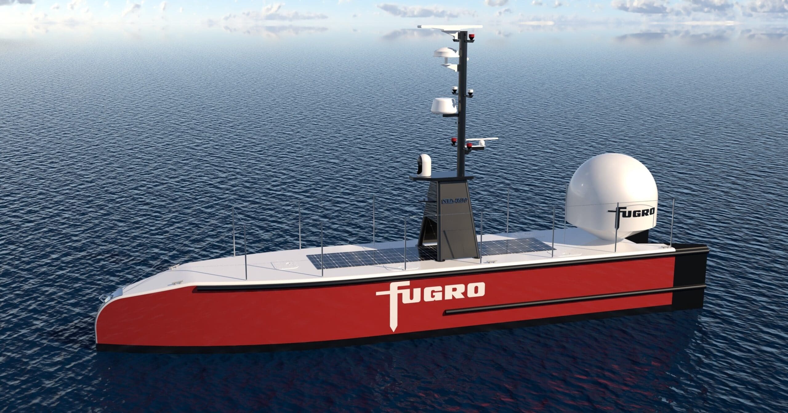
Fugro selects Sonardyne for its uncrewed vessel operations
Leading geo-data specialist Fugro has chosen underwater positioning and communications technology from Sonardyne to support its global fleet of uncrewed surface vessels (USVs) and remotely operated vehicles (ROVs). Fugro will integrate Sonardyne’s Mini-Ranger 2 Ultra-Short BaseLine (USBL) positioning system, configured with the company’s Marine Robotics software extension pack, into its new 12 m-long Blue Essence USV, of which the first vessel will be delivered to Fugro’s base in Perth in February.
Mini-Ranger 2 with the enabled Marine Robotics pack will enable the Blue Essence to be used to deploy, track, command and control the Blue Volta electric remotely operated vehicles (eROVs) and autonomous underwater vehicles (AUVs) as part of inspection, survey and data harvesting projects, all controlled from Fugro’s onshore remote operations centres.
Mini-Ranger 2 is ideal for use from small vessels, including USVs, where survey-grade positioning performance is required. It can simultaneously track 10 targets at very fast update rates, is quick to install and has a standard operating range of 995 m, extendable to 4000 m. Sonardyne’s Marine Robotics software pack unlocks valuable additional capability when used with a compatible subsea vehicle mounted instrument such as AvTrak 6. This includes secure data exchange and remote control of multiple AUVs deployed in swarm scenarios.
For more information visit: www.sonardyne.com

GeoAcoustics Ltd expanded their dealer network for Canada and North America
GeoAcoustics Ltd, the UK based manufacturer of side-scan, bathymetry and sub-bottom profiling systems have recently expanded their dealer network for Canada and North America through the appointment of Canadian based Dasco Equipment Inc and US based Telestra Technologies.

Dasco Equipment Inc based in Charlottetown, Canada have a 30 year track record in the supply of hydrographic instrumentation and will be able to represent GeoAcoustics’ product from their bases in both East and West Canada.
Telestra Technologies based in Katy, Texas are an established marine solutions provider with 4 locations across the US.
For more information visit: www.geoacoustics.com
IIC Technologies and XOCEAN Deliver Ground-breaking Survey of Lake Superior Seabed for the Canadian Hydrographic Service
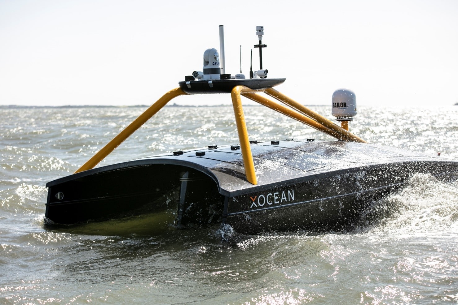
In a substantial move forward for the Canadian marine industry, two XOCEAN Uncrewed Surface Vessels (USVs), remotely controlled via satellite, took to Lake Superior this winter to undertake pioneering survey work for the Canadian Hydrographic Service (CHS) in partnership with IIC Technologies.
The project marks the first time that USV technology was used to gather bathymetry data in inland waters in Canada.
CHS contracted IIC Technologies to acquire a high-resolution seabed survey in water depths up to 200m, of over 800km2 off Thunder Bay, Ontario, using USV technology. IIC partnered with XOCEAN, who provided and remotely operated their XO-450 USVs from XOCEAN’s Control Centres in the UK and Ireland, while IIC provided the Party Chief, shore-based data processing, and logistical support.
The uncrewed vessels are around the size of an average car (4.5 metres) and half the weight (750kg) and are remotely monitored and controlled 24/7 via a satellite connection by a team that can be located anywhere in the world. XOCEAN’s USVs offer significant benefits including increased safety with operators remaining onshore, survey efficiency due to multiple-day mission 24/7 operations, drastically reduced local resourcing requirements, and carbon-neutral operations which together lead to significant economic savings.
Throughout the mission, a team combining IIC Technologies Hydrographers and Data Processors and XOCEAN USV Pilots and Surveyors remotely monitored the USVs to ensure safe operation of the vessels and quality of data acquisition. The success of this project demonstrates the highly flexible and collaborative nature of this new technology, enabling industry experts to have direct access to real time data, from any location. Given ongoing COVID-19 restrictions, XOCEAN continues to prove the resiliency of its operations by partnering with experts, such as IIC Technologies, who also performed an active support role on site with the USVs while in Thunder Bay.
Dave Bazowsky, Engineering Project Supervisor, said: “CHS wanted to evaluate the operational readiness of a commercial off-the-shelf autonomous technology in a real working environment. The area chosen in northern Lake Superior lies within a Secondary Low Impact Shipping Corridor and the world’s largest freshwater National Marine Conservation Area. It was also selected to simulate an analogous working environment one may expect in the Canadian Arctic. The IHO S-44 Order 1A data collected in this area will be used to update navigational publications used to facilitate safe and efficient navigation and will also contribute to the Blue Economy in general.”
John Conyon, Director of Hydrographic Operations, said: “The cooperation and flexibility shown by XOCEAN and CHS were key to successfully performing this project in very challenging late fall conditions in northern Lake Superior. The XOCEAN ASV’s performed well through storms and sea ice, providing a stable platform that enabled the acquisition of high-quality bathymetric data that meets CHS stringent requirements”
Commenting on the project, James Ives, CEO of XOCEAN said: “Our USV platform has demonstrated itself to be a safe, reliable and carbon neutral solution for the collection of ocean data. We are delighted to be working with IIC Technologies on this ground-breaking project delivering data for the Canadian Hydrographic Service.”
For more information visit: www.xocean.com
Greensea Receives US NAVY Award to Advance Standoff Command and Control
Greensea's open architecture technology on Remotely Operated Vehicles furthered by Small Business Innovation Research Phase II grant
Greensea Systems, Inc. creator of OPENSEA®, the open architecture robotics platform for the marine industry, is pleased to announce the award of a Phase II Small Business Innovation Research (SBIR) ASAP grant totaling $1,100,000, with option for additional funding, for the continued development of Standoff Command and Control of Remotely Operated Vehicles (ROVs). This project has been funded in whole or in part with Federal funds from the Naval Air Warfare Center Aircraft Division, under Contract No. N6833521C0113.
The Phase II award will further the development of Greensea's long range standoff command and control system for ROVs towards providing the US Navy a capability of conducting water-borne Explosive Ordnance Disposal operations with marine robotics from a safe standoff distance. The standoff system is hardware, transmission, and vehicle agnostic and provides high levels of autonomy for the ROV as well as the coordination of launch and recovery, vehicle tether, and host USV platform. Greensea's long range standoff system leverages almost 15 years of developing supervised autonomy systems for ROVs and by virtue of being built on OPENSEA, is entirely open architecture. Commercial applications of this technology include operating highly integrated ROVs and robotic systems from Unmanned Surface Vessels by operators located anywhere in the world.
Ben Kinnaman, CEO of Greensea, is the Principal Investigator of this Phase II SBIR award. “The long range standoff command and control of ROVs is the single best solution to keep the warfighter safe by getting them as far as possible from a subsea threat,” notes Kinnaman. Peter Kerson, Program Manager for EOD Technologies at Greensea, adds “standoff command and control will dramatically increase flexibility and maneuverability of maritime expeditionary EOD forces, and that same flexibility will be invaluable to industry users who want to centralize ROV operations, reduce personnel who have to go to sea, and migrate to fully unmanned offshore services.”
While the technology is being developed for the military, Greensea is working with leading marine industry companies on commercialized variants of the technology. Greensea's technology will directly address the shortage of offshore personnel for ROV operations including near-term shortages associated with the COVID pandemic.
For more information visit www.greensea.com

HR Wallingford launches new virtual Dredging Management course
The HR Wallingford new virtual dredging management course will be delivered live over four days in February. This new online format has been developed from their successful two-day classroom course, and will provide an overview of the environmental aspects of dredging, the latest technology and equipment, and the management of dredged material and dredging projects.
The course is aimed at those who are responsible for commissioning and managing dredging contracts and those who regulate dredging. It has been designed by their industry experts and will deliver 16 hours of live lectures and exercises (via MS Teams) on 11, 12, 15 and 16 February. The three course tutors for this training have excellent technical and practical knowledge, 50 years of combined experience in the dredging market, and have been involved in many commercial and research projects of international significance.
Further details on the course content can be found at http://bit.ly/OnlineDredgingCourse, or you can contact HR Wallingford at [email protected].
Registration is now open at http://bit.ly/OnlineDredgingCourse.
The course fee per delegate is £395.00 (excluding VAT).

Teledyne Marine Announces New Upgraded Universal Topside System
Teledyne Benthos is pleased to announce the availability of its new UTS-9500 Universal Topside System used to communicate with and command their full line of acoustic modems and releases. The UTS-9500 offers customers a CE marked, enhanced replacement to the UTS-9400 unit. The updated portable topside delivers a highly intuitive and flexible Graphical User Interface (GUI) that removes the need for an additional laptop, something particularly useful for deployments from RHIBs or smaller vessels. The redesigned UTS-9500 is also lighter than its predecessor, adding to the system portability, and features new rechargeable lithium ion battery technology that will lessen required maintenance cycles. Other new features include enhanced corrosion resistance, improved system safety, and an enhanced communication port.
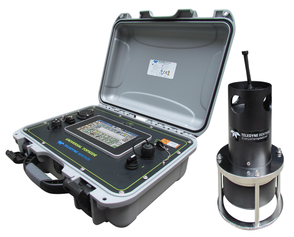
As with the UTS-9400, the UTS-9500 also offers optional GNSS functionality, allowing users to survey in their mooring without the need for an external PC. This saves valuable time and money by allowing the user to precisely calculate and record where their acoustic release and/or modem is deployed for fast and easy detection and recovery using a minimal set of hardware. For more information on the UTS-9500, visit: www.teledynemarine.com/UTS-9500
Aleron Group Announce Strategic Organisation Restructure to enhance Client Offerings
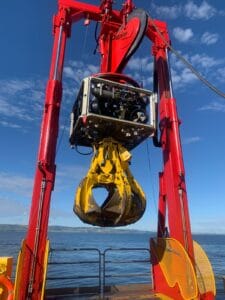
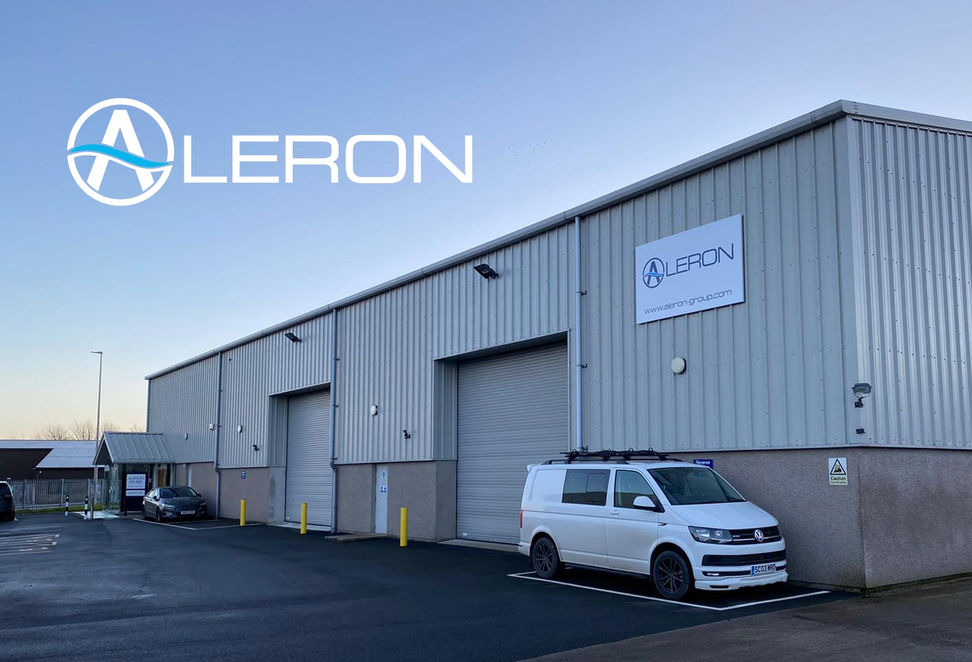
Aleron Group have announced a high-level organisation restructure to align with their strategic growth plans to consolidate product and service offerings to their global clients. The Aleron Group consisting of individual entities, Aleron Subsea and ROVQUIP, will now formally be recognised as the single entity of Aleron Limited.
The division of Aleron Subsea was originally established in 2009 and founded on decades of experience in Remote Operated Vehicles. Aleron Subsea design and manufacture flexible ROV systems including AUXROV, TRACKROV and most recently MultiROV. Joining the group in 2014, ROVQUIP, provided the complimentary service of custom and standard subsea tooling for either purchase or rental globally, as well as expert knowledge in concept design.
Gary McConnell, Commercial Director, Aleron, said “Combining the decades of experience housed with these brands will strengthen the Aleron packaged solutions, as well as bringing increased efficiencies to our clients by being able to contract with one entity, Aleron Limited”.
The Aleron restructure follows their recent expansion to an enhanced new facility in Aberdeenshire. Dedicated to their company mission, Aleron will continue to challenge conventional thinking, offering their clients responsive, efficient and bespoke specialised ROV solutions globally.
For further information on Aleron Limited’s products and services, visit www.aleron-group.com or email [email protected].

Fugro are recruiting a Hydrographic Surveyor
Fugro are recruiting for a Hydrographic Surveyor to join their leading geophysical survey department based in Portchester.
As a Hydrographic Surveyor, you’ll be responsible for processing hydrographic data, working with teams in the field and Project Surveyors to deliver industry-leading data to clients.
It’s an excellent opportunity gaining exposure to projects, working in a range of markets (including renewables, UXO, pipeline inspection) and processing different hydrographic data types. The role combines time at the office and offshore on Fugro vessels.
This job is for you if:
- You want to work in an innovative environment with the latest equipment and software;
- You want to be part of some of the largest offshore engineering projects in the world
- You want to work in a dynamic and ambitious team with opportunities to develop.
Typical Week:
- Processing, interpreting and reporting of hydrographic data
- Delivering high quality data at all phases throughout the project life cycle
- Leading and assisting vessel mobilisations and demobilisations where required;
- Undertaking offshore survey operations, including offshore processing, assisting with back-deck operations, undertaking data coverage checks and creating infill lineplans.
Essential
- A qualification in hydrography, ocean science or closely related subject;
- Analytical mindset, shown by experience in data management, data processing and/or programming;
- Good verbal/written English language skills;
- Working under pressure to tight deadlines;
- High attention to detail, quality and safety.
Desirable
- Experience of industry-standard hydrographic processing software, such as Teledyne CARIS, Fugro Starfix or Applanix POSPac;
- Offshore/practical experience in oil/gas, ocean science, renewables and/or survey industries;
- Able to work offshore for periods of up to 4 weeks.
Fugro are the world’s leading, independent provider of geo-intelligence and asset integrity solutions for large constructions, infrastructure and natural resources. We employ approximately 9,500 employees in 61 countries.
Benefits include; competitive salary accompanied by an attractive package - including contributory pension, life assurance, 24 days annual leave and PM insurance.
To apply visit: www.fugro.com/careers
Using innovative acoustic technology to prepare for the America’s Cup
INEOS TEAM UK needed accurate measurements of speed through water while training for the America’s Cup in waters with complex current flows. How did Nortek’s acoustic Doppler instrumentation meet their stringent demands for high performance?
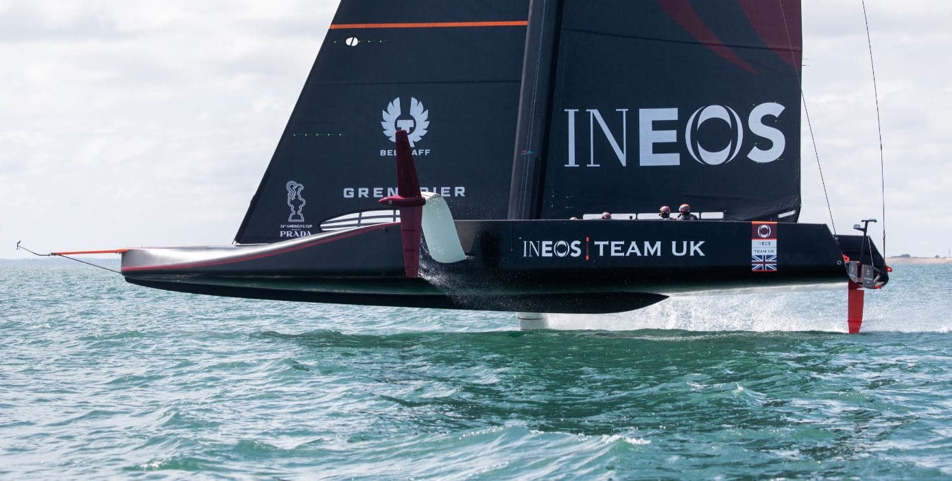
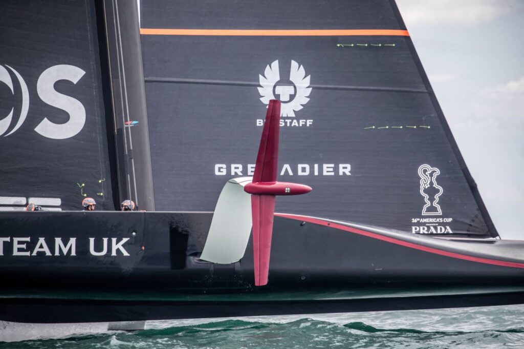
INEOS TEAM UK was formed to challenge for the 36th America’s Cup, to be held in New Zealand in 2021. They will compete in their new AC75 yacht named Britannia, a foiling monohull that flies over water on T-foils at speeds up to or exceeding 50 knots.
The team represent the Royal Yacht Squadron, one of the most prestigious yacht clubs in the world, and are based out of Portsmouth on the south coast of Britain, using the Solent as their training waters.
“The Solent’s reputation as a venue for sailboat racing is well-known. Its strong tides and complex geography and wind patterns make it an interesting and fun place to race,” says INEOS TEAM UK’s Technology Coordinator, Mark Chisnell.
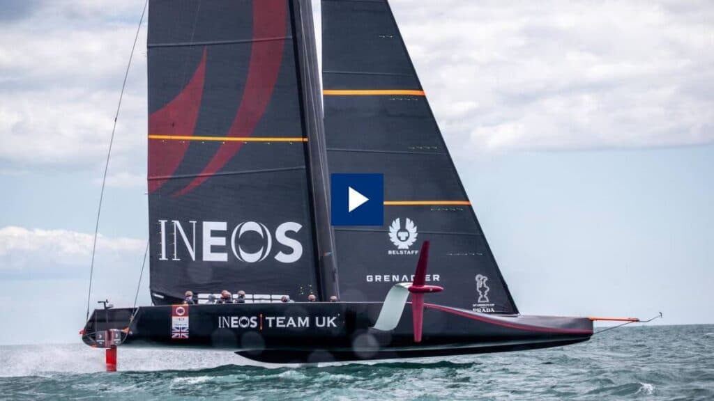
Watch video: Using innovative ocean technology to prepare for the America’s Cup
“Unfortunately, these conditions can make it a tricky venue for testing America’s Cup yachts, as satnav cannot be relied on for accurate performance information because it only measures motion relative to the seabed. The complex and ever-changing tidal current flows of the Solent add an unknown vector into the data that makes it difficult to accurately measure the yacht’s true speed.”
Measuring speed through water
The tide can flow at speeds in excess of four knots in some areas of the Solent, and if not measured correctly could potentially introduce a significant error in the test data.
“We try to sail in areas with weaker tidal flow to mitigate the error from satnav speed measurements,” adds Chisnell. “And we have tidal charts to help us work out the current rate in the test areas, but measuring the boat’s speed through water will give us much less potential error in the data.”
Finding the solution
The team needed to measure velocity through water very accurately. The team’s review of the market led them to oceanographic instrumentation specialist Nortek, who have had great success with their technologically advanced and accurate Doppler Velocity Logs (DVLs) for subsea navigation. These sensors use an acoustic Doppler measurement to estimate velocity relative to the water column.
“We knew that the Nortek DVL had been used successfully in ocean racing, involving high-performance monohulls that could reach 30 knots. So while the DVL was intended for the slow speed and high accuracy demands of subsea navigation, there was evidence that the sensor might cope with the speeds of the AC75,” says Chisnell.
Integrating a cutting-edge acoustic speed log
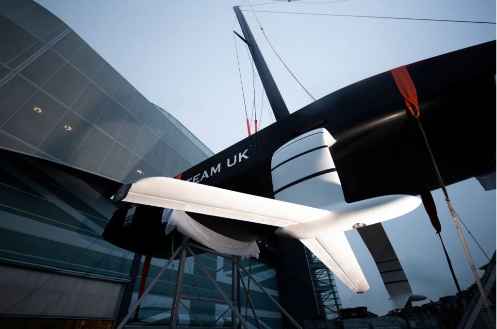
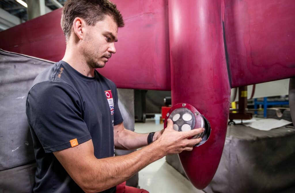
The solution was to mount a tailor-made Doppler speed log from Nortek inside the bulbs of each of Britannia’s T-shaped foils, with a flooded chamber sealing the space and forming a smooth interface with the external face of the bulb. This provides very accurate speed through water measurements without affecting performance.
“We recessed the speed log into the bulb, which was flooded. It was then covered with a piece of acoustically neutral plastic, a polycarbonate plate. This achieved the two goals of an unbroken (or measurable) acoustic path from the transducer into the water column, while maintaining a very smooth and efficient underside to the bulb,” explains Chisnell.
“We’re very happy to have had Nortek as a partner in this project. Nortek’s Doppler speed log is an impressive technical achievement. Having accurate knowledge of the inflow vector to the lifting foils has given the team new insights into the boat’s dynamic behavior and performance,” says Nick Holroyd, Chief Designer, INEOS TEAM UK.
Building on a tradition of marine problem-solving
Nortek has a long tradition of solving technically challenging problems in the marine environment.
“INEOS TEAM UK approached Nortek knowing that we had been down a similar path before. However, the challenge presented was to measure speed through water accurately from a foiling sailing machine – something that has not been done before now,” says Torstein Pedersen, Development Engineer at Nortek.
The success of this solution was very much cooperative: Nortek provided the modified electronics and operational advice, while the INEOS TEAM UK technical team ensured an optimized installation in the foil.
“We are familiar with an iterative process for these custom solutions, but in this instance I think we were all surprised how well it worked right out of the gate. When we now watch Britannia tearing across the ocean surface, balanced merely on its foils, it is hard to believe that there is a little speed log just below the surface pinging away and answering questions,” Pedersen adds.
Contacts for further information: www.ineosteamuk.com