

KVH Partners with GreenSteam for KVH WatchMaritime IoT Solution
KVH Industries, Inc., (Nasdaq: KVHI), announced today that GreenSteam, developers of vessel performance optimization solutions for a sustainable shipping industry, has joined the KVH Watch® Solution Partner program and will offer the KVH Watch service as part of its enhanced performance platform for improved data mobility. KVH Watch’s dedicated connectivity will support GreenSteam’s core services, facilitating the movement of data from vessels to shore-based analysts more frequently and reliably in real-time. This will enable customers to better understand the factors leading to fuel wastage and develop more effective sustainability optimization strategies, ultimately reducing costs.
“The lifeblood of GreenSteam is data volume, however, without the ability to move this data off a ship in a timely manner to enable rapid assessments and responses, its impact is lessened,” says Daniel Slater, head of business development at GreenSteam. “As vessels are becoming increasingly sophisticated data generators, this partnership with KVH Watch will enable us to benefit from significant advances in satellite communications by improving the flow of information. This in turn will support shipowners and charterers to make better operational decisions, saving time and money, while reducing emissions.”
“This is an excellent opportunity for the maritime sector to capitalize on the exceptional gains made in satellite communications and performance optimization technology in recent years,” says Sven Brooks, senior director of IoT business development for KVH. “The combination of our Watch HTS connectivity with GreenSteam’s machine learning solutions can result in operational efficiencies, cost savings, and increased sustainability for fleets. This represents one more way that shipping is benefitting from digitalization.”
Digitalization is proving to be a transformative tool for the maritime industry, but with the sector now evolving beyond the data collection stage, attention is turning to the management, storage, and transfer of the data generated. Without real-time data flow from the vessel, machine-learning solutions must rely on incremental data transfers, therefore limiting the accuracy and confidence of the IoT analysis and prediction. With dedicated satellite connectivity, shipowners can capitalize on real-time data analysis to support vessel optimization throughout the course of a sea voyage.
KVH Watch is an IoT Connectivity as a Service solution that provides Flow, secure 24/7/365 machine-to-cloud satellite connectivity for remote monitoring of onboard equipment plus the ability to perform on-demand Remote Expert Interventions using video, voice, or text via KVH’s global HTS network. KVH Watch is designed for maritime system optimization providers such as GreenSteam, maritime equipment manufacturers, multicard service providers, and shipyards seeking affordable monthly subscription-based connectivity that L-band and cellular services cannot deliver at deep sea.
KVH is a mobile tech innovator that provides connectivity solutions for commercial maritime, leisure marine, and land mobile applications on vessels and vehicles, including the award-winning TracPhone® and TracVision® product lines, the global mini-VSAT Broadbandsm network, KVH Watch maritime IoT solutions, and AgilePlans® Connectivity as a Service (CaaS). The company’s KVH Media Group provides news, sports, and entertainment content with such brands as NEWSlink™ and SPORTSlink™.
For more information, please visit kvh.com/watch

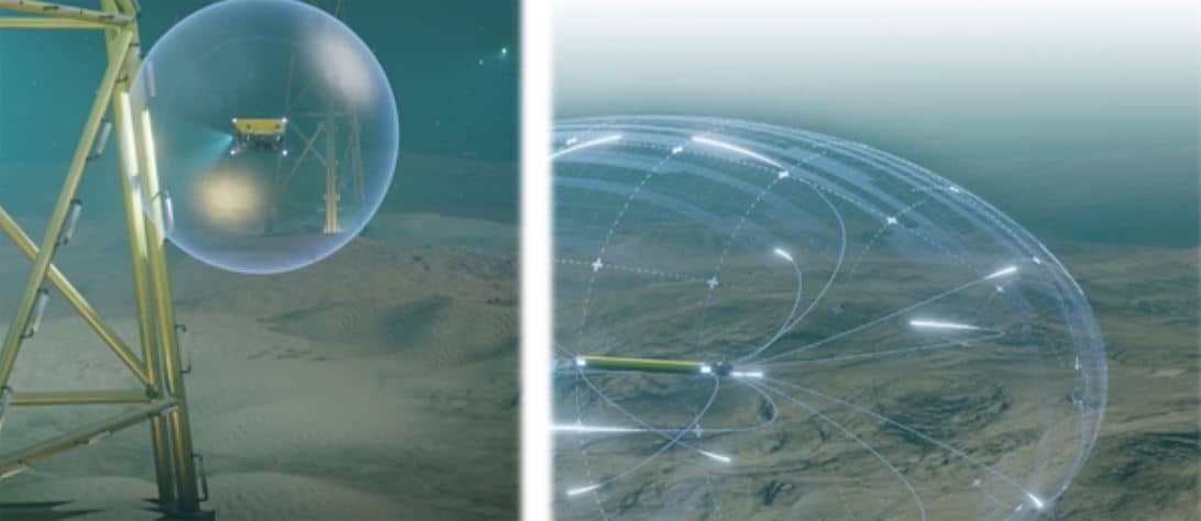
ELWAVE breakthrough “electric sense” perception technology for underwater vehicles
ELWAVE secures 2 million euros funding to commercialize its breakthrough “electric sense” perception technology for underwater vehicles, drones and robotics.
With its patented “electric sense” technology, manufacturers and operators of underwater and industrial robots can access a unique real-time 360° detection sensor to improve safety and productivity of their operations.
ELWAVE, an industrial designer and manufacturer of innovative electromagnetics sensors for the underwater and industrial robotics, announced today that it has completed its first capital raise. The funds will support the company’s global growth ambition, industrialization and commercialization of its first products for underwater robotics.
The funding round was led by SOFIMAC Innovation with co-investors Litto Invest Fund and Atlantique Vendée Innovation Fund. Bpifrance and banks have completed this capital raise with other financial supports. This equity financing comes as ELWAVE scales to meet strong demand in the underwater robotics, especially for wind offshore market and underwater autonomous vehicles (AUVs).
ELWAVE was founded in 2018 to valorize more than 10 years of top-level academic research on the « electric sense » technology from the Biorobotic Laboratory of Institut Mines Telecom Atlantique. Electric sense (or active electrolocation) is an electromagnetic perception mode used by tropical fishes living in muddy and cluttered waters in which vision and acoustic perception are inefficient.
Based on this biomimetics approach, ELWAVE solution is the only one to provide a real-time 360° perception for underwater and industrial robots, either remotely piloted and autonomous ones. ELWAVE technology can detect, locate and characterize (shape, size, metallic or non-metallic) any type of objects in simple and complex environments. ELWAVE will develop dedicated and market focus solutions. ELWAVE is especially completing a solution for the tracking of buried objects in underwater sediments such as cables, pipelines or mines.
Providing unmatched performances by other classic acoustic and magnetic technologies, ELWAVE currently works with leading underwater robotics companies such as TOTAL, SAIPEM, SUBSEA7, IXBLUE, NAVAL GROUP and others for the development of its solutions and their implementation on client's vehicles.
The financing will enable ELWAVE to industrialize and commercialize its first products and to pursue its developments in electronics and artificial intelligence. Shallow water applications, such as wind offshore cables inspection, UxO detection (unexploded mines from World War I and II) and ROV/AUV navigation
are first targeted.
“We are thrilled by the support of ambitious, successful investors who see the disruptive potential of electric sense technology to increase safety and productivity of operations in high-growth markets such as offshore wind” says Pierre Tuffigo, CEO and founder of ELWAVE.
For more information, please visit www.elwave.com

WHOI Appoints Douglas C. Webb as Oceanographer Emeritus
Teledyne Marine is delighted to announce the appointment of Douglas C. Webb, founder of Teledyne Webb Research, as Oceanographer Emeritus at the Woods Hole Oceanographic Institution effective January 1, 2021. This peer appointed honorary position has been bestowed upon Doug Webb in recognition of his contributions to WHOI and to oceanographic science and engineering world-over.
When asked about the appointment, Dr. Richard Murray, Deputy Director and Vice President for Research at Woods Hole Oceanographic Institution commented, “Throughout his career, Doug Webb elegantly crossed and merged the boundaries of science and technology, all the while setting a terrific example of how to be farsighted to the future while also getting whatever is before him simply “done”. It is a true honor for Woods Hole Oceanographic Institution to grant him this honorary and esteemed appointment.”
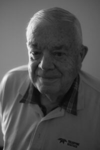 Although always quick to acknowledge the contributions of others, Doug is a gifted engineer and inventor whose pioneering work can be credited for fundamentally changing the way in which scientists are now able to observe the interior of the oceans. From his graduate work at Manchester University, where he demonstrated the first prototype transistorized computer, Doug brought individual transistor technology with him to WHOI where he developed accurate timing for acoustically tracking langrangian floats (integrated circuits were not yet available). Throughout his career, Doug has been an early adopter of enabling technologies (i.e. silicon chips, ceramic transducers, satellite communications, GPS, etc.), and continually brought those technologies to bear to solve a set of problems that helped resolve ocean dynamics.
Doug recognized early on that one of the key hurdles facing the oceanographic community and data collection was the ocean’s grand scale and the limited size of the research fleet. He set out to develop and create a toolbox of long-endurance remote sensing platforms that would provide scientists with a better look into the world’s vastly under-sampled oceans. His innovative work includes low-frequency acoustic sound sources used for water mass tracking, long range navigation, and tomography (SOFAR, RAFOS, Tonpilz), Vertical Current Meters (VCMs) to measure water chimney convection, profiling floats (ALACE and APEX) that evolved into the ARGO program, and the genesis of ocean gliders (Slocum). The sound sources are still in use today for a variety of applications. The VCMs morphed into the floats with the added capability of electromagnetic probes (EM-APEX) for water velocity measurements that are now air deployed from C-130 planes. Over the last 20 years of the Argo program, the floats have made over 2 million ocean profiles, or four times as many profiles as all other ocean observing tools combined! The Slocum gliders, capable of crossing ocean basins with well over a year of endurance, are routinely being used to measure and monitor many facets of the ocean including biogeochemical properties, whale and penguin movements, and facilitating hurricane intensity predictions.
“I continue to have the good fortune of working alongside Doug through many shared adventures. Doug’s spark of inquisitiveness and creativity is contagious, and we strive to follow the advice that he gave to Rutgers students after the first Slocum glider Atlantic Ocean crossing – “Work hard, have fun, and change the world”” Clayton Jones, Senior Director of Technology, Teledyne Marine
For more information visit: www.teledynemarine.com
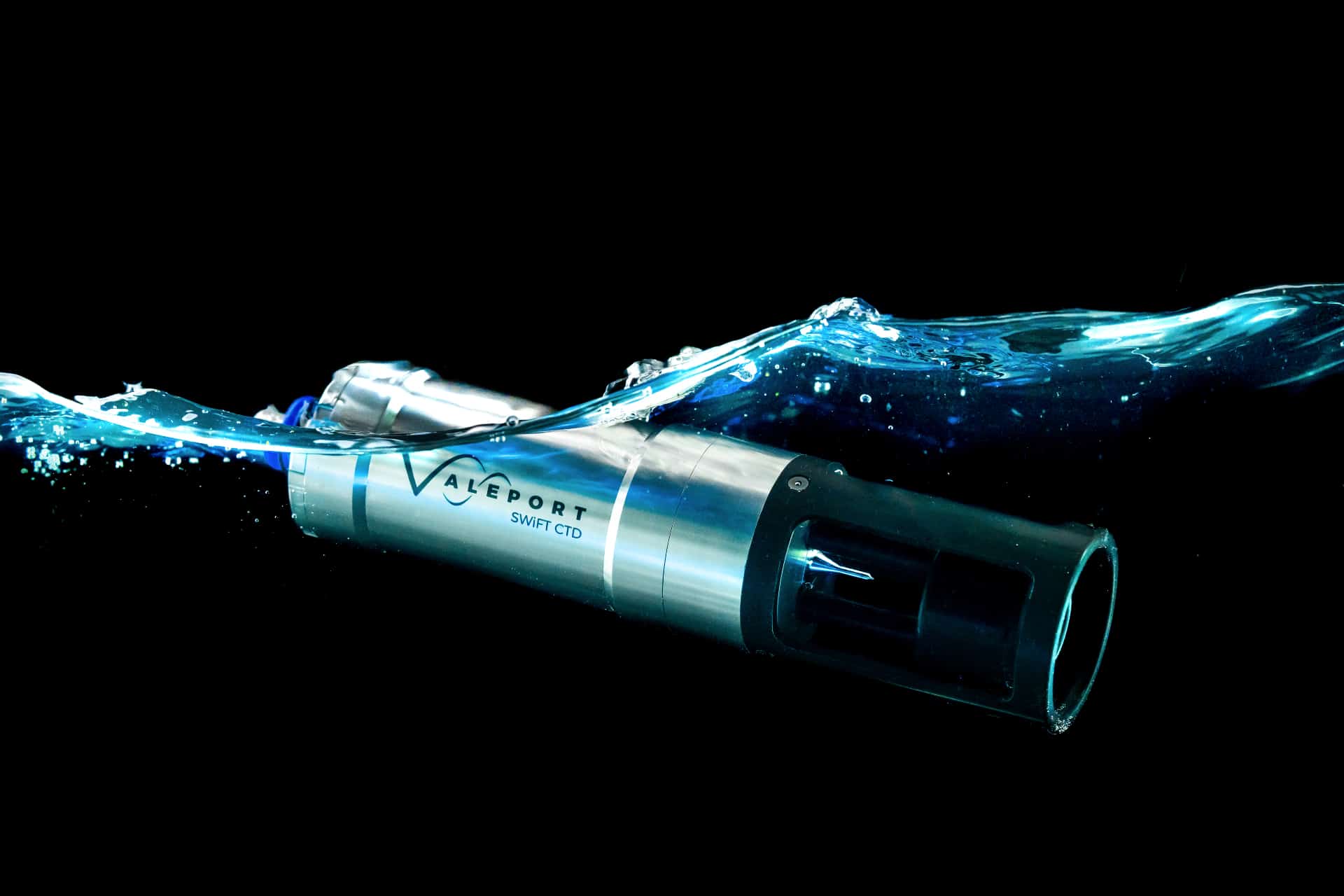
Valeport introduces new SWiFT CTD profiler
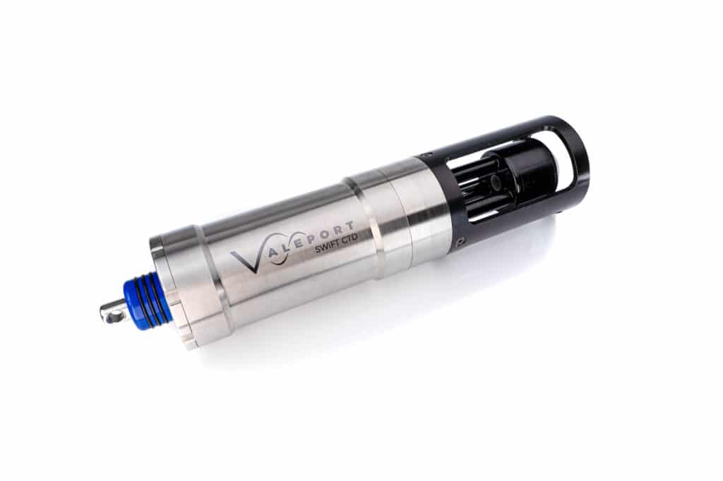
Designed with the intention of a seamless workflow, the new SWiFT CTD is the next generation of Valeport’s popular SWiFT profiler range and delivers enhanced accuracy and versatility for those requiring CTD measurements.
The SWiFT CTD profiler from Valeport, a leading oceanographic and hydrographic instrumentation manufacturer, provides survey-grade sensor technology coupled with the convenience of Bluetooth connectivity, rechargeable battery and an integral GPS module to geo-locate each profile.
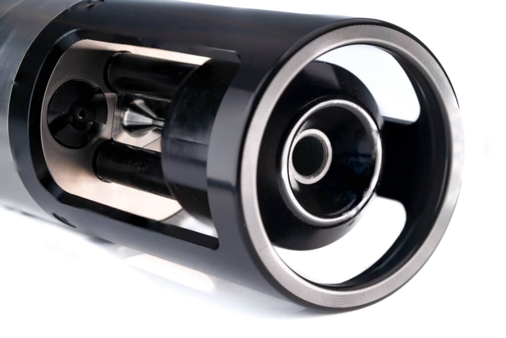
Using Valeport’s world-leading high accuracy sensor technology to combine sensors for multiple profiles in a single drop, the SWiFT CTD features a new fast response temperature probe and operates down to 500m as standard, delivering directly measured Conductivity, Temperature and Depth.
In addition to the directly measured CTD, computed Salinity, Density and Sound Velocity is calculated using the UNESCO international standard algorithm and the Chen and Millero equation. Data can be quickly and easily downloaded wirelessly, and uses Valeport’s new Ocean software for iOS, Android and PC platforms. Data can be instantly shared in industry standard data formats.
Ease of use is at the heart of the SWiFT range and the new SWiFT CTD not only makes any problematic battery changes a thing of the past and delivers fully automated data transfer with no user input required, it also features Valeport’s signature SWiFT magnetic switch ring. The switch ring is easy to operate even with cold hands, it simply turns through 90 degrees and reassuringly clicks into position. The end cap features user-friendly LED status indications for GPS, battery and communications.
With an operational battery life of up to five days and the convenience of charge via USB, the SWiFT CTD is intended for offshore, coastal, harbour and inland environmental and hydrographic survey use.
“Developed for those who need precise CTD data for scientific applications, this is the first time that measured CTD has been available with all the benefits of our SWiFT profiler; ease of use, Bluetooth connectivity, rechargeable battery and GPS. The new SWiFT CTD delivers the highest quality CTD profiles in a compact, robust and portable package.” commented Guy Frankland, Valeport head of marketing.
Constructed from titanium to provide unmatched durability, the CTD sensors are housed in a strong acetal sensor guard. An optional deployment cage is also available to bolt onto the instrument to help get the SWiFT CTD to depth in fast flowing currents.
The new SWiFT CTD is now available to order.
For more information contact: [email protected] or visit www.valeport.co.uk
SCS Ltd Supplies Heriot Watt University Location & Tracking Solutions For iAtlantic Deep-Sea Research Project
Subsea Commercial Services Ltd. (Aberdeen, Scotland) is delighted to have supplied Heriot Watt University (Edinburgh, Scotland) with a range of Xeos asset location, tracking and recovery beacons for deployment during the iAtlantic research programme.
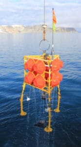
The Deep-Sea Ecology and Biogeochemistry Research Team located at the Lyell Centre at Heriot-Watt University will deploy the lithium battery powered solutions mounted to a seafloor autonomous lander. The lander will be released at the surface and will sink under its own weight to the seafloor. With deployments lasting up to one year, during a planned recovery, the lander will float back to the surface where the 11,000m rated titanium housed XMB-11K VHF location beacon will self-activate and start transmitting its location for tracking and recovery via the marine radio frequency. To aid in night-time recovery, the lander has also been fitted with a low light activated XMF-11K high intensity LED Flasher for visual confirmation.
In the event of an unplanned seafloor release and surfacing, the lander has also been fitted with the XMA-11K Argos satellite communication beacon. This transmits the lander’s location within 30 seconds of the beacon breaking through the water’s surface. With the research team alerted to the unplanned surfacing event, the nearest suitable vessel of opportunity can be tasked with asset recovery.

The iAtlantic programme is seeking to assess the health of deep-sea ecosystems across the full span of the Atlantic Ocean from the tip of Argentina in the south to Iceland in the north, and from the east coasts of USA and Brazil to the western margins of Europe and Africa. The ambitious project will – for the first time – undertake an ocean-wide approach to understanding the factors that control the distribution, stability and vulnerability of Atlantic deep-sea ecosystems. With the objective of determining the resilience of deep-sea animals and their habitats to threats such as climate change, pollution and human activities such as deep-sea mining and deep-sea trawling, the programme’s success is based upon international collaboration and sharing of expertise, equipment, infrastructure, data and personnel.
Programme co-lead and Head of Deep-Sea Ecology at Heriot-Watt, Professor Andrew K. Sweetman stated “We’re delighted to be using XEOS equipment supplied by Subsea Commercial Services Ltd that will aid in the recovery of our lander platforms. The Deep-Sea Ecology and Biogeochemistry research group at the Lyell Centre operate the largest and most advanced lander fleet in the UK and getting the equipment back from the deep sea is a key objective to us during each expedition. We currently have 13 deep-sea expeditions scheduled over the next 5 years and continue to use XEOS systems that we’ve always found are reliable, lightweight and more than capable of coping with the day-to-day stresses that we put on these systems."
For more information visit: www.subcomservices.com

OBIC (Southampton and Durham Universities) are recruiting a Instrumentation Software Engineer
Instrumentation Software Engineer
Apply your programming skills to cutting edge scientific research:
The Ocean-Bottom Instrumentation Consortium (http://www.obs.ac.uk), operated by Southampton and Durham Universities, designs, builds, and operates instruments on the seabed in the deep oceans. Our autonomous instruments are deployed for up to a year to record variation in water pressure, ground vibration, and electric or magnetic fields.
OBIC are looking for an enthusiastic and versatile software engineer to be based at the University of Southampton’s Waterfront Campus to help develop its next generation of seabed scientific equipment that will be deployed all over the world. Joining a small but highly skilled team of engineers, you will prototype, develop and test embedded firmware, as well as maintaining and improving a suite of data processing and visualisation code. This role would suit a programmer with a strong track record of development in C, who is enthusiastic about seeing their code go to production collecting unique datasets globally at the bottom of the Earth’s oceans. This post offers global travel and working at sea, providing the key data sets required by scientists working at the forefront to better understand planet Earth.
Informal enquiries can be made to Profs Tim Henstock ([email protected]) or Christine Peirce ([email protected])
For more information and to apply visit https://jobs.soton.ac.uk/Vacancy.aspx?ref=1325421HN
The deadline for applications is 27 January 2021.
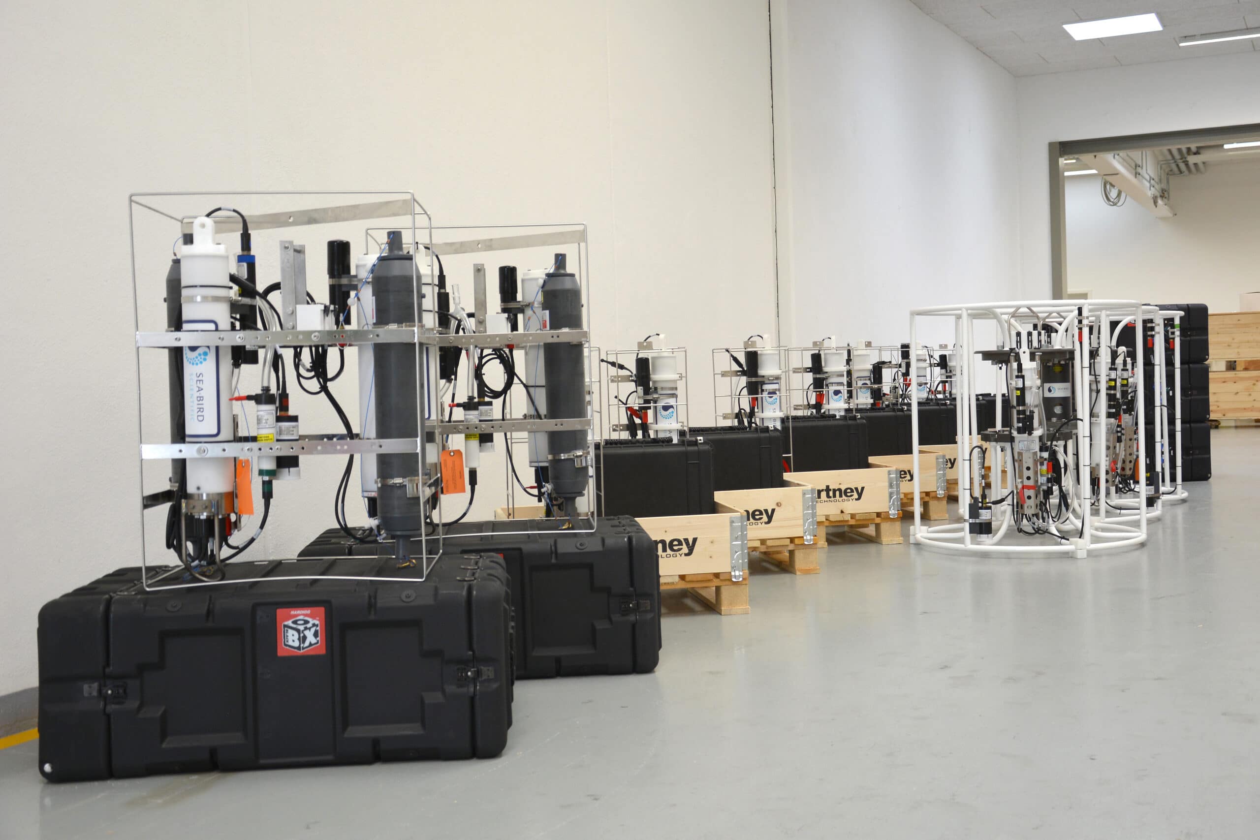
MacArtney Group supplies a 12-unit turnkey solution for the Danish Environmental Protection Agency
The solution - featuring three different water sampler configurations in dedicated frames - which will help the Danish Environmental Protection Agency (EPA) document marine conditions in Danish waters was made possible by MacArtney's skilled and professional workshop staff.
The solution comprises a high-tech toolkit for measuring Danish waters, enabling EPA's oceanographers to measure a full range of parameters:
-
- CTD – Conductivity, Temperature, Depth
- Fluorescence
- Yellow matter (CDOM)
- Dissolved oxygen
- PAR (Photosynthetically Active Radiation)
The CTD is one of the most commonly used tools in an oceanographer's armoury, providing detailed profile and time-series data on the measured parameters of conductivity, temperature and depth. Today's digital sampling techniques ensure a high level of accuracy, and the sample bottles are programmable for specific depths and intervals.
Each of the 12 units in MacArtney's solution presents marine scientists with real-time data and data logging. Any collected water specimens can be verified on-site or in laboratories later.
"It has been a tremendous pleasure to work with the Danish Environmental Protection Agency. Having such a professional and constructive partner involved in the process has enabled MacArtney to identify the right technical solution," explains Lars Jørgensen, Head of Product Management for MacArtney A/S. He continues: "Designing dedicated frames that allow single-user operations is part and parcel of MacArtney's philosophy of supplying safe-to-handle equipment that provides the client with stable and reliable data."
Full scope of supply
During the design process, time and cost-saving service procedures were carefully considered, and a running service/maintenance agreement is included.
The supply scope includes seven units with one all-electrical sensor, two units with two 4.5-litre Niskin water sample bottles, and three units on a specially customised Seabird 32 carousel water sampler frame. All 12 units can reach a maximum depth of 100 metres and feed data to MacArtney designed and produced topsides.
Furthermore, three are supplied with dedicated upwards and downwards-looking photosynthetically active radiation (PAR) sensors, which measure photosynthetic light levels in the water.
All the units are either deployable manually from small boats, such as rigid inflatable boats (RIB) or via a small winch or hand winch. Over half of the units can be operated by just one person, making them extremely practical and versatile.
Ingenious mounting solution
Usually, a Seabird 32 carousel water sampler frame carries 12 bottles but in this case, due to a higher mounting of the electronics – with two pipes instead of a frame – it only holds 10 bottles. This design's benefit is a reduced lifting height by 0.5 metres, meaning the carousel is still manageable on smaller boats with smaller winches. Moreover, the mounting solution saves time and money on the annual calibration, as just two hose clips need loosening to remove and reinsert the gear.
"Our skilled workshop team has been inventive in devising usable, practical solutions for both small vessels and larger ships. The mounting of the electronics on the carousel is, quite simply, a stroke of genius," concludes Lars Jørgensen.
For more information visit: www.macartney.com

Sales Manager for Teledyne CARIS and Optech in the Netherlands
Responsible for the further expansion of our market share in the Geospatial Technology world in close cooperation with the global team of outside and inside sales team members. The combination of new business development and expansion of the existing customer database makes this a versatile role with great opportunities for an eager and enthusiastic individual. Helping to ensure the market share and revenue growth of Teledyne CARIS and Optech products and services in the EMEA region.
Teledyne CARIS is the world’s leading developer of geospatial software for ocean mapping and marine information systems with its headquarters in Fredericton, Canada. We offer an integrated suite of software that specializes in processing sonar and LiDAR data, managing and analyzing large data sets, producing charts and maps, and serving data over the internet as well as other specialized needs. Teledyne Optech has been a world leader in the design, development and manufacture of advanced lidar instruments for 40 years. Teledyne Optech is widely recognized for its technological depth in lidar and related technologies.
Main tasks and responsibilities:
- Define and Act on the territorial Sales Development Plan by working with the regional sales teams at Teledyne CARIS and Teledyne Optech. Achieve the defined order and revenue targets through the sale of CARIS software products and services, and Optech Lidar and imaging sensor systems.
- Actively chase market data and define growth opportunities
- Advise on new product initiatives towards the Products and Development teams
- Together with the Regional Sales Manager define annual sales and marketing plans for your current and future customer database
- Acquire and qualify leads, seeking the right opportunities and pursue these
- Sales and product promotions at customers sites, at conferences/exhibition, on the phone or online
- Define cross- and upselling opportunities across the bigger Teledyne corporation
What will you bring on the table:
- Bachelor level degree or other degree in a Geomatics/Geography related area
- Proven experience in the hydrography and geomatics, with a solid understanding of sonars, lidar and survey methods
- Working knowledge of hydrographic survey and survey equipment an asset.
- Knowledge of Lidar and mobile mapping systems an asset
- Great networking skills and a genuine interest in our customer’s needs; understanding that value is different for every customer
- Existing sales experience, ideally with CRM experience, is preferred, but the willingness to sell and the desire to promote our solutions is key
- Great presentation and demonstrations skills; both for a small and a large audience
- Excellent organization and negotiation skills; knowing how to close the deal
- Fluency in English and preferably one other European language
Willingness to travel internationally. In periods for 25-50% of your time, including sales meeting/training visits to both Teledyne CARIS and Teledyne Optech offices throughout the year.
Apply here: www.teledyne.com/careers

McLane Announces Passing of Founder Dr. Sus Honjo
McLane Research Labs announces with great sorrow the passing of its founder, Dr. Susumu ‘Sus’ Honjo. He died peacefully at home on 23 December 2020 surrounded by his family. His pioneering work as a scientist at Woods Hole Oceanographic Institution (WHOI) contributed to the understanding and observations of marine particle compositions and fluxes and of the oceanic biological pump. Dr. Honjo was a 2019 recipient of the first ever WHOI Distinguished Emeritus Award for his lifetime achievements.
Along with his pioneering research in biogeochemical particle flux studies, Honjo also led the development of several notable oceanographic instruments over four decades including the sediment trap, moored profiler, and ice-tethered Arctic environmental buoys.
In 1983, McLane Research Laboratories Inc. in Falmouth, Massachusetts was founded to make his instruments commercially available to the global scientific community. Hundreds of the instruments he developed have been deployed in every ocean of the world, and remain a significant tool for biological pump studies today. The company continues to thrive and in 2017, McLane was awarded Massachusetts SBA Exporter of the Year.
Sus was as proud of the team he built at McLane as he was of his instruments’ contributions to science. His wife Kazuko ‘Kay’ Honjo was an integral part of the company from its early days in the Honjo’s garage. He would often credit Kay as McLane’s true driver of success. He was also thrilled when his daughter Dr. Yuki Honjo joined McLane as President and COO in 2009. For many years, Sus was a frequent presence at McLane where he would attend meetings, investigate new product developments, and chat with staff about everything from current events, to the Boston Red Sox, and staff’s hobbies.
He was active in education and training programs, supervising many graduate students in the MIT/WHOI Joint Program in Oceanography and Applied Ocean Science and Engineering and postdoctoral investigators. His greatest joy in his final days was reading the research of his former students and mentees and seeing their success.
Susumu Honjo was born in Japan in 1933 and received his formal education at Hokkaido University in Sapporo. He was one the first post WWII Japanese Fulbright scholars to the US at Kansas University. He was later a Post-Doctoral Fellow at Princeton University. From 1963 to 1970 he was Assistant and Associate Professor at Hokkaido University.
In 1970, he set down roots on Cape Cod by joining the Woods Hole Oceanographic Institution (WHOI) as an Associate Scientist. In 1982 he was promoted to WHOI Senior Scientist (holding the Institution’s Columbus O’Donnell Iselin Chair for Excellence in Oceanography from 1989 to 1994). As one of the first oceanographers to measure oceanic particle fluxes and examine mechanisms of particle transport, his work gave rise to the explosive research field of biogeochemical particle flux dynamics, linking biological particle production, chemical transformations, and sediment composition—with the ultimate goals of quantifying the delivery and sequestration of carbon in the deep-sea.
He was a founder of the International Joint Global Ocean Flux Study (JGOFS), an international collaborative research project established in 1983 to understand the ocean carbon cycle. Through his 15 years of leadership, the project collected data through sediment traps at sites in all the major ocean basins of the world.
His distinctions also included directing the establishment of a new ocean research institution in Mutsu City, Japan; serving as part-time Executive Director of the Japan Marine Science and Technology Center (JAMSTEC); and serving as Director of the Joint North Pacific Research Center at WHOI, a collaborative effort between Mutsu Institute of Oceanography of JAMSTEC and WHOI. In 2003 he was awarded the Imperial Order of the Rising Sun in Japan, for his research on the transfer of CO2 from the atmosphere to the ocean’s interior and for his efforts to strengthen Japan’s role in the international ocean science research community.
In 2014 he was elected a fellow of the American Geophysical Union (AGU). In 2018, he received an American Association for Advancement of Science Fellow award.
He is survived by Dr. Yuki Honjo, his daughter, her husband Jason Cullinane, and two cherished grandchildren. His beloved wife Kazuko “Kay” Honjo, passed in December 2019. The family plans a celebration of life for both Susumu and Kazuko when the pandemic eases.
For more information visit: www.mclanelabs.com
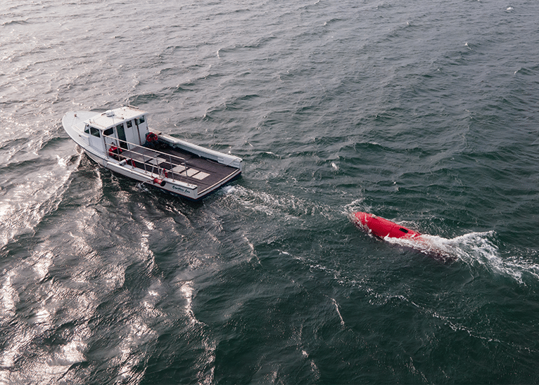
Complete Sonardyne suite for Dive Technologies’ large displacement AUV
Quincy, Massachusetts, based underwater robotics innovator Dive Technologies has chosen a complete suite of Sonardyne technologies for navigation, tracking and control of its large displacement DIVE-LD autonomous underwater vehicle (AUV). To support long-distance and long-duration navigation, while minimizing complexity and payload space consumption, the vehicle is fitted with Sonardyne’s industry leading hybrid navigator SPRINT-Nav.
For underwater positioning and acoustic communications, the DIVE-LD is fitted with Sonardyne’s AvTrak 6 – a combined transponder, modem and emergency relocator beacon all in one. To cover all its concepts of operations (CONOPS), including tracking and communication during development and testing, Dive Technologies has also acquired Sonardyne’s most capable Ultra-Short BaseLine (USBL) system, Ranger 2, with its latest, compact Gyro USBL.
The DIVE-LD AUV is being developed to meet a wide range of long-endurance mission requirements, across the commercial, research and defense sectors. The vehicle, measuring 48 inches in diameter and 19 feet long and designed for operations down to 6,000 m water depth, is currently in production in the US with sea testing ongoing in New Bedford.
For more information visit: www.sonardyne.com