
Job Advert: CMS GeoScience hiring for a Hydrographic Surveyor
CMS GeoScience Ltd is looking for a Hydrographic Surveyor to join the team, primarily based in its office near Falmouth, Cornwall.
CMS GeoScience's multidisciplinary team specialise in the collection of data from around the UK and Europe for a variety of marine business ranging from ports & harbours to offshore energy developments, civil engineering projects through to key aggregate industries. Its data allows its clients to properly evaluate the seabed prior to developments or activities effecting the seabed.
You will become a key member of this very specialised team and will be responsible for a variety of tasks related to accurate site characterisation and marine engineering projects, offshore site investigations and the production of accurate and concise reports in accordance with industry and company standards.
This role will primarily be based in the South West offices near Falmouth, but will demand a flexible approach towards your working location.
You will typically be required to work offshore for several weeks at a time throughout the year, in demanding marine environments as well as having the opportunity to work around the globe on various third party contracts. Tidal and coastal/inshore working demands a flexible approach to working patterns.
When not offshore you will be working to review and interpret the data in order to compile accurate reports for CMS GeoScience's clients. You will also work from its sites in Plymouth or Lowestoft, with travel/temporary accommodation provided as required.
CMS GeoScience would like to hear from you if:
• You are looking for a career in a company where your actions count, and you become a valid and pivotal member of a small and ambitious team.
• You want to be continuously challenged and motivated to develop an exciting and rewarding career.
• You are highly organised & flexible with an ability to adapt & remain calm in challenging and rapidly changing situations.
• You can work closely with a variety of different people and communicate clearly to achieve positive outcomes.
• You can prioritise and remain focused when under pressure.
• You are accountable and responsible for your own decisions and actions and will prioritise the health and safety of yourself and those you are working with.
What would a typical week involve?
No two days will ever be the same in this vibrant company but you can typically expect to be assisting with the planning and preparation of all upcoming offshore projects with responsibility for creating the correct paperwork and project information, as well as ensuring that all relevant equipment is calibrated, verified and mobilised correctly. You will participate in operational planning meetings and provide accurate updates and information on projects.
If you are out at sea you will be in charge of the positioning for the offshore team to ensure data is collected accurately and meets the specified contractual and company requirements, quality checking the data at all stages. You will jump in and help other team members as necessary for the duration of the job in order to get the contract completed and you will be working closely with the skipper to ensure accuracy and efficiency in all operations. When the project is over you will be responsible for ensuring the safe demobilisation of the survey equipment and ensuring the safe transfer of any data, feeding back any faults or improvements you recommend.
When not offshore you will be desk based processing the data and compiling reports and information as required. You will also be continuously working to maintain our company systems and procedures and provide input into the continuous improvement and development of our systems. You may also spend some of your time at shows and events or networking on behalf of the team.
What do you need to apply?
• Survey/hydrographic/ocean science/data related degree
• Extensive knowledge & skills for data processing and interpretation of relevant data
• Ablility to use Trimble, HydroPRO, Hypack and QPS QINSY navigation software
• Sound knowledge & skills of modern survey methods and equipment
• A full UK driving licence
• Currently eligible to work in the UK
• A valid offshore medical certificate
• Strong IT skills, especially in Microsoft 365
• Strong technical writing skills
• Fluent in spoken and written English
Nice to have but not essential:
• Software /programme experience
• Offshore / marine experience and interests
• Experience of working in the shallow nearshore and coastal environments
• Experience of mobilising and demobilising a variety of inshore to offshore vessels
• Practically minded & ‘hands-on’ aptitude
What CMS GeoScience offer you in return?
A competitive salary along with an attractive package of benefits including a contributory pensions scheme, private medical insurance and offshore top up pay.
Comprehensive training and personal development opportunities allowing you to move your career forward to reach your full potential within a supportive and progressive company.
28 days annual leave including statutory holidays plus up to 5 days sell-back/buy-extra options.
An inclusive culture, with a friendly environment and regular social events.
What makes this opportunity stand out?
CMS GeoScience is an equal opportunities employer. It builds and adapts its business using the strengths of its employees. CMS GeoScience believe providing professional training and personal development opportunities are vital for growth of the individual and the team. No longer just a holiday destination, Cornwall provides a thriving and dynamic environment to work, live and relax and features in the top 20 list of the happiest places to live in the UK.

Seabed 2030 and NORBIT Oceans join forces to accelerate global ocean mapping efforts
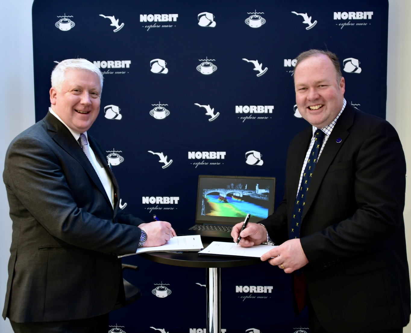
The global effort inspiring the complete mapping of the world’s ocean floor - The Nippon Foundation-GEBCO Seabed 2030 Project - has announced its newest partnership with NORBIT Oceans, a leading provider of underwater imaging and mapping technology. The parties will work together to advance the field of ocean science, and obtain a complete map of the entire ocean floor.
A collaborative project between The Nippon Foundation and the General Bathymetric Chart of the Oceans (GEBCO), Seabed 2030 seeks to inspire the complete mapping of the world’s ocean by 2030, and to compile all the data into the freely available GEBCO Ocean Map. Seabed 2030 is formally endorsed as a Decade Action of the UN Ocean Decade. GEBCO is a joint programme of the International Hydrographic Organization (IHO) and the Intergovernmental Oceanographic Commission (IOC), and is the only organisation with a mandate to map the entire ocean floor.
With a focus on providing technology solutions to global maritime markets, NORBIT Oceans is one of three segments within the global technology company NORBIT ASA, headquartered in Norway. NORBIT Oceans offers advanced solutions for seafloor mapping, environmental monitoring, tailored products for the aquaculture and security markets, as well as customised cables.
Under the partnership, which was entered into in Monaco during the 3rd IHO Assembly, NORBIT Oceans will strengthen the capabilities of Seabed 2030 and its network by providing innovative solutions involving bathymetric survey data sets, research voyages, as well as general survey activities.
In April, NORBIT Oceans launched its next-generational stabilised multibeam sonar system in Southampton, ahead of Ocean Business 2023. The company introduced the new ‘iWBMSh Stabilised’ system which provides active roll, pitch, and yaw stabilisation as well as dual swath capability in a compact and lightweight form.
"NORBIT Oceans’ technology solutions and expertise in underwater imaging will be invaluable to our mission of mapping the entire ocean floor,” commented Jamie McMichael-Phillips, Seabed 2030 Project Director. “This collaboration will bring us closer to achieving our ambitious goal, whilst advancing scientific understanding of the world’s marine environment.”
“We share Seabed 2030’s values in social responsibility and sustainability,” said John Fraser, NORBIT UK and Middle East Director. “We’re therefore delighted to join the project and support the delivery of its crucial objective, which is essential to the sustainable management of the planet.”
ACUA Ocean and HydroSurv announce intention to merge
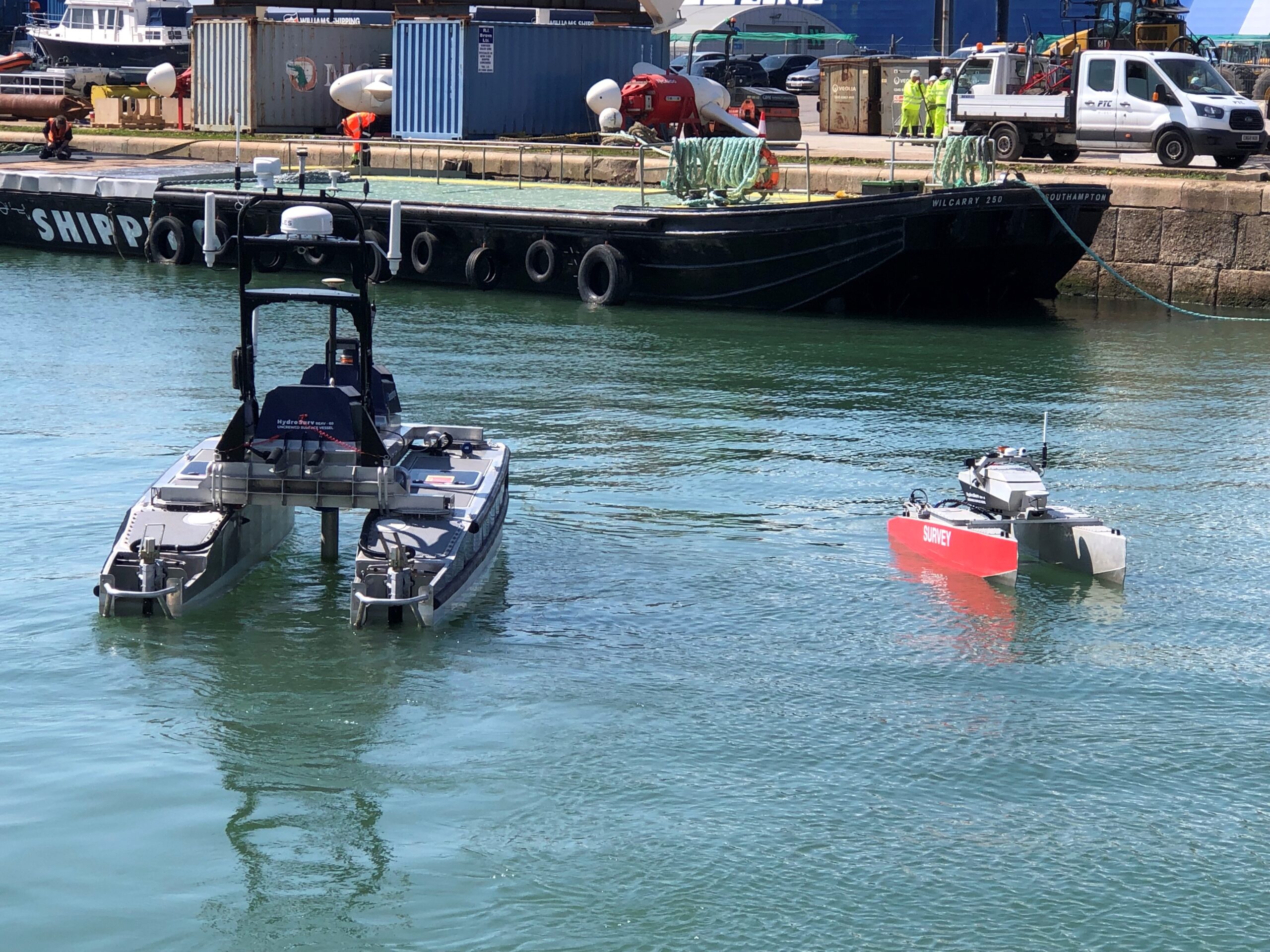
ACUA Ocean and HydroSurv, two UK-based companies specialising in maritime autonomous systems, have announced their intention to merge, combining extensive expertise in the development and operation of Uncrewed Surface Vessels (USVs) and associated technologies for marine surveying and surveillance.
The new company, to be named Blue Ocean Autonomy, will deliver turnkey solutions across a broad spectrum of capabilities, covering the inland, nearshore and offshore sectors.
David Hull, Founder and CEO of HydroSurv said: “In an evolving market, customer demand is shifting towards a comprehensive solution for trusted and certified USV systems. In response to this trend, we are excited to announce the intent to merge our two companies with a shared focus on accelerating the availability of these solutions for widespread commercial use, expanding our market presence and providing a better value offer to our customers.”
Blue Ocean Autonomy’s strategy will centre around low and zero-emission vessel operations with a strong focus on sustainability. It will leverage both companies’ technologies; HydroSurv’s commercially proven electric and battery-hybrid Rapid Environmental Assessment Vessels (REAV) and ACUA Ocean’s hydrogen-powered H-USV, being developed as part of the UK Department for Transport’s flagship Clean Maritime Demonstration Competition (CMDC) programme.
The merger will deliver a broad offering of both near-shore and long-endurance vessels, from 2.8m to 13.5m, for ocean data collection, hydrographic, geophysical and environmental survey and surveillance and monitoring of critical offshore infrastructure.
Neil Tinmouth, Founder and CEO of ACUA Ocean said: “Our emphasis has always been on what is best for our customers. This merger represents a natural progression of our vision and values with a company that is a strong cultural, as well as technological, fit. The new entity will undoubtedly be greater than the sum of its parts, establishing one of the most experienced and talented teams in marine autonomy.”
Commenting on the merger, Tom Chant MBE, CEO of the Society of Maritime Industries added: “In an increasingly competitive market, this merger represents a unique opportunity for UK SMEs to make their mark on the fast-growing autonomous vessel space. We look forward to supporting their progress through their membership of SMI and the MAS Working Group.”
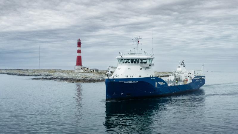
KONGSBERG successfully completes autonomous operation of coastal cargo ship as part of EU’s AUTOSHIP project
Kongsberg Maritime has successfully demonstrated a range of remote and autonomous technologies on a cargo vessel operating off the coast of Norway.
The test cruise has been named one of the most complex autonomous journeys at sea so far.
The Eidsvaag Pioner is one of the two vessels that are equipped for remote-operated and autonomous transport demonstrations for the AUTOSHIP project, which is part of Horizon 2020, an EU research programme.
Owned by the Eidsvaag shipping company, the Eidsvaag Pioner operates along the Norwegian coast and in fjord areas where it carries fish feed to ocean fish-farms.
The demonstration was carried out over 13 hours and involved the vessel completing a voyage outside the coast of Kristiansund on the northwest coast of Norway. The ship undocked from the port of Averøy, sailed to the world’s first ocean fish-farm and back to port again, a journey of about 160 nautical miles in total.
CEO of KONGSBERG, Geir Håøy, said: “This was an opportunity to show the world that remote and autonomous technologies can be successfully deployed on a general cargo vessel, carrying out a range of operational aspects of a typical voyage.
“There has been great collaboration between all partners in the AUTOSHIP project, and we have all been impressed with how the Eidsvaag Pioner performed under remote control and during autonomous sailing and docking.
“Today we have demonstrated a range of the key enabling technologies that will lead the way towards routine remote and autonomous operation in the years ahead.”
What was demonstrated
The demonstration was initiated, managed and monitored by the crew from the Kongsberg Remote Operating Centre (ROC) on land in Ålesund. It involved a mix of remote and autonomous operations during different stages of the voyage. For reasons of safety and current regulations, crew members have also been on board the ship during the test cruises.
The first part of the demonstration included automatic undocking from the quay at Averøy. The autonomous technology then took control to navigate and manoeuvre out of the harbour and further out to open sea. Here the ship navigated a route between several islands and avoided other sea traffic, before arriving at the offshore fish farm Ocean Farm 1, owned by Salmar.
Various manoeuvres were then carried out using the Dynamic Positioning (DP) system. The vessel next returned to port, again navigating open sea and congested seaways before it automatically docked again. The entire operation was monitored and occasionally controlled remotely by the shore-based captain and engineer.
During the demonstration, a number of established and new KONGSBERG technologies were deployed, and included Auto-undocking and Autodocking, Situational Awareness System, Autonomous Navigation System, Intelligent Machinery System, Connectivity & Cyber Security System, Remote Operations Centre and Dynamic Positioning. Cloud-based communication systems and advanced simulations have also been involved to test and ensure that the vessel operated safely and optimally.
About AUTOSHIP
AUTOSHIP is a four-year project that has received funding from the European Union’s Horizon 2020 research and innovation programme under Grant Agreement N°815012.
The demonstration in the North Sea has been a collaboration between a large team of people from KONGSBERG and the shipowner Eidsvaag AS, including also expertise from Norway's leading research organisation, SINTEF and the University of Strathclyde in the UK.
The AUTOSHIP project runs its demonstrations in important areas in Europe where the early use of remote control and autonomy is necessary to accelerate the transition from road to greener and safer sea transport.
The aim of the project is to test and further develop key technology linked to fully autonomous navigation systems, intelligent machinery systems, self-diagnostics, prognostics and operation scheduling, as well as communication technology enabling a prominent level of cyber security and integrating the vessels into upgraded e-infrastructure.
The second AUTOSHIP demonstration will take place on 1st June and involve a cargo barge navigating part of the inland waterway network in Wintam, Belgium.
Find out more information about the project.
Job Advert: XOCEAN hiring Shallow Marine Geophysicist
XOCEAN is an ocean data company that's changing the way we collect and analyse data. XOCEAN developed a cutting-edge marine robotic system known as an Uncrewed Surface Vessel (USV) that's revolutionising the industry. And now, they are looking for a talented Shallow Marine Geophysicist to join the team.
As a Shallow Marine Geophysicist, you'll be responsible for geophysical data collection, processing on XOCEAN's cloud-based processing system cyberdrive to include the interpretation and reporting of many different datasets. You'll work with some of the most advanced technology available, including data from automatically towed Side-scan Sonar & magnetometer, and Shallow 2D Sub-bottom sensors. You'll use your expertise to support XOCEAN's Lead Geophysicist with survey planning, online surveying on projects in shifts, and the setup of survey systems before vessel mobilisation on a project.
XOCEAN are looking for someone with at least 3 years of marine survey experience and a degree in Geoscience or Geophysics. You should have experience with the processing software packages Chesapeake SonarWiz, DUG Insight and Oasis Montaj. You should also be familiar with sidescan sonar processing, including target ID and listing, and the creation and export of navigationally and gain corrected mosaics. Additionally, you should be able to process shallow 2D seismic data to include SEGy conversion, tidal reduction, band-pass and denoise filtering and, interpretation and export of subsurface horizons and contact hyperbolas.
XOCEAN are committed to creating an inclusive and collaborative workplace culture. They believe in supporting employees and helping them achieve their full potential. That's why they offer competitive salaries, opportunities for personal development, and a range of benefits, including healthcare contribution and a pension plan.
If you're passionate about marine geophysics and want to be part of an exciting and innovative company, apply today!
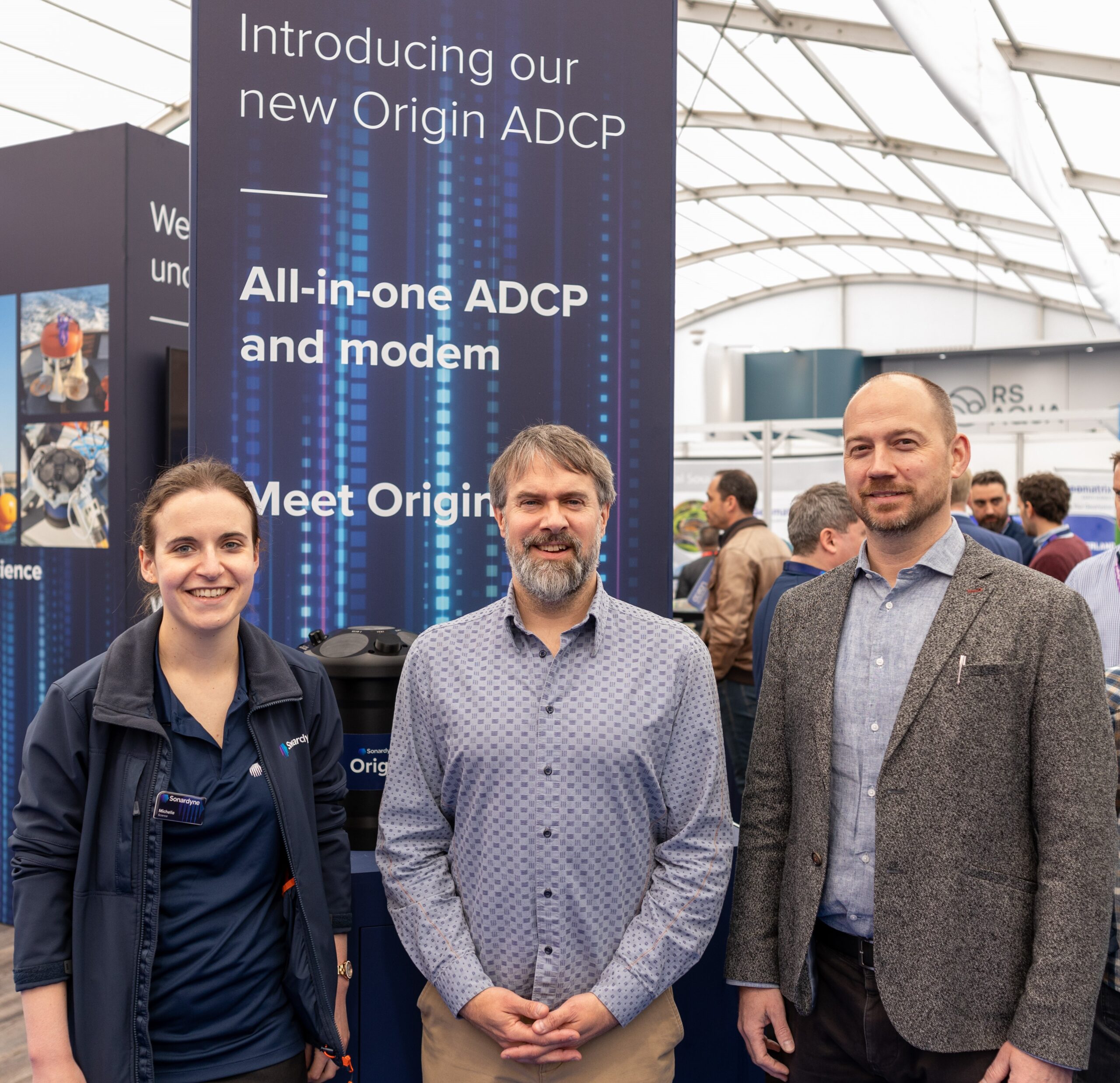
Sonardyne announces RS Aqua as UK reseller for leading-edge Origin 600 ADCP
Marine technology company, Sonardyne, launched its new Origin Acoustic Doppler Current Profilers (ADCPs) at Ocean Business in April. As part of this launch, RS Aqua have been appointed as the UK reseller for their new Origin 600 ADCP.
The Origin 600 sets new standards for intelligent ADCP data. It is the first ADCP to include an integrated acoustic modem and advanced onboard Edge processing – enabling remote access to all core features and giving high quality, intelligent data in near real-time.
It also delivers new and exclusive high-fidelity data formats, whilst its ability to link to other external sensors allows you to get the most out of a single device deployment and the data generated.
“The launch of the Origin 600 marks a huge step forward in ADCP technology, providing the user with expanded ADCP capability, whilst presenting a number of operational possibilities and advantages, including in-field flexibility and data assurance.” said Michelle Barnett, Ocean Science Business Development Manager at Sonardyne. “We welcome RS Aqua as the UK reseller of Origin 600 and know the product will benefit their customers and business portfolio for years to come.”
Portsmouth-based RS Aqua have supported the UK marine industry for over 40 years. Their depth of knowledge and experience of supporting customers across a variety of sectors makes them an ideal choice as a Sonardyne reseller.
“We are thrilled to have established a partnership with Sonardyne, one of the most respected engineering businesses in the industry. RS Aqua can now offer our clients access to the latest Origin ADCP technology, which we have carefully selected to be part of our product portfolio.” Said Martin Stemp, Managing Director of RS Aqua.
Martin further explains, “The Origin technologies are not only extremely high performing ADCPs, but they are also a central control and communication hub for subsea observatories, enabling two-way communication and configuration of instrumentation when deployed. We can’t wait to get these systems in the hands of our clients.”
Find out more information about the Origin 600 here.
Find out more about RS Aqua here.
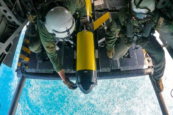
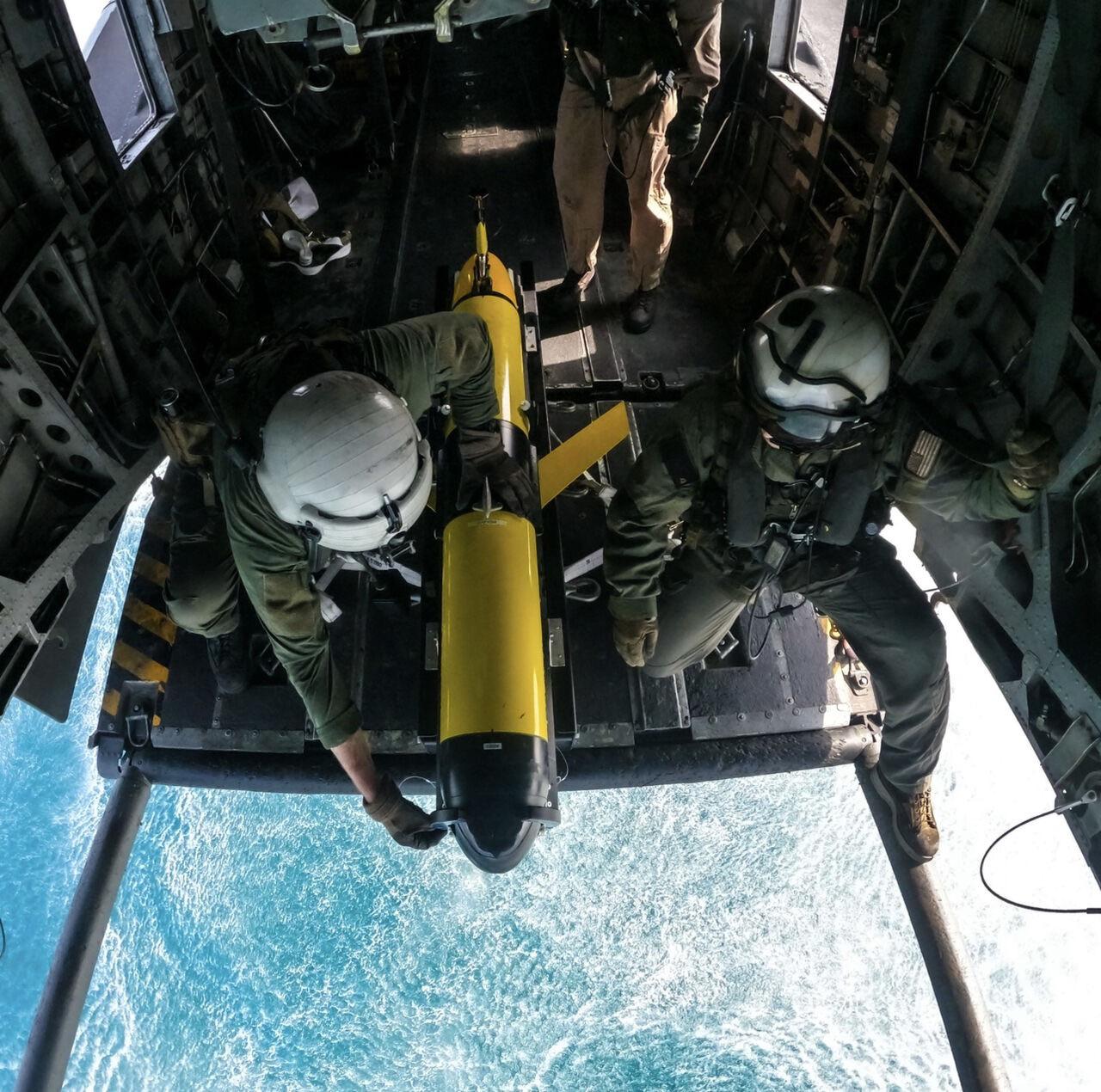
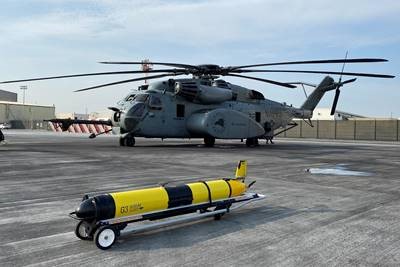
Teledyne Slocum Glider successfully deployed from a U.S. Navy helicopter
Teledyne Marine and the U.S. Navy successfully executed the first-ever undersea glider launch from a helicopter and the first-ever successful deployment from an aircraft. The Teledyne-owned Slocum glider, configured with Littoral Battlespace Sensing – Glider (LBS-G) mine countermeasures (MCM) sensors, was launched from the ramp of U.S. Navy helicopter flying “low and slow” over shallow waters. Teledyne Marine provided Slocum glider piloting and technical support in theater. "We are excited to be a part of another series of firsts! In this instance, the first launch from a helicopter and the first-ever successful glider deployment from an aircraft. Teledyne Marine takes pride in our continued innovation and support of the U.S. Navy as it expands the operational envelope of underwater gliders." said Dr. Thomas Altshuler, Senior Vice President, Global Maritime Defense Strategy and Business Development Teledyne Technologies.
The Mine Countermeasure (MCM) Commander now has the capability for rapid and widespread glider deployment by Task Force elements under direct, tactical control, eliminating the dependency on strategically tasked oceanographic ships. The gliders provide critical environmental information to optimize acoustic and optical MCM sensor performance. This constitutes a revolution in MCM decision support.
The Teledyne Slocum glider is a long-endurance, autonomous undersea vehicle (AUV) used for multiple persistent operational missions, including oceanographic data collection. Teledyne has delivered over 1,000 Slocum gliders to a global customer base. The Slocum glider is the backbone of the US Navy LBS-G program, with over 210 delivered since 2009. The Naval Oceanographic Office (NAVOCEANO) pilots the LBS gliders and includes collected data supporting Navy operations. Until this successful helicopter deployment, LBS gliders were almost exclusively launched and recovered by the T-AGS 60 class multi-mission ocean survey ships.
Job Advert: Titan Environmental Surveys hiring Hydrographic Geophysical Surveyors
Hydrographic Geophysical Surveyor
Titan are looking to expand its survey team with the recruitment of Hydrographic \ Geophysical Surveyors to join its rotational field teams.
As a Surveyor you will be responsible for the day-to-day tuning, deployment and care of survey equipment, data acquisition, data processing and QA/QC. Your role will involve working closely with the vessel skipper and Party Chief to ensure project deliverables are met.
Job brief
• Equipment interfacing and tune-up for equipment onboard.
• Multi-role surveyor, collecting data including, MBES, SSS, Magnetometer, SBP.
• Survey equipment maintenance.
• Be part of the Company field rota, currently 3 weeks on-call, 3 weeks office based. Undertaking 80-120 field days a year.
• Office and field office data processing and reporting.
• Supporting Party Chiefs and Vessel Skippers in delivering jobs within expected timelines and specifications, end to end.
• Vessel crewing duties with the potential for skippering opportunities or development.
Desirable Skills Experience:
• Relevant degree with 1-2 years of industry experience in a similar role.
• Experience in Hydrographic and Geophysical surveys.
• Knowledge of industry standard software packages QINSy, Teledyne PDS, POSPac MMS, Trimble Business Centre, Caris HIPS and SIPS, Geosoft Oasis Montaj, AutoCAD and QGIS.
• Previous knowledge of Multibeam data processing, GNSS data processing, Geophysical data processing, UXO data processing along with tidal theory, acoustic theory and geodesy.
• Geophysical survey background would be an advantage.
• Fluent in English language both oral and written.
• Must be eligible to work in the UK and hold a Full Clean Driving License.
You must live or be willing to relocate to a commutable distance of the Titan Surveys office in Bridgend, South Wales.
If you believe you have the experience, skills and ambition for this challenging role, please apply by sending a cover letter and your CV to [email protected].
Senior Hydrographic Geophysical Surveyor
Titan are looking to expand its survey team with the recruitment of Senior Hydrographic \ Geophysical Surveyors to join its rotational field teams.
As a Senior Surveyor you will be responsible for the mobilisation and calibration of survey equipment, acquisition, data processing and QA/QC of data. As Senior Surveyor your role will involve client liaison, Party Chief activities, survey execution and mentoring for less experienced surveyors.
Job brief
• Mobilisation and demobilisation of survey equipment, including calibrations and verifications.
• Equipment interfacing and tune-up for all equipment onboard.
• Multi-role surveyor, collecting data including but not limited to, MBES, SSS, Magnetometer, SBP.
• Be part of the Company field rota, currently 3 weeks on-call, 3 weeks office based. Undertaking 80-120 field days a year.
• Office and field office data processing and reporting.
• Promote safety and health of the workforce
• Potential for skippering opportunities or development.
Desirable Skills Experience:
• Relevant degree with a minimum 3-4 years of industry experience in a similar role.
• Good experience in Hydrographic and Geophysical surveys in a leading role.
• Knowledge of industry standard software packages QINSy, Teledyne PDS, POSPac MMS, Trimble Business Centre, Caris HIPS and SIPS, Geosoft Oasis Montaj, AutoCAD and QGIS.
• Previous knowledge of Multibeam data processing, GNSS data processing, Geophysical data processing, UXO data processing along with tidal theory, acoustic theory and geodesy.
• Geophysical survey background would be an advantage.
• Fluent in English language both oral and written.
• Must be eligible to work in the UK and hold a Full Clean Driving License.
You must live or be willing to relocate to a commutable distance of the Titan Surveys office in Bridgend, South Wales.
If you believe you have the experience, skills and ambition for this challenging role, please apply by sending a cover letter and your CV to [email protected].
Job Advert: RS Aqua hiring Sales & Marketing Manager
RS Aqua are hiring a Sales & Marketing Manager, one of 5 new roles in the business. This new and important role has been created to lead, align and optimise our sales and marketing teams, to generate new business opportunities, and to allow its high growth journey to continue at pace.
The role will be based in Portsmouth, UK. You must be UK based and commutable to Port Solent on a regular and frequent basis. RS Aqua offer flexible & hybrid working + 25 days holiday + 24 days flexitime + public holidays + supportive culture + health & wellbeing benefits + beautiful location.
If you are excited by this opportunity, if you are passionate about advanced sales and marketing strategies, and if you are from the ocean tech sector, RS Aqua would love to hear from you.
Please submit your CV and covering letter directly to RS Aqua for the attention of the Managing Director, via [email protected].
Job Advert: Kraken Robotics hiring new positions
Project Surveyor
Kraken Robotics offers a unique career opportunity to work with an internationally recognized leader in ocean technology that is harnessing our world class talent to provide superior subsea solutions for global security, environmental, and scientific challenges. Kraken Robotics' highly talented team design and manufacture technology platforms for NATO navies and commercial clients throughout the world and provide acoustic 3D Synthetic Aperture Sonar (SAS) data solutions and imaging in the offshore energy sector with increasing focus on offshore renewables.
The Project Surveyor's primary function will be the day-to-day provision of survey support to Kraken projects. The role will also support the Business Development team with early involvement in proposals, advising on scope of work and interface requirements, following through to the Project handover/execution stage. This role can be based in Newfoundland, Canada or Aberdeen, UK. If this sounds exciting to you, and you are approachable, engaging and enjoy helping employees and business functions to succeed, Kraken Robotics are interested to hear from you. Please email [email protected]
Key responsibilities include:
• Maintain a "safety first" culture ensuring all activities are executed in a safe and effective manner in compliance with all relevant health and safety legislation.
• Provide input to preparation of formal tender responses as the enquiry stage as required.
• Identify required equipment and communicate these requirements to the internal engineering and geoscience support group to ensure timely delivery of equipment to worksites
• Undertake project briefings/ debriefings during periods of mob / demobilisation with key project personnel
• Proven experience in a Project Surveyor Role in the offshore energy sector, preferably 5 years plus
• Experienced in a range of survey software and equipment
• Familiar with Eiva NaviPac, Navimodel. Qinsy software or other similar Hydrographic Survey software suites
• Project Management Certification considered an asset
Geoscientist
Kraken Robotics is seeking a Geoscientist to join the team. If this sounds exciting to you, and you are approachable, engaging and enjoy helping employees and business functions to succeed, Kraken Robotics are interested to hear from you! Please email [email protected]
Roles and Responsibilities
• While working offshore, carryout the quality control and interpretation of various geophysical datasets such as; Sub bottom Imager (SBI), Acoustic Corer (AC), KATISH synthetic aperture sonar (SAS) and magnetometer.
• Assist with the mobilisation and demobilisation of Kraken equipment during offshore projects.
• While working onshore, continue interpretation of Sub-bottom Imager, Acoustic Corer and SAS datasets and produce the required client deliverables.
• Integrate geotechnical and other geophysical interpretations into Kraken interpreted datasets.
• Write technical reports while offshore during a survey and for the end project results reports.
• Assist in writing pre-project documentation such as Survey Acquisition Plans and Desktop Studies.
• Conform to all Kraken Robotics HSEQ policies and procedures to ensure all activities onshore and offshore are carried out in a safe manner.
• Work offshore when required around the world as assigned by the Geoscience Manager and Operations team.
Qualifications and Experience
• Bachelor (BSc) degree in Geophysics, Geology or similar.
• Previous offshore experience (1-2 years).
• Experience with using geophysical interpretation/processing software such as: OpendTect, EIVA NaviModel, GIS software packages, Oasis Montaj, Kingdom or Landmark and SonarWiz.
Tender Manager
The Tender Manager is a core member of the commercial team, responsible for managing Tenders across all Kraken business units. The role will work closely with the Business Development and Sales Teams and engage with all departments for support in reviewing tender documents and preparation of tender submissions. Managing numerous ongoing tenders including liaising with suppliers and subcontractors to obtain quotations, including contract negotiations. If this sounds exciting to you, and you are approachable, engaging and enjoy helping employees and business functions to succeed, Kraken Robotics are interested to hear from you! Please email [email protected]
Key responsibilities include:
• Respond to tender pre-qualification requests and manage registrations for client portals to become approved supplier.
• Review client ITT’s and RFQ’s, preparing high quality tender submissions, managing the bid process from receipt of enquiry through proposal submission and contract award.
• For larger/more complex bids, development, manage and distribute a schedule to bid team to ensure sufficient time is planned for preparation, review, approval, and submission.
• Ensure bids are compliant with the client requirements and adhere to internal commercial processes.
• Identify and coordinate bid documents to be reviewed by internal departments.
• Write bid submission content with input from internal department subject matter experts.
• Prepare RFQ documentation for requesting proposals from suppliers and subcontractors.
• Prepare bid cost estimates, engaging with external suppliers as required to obtain quotations.
• Manage internal bid review meetings and internal approval process.
• Identification of risks, HSEQ, Fiscal, Contractual & Technical and opportunities within tenders and mitigation/improvement plans.
Qualifications and Experience
• 5+ years experience in Tendering/estimating.
• Preferably Degree or HNC qualified in either a Business, technical or related subject
• Experience of tendering offshore renewables survey workscopes with a Marine Technology, Subsea services provider
• Strong commercial awareness and effective negotiation skills are essential.
• Knowledge of standard industry contracts, such as IMCA, BIMCO and LOGIC