
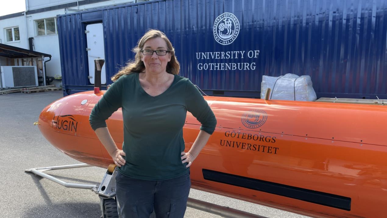
New HUGIN for the University of Gothenburg to Replace “Ran”
 The purchase contract is currently being signed for the HUGIN underwater vehicle with a 3000-meter range, which will replace “Ran”, lost under an Antarctic glacier in 2024. A major donation from Voice of the Ocean, along with insurance funds, now enables researchers at the University of Gothenburg to plan new expeditions.
The University of Gothenburg is pleased to announce the purchase of a new underwater vehicle, which will enable the continuation of its vital research activities.
“Thanks to Ran, we became the first researchers in the world to enter beneath the Thwaites grounding-line glacier. Although ice melt and movement can be observed through satellite data, we were able to get close-up images of the underside of the ice and detailed information about the exact mechanisms driving the melting,” says Anna Wåhlin, professor of oceanography, who led the expedition with Ran in Antarctica.
Stene Førsund, Executive Vice President for Sales and Marketing in Kongsberg Discovery, is pleased that the research in Antarctica will continue with a new autonomous underwater vehicle.
“The new vehicle “Ran II” will have better capacity than “Ran”, with more robust emergency decision support and improved navigation. These upgrades enhance both safety and precision in hard-to-reach environments such as beneath glaciers, sea ice, and near the seabed,” he says.

Temperature-sensing technology to improve safety on snow and ice
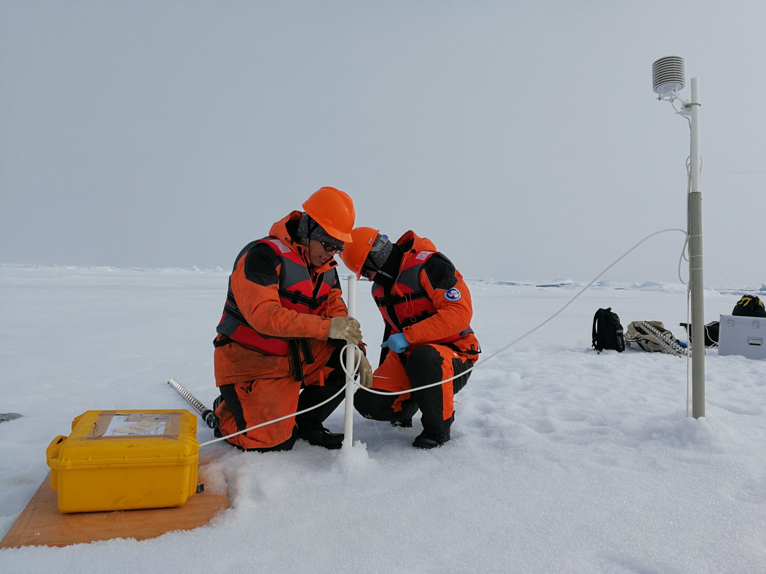
 Technology capable of monitoring snow and ice conditions in some of the most extreme and challenging environments on Earth is now providing real-world solutions to improving safety and infrastructure management in a changing climate.
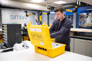
SIMBA (Snow Ice Mass Balance Apparatus) is a powerful autonomous device that was originally designed as a scientific research tool for polar researchers but is now also being used to help forecast avalanche risk, assess the safety of ice roads, flood risk monitoring and protect energy infrastructure.
The device consists of a thermistor chain that measures temperature and thermal characteristics of the environment. These sensors deliver data in real time, giving detailed information on snow and ice pack conditions in regions and locations where safety is paramount.
In launching its latest version today [Monday], developer SAMS Enterprise, based in Oban, Scotland, has enhanced SIMBA’s capabilities for a number of commercial applications.
SIMBA units can now be seen across the Arctic and Antarctic, throughout northern Europe and in Canadian mountain ranges, providing valuable data for climate researchers, avalanche forecasters, hydroelectric power companies, engineers, transportation and logistics planners and flood risk evaluators.
Dr Mark Hart, SIMBA project manager, said: “Originally developed as a scientific research tool, SIMBA has evolved into a real-world solution used by those on the frontlines of climate, safety, and infrastructure management. With this history of providing scientifically accurate data, the New Generation SIMBA is the most reliable tool for quick and accurate snow and ice information.
“Operating in some of the most extreme environments on the planet requires reliability, durability and adaptability. That’s why the latest developments have included enhanced battery performance, compatibility with external power sources, SDI-12 enabled for third party sensors, Internet of Things (IoT) data transmission capability and USB-C interface.
“There is now capacity for two thermistor chains instead of one, meaning more data points, greater resolution and contingency to understand the environment. We have also been working with Peli Products UK to improve the robustness and appearance of the unit itself to make it more user friendly.”
Data from SIMBA units has contributed to more than 70 peer-reviewed research papers to date and 28 units were used on the MOSAiC expedition, billed as the largest polar expedition of all time.
In Canada, SIMBA units have been deployed as part of The Churchill River Monitoring project, which was established after a flood caused by an ice jam at the outlet into Goose Bay required the evacuation of a nearby community. The units autonomously return data every 6 hours, minimising the risk to people by reducing the number of visits onto the ice.
In the Cairngorm mountains, Scotland, SIMBA units are used to assess the snow depth, consistency and the rate at which it melts in order to provide data for avalanche forecasters.
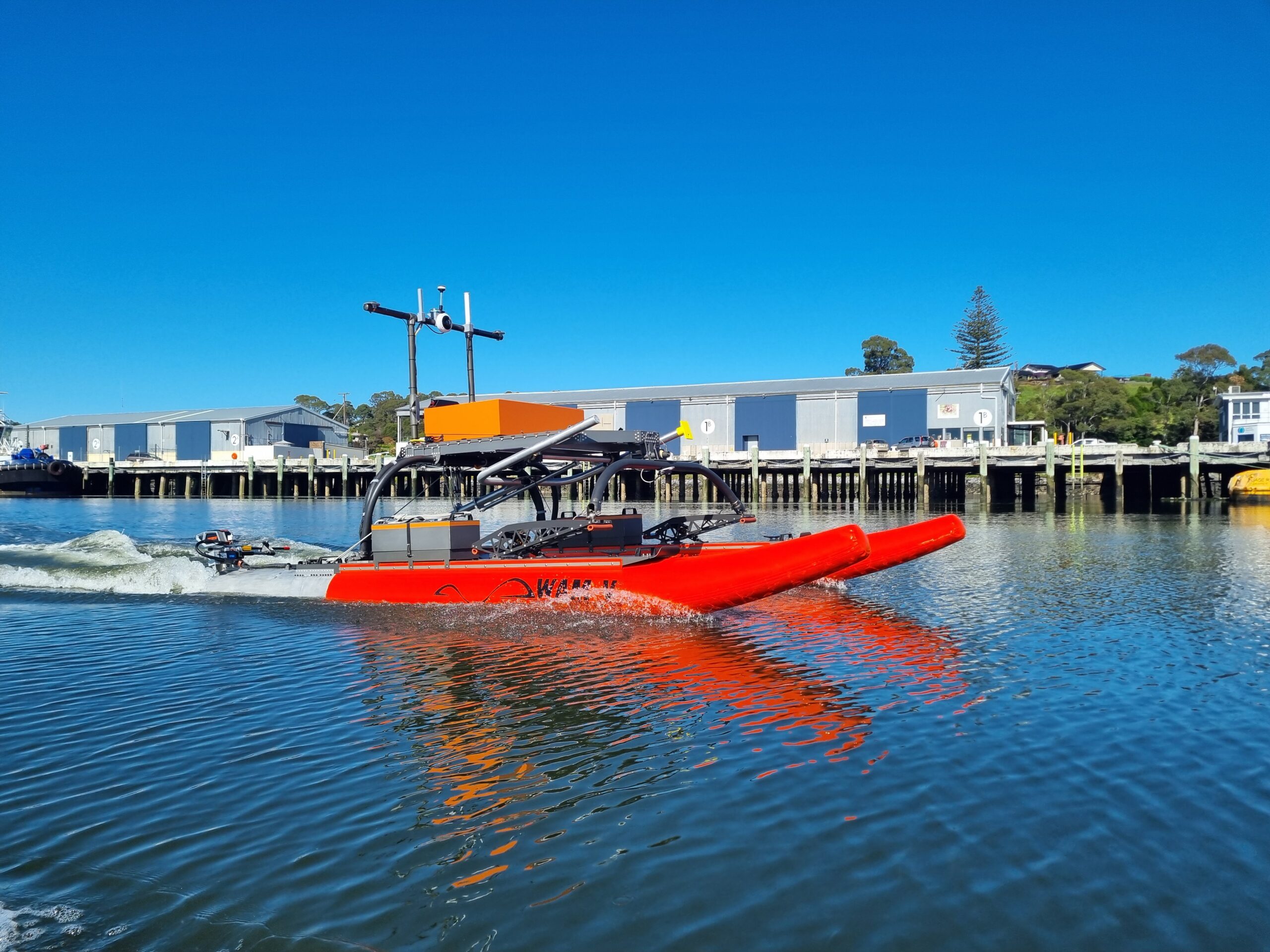
Australia’s AMC Search Contract Award to Robosys Automation to support ASV Training
AMC Search will be using Robosys’ VOYAGER AI to support its ASV Remote Operator Training with its WAMV-16 USV
Robosys Automation, a global leader in advanced maritime autonomy and remote operations, has announced a new contract award from the Australian Maritime College, AMC Search, to supply its advanced VOYAGER AI software as a retrofit to its OPT WAMV-16 Unmanned Surface Vessel (USV).
This contract builds upon the current successful collaboration between Robosys and AMC Search for where VOYAGER AI is deployed in the Australian Maritime College’s (AMC) Bridge Simulators to build trust in AI navigation testing for STCW watchkeepers as well as to test autonomous COLREGS based Collision Avoidance.
This new contract will further be enhancing the college’s ASV (Autonomous Surface vehicle) Remote Operator Training Courses.
Under this new agreement, Robosys’ VOYAGER AI remote operations and maritime autonomy software will be integrated with the WAM-V 16 USV to provide enhanced autonomous navigation, real-time decision-making, and adaptive mission planning capabilities. VOYAGER AI will therefore be in operation in both AMC’s Bridge Simulator Suite, and afloat onboard the WAM-V.
Nick Bonser, of AMC Search comments: “Continuing AMC Search and Robosys’ successful ongoing collaboration, the adoption of Robosys’ VOYAGER AI into a new remote operator training course will significantly expand the college’s training capacity, giving students direct experience with state-of-the-art AI-driven autonomy systems used in modern uncrewed maritime operations.”
The WAM-V 16 platform, developed for training, research, and operational use, will benefit from Voyager AI’s robust capabilities in autonomous control, COLREG-compliant collision avoidance, and multi-sensor data fusion. The system will serve as a core component in AMC Search’s training curriculum, preparing students to meet the evolving demands of remote and autonomous vessel operations.
Nigel Lee, CSO of Robosys Automation, stated: “We are proud to continue our partnership with AMC Search. The awarding of this new contract is a strong endorsement of the value that VOYAGER AI brings to ASV operations and training. It’s a privilege to support AMC Search in shaping the future of maritime autonomy through cutting-edge education and technology.”
This renewed collaboration reinforces Robosys Automation’s position as a trusted global provider of maritime autonomy solutions and underlines its commitment to supporting academic and training institutions worldwide in developing the next generation of USV remote operators.
Find out more at www.robosysautomation.com.
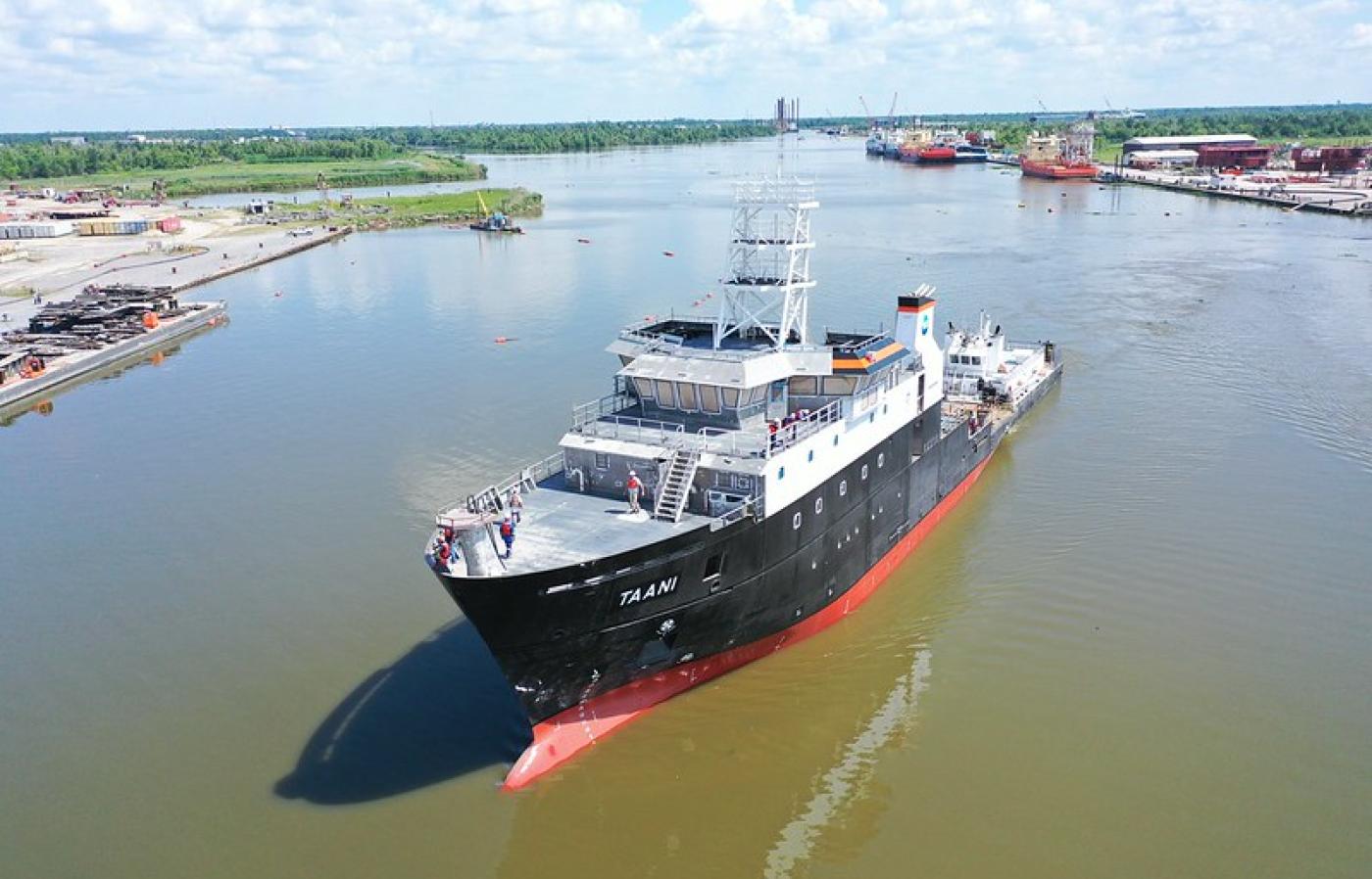
Sonardyne underwater positioning and tracking for US Academic Research Fleet
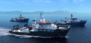
Underwater positioning and tracking technology from Sonardyne has been chosen for three new oceanographic research vessels being built under the US' National Science Foundation (NSF) Regional Class Research Vessel (RCRV) construction programme.
Led by Oregon State University, the state-of-the-art RCRVs are being built for the US' Academic Research Fleet (ARF), enabling a new era of coastal and regional marine science.
To support the RCRV's scientific missions, across diverse marine environments, Oregon State University selected Sonardyne's Ranger 2 Gyro USBL 7000, engineered to meet both the demanding, multidisciplinary research objectives of the ARF and vessel-build requirements.
The first system has recently been delivered to Oregon State University to be fitted to the R/V Taani, to be operated by the university, by vessel builder Bollinger Houma Shipyards.
Systems for the other two vessels, R/V Narragansett Dawn (to be operated by a University of Rhode Island-led consortium) and the R/V Gilbert R. Mason (to be operated by the Gulf-Caribbean Oceanographic Consortium) will be delivered next year.
"The RCRV construction programme represents a significant enhancement to the US Academic Research Fleet," says James Caison, Design Specialist, at OSU working on the RCRV programme. "These vessels will empower researchers to address critical questions in climate, ecology, and ocean dynamics across the Pacific coast, east coast and Gulf of Mexico."
"The RCRV construction programme represents a significant enhancement to the US Academic Research Fleet," says Kim Swords, Technical Sales Manager at Sonardyne.
"This order is an endorsement of the precision and reliability delivered by our Ranger 2 USBL systems. It reinforces Sonardyne's position as a trusted provider of high-performance acoustic positioning technologies for the US marine science and research community."
Sonardyne's Ranger 2 will allow US researchers to accurately track and simultaneously communicate with multiple underwater scientific instruments, vehicles or towed platforms, at ranges up to 10,000 m depending on its configuration.
The Ranger 2 Gyro USBL 7000 system was specifically selected for its precise acoustic tracking performance, integrated gyrocompass and proven reliability in complex deployment scenarios.
With Ranger 2 Gyro USBL, scientists and researchers using the RCRVs can be sure of optimal underwater positioning and tracking capabilities, without the need for separate external heading sensors.
For vessels equipped with a dynamic positioning system, Ranger 2 can also provide accurate and repeatable position referencing, in any water, without interrupting target tracking operations.

Register for ESA’s Maritime Decarbonisation event today
 Join ESA’s Business Applications and Space Solutions (BASS) team and maritime and space sector stakeholders on 19 November at ESTEC (Netherlands) for “Showcasing Space Applications for Maritime Decarbonisation.”
Explore how space data and technology are helping the maritime sector tackle environmental challenges and drive decarbonisation. The event will bring together ports, authorities, classification societies, shipyards, ship owners, and technology providers for a full day of insights and collaboration.
Find out more and register here: https://business.esa.int/news/showcasing-space-applications-for-maritime-decarbonisation
Registration closes 7 November or when full.
EGS International Ltd are recruiting HYDROGRAPHIC DATA PROCESSOR
Location: Bordon, Hampshire
Position: Full time, Permanent
Salary: Dependant on experience
As part of our continued growth, EGS International is looking to recruit a Hydrographic Data Processor to strengthen our Survey Department. This position is primarily office-based, with occasional offshore processing support when required.
This role will suit candidates with a strong background in MBES and GNSS data processing, coupled with excellent GIS skills, who can deliver accurate and reliable survey products to industry standards. Successful candidates will be highly organised, able to manage large datasets efficiently, and motivated to contribute to continuous improvement within a fast-paced survey environment.
Responsibilities
· Process MBES, GNSS, and associated survey datasets to deliver high-quality surfaces and client deliverables.
· Apply industry standards (IHO, IOGP, ICPC, etc.) and project specifications to ensure data quality and compliance.
· Manage, organise, and quality-control large volumes of survey data.
· Work with GIS tools (ArcGIS, Global Mapper) to prepare and deliver mapping and analysis outputs.
· Contribute to development of workflows, documentation, and technical improvements.
· Provide occasional offshore processing support during mobilisations or project delivery phases.
Requirements (Junior Surveyors / Entry Level)
· Degree in Hydrography, Geomatics, Ocean Science, or a closely related discipline.
· Proven experience in MBES and GNSS data processing.
· Proficiency with CARIS HIPS & SIPS or equivalent MBES processing software.
· Strong knowledge of ArcGIS and Global Mapper for spatial analysis and deliverables.
· Good understanding of data quality control, error analysis, and survey specifications.
· Exposure to offshore survey operations and willingness to support short rotations if required.
· Strong organisational and documentation skills.
· Eligible to work in the UK.
What We Offer
· A key role in a growing international survey company.
· Opportunities for technical development and progression into senior processing or data management roles.
· Competitive salary package, company pension.
· Exposure to a wide range of survey projects with a strong focus on quality and innovation.
To apply for this position please send your CV [email protected]
EGS International Ltd are recruiting EXPERIENCED & JUNIOR HYDROGRAPHIC SURVEYORS
Location: Bordon, Hampshire
Position: Full time, Permanent
Salary: Dependant on experience
As EGS International continues to grow, we are expanding our Hydrography Department and seeking both experienced hydrographic surveyors and junior surveyors who are keen to develop their skills within a leading offshore survey company. This is an exciting opportunity to join a fast-growing team that works on a wide range of international offshore projects, using some of the most advanced hydrographic, geophysical, and geotechnical survey systems in the industry.
Successful candidates will work both offshore and onshore, gaining exposure to challenging marine environments and multidisciplinary project delivery. With EGS, you will be part of a company that values technical excellence and professional development.
Requirements (Experienced Surveyors)
· Minimum 3 years in a similar offshore/onshore survey position.
· Degree in Hydrography, Geomatics, or a closely related marine discipline.
· Strong background in offshore windfarm, cable route, or shallow water surveys.
· Hands-on experience with MBES (Kongsberg), positioning systems (Applanix, C-Nav), USBL (Sonardyne), and SVP systems.
· Skilled in QINSy, SIS, Caris HIPS & SIPS, and POSPac.
· Other industrial acquisition and processing software experience would be advantageous.
· Proven ability to mobilise, calibrate, and deliver high-quality survey data.
· Flexibility for offshore rotations (up to 6 weeks).
Requirements (Junior Surveyors / Entry Level)
· A degree (or equivalent qualification) in Hydrography, Geomatics, Ocean Science, or a related technical subject.
· Industrial placement, internship, or project experience in surveying is advantageous but not essential.
· Enthusiasm to learn new survey software and techniques.
· Willingness to work offshore in challenging environments.
· Team-focused, motivated, and eager to build a long-term career in the offshore survey sector.
What We Offer
· A career path suited to both experienced professionals and those new to the industry.
· Exposure to advanced survey equipment and data processing techniques.
· Opportunities for rapid career progression in a company experiencing strong growth.
· Competitive salary package, company pension, and professional development support (e.g., Hydrographic professional accreditation).
· A collaborative working culture with strong focus on training, mentoring, and continuous improvement
To apply for this position please send your CV [email protected]
EGS International Ltd are recruiting GIS/CAD Analyst
Location: Bordon, Hampshire
Position: Full time, Permanent
Salary: Dependant on experience
As a GIS/CAD Analyst at EGS you will have the opportunity to work on complex projects within the offshore survey industry. You will be part of a team responsible for analysing seabed survey data and creating the appropriate reports and charting. Your work will also involve provision of GIS and CAD support to our Hydrographic Survey and Geophysical departments as part of the tendering and survey planning process. Databases and geospatial visualisation are needed in order for our clients to understand the environment within which they will be operating. By utilising software such as ArcGIS, QGIS, Global Mapper and AutoCAD we can accommodate these criteria. Requirements:
· University degree in Geographical Systems or Oceanography
· Knowledge of geospatial data and coordinate systems
· Experience with ArcGIS and AutoCAD
· Python knowledge beneficial
· Eligible to work in the UK
· Live within or willing to relocate to a commutable distance of the EGS office in Bordon
EGS offers successful applicants a workplace with a positive atmosphere surrounded by enthusiastic and supportive colleagues, a competitive salary and private pension. EGS promotes a good work / life balance and encourages continuous learning and professional development.
To apply for this position please send your CV [email protected]
EGS International Ltd are recruiting JUNIOR SURVEY ENGINEERS
Location: Bordon, Hampshire
Position: Full time, Permanent
Salary: Dependant on experience
EGS International is expanding its Engineering Department and seeking Junior Survey Engineers who are eager to develop their expertise within a leading offshore survey organisation. This is an excellent opportunity to join a dynamic and growing team engaged in a wide range of international offshore projects, utilising some of the most advanced hydrographic, geophysical, and geotechnical survey technologies in the industry.
Successful candidates will gain hands-on experience both offshore and onshore, working in diverse and challenging marine environments as part of multidisciplinary project teams. At EGS, we are committed to technical excellence and continuous professional development, providing our engineers with the training, support, and opportunities needed to build rewarding careers in offshore surveying.
Minimum Requirements (Junior Surveyors / Entry Level)
· A NVQ level 3 in Engineering Practices or a related technical subject.
· Industrial placement, internship, or project experience in engineering is advantageous but not essential.
· Enthusiasm to learn new survey equipment / software and techniques.
· Flexibility and willingness to work offshore in challenging environments.
· Team-focused, motivated, and eager to build a long-term career in the offshore survey sector.
What We Offer
· A career path suited to those new to the industry.
· Exposure to advanced survey equipment.
· Opportunities for career progression in a company experiencing strong growth.
· Competitive salary package, company pension, and professional development support.
· A collaborative working culture with strong focus on training, mentoring, and continuous improvement.
To apply for this position please send your CV [email protected]

World first project launched in Plymouth to teach autonomous vessels to "read" critical navigation data
- World-first UKHO–Marine AI project launched in Plymouth to teach autonomous vessels to read official navigational data
- Eight-month programme will finetune AI models to interpret UKHO Sailing Directions and Radio Navigation Warnings
- Live on-water demonstration using ZeroUSV’s Oceanus12 vessel planned for spring 2026 to inform global standards
The UK Hydrographic Office (UKHO), located in Taunton, and Marine AI, a Plymouth-based leader in maritime autonomy software, have this month launched a world-first research programme to enable Maritime Autonomous Surface Ships (MASS) to read, interpret, and act upon official navigational information once only usable by human mariners.
The eight-month project will see Marine AI finetune its baseline large language model (LLM) to process ADMIRALTY Sailing Directions (SDs) information and Radio Navigation Warnings (RNWs), currently written in natural language for human interpretation, and feed this structured information into the GuardianAI software suite for autonomous control. The breakthrough could transform global shipping by enabling uncrewed vessels to make safe, real-time decisions based on the same authoritative data used by professional mariners.
At present, MASS rely on human operators to interpret text-heavy navigation data, often described in non-standard nautical language and distributed through legacy systems. This project will address the challenges posed by unstructured text, legacy broadcast formats, and the lack of machine-readability, by retraining a bespoke large language model (LLM) and developing supporting AI agents to structure the data before it is fed into GuardianAI’s tactical engine and human–machine interface.
By solving these challenges, the research will allow autonomous vessels to operate more independently, responding immediately to navigational warnings and Sailing Directions without waiting for human interpretation.
The research programme will culminate in a live on-water demonstration in spring 2026, using ZeroUSV’s Oceanus12 vessel equipped with Marine AI’s GuardianAI suite on Plymouth’s waterways, alongside advanced simulation events. The results will also help inform the International Hydrographic Organization’s S-100 data framework, the new universal standard that will underpin the next generation of navigation technologies.
Oliver Thompson, technical director at Marine AI, said: “This is the first time anyone has attempted to process ADMIRALTY Sailing Directions and Radio Navigation Warnings in a way that an autonomous control system can act upon. By proving this capability on the water, we are closing one of the biggest gaps in MASS autonomy and taking a major step toward safe, fully automated operations.”
Mark Casey, Head of Research, Design and Innovation at the UK Hydrographic Office, said:
“Working with Marine AI allows us to push the boundaries of how autonomous systems can use official hydrographic information. The outcomes will not only support the safety of lives at sea but also feed directly into the development of the IHO’s S-100 framework, ensuring that UKHO data continues to set the global benchmark for safe navigation in both crewed and uncrewed vessels.”
Autonomous shipping is a key priority for the UK maritime sector, with Plymouth already established as a national testbed for MASS technology. Demonstrating that uncrewed vessels can understand and act on the same official navigation information used by seafarers could:
- Improve safety of life at sea through faster, automated responses to hazards.
- Support the international community in defining the standards for autonomous navigation.
- Accelerate the safe deployment of MASS across commercial, research, and defence applications.