Fugro enhances ocean habitat mapping technology by joining forces with PlanBlue
Fugro and PlanBlue are teaming up in a strategic partnership to advance habitat mapping technology, a significant move for both companies as they integrate new mapping technology and digital solutions within Fugro's existing systems.
The aim is to enhance and broaden Fugro's hydrographic solutions by incorporating cutting-edge technology such as advanced imaging and AI-based processing and deploying it across different platforms like remote and autonomous underwater vehicles. This collaboration targets the improvement of habitat mapping solutions, systematically studying and documenting the characteristics and distribution of critical marine ecosystems such as seagrass and corals. Habitat mapping helps in understanding their ecological importance, assessing their condition, monitoring changes over time, and informing conservation and management efforts.
Roughly 75% of the ocean floor remains unexplored. Even the parts we have explored lack detailed information, especially regarding the ocean's impact on climate and food security. The development of this new capability aims to improve the speed, accuracy, and scope of underwater mapping, leading to better decisions for ocean conservation and use.
PlanBlue's expertise in advanced imaging and AI-based data processing is set to gather crucial information about the ocean floor and its ecosystem. This partnership, leveraging Fugro's industry knowledge, aims to develop solutions that meet industry needs while championing environmental conservation.
"We are excited about the opportunities this partnership brings," said Dr Marco Filippone, Fugro’s Solution Director for Ocean Science and Hydrography. "By integrating PlanBlue's advanced technology and analytics, we aim to lead the industry in providing innovative solutions that positively impact the environment and various sectors."
“This partnership is a great opportunity to scale our business operations and data products and have a growing impact on coastal resilience,” commented Dr Hannah Brocke, Co-founder and CSO at PlanBlue. “Accelerating the collection of insights about marine habitats is essential for meaningful policy decisions in the blue economy. Through this partnership we strengthen our contributions to the UN Sustainable Development Goals, and global initiatives like the UN Decade of Ocean Science and Seabed 2030.”
The partnership between Fugro and PlanBlue signifies a shared commitment to driving positive change through technological innovation. This collaboration is particularly vital considering initiatives like the recently awarded Italian government’s Marine Ecosystem Restoration (MER) Project, which aims to restore the marine habitats, fortify the national system for observing marine and coastal ecosystems, and comprehensively map coastal and marine habitats across Italian waters (specifically seagrass meadows). As the collaboration progresses, both companies look forward to exploring new frontiers, pushing boundaries, and creating solutions that make a lasting difference for a safe and liveable world.

Teledyne Marine unveils revolutionary Vertical Detection Mode for SeaBat T-Series sonars
Teledyne Marine, a leader in subsea technology, announces a breakthrough innovation in sonar technology with the release of Vertical Detection Mode (VDM), a game-changing enhancement now available as a free upgrade for all SeaBat T-Series sonar systems. This new feature is set to revolutionise how vertical structures are detected underwater, providing precision like never before.
Traditional multibeam sonar systems have historically struggled with accurately detecting vertical structures, often facing issues such as multipath interference, which can degrade data quality. The typical bottom detection algorithms are not designed to handle the complexity of these environments effectively. However, with the introduction of VDM, Teledyne Marine has redefined the standard for vertical-structure surveys, delivering exceptional accuracy and improving data quality, particularly in environments challenged by multipath interference from structures like sheet pilings.
VDM is engineered to conquer these challenges with a 'purist' approach. Each detection is processed to stand on its own merit, independent of adjacent beams or historical data. This ensures that true features are captured without compromise, maintaining the integrity and detail of the vertical structures.
The release of VDM comes with the SW/FW upgrade Release 3.0, which is compatible with all Teledyne RESON SeaBat T-series systems. This versatile mode is designed to work flawlessly across any frequency, pulse, or beam mode and is suitable for single or dual-head configurations. Users can now access these powerful capabilities without the need for additional licenses, changes to data output, or new configurations, ensuring a seamless integration into existing operations.
Beyond VDM, the latest software and firmware upgrade introduces a suite of enhancements and new features, including Ping Sequencing, further improvements to Tracker, and overall FW stability, all designed to augment the performance of Teledyne Marine's sonar systems.
Teledyne Marine is committed to continuous innovation and providing customers with the most advanced and reliable underwater technology solutions. The Vertical Detection Mode is a testament to this commitment, offering unparalleled detection accuracy and quality for surveyors and marine professionals worldwide.
Fugro maps seagrass around Italy in groundbreaking ecosystem restoration project
Fugro has been selected to map the coastal habitats of the entire Italian coast as part of the Italian government’s Marine Ecosystem Restoration (MER) Project, a groundbreaking initiative under the National Recovery and Resilience Plan. The Italian Institute for Environmental Protection and Research (ISPRA) has selected Fugro, in partnership with Compagnia Generale Ripreseaeree (CGR), to leverage their cutting-edge technology and extensive experience in coastal resilience solutions to deliver the crucial mapping component of the MER Project, which is set to revolutionise marine conservation and environmental restoration efforts in Italy.
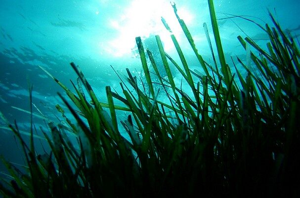
The MER Project aims to restore the marine habitats, fortify the national system for observing marine and coastal ecosystems, and comprehensively map coastal and marine habitats across Italian waters (specifically Posidonia oceanica and Cymodocea nodosa seagrass meadows). Fugro and its partners will play a pivotal role in the success of the MER project executing the MER Project’s mapping phase via a mix of mapping methodologies.
The project, which is due to start in March 2024 and be completed by June 2026, includes acquisition of hydrographic data utilising state-of-the-art sensors, including airborne lidar and imagery, airborne gravimetry and satellite sensors covering 10 200 km²; vessel-based multibeam technology spanning 4000 km2; and deployment of an autonomous underwater vehicle, one of Fugro’s state-of-the-art underwater drones, to cover 4000 km of coastline for direct observation and ground-truthing of other datasets. The collected data will be managed through VirGeo®, Fugro’s cloud-based Geo-data engagement platform, to provide seabed and habitat mapping insights, enhancing the local Government’s decision-making process for the protection of coastal marine habitats.
Giordano Giorgi and Sante Francesco Rende, respectively Project Director and Technical Director at ISPRA said: “We are delighted to announce the award of this project to a consortium led by Fugro and its partner, CGR. This contract signifies a significant milestone in our environmental efforts within the PNRR Marine Ecosystem Restoration project and specifically aligns with Mission 2: Green Revolution and Ecological Transition and the objectives to protect the territory and water resources and restore and protect the seabed and marine environments. The project is administered by the Ministry of Environment and Energy Security, with funding from the European Union's Next Generation EU programme”.
Mark Heine, Fugro’s CEO, said: “The MER Project represents a milestone in marine ecosystem restoration. We’re delighted with this opportunity from ISPRA to demonstrate our commitment to environmental stewardship and climate resilience. Our Geo-data for this transformative project will support the conservation and restoration of Italy's coastal and marine ecosystems for generations to come spearheading the drive towards a sustainable future for Italy's marine heritage, for a safer and more liveable world.”
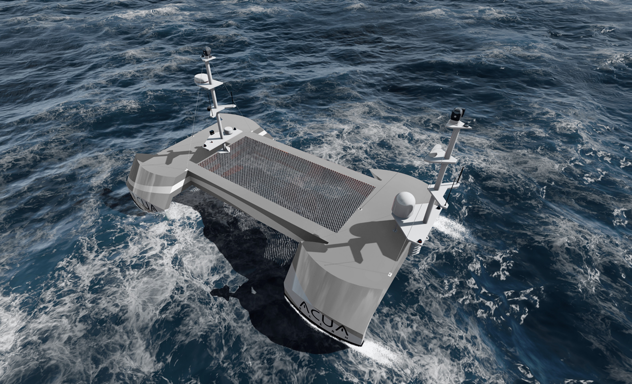
ACUA Ocean and Robosys Automation make waves announcing global partnership to integrate Voyager AI systems with ACUA’s hydrogen-powered USV
The ocean monitoring and protection innovator and unmanned craft specialist, ACUA Ocean, has signed a commercial contract to integrate Robosys Automation’s groundbreaking Voyager AI vessel control systems with its unique ACUA hydrogen-powered H-USV.
The contract marks ACUA Ocean’s ongoing commitment to further develop its range of innovative long endurance hydrogen-fuelled uncrewed surface vessels for open ocean monitoring and data collection, across the security, offshore energy, and marine conservation sectors.
Partnering with Robosys, ACUA plans to undertake a phased approach of integrating the Voyager AI vessel control software with its hybrid electric and hydrogen propulsion systems.
Robosys’ Voyager AI is regarded as the world-leading maritime artificial intelligence (AI) software, which delivers autonomous navigation and remote control for unmanned surface vessels’ (USV) control systems at various levels of autonomy.
ACUA’s highly seaworthy offshore H-USV will deliver up to 40 days of endurance, meaning increased operational time on site and data collection through its novel modular sensor payload system. The integration of Robosys’ solutions will provide navigational, platform controls, and supported decision aids, to deliver precise USV monitoring and protection to oceanic operations.
ACUA Ocean has deployed its first mobile Remote Operations Centre situated at its Plymouth (UK) headquarters, with vessel Harbour and Sea Acceptance Testing commencing in H2 2024. This will rigorously evaluate its Small Waterplane Area Twin Hull (SWATH) design for seakeeping and manoeuvrability, as well as its unique hydrogen-electric hybrid powertrain and command, control, and communications systems. ACUA Ocean’s H-USVs are powered by RAD Propulsion’s drive-by-wire 40kW electric twin drives allowing clean and efficient control by third party systems such as Robosys. RAD’s drives provide exceptional control and manoeuvrability.
Nigel Lee, CSO of Robosys Automation, which is headquartered at the National Oceanography Centre in Southampton (UK) comments, “Combining the unique features of ACUA’s H-USV with Robosys’ Voyager AI solutions will result in ACUA Ocean’s pioneering H-USV continuing to be the most innovative unmanned surface vessel available in the market, both now and in the foreseeable future.”
Commenting on the agreement, Oli Mulcahy, ACUA’s Head of Product said, “ACUA is excited to be working with Robosys, and to accelerate the adoption of zero-emission technology across the marine sector. After a lengthy evaluation process, it was evident that Robosys’ system offers both flexible and dynamic solutions, and a roadmap to future certifications for unmanned systems controls which will be key to scaling the use of autonomous technologies.”
Through the partnership with Robosys, the H-USVs will operate to Workboat Code Edition 3, Annex 2, ROUV. Additionally, as part of the agreement, the companies will further collaborate in workshops with the Maritime Coastguard Agency and Lloyd’s Register, aiming to obtain UK Flag and vessel class society certification of the ACUA H-USV with Robosys Voyager AI software.
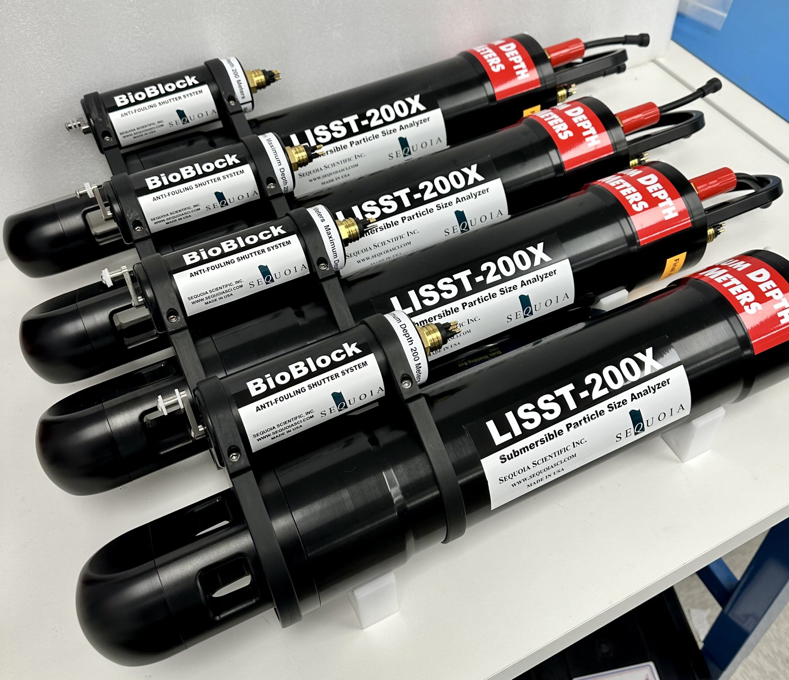
Sequoia Scientific Inc. provides 13 LISST-200X particle sizing instruments for the Ocean Observatories Initiative
Sequoia Scientific Inc., a leading provider of cutting-edge oceanographic instrumentation, proudly announces an agreement for purchase to The Woods Hole Oceanographic Institution (WHOI), the operator of NSF’s Ocean Observatories Initiative (OOI). WHOI is an independent non-profit dedicated to ocean research, exploration, and education. WHOI's scientists and engineers push the boundaries of knowledge about the ocean to reveal its impact on our planet and our lives. 13 LISST 200X instruments with BioBlock accessories were delivered to their facilities in Woods Hole, MA.
The LISST-200X is a self-contained submersible laser diffraction particle size analyzer, designed for measuring suspended particle size and concentration in the aquatic environment – oceans, rivers, lakes, streams. The LISST-200X also takes a variety of measurements such as temperature, depth, and optical transmission. Sequoia’s Bioblock accessory, when attached to the LISST 200X, utilizes a copper shutter to prevent biofouling, enhancing the instruments’ performance during extended deployments such as those being done for the OOI.
The Ocean Observatories Initiative is a National Science Foundation sponsored research facility with a network of platforms across both the Atlantic and Pacific Oceans that collect continuous data real-time about the state of our oceans. One of these data collection sites was the Coastal Pioneer Array located about 75 nautical miles south of Martha’s Vineyard, Massachusetts. Plans are underway to relocate the Pioneer Array to the Mid-Atlantic Bight (MAB) off the coast of Cape Hatteras, NC in spring 2024.
Among the science questions of interest for the Pioneer MAB Array are the nature of suspended particles and how they are distributed in the water column over time. A competitive procurement process, based on solicitation of information from multiple vendors and evaluation of the responses relative to pre-defined criteria, resulted in selection of the Sequoia product. The first planned deployment of the Sequoia instrumentation is in the spring of 2024. Data are to be available after instrument recovery in the fall of 2024.
This association between Sequoia Scientific, Inc. and WHOI emphasizes a shared commitment to advancing oceanographic research. It also shows that Sequoia products are the standard for such projects.
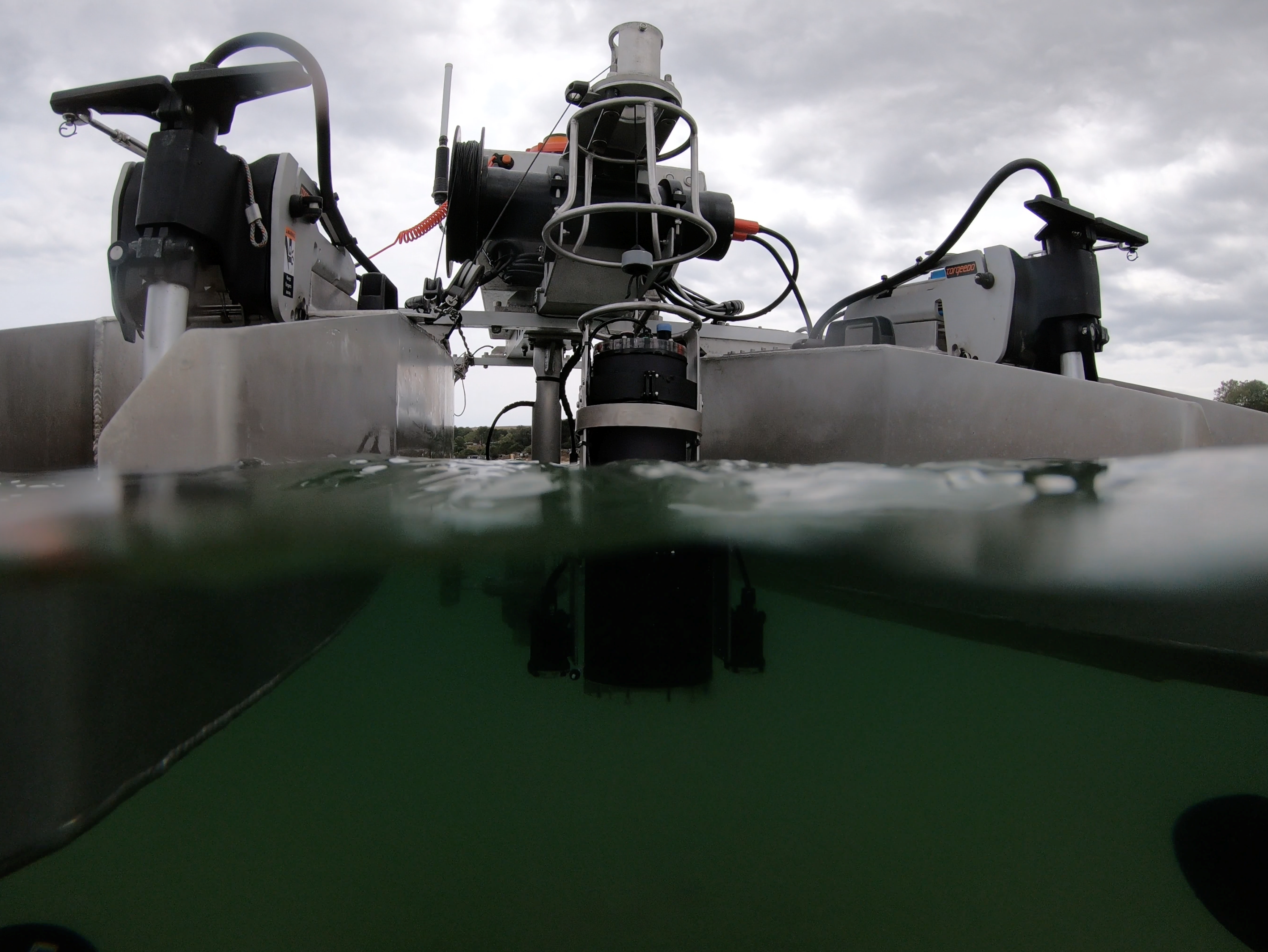
Robotic seagrass solution targets commercial adoption
HydroSurv, a leading provider of electric and hybrid uncrewed surface vessels (USVs), has secured Innovate UK funding to commercialise an end-to-end seagrass monitoring solution with support from the Department for Environment, Food and Rural Affairs (DEFRA).
The project aims to provide a rapidly scalable, low-impact and comprehensive answer to the numerous challenges of monitoring seagrass meadows by combining HydroSurv USV platforms with an automated data processing toolchain. The robotic solution will be demonstrated over spring and summer 2024 at three designated worksites on the south west coast of England, conducting baseline and seasonal re-survey work and ultimately delivering some 40 days of on-water testing and data, showing seasonal variation over the project’s 9-month duration.
Dubbed SONARS (Seagrass Observation using Novel Acoustic Remote Sensing), the project will see HydroSurv work with Coastal Marine Applied Research (CMAR) from the University of Plymouth, the Ocean Conservation Trust, Falmouth Harbour and the South Devon Area of Outstanding Natural Beauty.
The technology package has already significantly advanced seagrass mapping capabilities. HydroSurv started to develop the non-invasive solution, with Innovate UK support, in early 2022 in collaboration with the University of Plymouth and Valeport. This previous work focused on refining acoustic ground discrimination techniques from the robotic vessel platforms and was successfully demonstrated in live trials over the past two years. The partners envisage that this next stage of technology development will propel the concept towards scale deployment and commercial viability.
“Working with partners and end-users, our focus has shifted from technology development towards the scale pilot of a whole-system solution. The ability to demonstrate to service operator customers and channel partners that the solution has been extensively tested with engagement from survey commissioners, not only on small field trials, but also on multiple sites and seasonal resurveys, will build confidence in the solution.” commented David Hull, CEO of HydroSurv.
“We’ve received a lot of interest from survey contractors who are interested in delivering these services, amongst others in environmental monitoring. Working together with them, I expect we could take this solution to market within the next 12 months across the UK and further afield in Europe.”
HydroSurv's cloud-based data hosting and visualisation application, EasySurv, facilitates real-time decision making without the need for specialist GIS packages or interrogation skills. EasySurv hosts content-managed data deliverables, processed using machine learning algorithms, alongside the raw data collected from the company’s USVs.
Timothy Scott, Associate Professor in Ocean Exploration at University of Plymouth, said: “It is great to see how our early-stage academic collaboration with HydroSurv is developing into a ready for market solution. HydroSurv has leveraged our expertise in hydrographic survey and data analytics to facilitate a streamlined end-to-end solution for seagrass monitoring. We look forward to supporting HydroSurv in this next phase of development.”
HydroSurv is delivering the project from its facilities in Exeter, in close proximity to the pilot test sites in the South West of England. The company will expand its data processing team as a result of the project.
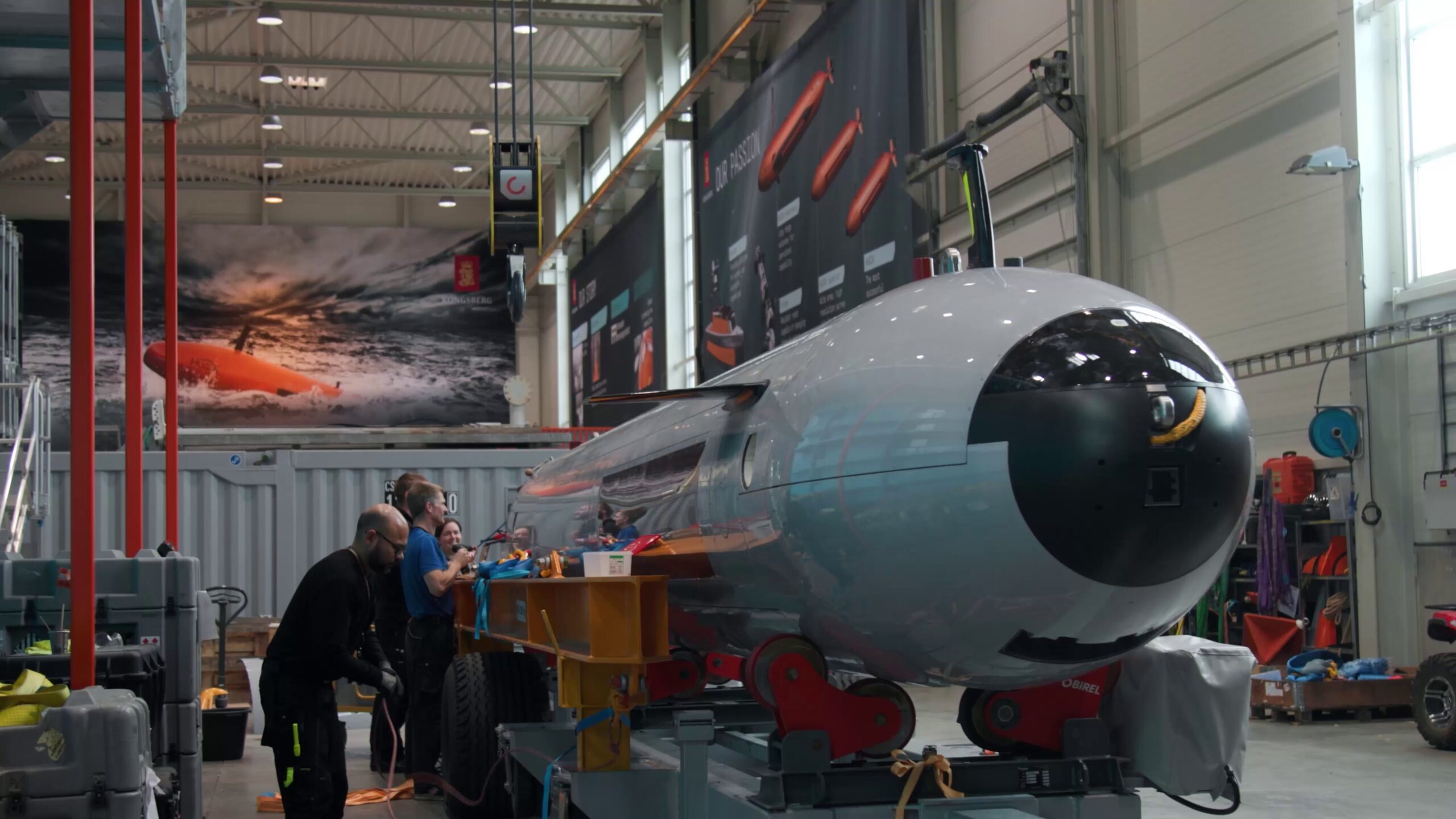
Kongsberg Discovery awarded 24 month contract with the Defense Innovation Unit (DIU)
Kongsberg Discovery is excited to announce a Defense Innovation Unit (DIU) award to assist in the U.S. Navy’s Large Displacement Unmanned Underwater Vehicle (LDUUV) prototype.
Kongsberg Discovery has been awarded a contract with the Defense Innovation Unit (DIU) to rapidly deliver HUGIN Autonomous Underwater Vehicle (AUV) capabilities for the U.S. Military. The total contract could result in the Navy acquiring HUGIN Endurance and HUGIN Superior deep-water AUV systems.
Kongsberg Discovery offers unmatched and proven Unmanned Underwater Vehicle (UUV) experience spanning over 30 years. Since the start, Kongsberg continues to develop and deliver the most successful and trusted large deep-water AUV systems for both commercial and government customers, with approximately 100 large HUGIN AUV systems delivered globally.
HUGIN Endurance, one of the newest members in the HUGIN AUV family, is the biggest and most capable with its 39’ length, 47” diameter and 15-day endurance, enabling unsupervised shore-to-shore operations over a 1,200 nm range. HUGIN Superior, the workhorse of KONGSBERG’s HUGIN AUV family and the deep-water industry standard, is a 22’ long, 35” diameter, and 70-hour endurance vehicle.
Both vehicles are tightly integrated with a suite of KONGSBERG’s proven sensors providing IPoE (Intelligence Preparation of the Operational Environment), MCM (Mine Counter Measure), SBW (Seabed Warfare), and seafloor mapping capabilities at delivery. HUGIN Endurance expands these capabilities by providing capacity for further payload integration and range. KONGSBERG’s longstanding expertise in inertial navigation, autonomy in both UUVs and USVs, battery development, and the ability to fuse sensor and payload data seamlessly, enhances productivity and cost effectiveness for the operator.
Martin Wien Fjell, President of Kongsberg Discovery, shared “With HUGIN Endurance we are pushing the boundaries for autonomous over-the-horizon AUV operations. We are excited to bring our many years of AUV experience in support of the U.S. Government and look forward to closely partnering with DIU and the U.S. Navy to support making their LDUUV program a reality. HUGIN’s reliability has created a legacy and our continued evolution has enabled us to provide the expertise needed on such a program.”
KONGSBERG has been supporting the U.S. Department of Defense (DoD) in various forms since 1892 when the Krag–Jørgensen rifle was first selected for standard U.S. Army issue. Since then, KONGSBERG has continued to support the U.S. DoD with products such as: NASAMS (National Advanced Surface-to-Air Missile System), Remote Weapons System (RWS), Naval Strike Missile (NSM), and oceanographic mapping sonars.
Headquartered in Lynnwood, Washington, KONGSBERG Discovery’s U.S. team specialises in the delivery and integration of underwater acoustic systems, UUVs, and uncrewed surface systems, along with value-added engineering. Caitlin Hardy, President of KONGSBERG Discovery's U.S. entity shared “Our team in the U.S. is proud to have a long-standing relationship with U.S. Government customers to enable acquisition of the best quality oceanographic data for the rapid creation of mission-critical information utilising KONGSBERG Discovery’s acoustic products, considered gold standards for efficient seabed mapping and characterisation. We are honoured to help DIU’s efforts in leveraging best-in-class commercially available equipment with our team of UUV experts supporting here in the United States.”
For more than 200 years, KONGSBERG has combined industrial experience with technology and creativity. Alone and in partnership with others, it has developed world-class products that have made the planet safer and more sustainable.
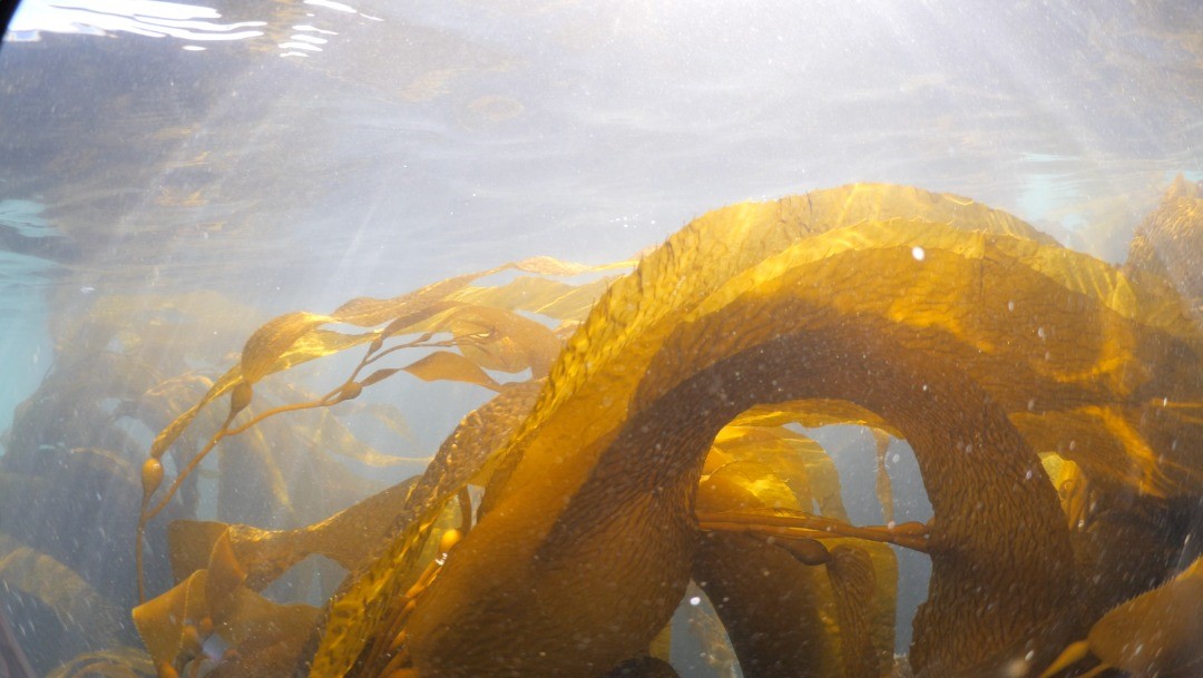
New global research initiative investigates carbon sequestration potential of kelp
Could kelp be a secret weapon in the fight against climate change? A new research project aims to answer that question by better understanding how kelp contributes to carbon sequestration in our oceans.
The international collaboration, led by New Zealand’s Cawthron Institute with partners Sequench (NZ), Kelp Forest Foundation (Netherlands), and NatureMetrics (UK), aims to revolutionize our comprehension of kelp forests' contributions to the global carbon cycle and their potential as a tool for climate mitigation.
Nathan Geraldi, Lead Developer for Ocean Solutions at NatureMetrics, said seaweeds, particularly kelp, could be a significant source of the carbon sequestered in the ocean.
“Up until now, kelp’s contribution to the carbon cycle has remained unknown because we have not had the tools to measure it.”
Samantha Deane, Managing Director of the Kelp Forest Foundation, said traditional methods such as stable isotope, pigments, and lipid analysis have been limited in their ability to accurately detect and identify kelp-derived carbon in marine sediments.
“This project's approach leverages the power of environmental DNA, which involves the extraction of genetic material directly from environmental samples without any obvious signs of biological source material.”
Cawthron Institute’s Dr Xavier Pochon, who will lead the project, said a core focus of the project will involve building a kelp genomic library.
“We’ll be using leading edge molecular diagnostic tools to estimate the amount of kelp-derived organic matter that is stored in marine sediments and surrounding environments.”
Anastasija Zaiko of Sequench said the central hypothesis of this research is that eDNA is a reliable and traceable marker for tracking giant kelp-derived carbon, allowing for a more accurate assessment of carbon sequestration potential in kelp forests.
“By successfully identifying and quantifying giant kelp DNA in sediment samples, this project aims to establish a direct link between source and sink habitats.”
Elif Demir-Hilton, advisor at Oceankind, said they are happy to support this strategic partnership to design and test molecular tools for species-specific carbon tracing.
“The capacity to track the fate of kelp carbon can inform restoration and conservation efforts and fill an important gap in the toolkit for carbon sequestration.”
Ocean Census and Ocean Genome Legacy forge alliance to revolutionise marine biodiversity research
Ocean Census, a global mission to discover marine life, is excited to announce a new partnership with Northeastern University's Ocean Genome Legacy center (OGL), a research laboratory and public-access marine DNA and tissue bank, as part of the growing Ocean Census Alliance.
This collaboration unites the Ocean Census commitment to accelerate the discovery of ocean life with the Ocean Genome Legacy center’s two decades of expertise in marine genomics, with the goal of catalysing our understanding and protection of marine biodiversity.
Initiated by The Nippon Foundation and Nekton in April 2023, Ocean Census has set an ambitious global target to discover 100,000 new species over the decade. Despite estimations that our ocean is home to 1-2 million species, only a fraction, about 10-25%, has been documented so far. Historically, the pace of species discovery has been steady, with approximately 1,500 new ocean species identified each year since the 1840s. Recent decades have seen a slight uptick, but the introduction of cutting-edge technologies in imaging, DNA sequencing, and artificial intelligence is poised to dramatically accelerate this rate.
OGL is set to play a pivotal role in the global programme, contributing extensive experience in collecting, exploring, preserving and sharing the genomic diversity of the sea to enrich the process of species discovery and documentation. In addition, OGL’s global network of research collaborators will be engaged in Ocean Census, including participating in expeditions, knowledge sharing, and public engagement, strengthening this collaborative initiative.
"In protecting our planet, lack of knowledge is the greatest bottleneck—we cannot protect what we do not know and understand. By exploring the incredible diversity of life in the sea and the rich information hidden in its genomes, we learn the best ways to safeguard our planet’s delicate ecosystems. We are thrilled to join with Ocean Census in this extraordinary expedition of discovery and preservation."
Prof. Dan Distel, Director of OGL
This alliance between Ocean Census and OGL not only signifies a fusion of expertise, but a commitment to provide open-access to biological samples and data to scientists, policymakers, and the general public, fostering a collective consciousness of our ocean’s biodiversity. Each discovery promises to guide the sustainable management and protection of marine ecosystems.
Ocean Census builds upon significant historical marine exploration initiatives, such as The Challenger Expeditions and The Census of Marine Life.
"Our endeavour is not the first of its kind, but it is undoubtedly the most expansive and timely. Collaborating with OGL enables us to magnify our impact, ensuring that our discoveries contribute profoundly to both our understanding and stewardship of the ocean."
Prof. Dr. Alex Rogers, Science Director at Ocean Census
The Nippon Foundation of Japan, a private, non-profit foundation for social innovation, and marine research charity Nekton, a UK-based marine science and conservation institute, are coordinating partner activities along with funding and managing the Ocean Census Science Network, species discovery, expeditions, and public and policy engagement activities.
Call for partners to join the Ocean Census Alliance:
Ocean Census is made possible as a result of an Alliance that connects philanthropy with government, business, science, media and civil society organisations.
Every one of Ocean Census' partnerships brings the company closer to its goal and enriches its mission by adding diverse knowledge, resources, data and perspectives. If you share Ocean Census' passion for the discovery and protection of ocean life, you can join them.
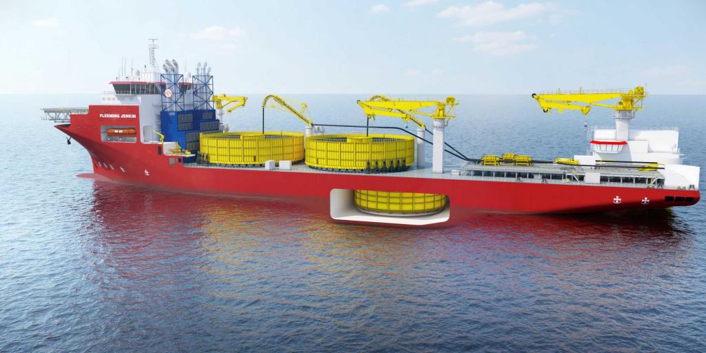
Jan De Nul Group selects MacArtney's cutting-edge CEMAC tensioner systems for complete CLV fleet
MacArtney's comprehensive scope involves designing, constructing, and delivering advanced tensioner systems for Jan De Nul Group’s entire cable-laying fleet, including the Connector, Willem de Vlamingh and the new Fleeming Jenkin. The scope also encompasses upgrading tensioner systems previously delivered for the Isaac Newton.
Remarkably, MacArtney's involvement extends to the recently announced XL CLV - the Fleeming Jenkin - boasting a cable carrying capacity of 28,000 tonnes and engineered for ultra-deep laying in waters up to 3,000 meters, as well as bundled lay operations.
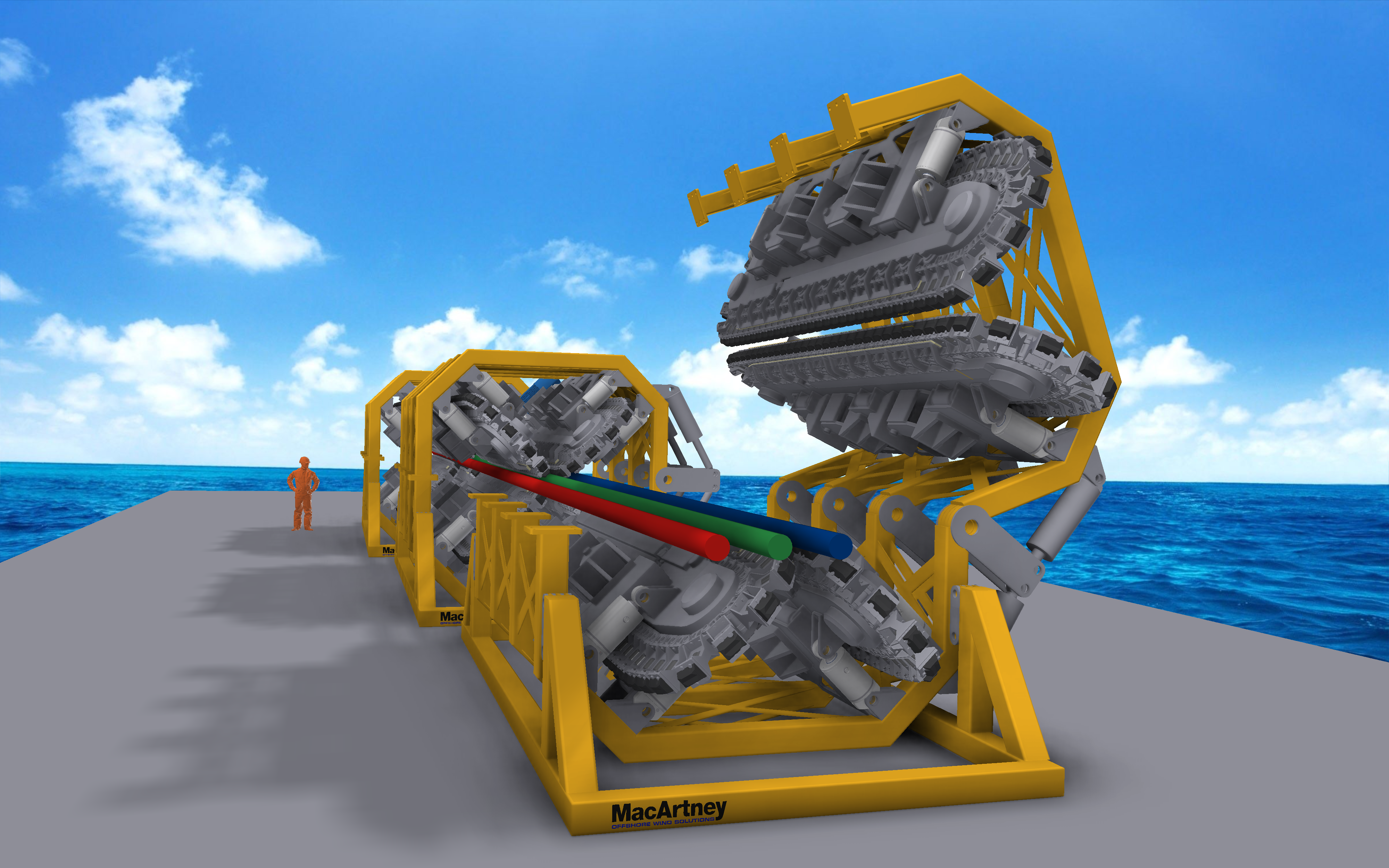
For the XL CLV, MacArtney will supply three high-capacity CEMAC four-track main deck tensioners designed to facilitate bundled lay operations with minimised cable distance and combined lay operations up to 150 tonnes, two CEMAC loading arm tensioners and associated fully electrical 1-tonne cable engines.
Unique system qualities secure re-selection by Jan De Nul Group
Recognising the technology expertise following previous collaborations with MacArtney Group on a 50-tonne all-electric Launch and Recovery System (eLARS), Jan De Nul Group engaged MacArtney to develop a large-scale, leading-edge solution for their CLV fleet. MacArtney’s mission-critical equipment solutions are known for their exceptional versatility and seamless integration with clients' existing systems.
The electrically driven tensioners ensure safe and controlled cable handling, with real-time monitoring of cable integrity. All equipment is fully integrated with the vessel’s central control system. The solution is future-proof and designed to handle Jan De Nul Group’s advanced export and interconnect cable installations.
Mike Welling, the Business Development Manager at MacArtney Offshore Wind Solutions, says: "Being re-selected by Jan De Nul Group for the supply of mission equipment signifies a testament to our competencies. Our dedicated team of construction and automation engineers is motivated by the challenge of aligning with the vessel's dynamics and control system seamlessly. We are committed to ensuring that Jan De Nul Group keeps playing a leading role in pioneering the cable installation market with their advanced fleet."
Advancing sustainability in maritime operations
In line with the commitment to sustainable practices, all CEMAC tensioners provided by MacArtney will be driven by electric motors and feature active front-end drive technology. This innovative approach ensures efficient cable tension and facilitates energy regeneration, which is redirected back to the vessel's power plant, which includes batteries. By incorporating green technologies, MacArtney contributes to developing a future-proof fleet, aligning with the broader industry shift towards environmentally conscious solutions.