OceanWise deliver Data Governance and Marine Spatial Data Training as part of the GEOMAC course at the UK Hydrographic Office
OceanWise’s Dr Mike Osborne recently delivered a short course as part of the latest Geospatial Marine Analysis and Cartography (GEOMAC) course held at the UK Hydrographic Office in Taunton. The course, ‘Data Governance and Marine SDI’, underlines the importance of data governance in increasing efficiencies and reducing risk when creating and maintaining traditional and e-navigational products and services.
The GEOMAC is a Nippon Foundation funded initiative under the International Hydrographic Organization (IHO) Capacity Building (CB) Programme and is open to individuals from all national hydrographic offices and maritime authorities who wish to expand their knowledge and understanding in this area. The programme “aims to provide an education programme for young nautical cartographers with cutting-edge knowledge and connects the nautical cartography community… The skill and knowledge of this community contributes to solving regional and global challenges beyond the SOLAS obligation”.
Why is data management important to hydrography?
In recent years, the importance of data management to hydrography generally, and as a fundamental building block to marine cartography and source data receipt and assessment, has been highlighted. In addition, the concept of a Marine Spatial Data Infrastructure (MSDI) is increasingly being used to describe how marine geospatial datasets, including hydrographic datasets, are created, and how the data products based on them are maintained and made available to users. Although one of the drivers behind MSDI is to make hydrographic data more readily available for activities unrelated to navigation (e.g., Marine Spatial Planning), it is now accepted that the principles and components that make up MSDI can be applied across all other application areas, including in support of e-navigation.
OceanWise Training:
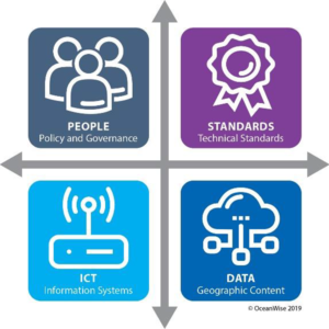
OceanWise was asked to supplement the GEOMAC course by introducing students to data governance theory and practices used in other geographical domains and application areas and how best practice data governance is fundamental to supporting the use of new technologies (e.g., machine learning, autonomous vessels, smart ports) and to making hydrography relevant more widely.
The current GEOMAC cohort included students from 15 countries including from West Africa, Middle East, South America and New Zealand. Particularly satisfying was that included in this group were students from IHO member states that have not participated in IHO MSDI related activities previously.
“[The course was] very helpful and opened my vision greatly”; “Instructor was top of his game. Great understanding of the topic and good delivery”; “Thank you for your time and effort – I will use all the knowledge when I return to my country”.
Several examples of student feedback from Dr Mike Osborne training in 2022

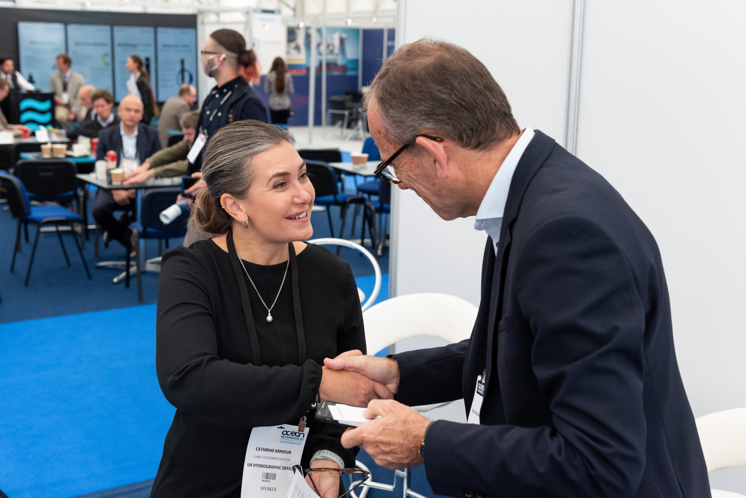
Ocean Business announces exhibitor list for 2023 show
With just two months to go until Ocean Business 2023, more details can be revealed about the line-up of exhibitors at the global technology and science exhibition for marine industries.
More than 300 world leading manufacturers and service providers shaping the future of ocean science and technology have booked space at the sold-out show, which runs from April 18-20 at the National Oceanography Centre in Southampton.
The three-day event is open to all visitors for free by registering online at www.oceanbusiness.com.
This year’s exhibition, covering two halls and including a full programme of training and demonstrations on the dockside, on board vessels and in the classroom, promises to attract record crowds from around the world.
Visitors will be able to see the latest developments in transformational ocean technology, from cutting edge ROVs, to next generation sensors, to advances in automation.
Among the highlights, Framework Robotics is launching its new remotely operated vehicle, BUDDY, which can be adjusted to suit any mission, from exploration to surveying, inspection and more.
Leading UK scientific technology company ANB Sensors will present its state-of-the-art pH sensors, which operate to depths of 1,250m in fresh or saltwater environments, are virtually maintenance-free and allow for long-term remote monitoring.
Subsea cable specialist Novacavi, meanwhile, will provide updates on its range of solutions designed to meet the most complex needs of marine and underwater technology – expertise that has seen the company support projects from upgrading the infrastructure of the European Multidisciplinary Seafloor and Water Column Observatory, to supplying the INGV National Institute of Geophysics and Volcanology with cables deployed at 4,000m to monitor the sea.
UK company RoboSys Automation, which uses artificial intelligence and machine learning algorithms to provide scalable levels of autonomy, will introduce its smart shipping software, Voyager AI, that can transform a new or existing vessel into a fully autonomous USV.
Also taking a stand at Ocean Business is Terradepth, the company spearheading seafloor hydrographic and geophysical survey solutions through unique autonomous underwater vehicle technology. Find out more about Terradepth’s high resolution data collection and its data management and visualisation system, Absolute Ocean.
Tom Chant, CEO of the Society of Maritime Industries, said: ‘Ocean Business is simply an essential event for the MST sector. If you cut Ocean Business with a knife you’d see ‘collaboration and innovation’ written through the heart of it. It’s a really important component supporting the industry turnover of £1.6 billion per annum. We look forward to seeing you there.’
Cheri Arvonio, Event Director at show organiser Diversified Communications, said: ‘Ocean Business 2023 is gearing up to be a bumper show, providing unbeatable opportunities for doing new business, sealing deals, networking and hearing industry updates.
‘We can’t wait to welcome both Ocean Business regulars and first-time show goers for three days of exciting product launches, innovation and ideas from today’s ocean technology trailblazers.’
To see the full exhibitor list, please visit: https://exhibitormanual.oceanbusiness.com/
About Ocean Business: Ocean Business is a hands-on ocean technology exhibition and training forum which is owned and organised by Diversified Communications UK in partnership with the Society of Maritime Industries. Since its launch in 2007 it has been hosted by the National Oceanography Centre where the event benefits from utilising the facilities of a world class centre. In recent years the event has grown substantially and now attracts more than 360 exhibitors and 5,000 international attendees.
For further information, please contact:
Georgia Smith, Marketing Manager
t: +44 (0)1273 916528
e: [email protected]
Website: www.oceanbusiness.com
Cheri Arvonio, Event Director
t: +44 (0)1453 836363
e: [email protected]
BeeX, Sulmara and the University of Strathclyde secure international grant funding for a Targeted Autonomous Inspection Service for offshore wind
An international consortium has been awarded a prestigious Enterprise Singapore - Innovate UK grant to develop a next generation autonomous structural integrity inspection capability.
Autonomous robotics specialist BeeX, offshore survey and inspection specialist Sulmara, and structural integrity specialists at the University of Strathclyde share a vision to deliver an autonomous low carbon solution for windfarm integrity monitoring. Ultimately the end goal is a Robotics-as-a-Service (RaaS) solution drastically reducing the resources required to conduct essential underwater inspections and asset integrity assessment of offshore wind turbines.
This solution would contribute to meeting Europe’s net-zero commitments by slashing energy requirements and emissions related to inspection activities in the wind sector. Large diesel fuelled and carbon intensive vessels are currently required to inspect energy assets, making the introduction of optimised, automated, lower carbon solutions a crucial part of any net-zero future.
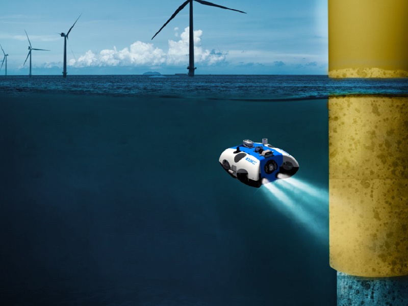
Assisted by the grant funding, BeeX will be delivering their next-generation Hovering Autonomous Underwater Vehicle (HAUV) specifically for Offshore Wind; carrying specific survey & inspection payloads suitable for monopile and jacket inspections, piloted by artificial intelligence to automate inspection tasks & deliver repeatable efficient inspection of windfarm monopiles from seabed to the air water interface. This HAUV platform will be enhanced with new features including enhanced endurance and improved sensor payload from critical learnings discovered from BeeX experience with their flagship HAUV, A.IKANBILIS on the Nordsee One windfarm, offshore Germany last year.
Sulmara’s scope will define the vertical asset inspection capabilities and sensor payloads needed for this next generation HAUV to meet the demands of the offshore wind sector as well as managing field trials and demonstration of the system alongside BeeX in 2024, with the ultimate aim to integrate the HAUV into a bespoke Unmanned Surface Vessel. The inspection missions will be optimised based on research by the University of Strathclyde, in developing a Structural Integrity framework to generate risk-based, fit-for-purpose, inspection missions that will feed into the HAUV automated mission control software.
Offshore wind is a critical and rapidly expanding sector with UK government targets to deliver 5 GW of floating wind by 2030. Underwater inspections are essential in ensuring its safety. In many cases, these inspections are also mandatory by governments and financial backers. Operations and Maintenance Costs at offshore wind farms remain the biggest operational cost. The costs are largely driven largely by the use of large, specialised Dynamically Positioned (DP2) vessels to deploy work-class remotely operated vehicles (WROVs). With low carbon and reduced cost at the forefront of this project, it is clear that an HAUV hosted from an Uncrewed Surface Vehicle (USV), both optimised for the offshore wind sector can build on and improve the capabilities of the current Work Class ROVs hosted from larger crewed vessels.
BeeX chief executive officer, Grace Chia, said: “By 2025, we expect BeeX’s fully autonomous systems to help wind farm developers and operators reduce costs and risks to a fraction of today’s, from consenting to end-of-life. This grant funding is a critical piece of financing that unlocks the partners’ abilities to enable safer and clean energy for all, and we look forward to deployments at more wind farms across Europe.”
Kevin McBarron, CEO Sulmara added: “BeeX next generation HAUV combined with Sulmara USV hosting has the potential to be an industry game changer, cutting costs and drastically reducing carbon emissions.”
Professor Feargal Brennan, Head of Department for Naval Architecture Ocean and Marine Engineering at Strathclyde said: “The climate emergency demands that we apply the very best innovation to ensure better underwater data collection methodologies. We look forward to delivering this research and to seeing our innovations applied to achieve breakthroughs in remote subsea inspection.”
Royal Netherlands Institute for Research acquires new Teledyne Gavia Osprey AUV
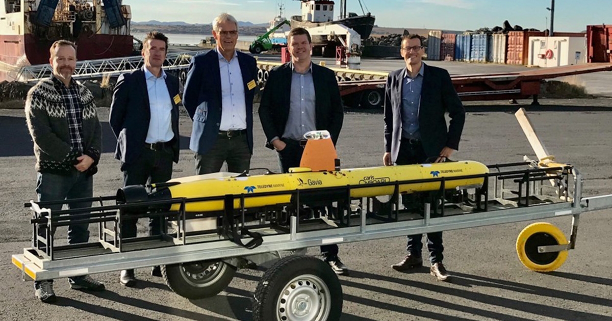
Teledyne Marine announces the acquisition of a new Gavia Osprey AUV by the Royal Netherlands Institute for Sea Research (NIOZ). NIOZ is the Netherlands' national oceanographic institute conducting multidisciplinary applied marine research to address major scientific questions about our oceans and seas. NIOZ acquired the Teledyne Gavia Osprey AUV to add to its ever-growing fleet to be used in scientific projects, like understanding the significant impacts of climate change on the seas and oceans, such as temperature increase and acidification. NIOZ studies the ocean's role in changing climate from equator to pole, from the continental shelf to the deep ocean, and from present to past.
Today, the ocean environment is changing rapidly due to external pressures, which will affect the diverse but poorly understood ocean processes that play an essential role in marine ecosystems and our future climate. The Osprey AUV is Teledyne's latest member of its underwater vehicle family and provides customers like NIOZ with longer endurance and greater payload capacity while maintaining true modularity. The Osprey AUV builds on the Gavia product line of the world's first truly open and modular AUVs. The Osprey extends operational endurance to over 24 hours (configuration dependent) combined with high-performance payloads like Synthetic Aperture Sonar and Teledyne Reson SeaBat series multibeams, making it the perfect tool for collecting high-quality data with consistency and accuracy.
“We are really looking forward to field operations and being a part of new developments with this most recent addition to the Teledyne Gavia AUV family. The Osprey will be a real modular AUV with a flooded payload bay that will allow us to interface and use our new in-house developed sensors. The Teledyne Osprey also makes logistics effortless because it can easily be moved around in Pelican cases.” Said Marck Smit, NIOZ Sea Research.
How EIVA’s autopilot software and hardware helps HydroSurv provide accessible and scalable USV solutions
‘Working with EIVA on this autopilot has helped us ensure our USVs and their users can scale up – towards accessible autonomous technology deployed globally.’ David Hull, CEO HydroSurv
NaviSuite Kuda – Autopilot, EIVA’s total autopilot survey solution provides a fleet of benefits – through seamless integration between software and hardware, as well as the specially developed features of both. This solution took off to new waters when EIVA met HydroSurv, designer and operator of uncrewed surface vessels (USV) for inland, nearshore and offshore operations. This journey began with a mission…
The challenge of making emerging USV technologies accessible for more surveyors ‘USV technology has yet to achieve the widespread adoption it deserves – given the benefits include low fuel costs and carbon emissions. As an emerging technology, USVs are inaccessible to many, and we work to overcome this through our solutions.’ – David Hull, HydroSurv
In 2020, HydroSurv was looking for an industry partner that could help them expand globally by delivering autopilots for their USVs at a large scale. When they chose to work with EIVA, the two companies collaborated in further developing EIVA’s optimised autopilot hardware and software solution, NaviSuite Kuda – Autopilot.
By leveraging EIVA’s existing resources, such as the well-established NaviSuite software, USV manufacturers like HydroSurv can provide a solution that helps to overcome challenges to USV accessibility like:
- Getting started with a new technology, for example training users
- Adapting to different project requirements
With the help of HydroSurv’s input, EIVA’s development team improved and sailed out NaviSuite Kuda – Autopilot onto the market (officially released in 2022). In this case study, journey through EIVA and HydroSurv’s partnership in the stages of development leading up to this release. You will learn why HydroSurv has integrated this autopilot on several of their USVs to increase accessibility, scale up operations globally and keep up to date supporting emerging autonomous technological developments.
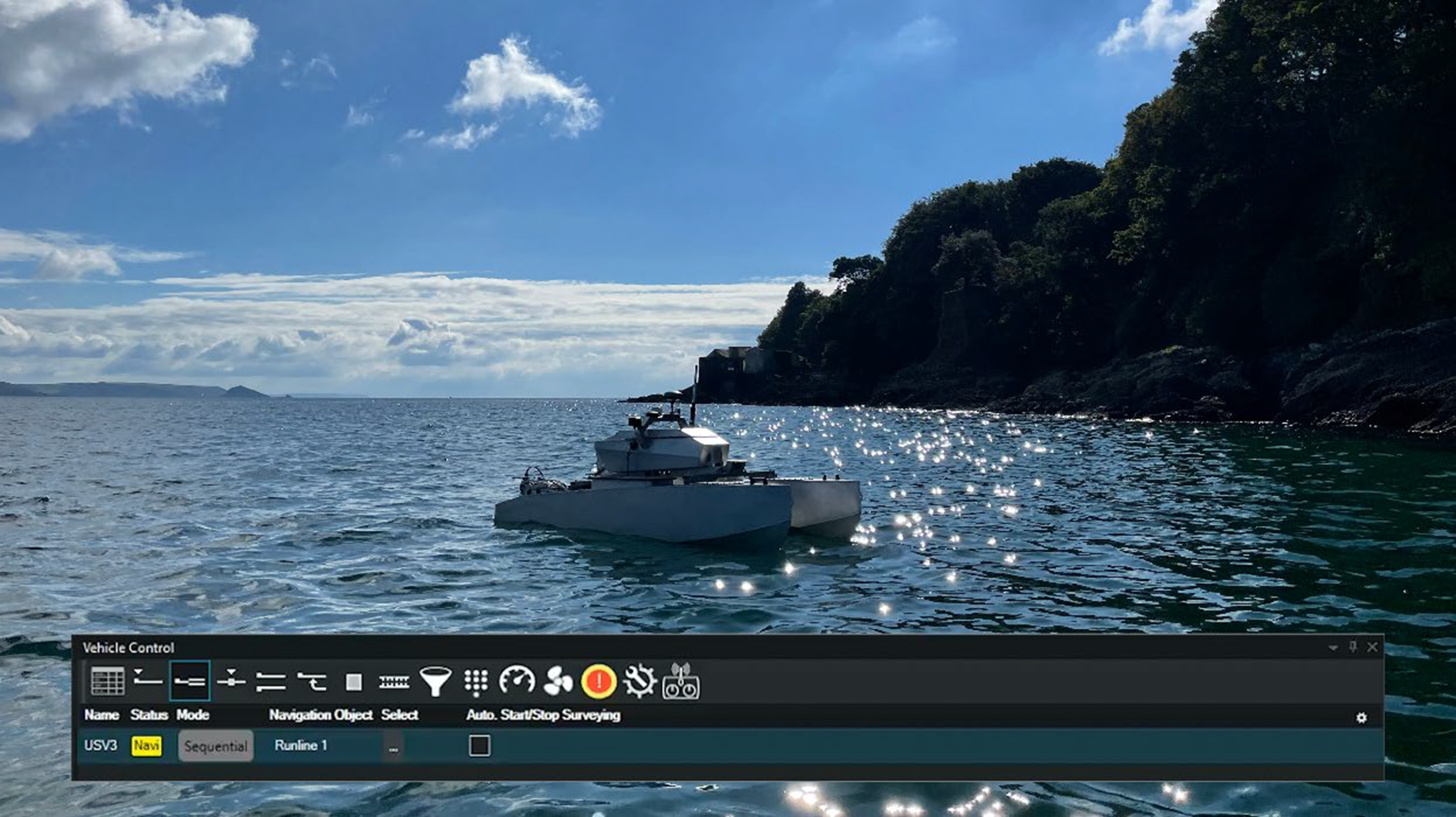
Easy to get started: Surveyors meet a familiar (inter)face
Before this autopilot was even a twinkle in EIVA’s eye, NaviSuite Kuda survey software was sailing the seas, providing surveyors with real-time QC data displays, automated coverage tools, comprehensive 3D data deliverables and more.
The offshore surveyors in HydroSurv’s team were familiar with EIVA’s NaviSuite software from their experience at sea – and they’re not alone with this. By choosing to use an autopilot that seamlessly works together with a software suite many surveyors already have training in, HydroSurv made it easier for new users of their USVs to get started surveying.
‘One of the challenges that face emerging technology is the difficulty and expense of training new users. We decided to equip our USVs with EIVA’s NaviSuite survey software, which is an interface already familiar to many surveyors, so they can save on the cost of training’ – David Hull, HydroSurv
In addition to having an existing user base familiar with the software, as a long-time key player in bathymetric survey solutions, EIVA offers many training opportunities, such as eLearning and virtual or classroom training courses. This all makes it ideal for helping new users get started with HydroSurv’s USV.
A 360 total solution: Leveraging the teamwork between sister companies
To provide a ready survey tool, HydroSurv chose EIVA as provider of not only survey software and control interface, but also provider of the autopilot. By further developing EIVA’s autopilot in cooperation, the teams collaborated to ensure that the software and hardware work together optimally for safe autopilot surveys.
Another way HydroSurv could ensure streamlined integration between parts in their USV was by partnering with several companies in Covelya Group, which EIVA is part of.
‘In order to best provide 360 solutions, we decided to work with several Covelya Group companies. We started out with positioning equipment from Sonardyne, then survey software and autopilot from EIVA, and recently we’ve been working with Voyis, who provides laser and optical payloads’ – David Hull, HydroSurv
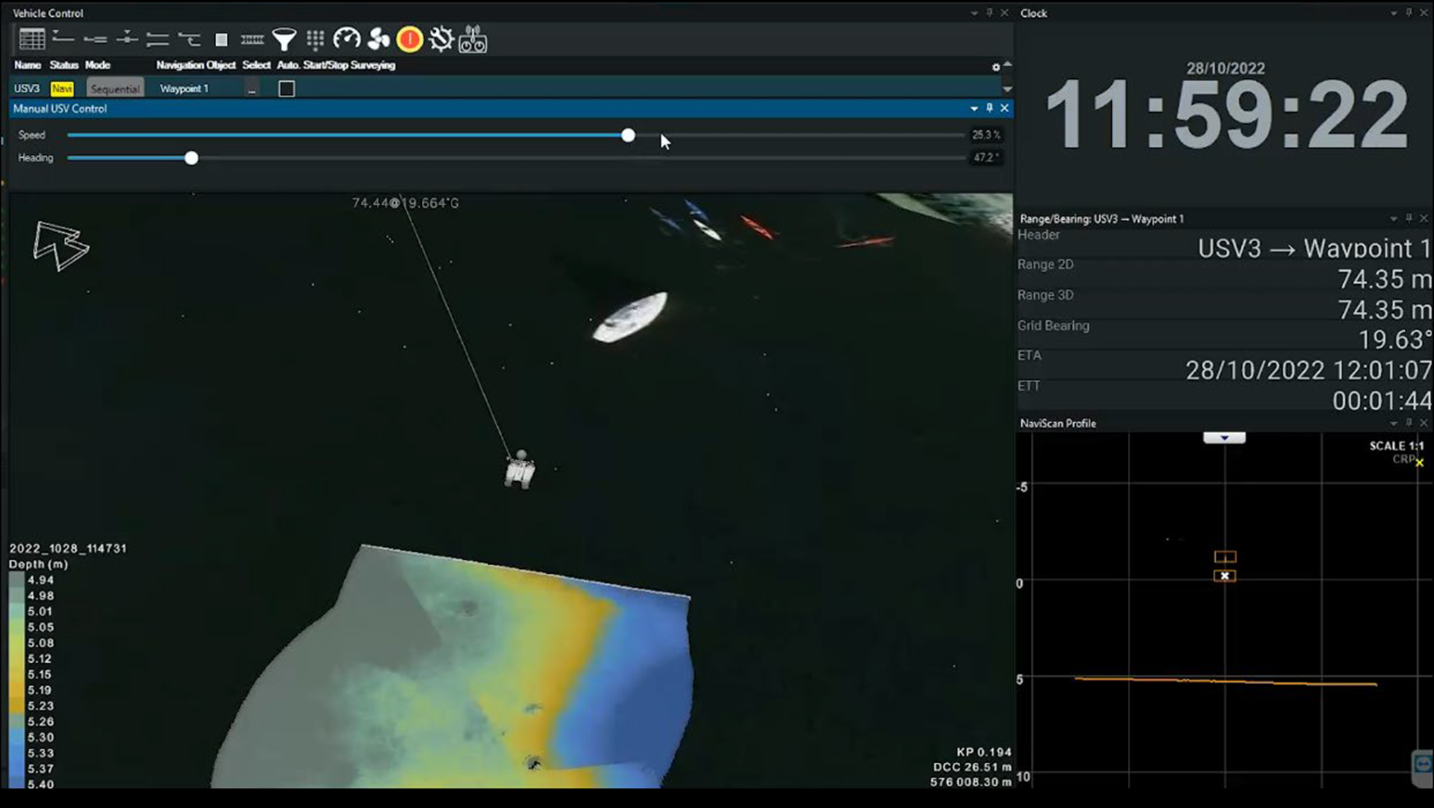
Remote survey solution sails forward benefits for operators
HydroSurv contributed with practical insights into the needs of surveyors for safety, flexibility and scalability – while EIVA developed and tailored hardware and software solutions to meet these needs.
Safety: Solutions developed for practical needs
One of the main concerns with any autopilot is safety. EIVA addressed this in the precise control and emergency stop features of NaviSuite Kuda software, but also by providing an ideal controller to go with the autopilot.
When switching between manual and automated steering, the choice of controller used is important to ensure safety, ease and quality. HydroSurv wanted a radio-controlled (RC) joystick solution optimal for the task through a rugged design and ensuring seamless integration with the autopilot’s hardware and software interface. This integration means the controller is plug-and-play, with the buttons and joysticks pre-configured for your use.
Preparing this ideal controller for HydroSurv is how NaviSuite Kuda – RC Joystick came to be a standard optional add-on with EIVA’s autopilot.
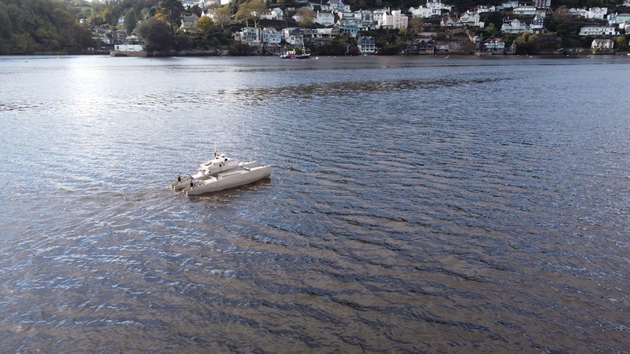
Flexibility: Software supports a variety of project-based requirements
Investing in USV technology becomes more feasible if a USV operator can continue using one solution for a wide variety of projects. This is one of the goals of HydroSurv and EIVA’s partnership: to create the autopilot building block enabling HydroSurv’s ready-to-go USV solutions to be used for a multitude of tasks.
NaviSuite Kuda was designed to allow surveyors to use the same software for any setup. It supports a variety of survey and inspection tasks and is possible to integrate with virtually any sensor and vessel type – adapting easily to different project requirements.
This flexibility was also applied in developing NaviSuite Kuda – Autopilot.
‘NaviSuite Kuda – Autopilot supports both entry-level setups with widely available parts, as well as high-end professional level parts and protocols’ – Martin Kristensen, VP Hardware Development EIVA
To make USV total solutions more accessible for users such as freelancers and startups, HydroSurv offers leasing options, while EIVA tailors software pricing based on capabilities needed. For example, entry level surveys with a multi-beam echo sounder and LiDAR can be performed with the NaviSuite Kuda Core variant. At the other end of the spectrum is NaviSuite Kuda Pro + Processing, which may be chosen if advanced data processing tools are needed.
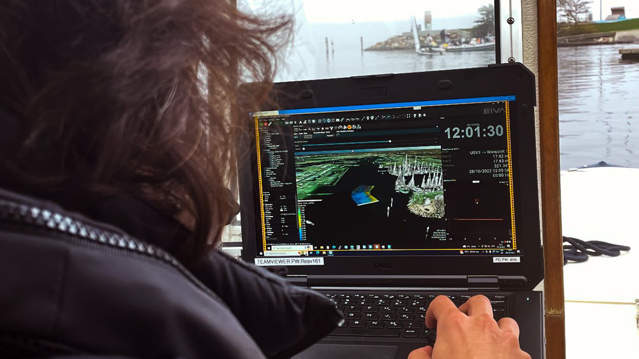
Scalability: Keeping up with the growing wave of autonomous technology
NaviSuite Kuda is not only a complete toolbox for everything from survey planning and acquisition to processing and delivery, it’s part of a suite of solutions that are constantly growing, for example to enable data processing automation with Workflow Manager, AI image recognition with NaviSuite Deep Learning. Advanced features for autonomous operations are added to NaviSuite Kuda with each new version. EIVA is consistently in close dialogue with innovative partners like HydroSurv for input on these updates.
Resulting autopilot sails forward with support
In 2022, EIVA delivered the first autopilots to HydroSurv, with orders for more in the works. The autopilot is integrated as standard on the REAV-28, and HydroSurv continues to integrate NaviSuite Kuda – Autopilot and software on more USV models.
‘It’s always challenging to integrate new core technologies. With an industry partner, we want to know that they will be there to help overcoming these challenges’ – David Hull described how HydroSurv experienced issues during an important integration sea trial integrating the autopilot on a new, larger USV model… ‘EIVA was there when we needed it – they put an engineer on the plane to help us out. This built a lot of trust that we can go forward and keep growing with EIVA as a partner’.
Products in play
- NaviSuite Kuda – Autopilot
- NaviSuite Kuda survey software bundle
- Custom hardware & software development
New Seabed 2030 partnership strengthens autonomous ocean mapping in support of a complete map of the entire seafloor
The Nippon Foundation-GEBCO Seabed 2030 Project has entered into a memorandum of understanding with ecoSUB Robotics - a division of Planet Ocean - which designs and builds innovative autonomous underwater vehicles (AUVs) for ocean research.
The collaboration will greatly support the realisation of a complete map of the ocean floor as ecoSUB AUVs are able to navigate areas which are inaccessible to scientists and divers for safety or other reasons.
Established in 2004, Planet Ocean provides instrumentation to the oceanographic research community, as well as the defence sector. In 2015 the company - together with the Marine Autonomous Robotic Systems group based at the National Oceanography Centre (NOC) - developed a groundbreaking micro AUV which led to the creation of ecoSUB Robotics, based at the Marine Robotics Innovation Centre of NOC. Since then ecoSUB Robotics have developed the system to include a comprehensive and growing range of AUV’s incorporating advanced navigation techniques and the highest resolution side scan soar systems available along with cameras and acoustic communications.
The portability and affordability of ecoSUB enables new and existing users of AUV’s to explore new opportunities offered by compact autonomous systems for survey, science, defence and exploration.
Seabed 2030 is a collaborative project between The Nippon Foundation and GEBCO to inspire the complete mapping of the world's ocean by 2030, and to compile all bathymetric data into the freely available GEBCO Ocean Map. GEBCO is a joint programme of the International Hydrographic Organization (IHO) and the Intergovernmental Oceanographic Commission (IOC) and is the only organisation with a mandate to map the entire ocean floor. Seabed 2030 is formally endorsed as a Decade Action of the UN Decade of Ocean Science for Sustainable Development.
“At ecoSUB Robotics we’re committed to increasing accessibility to AUVs and making this groundbreaking technology available to all,” commented Terry Sloane, Managing Director of Planet Ocean.
“Advancing oceanographic research will benefit the entire population and AUVs play an invaluable role in progressing this field of ocean science. We look forward to supporting the global effort in pursuit of a complete ocean map led by Seabed 2030 through the development of our advanced, yet affordable, AUV technology.”
Seabed 2030 Project Director Jamie McMichael-Phillips said “Not only do AUVs enable us to access hazardous areas, but they also provide a solution to the mapping of remote and uncharted areas.
“Collaborative working is essential to Seabed 2030 and it’s through partnerships - such as this with ecoSUB Robotics - that we’re able to ensure our strategy remains forward-looking, and that our efforts are well-positioned to make use of innovative technologies as they become available to progress our goal.”
All data collected and shared with the Seabed 2030 project is included in the GEBCO global grid, which is free and publicly available.
Planet Ocean and ecoSUB Robotics will be exhibiting at Ocean Business in Southampton, in April this year.
EdgeTech announces major order from ECHO81
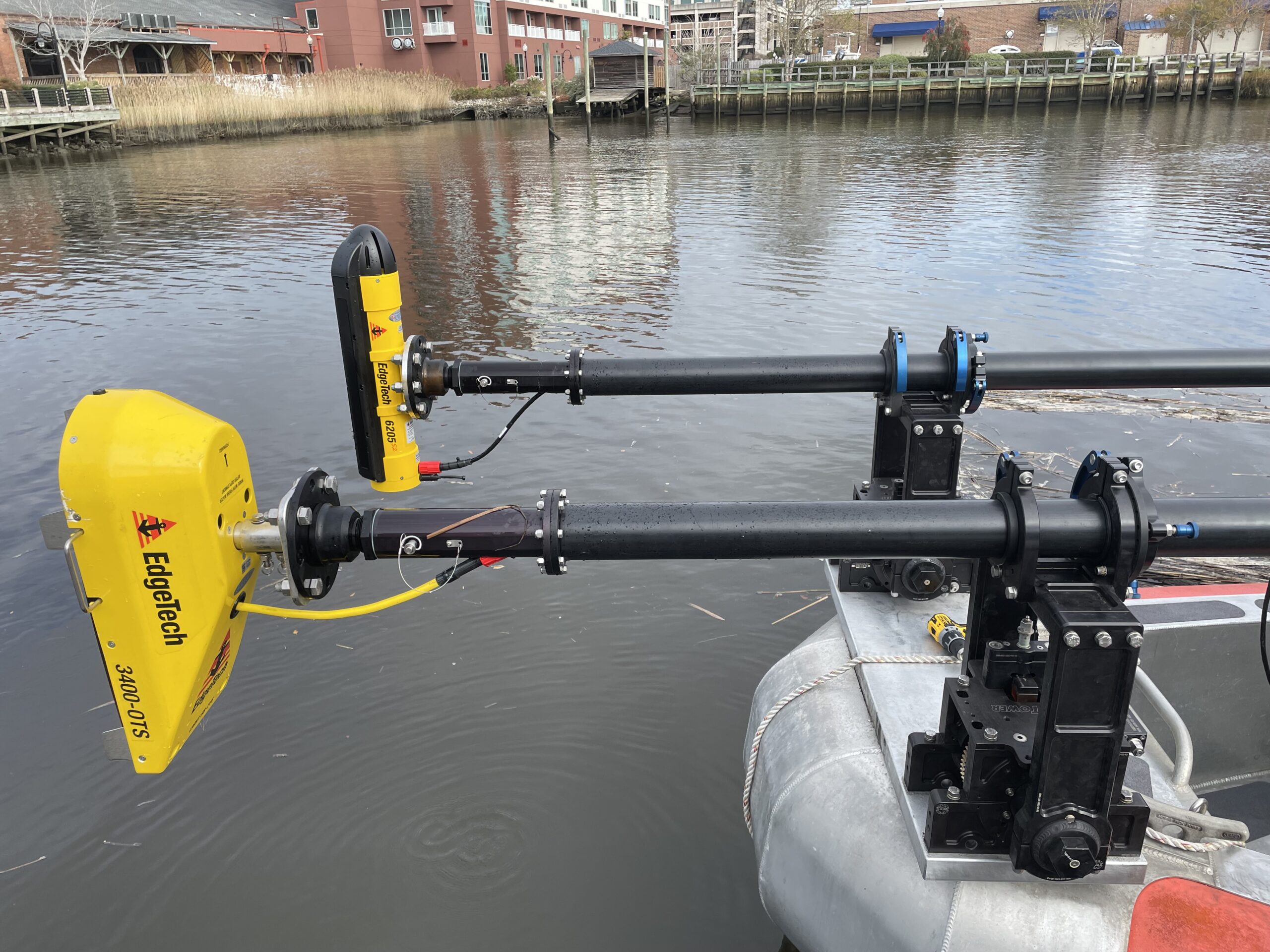
EdgeTech, the leader in high resolution sonar imaging systems and underwater technology, is proud to announce that it has received a significant order from ECHO81 for its 6205s2 Bathymetry Systems, 4205 & 4125 Side Scan Sonar Systems, 3400-OTS Sub-Bottom Profilers, and 2050-DSS combined Side Scan & Sub-Bottom deep tow systems. The order, valued at over $2 million, will be available for direct purchases from ECHO81.
ECHO81 is EdgeTech's exclusive partner and distributor in the United States and Latin America for the 6205s2 and 3400 product lines. In late 2022, ECHO81 also purchased EdgeTech's 3000m rated deep tow system, Model 2300, which is equipped with advanced Bathymetry, Side Scan, and Sub-Bottom sensors, as well as INS and USBL systems. To further enhance its Sub-Bottom Profilers arsenal, EdgeTech supplied ECHO81 with its new and improved low-frequency sub-bottom profiler model SB-0512e in December of last year.
"We are honored to have received this large order from ECHO81 and are confident that our advanced sonar technology will meet their clients’ needs for high-quality underwater mapping and exploration," said Doug McGowen, Director of Sales and Marketing at EdgeTech. "We look forward to a continued partnership with ECHO81 and providing them with the best equipment and support."
CSignum announces commercial availability of HydroFi™ Wireless Radio Modem to transmit data across water-air boundary
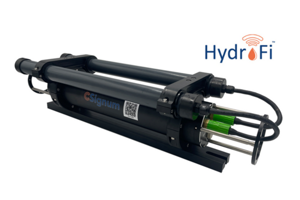
CSignum Ltd., the global leader in wireless underwater communications, asset digitization, and actionable insights for ocean and freshwater industries, announced that the CSignum HydroFi Modem™ will become commercially available in early Q2 of 2023. The low-frequency HydroFi Modem, the first and only reliable point-to-point wireless radio communications system that enables the transmission of data through the water-air boundary, is currently undergoing successful trials for three use cases: AUV and ASV data recovery, ship hull networking, and real-time ADCP data backhaul.
CSignum has successfully transmitted real-time data 28-30 meters from underwater modems to topside receivers connecting HydroFi technology to industry standard sondes, ADCPs and dataloggers. The HydroFi Modem is complementary to and overcomes the limitations of acoustic, optical and cabled data transmissions to provide the monitoring and navigational platform and solutions that digitize and scale IoT subsea devices for underwater industries encouraging greater sustainability, increased performance, and preparedness for unforeseen events.
AUV/ASV Data Recovery
HydroFi has also been used in an industrial asset integrity initiative underway at HESS for monitoring, inspecting, and repairing assets using autonomous vehicles in the oil and gas sector, a project that also has promising potential for environmental monitoring. HESS and Ocean Aero (Stand A50) have successfully completed initial trials in which a HydroFi Modem deployed on a Triton AUV sent and received information from underwater sensors positioned either on the sea floor or on submerged buoys. The companies are currently exploring how sensors could be further utilized to monitor overall water quality parameters in the future -- from dissolved oxygen levels to turbidity to ocean temperatures. Initial trials have proven the industrial use case workable whether the transmitting modem and receivers are connecting with vehicles underwater, at the surface or in the air.
“The ability to deliver underwater communications utilizing the HydroFi Modem unlocks exciting opportunities to expand Hess autonomous operations,” said Keith Blystone, Chief of Staff at Ocean Aero. “By autonomously collecting and communicating subsurface data wirelessly with the TRITON, we can speed up information gathering for Hess—and that means faster decision making.”
Ship Hull Networking
Working with partners and the HydroFi Modem, CSignum has successfully provided access to real-time wireless data transmissions from the keel of Her Majesty’s Yacht (HMY) Britannia, which was decommissioned in 1997 and is now moored in Ocean Terminal in Edinburgh, to topside receivers on multiple decks without the expense and difficulty of fitting cables through the hull to monitor the environment around and under the ship and the ship’s condition. Prior to the successful trial, marine vessel operators have had no way to conduct inspections or to “see” what is happening below the waterline of their ships without dive crews, underwater vehicles or bringing vessels into drydock for routine maintenance – an inefficient, expensive and potentially dangerous process. CSignum and its partners are currently evaluating other commercial use cases for underwater-to-air deck use cases in the under-hull domain.
Real-Time ADCP Data Backhaul
Working with a recognized leader in the field of water quality, CSignum is trialing a simplified system using the HydroFi Modem that eliminates the need for a cabled link (which can snag and fail due to repeated wave motion stresses) to an ADCP (Acoustic Doppler Current Profiler). In the solution, which is deployed in the Baltic Sea, data are communicated wirelessly for a range of 25 meters from an ADCP modem on the seabed to a second modem with datalogger on a surface vehicle or buoy. The system, which transmits data every five minutes, is planned to be expanded to allow the transmission of corrosion, strain, flow, motion, pressure, pH, sea levels, pollution, climate change and temperature data from seabed to air. This solution is ideal for environmental monitoring and wireless deployment in turbid adverse conditions such as where fresh water and sea water collide, or out in shipping channels where buoys are tough to deploy.
“We are thrilled with the progress we have made in just the last year to bring our patented HydroFi Modem to market and appreciate the partnerships we have with Hess, Ocean Aero, and others, so our solutions are ready for these use cases and others yet to be imagined,” said Chris Brooks, CEO at CSignum.” “Our ongoing work with sensor manufacturers to ensure sensors, sondes and ADCPs can connect seamlessly with HydroFi technology means we can expect to play a central role in unlocking data collection from below the surface of our oceans, lakes and rivers – providing end-to-end reliable and standardized connections in real time for all subsea IoT devices.”
Availability
The CSignum HydroFi Monitor version 1.0 is available for commercial sale in Q2 of calendar year 2023.
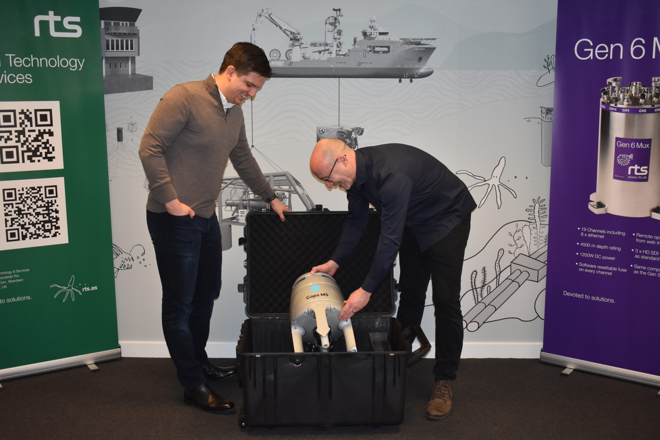
Rental Technology & Services expands its rental pool of equipment with the addition of Exail's Gaps M5 USBL system
Rental Technology & Services (RTS), a leading provider of rental equipment for the subsea industry, adds Exail's Gaps M5 USBL acoustic positioning and communication system to its rental pool of equipment. The move comes as part of the company's ongoing effort to offer the latest and most innovative solutions to its customers from its newly established UK offices. Available for RTS customers globally, Gaps M5 addresses accuracy and performance needs, and requirements for vertical and horizontal tracking applications.
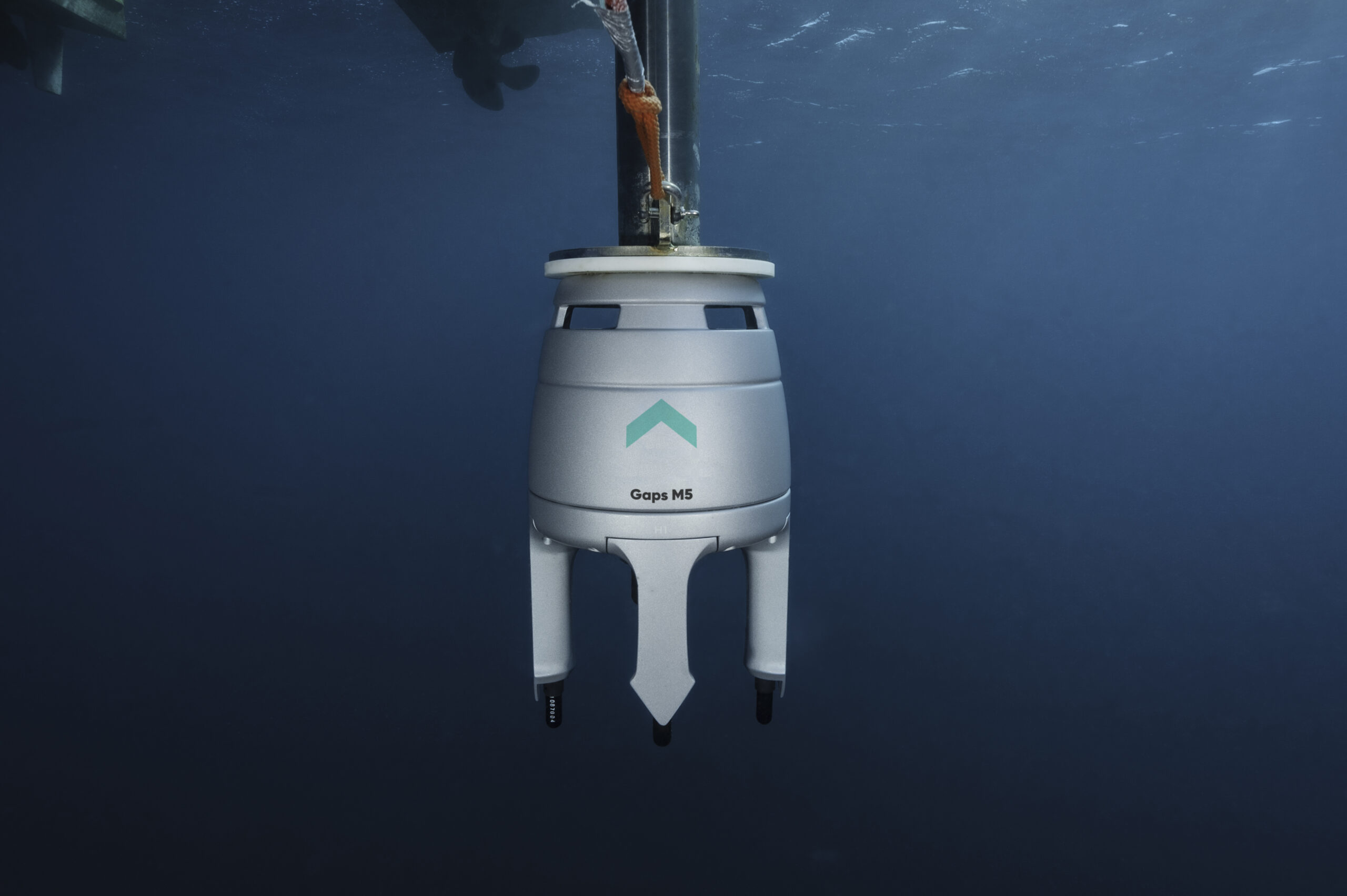
The latest addition to Exail’s USBL product range, Gaps M5 is a compact, export-free, and omnidirectional USBL system that uses acoustic technology to accurately locate and track subsea assets in real-time. Designed for use in challenging environments with shallow water up to 995 m water depth, the system offers high accuracy, reliability, and ease of use, making it an ideal solution for a diver, subsea asset, or inspection ROV horizontal tracking.
“By bringing the Gaps M5 USBL system to our UK office, we are once again looking to respond to what we know our customers are demanding” said Dale Townend, UK Technical Manager at RTS. “This investment in the new Gaps M5 USBL systems and MT9 transponders represents a valuable addition of assets that we haven’t previously held in our rental pool. We are excited to now have access to these advanced systems going forward, continuing our close relationship with Exail, and supporting our customers' project requirements for accuracy and efficiency on a global scale”.
Maverick Piccininni, Regional Sales Manager at Exail said: “We are grateful to RTS for their renewed trust and continued support of our underwater navigation and positioning technology. As a leading provider of rental equipment, RTS is committed to providing the highest quality solutions to its customers, and the addition of our Gaps M5 USBL system to its rental equipment fleet is a testament to that commitment. We look forward to seeing our Gaps M5 USBL systems deployed in the field and supporting RTS customers globally”.
The Gaps M5 USBL system is available for rent immediately and is backed by RTS’s experienced team of technicians and support staff.
Fugro and IOC/UNESCO launch working group to unlock private-sector ocean data
The Ocean Decade Corporate Data Group—co-chaired by Fugro and the Intergovernmental Oceanographic Commission of the United Nations Educational, Scientific and Cultural Organisation (IOC/UNESCO)—was officially launched last week during an online kick-off meeting. Organised in support of the United Nations Decade of Ocean Science for Sustainable Development, the working group is focused on creating frameworks and mechanisms to make privately owned ocean science data publicly available for the benefit of humanity.
Joining the group as founding members are five private-sector companies representing a diverse range of industries. They include Alcatel Submarine Networks, Ava Ocean, CGG, Equinor and Ørsted. Discussions are ongoing with other industry-leading companies who are expected to join the group at a later stage. Together with co-chairs, members will explore data sharing challenges and opportunities to develop solutions and best practices for making private-sector ocean data publicly available, including during a special session at this week’s Oceanology International Americas Conference.
“We are delighted to officially launch this working group to establish ways to unlock the huge potential of industrial ocean data that is currently inaccessible to science,” said Dr. Vladimir Ryabinin, IOC/UNESCO Executive Secretary. “Such collaborations amongst science, industry and governments are transformative in enhancing ocean knowledge and information, and to developing the long-term sustainable solutions that we need to return to the clean, healthy, productive and resilient ocean. I am very grateful to the founding members of this group for engaging proactively with us in this movement and I know they will inspire many others to join.”
Fugro CEO Mark Heine concurred, stating, “It is heartening to have such high-calibre businesses answer the call to join this critical working group. As companies who actively collect and own a wide range of ocean data useful for the global science community, we have a unique opportunity to contribute to the Ocean Decade movement through data sharing, collaborative partnerships and technology innovations that will help increase our collective understanding of the ocean and restore its health.”