
Arctic Rays Announces Acquisition by Inkfish
 Arctic Rays, a pioneering leader in subsea imaging technologies, proudly announces its acquisition by Inkfish, a newly established organization dedicated to providing services to support marine researchers globally. This strategic acquisition is set to combine Arctic Rays's innovative product offerings with Inkfish's ability to connect with scientific partners and causes around the world.
Founded in 2015 on a commitment to manufacture turnkey custom imaging solutions with superior responsiveness, Arctic Rays has consistently delivered patented lighting packages, still and video capture payloads and other integrated systems for subsea vehicles operating as deep as 6,000 meters.
Inkfish was founded in 2021 to support marine researchers by planning and executing research expeditions, providing resources and developing new technologies to further research initiatives.
With this acquisition, Inkfish recognizes the value of Arctic Rays's market position and its dedication to quality engineering design, manufacturing processes and post-deployment support.
“Today marks the beginning of an exciting new chapter for our company and ocean exploration,” said Dirk Fieberg, general manager and co-owner of Arctic Rays. “As we join forces with Inkfish, we embrace the opportunity to pioneer new technologies and make discoveries beneath the waves. Together, we will chart new frontiers in marine exploration, inspiring innovation that will define the future of our industry and beyond.”
This acquisition marks a significant milestone in the evolution of both companies. Customers can expect continued support and availability of Arctic Rays's current product lines, including repairs, replacements and ongoing customer service. In alignment with the acquisition, new custom development will be evaluated on a case-by-base basis. The Arctic Rays brand will be phased out and will take the Inkfish name, including its Satellite Beach, Florida, location and equipment sales.
“What Inkfish has accomplished quietly in only three years, is nothing short of amazing,” said Lee Frey, director of engineering and co-owner of Arctic Rays. “We are proud to add Arctic Rays’ extensive engineering knowledge and field experience to the exceptional Inkfish team, and we look forward to an exciting future together, pushing the boundaries of technology toward furthering marine science and the betterment of our oceans.”
"This acquisition represents a pivotal moment for marine exploration and technology," says Annika Andresen, who oversees Inkfish operations and research programs. "By combining our expertise and resources, we'll be able to push the boundaries of ocean research further than ever before, developing cutting-edge tools and methodologies that will benefit the entire marine industry."
For more information about the acquisition, please visit arcticrays.com or contact [email protected]

New Partnership in Germany with Ocean Metrics
 Impact Subsea has appointed Ocean Metrics, a leading provider of innovative solutions in environmental monitoring and marine technology, as its official distributor.
With their expertise and commitment to customer service, Ocean Metrics is the perfect partner to ensure German sensor users receive continued exceptional support.
Ben Grant, Managing Director says,
“We are thrilled to work closely with Ocean Metrics in Germany to further enhance our customer support in the region.
The technical focus and capability of Ocean Metrics is well aligned with the customer supporting ethos of Impact Subsea.”
Kraken Robotics completes High Resolution route survey contract in Australia
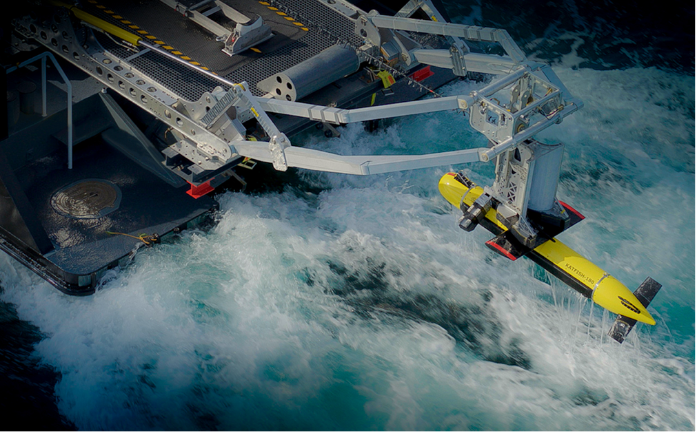
Kraken Robotics Inc. announces the successful completion of a contract to supply high-resolution seabed mapping sonar service to Precision Hydrographic Services (PHS), a customer supporting the Australian Department of Defence. The Australian Department of Defence project sought to undertake Hydrographic High Resolution Route Surveys (RS) for a number of Australian ports. The purpose of these surveys was to enable the collection of Maritime Geospatial Information (MGI) to support maritime domain awareness through the acquisition of high-resolution seabed foundation data and associated oceanographic data.
Managing Director of Precision Hydrographic Services Pty Ltd (PHS), Neil Hewitt stated: “Our decision to partner with Kraken Robotics and the KATFISH synthetic aperture sonar (SAS) system for this important Defence project has proven to be highly successful. Over the course of five months our team travelled non-stop from port to port and surveyed several thousand line-miles of Australia’s most important ports and waterways for Defence. The Kraken KATFISH performed faultlessly with not one hour of downtime.”
Kraken President and CEO, Greg Reid commented: “The Australian Defence Route Survey project has provided an excellent opportunity to test and demonstrate the performance of the Kraken KATFISH system. This is the first time that a customer has undertaken a wide area, multi-port survey project of this scale with the KATFISH - anywhere in the world. To do so in a safe and efficient manner with no downtime is a great credit to the vessel crew and the teamwork of the technical and survey personnel from PHS and Kraken Robotics.”
Under the scope of Kraken’s contract, a KATFISH™ high-speed survey/detection solution was used to acquire high-resolution route surveys of Australian ports. Under the contract, the survey campaign commenced in January 2024 and was fully complete in May 2024. This contract follows the results of a successful in-country demonstration of KATFISH™ for the RAN in Q1 of 2023 and the purchase of a KATFISH system by the RAN in Q2, 2023.
ABOUT KATFISH
The KATFISH is a high-speed seabed survey system providing ultra-high resolution seabed imagery and bathymetry for defense and commercial customers. The acoustic imagery and bathymetry collected by KATFISH systems provides customers with actionable intelligence about subsea assets and infrastructure such as subsea pipelines and fiber optic cables, as well as important hydrographic information about the safety of key transit routes for ocean going assets. Kraken has integrated KATFISH to a variety of manned and unmanned vessels of opportunity, providing both standalone turnkey seabed mapping as well as optional integration to a customer’s combat mission management systems.
ABOUT KRAKEN ROBOTICS INC.
Kraken Robotics Inc. (TSX.V:PNG) (OTCQB: KRKNF) is a marine technology company providing complex subsea sensors, batteries, and robotic systems. Our high-resolution 3D acoustic imaging solutions and services enable clients to overcome the challenges in our oceans - safely, efficiently, and sustainably. Kraken Robotics is headquartered in Canada and has offices in North and South America and Europe. Kraken is ranked as a Top 100 marine technology company by Marine Technology Reporter.
Fugro completes comprehensive survey for Atlantic Shores to advance US offshore wind projects
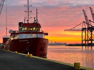
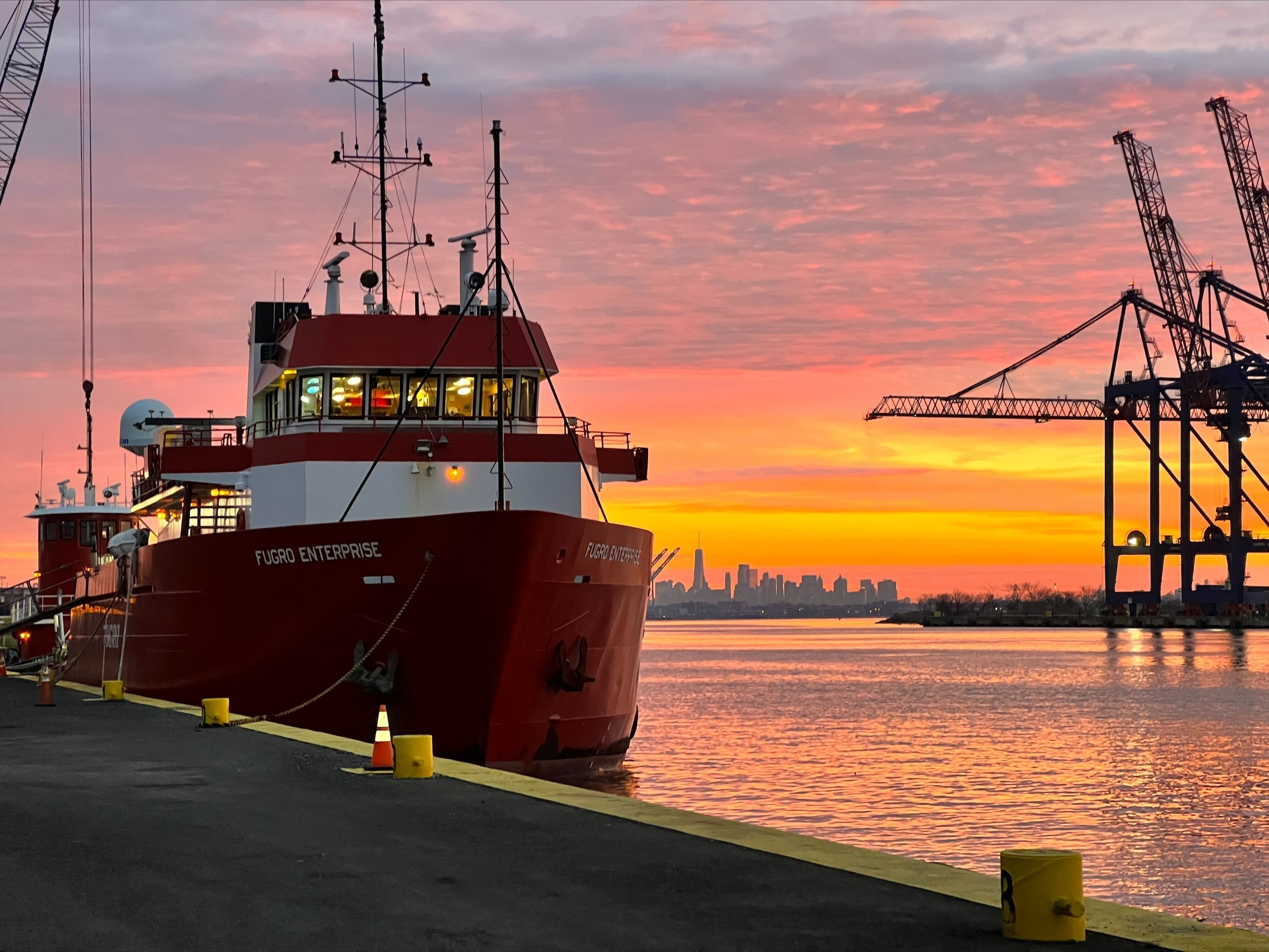
Fugro has successfully completed four years of continuous survey operations in New Jersey and New York for US-based offshore wind developer Atlantic Shores Offshore Wind. Supporting the site assessment of five projects across three lease areas totalling 1,000 km², Fugro worked with Atlantic Shores to pioneer a new data collection and management approach that increased survey efficiency by 30% and contributed to the recent federal approval of Atlantic Shores South, which will provide 2,800 MW of clean energy to New Jersey.
Traditionally, offshore wind site assessments have required multiple independent campaigns to gather oceanographic, seabed, soil and habitat data. Fugro streamlined this process by consolidating these efforts into a single, integrated programme aligned with Atlantic Shores’ portfolio strategy. To manage the large volumes of data associated with this approach—upwards of 100 TB—Fugro collaborated with Atlantic Shores to develop Fugro VirGeo®. This cloud-based Geo-data engagement and delivery platform provides internal stakeholders with real-time project information for faster decision making both in the field and office.
The platform also facilitated the first digital deliverables to federal regulators, supplementing the thousands of pages of reports required by current permitting standards. This push toward digital deliverables aims to increase transparency, build public trust, and further compress the development timeline through more efficient regulatory reviews, steps critical to achieving the aggressive national goal of deploying 30 GW of offshore wind energy by 2030.
“Given the shared values between Fugro and Atlantic Shores, we are proud of the longstanding partnership and commitment to advancing New Jersey’s first offshore wind project,” said Joris Veldhoven, Chief Executive Officer, Atlantic Shores Offshore Wind. “Over the last four years our teams have worked tirelessly to ensure we possess the most accurate data to develop our project portfolio safely and responsibly. Our partnership has led to industry innovations, advancements, and best practices that are charting the course for clean energy delivery now and for future generations.”
Céline Gerson, Fugro’s President and Group Director in the Americas, said, “The energy transition will require companies that are willing to lead by example—that work smarter to move faster while maintaining the highest accuracy and safety standards. Atlantic Shores is that kind of company, and we’re incredibly proud to have partnered with them to accelerate their offshore wind development journey. We’ve achieved a great deal together in the last four years, and we’re excited to keep this momentum going during future phases of development, working together to increase renewable energy in the US.”
Throughout the four-year field programme, Fugro achieved Atlantic Shores’ stringent “Goal Zero” safety standard for people and the environment. This accomplishment was made possible by the safety excellence of Fugro’s own team, as well as their subcontractors Alpine and S.T. Hudson Engineers, two local survey companies whose work on the project contributes to Atlantic Shores’ commitment to New Jersey job creation.
Successful collaboration secures MacArtney a contract with T. Mariotti for new navy vessel
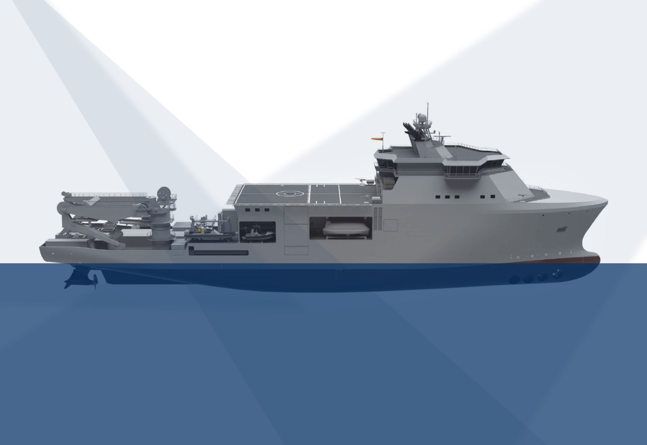
 MacArtney has been entrusted the role of one-stop solution partner, delivering critical underwater systems that bolster the security, safety, surveillance, and rescue efforts of the Italian Navy's Special and Diving Operations - Submarine Rescue Ship (SDO-SuRS) contracted to Italian shipbuilder T. Mariotti.
MacArtney's expertise in underwater systems integration proved paramount in delivering a comprehensive solution for the Italian Navy's SDO-SuRS. The solution comprises MacArtney's electric launch and recovery system eLARS™ and advanced technology from esteemed business partners Klein, AML Oceanographic and Sonardyne, providing high-res Side Scan Sonar, Moving Vessel Profilers, and Diver Detection Sonar systems.
Combined, these enhancements from MacArtney and its partners improve the vessel's launch and recovery, security, and surveillance capabilities. They also strengthen safety measures by enhancing the detection of unauthorised divers and vessels, tracking movements, and improving underwater imaging, thereby advancing the SDO-SuRS's search and recovery operations.
Together towards tomorrow
T. Mariotti, committed to setting new benchmarks in shipbuilding with every vessel, was intrigued by MacArtney's holistic approach and adherence to their high standards for next-generation technology.
"We are delighted to collaborate with our trusted partner, MacArtney, on this esteemed naval project, which represents the highest level of shipbuilding and technology,” states Marco Ghiglione, CEO of T. Mariotti, and continues: "MacArtney's adept integration of advanced technologies and expertise will undoubtedly contribute to the enhanced capabilities and efficiency of the Italian Navy's SDO-SuRS."
The new-built 120 m SDO-SuRS replaces the retiring Nave Anteo as the Italian Navy's (Marina Militare Italiana) primary special and diving operations - submarine rescue ship. It elevates both naval and civil underwater operations, supporting rescue missions, special tasks, and marine infrastructure protection.
Reliable performance through innovative design
T. Mariotti selected the MacArtney eLARS as a key feature of the SDO-SuRS. 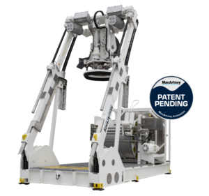
The eLARS technology provides an eco-friendly, compact, and reliable all-electric system. Its efficiency exceeds that of hydraulic systems by more than 30%. At the same time, eliminating pressurised oil over water significantly reduces oil spillage risks. Additionally, it features a self-assessment capability for preventive maintenance and enables remote shore-based operation, optimising overall processes.
Increasing MacArtney's Italian footprint
MacArtney's Italian subsidiary, established in 2019, has swiftly gained ground. Led by Managing Director Vincenzo Mauro, the Bologna-based office achieved remarkable feats in just five years, including the groundbreaking contract with T. Mariotti for the Italian Navy and the debut of the first eLARS in the Italian market. This progress highlights MacArtney's dedication to providing global access to local support, concludes Vincenzo Mauro:
"We value our client's trust in us for this pivotal project and remain devoted to delivering dependable and efficient underwater solutions for maritime operations worldwide."
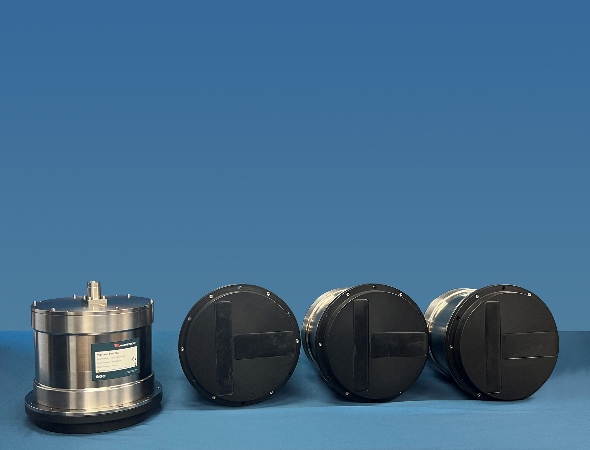
Wavefront announces shipment of first batch of Vigilant FLS® 600
 Wavefront, a leader in innovative sonar technology, is thrilled to announce the shipment of the first batch of its highly anticipated Vigilant FLS® 600. This latest addition to the Vigilant family of forward looking sonars will see the first units installed in a range of applications including surface and subsurface, crewed and uncrewed platforms.
Vigilant FLS 600 is a compact navigation and obstacle avoidance sonar creating – with unrivalled resolution and detail – a real-time, easy to interpret 3D terrain map of the seabed with automated alarms warning of objects in the water column ahead.
Vigilant has two principal operating modes: 3D and SONAR mode, both of which offer a class leading 120 degrees field of view on all range scales. Vigilant’s unique patented technology allows our 3D mode to provide stunning 3D depth imagery, further ahead of the platform than any competing system, at ranges in excess of 20 times the prevailing water depth up to a maximum 600 m range and down to 100 m depth. Sonar mode processes the intensity of the acoustic data to extract long-range positional data of objects up to ranges of 600 m. Data from both modes are used to automatically generate alerts for the operator or supervising system to warn of the presence of a navigationally relevant obstacle.
With its history mapping capability, a comprehensive picture of the underwater environment surrounding the vessel is built up. This provides crews and autonomous systems with maximum situational awareness for collision or ground avoidance, tight manoeuvres or backing out of confined areas. 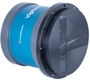
Speaking about this milestone for the Vigilant FLS 600, Paul Badger, Wavefront Managing Director, said ‘Vigilant FLS 600 bridges the gap from UUV, AUV and ASV applications all the way through to mega yachts and cruise ships to deliver high resolution navigational imaging and long range obstacle avoidance’.
About Wavefront
Wavefront was founded in 2004 with a mission to apply engineering excellence to the problems of underwater detection, imaging and navigation. Wavefront works with its customers to make the underwater world visible – protecting Critical National Infrastructure (CNI), preventing maritime collisions, monitoring the integrity of undersea assets and exploring our under-water world with stunning high-resolution imagery.
Wavefront is proud to have designed and developed some of the world’s most capable commercially available sonar systems:
- Sentinel IDS is the world’s most deployed Intruder Detection Sonar capable of detecting, tracking and classifying underwater targets including new drone threats;
- Vigilant FLS is a Forward Looking Sonar with unique patented technology capable of depth finding at ranges ahead of your vessel in excess of 20 times the prevailing water depth;
- Solstice MAS is a unique Multi-Aperture Sonar designed to provide world-class imagery by blending the high performance of Synthetic Aperture Sonar with the reliability and robustness of conventional side-scan; and
- Sentry IMS is a field-proven Integrity Monitoring Sonar designed for ocean depth deployments where it continuously monitors billions of cubic feet of seawater around critical seabed assets.
Wavefront’s industry-leading products are in use globally in civilian, public, defence, offshore and commercial markets.
Contact Information:
Andy Covey, Marketing Manager, [email protected]
Wavefront Systems Ltd - Camway, West 303, High Street, Sparkford, Yeovil, Somerset, BA22 7JQ, UK
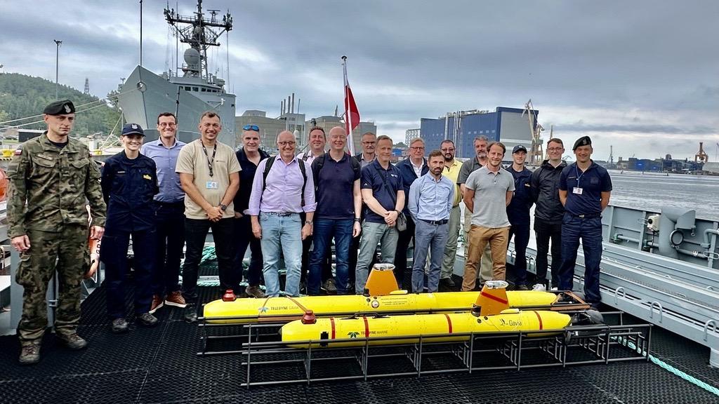
Grand opening of Teledyne GAVIA AUV Service Center in Poland
 Teledyne Gavia ehf. Headquartered in Kopavogur, Iceland, proudly announces its attendance at the grand opening of the Gavia Autonomous Underwater Vehicle (AUV) Service Center established by ENAMOR Limited in Gdynia, Poland.
ENAMOR Limited has supported the Polish Navy´s expanding fleet of Gavia AUVs for over a decade. To commemorate this long-standing relationship, the Service Center has been opened in partnership with the Polish Naval Academy. Several honored guests, including highly respected Polish Navy Admirals, Captains, and Officers, attended the grand opening in July 2024. Representatives from Teledyne Gavia in Iceland, Teledyne Marine personnel from the United States and Europe, as well as various NATO partners and Gavia AUV Users, attended the grand opening.
Teledyne Gavia and ENAMOR have developed a robust partnership over the past ten years. The Polish Navy’s initial acquisition of Gavia AUVs in 2013 was facilitated through a contract secured by ENAMOR Limited. Following the delivery, the Polish Navy received guidance and training from both Teledyne Gavia ehf. and ENAMOR Limited.
The Polish Navy has been successfully operating Gavia AUVs for mine countermeasures (MCM) since 2013. Beginning with that initial delivery ENAMOR has continued to support the Polish Navy both operationally and 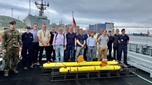 technically over the last decade. With an increased number of Gavia AUVs in Poland and with other NATO users combined with an increase in critical underwater projects in Europe comes an increased need for Gavia service and support outside of Iceland. To expand Gavia technical support in Europe, as well as increase ENAMOR’S technical support capabilities, ENAMOR has dedicated personnel and investments to open a Gavia AUV Service Center in Gdynia, Poland. The service center can perform Gavia Maintenance with a faster turnaround for Polish and other continental customers due to its central European location.
Stefan Reynisson, Vice President, and General Manager of Teledyne Gavia ehf., was very pleased with the Service expansion into Europe. In his speech at the grand opening, Reynisson highlighted the strong partnership between ENAMOR, the Polish Navy, and Teledyne Gavia. “A strong and successful working relationship has been the foundation of the success of Gavia AUVs in Poland. Thank you to both ENAMOR and the Polish Navy. Teledyne Gavia looks forward to continuing our partnership and collaboration.”
Kraken Robotics appoints Chief Operating Officer and hires Marketing Director
 Kraken Robotics Inc. (“Kraken” or the “Company”) (TSX-V: PNG, OTCQB: KRKNF) announces that effective July 9, Nathaniel Spencer has been appointed Chief Operating Officer of Kraken. Mr. Spencer joined Kraken in August 2021 with the acquisition of PanGeo Subsea, where he was the Vice President of Service Delivery. For the last 18 months, Nat has been the Managing Director of Kraken’s subsea power business. Nat has over 12 years in the marine sector, including founding a subsea inspection business that was sold to Oceaneering in 2016.
Greg Reid, Kraken’s President and CEO noted, “I am pleased to promote Nat to the COO role after 3 years at Kraken. Nat’s strength is in driving operational performance, by building strong teams, setting goals, and effectively monitoring and communicating both up and down an organization. He is very process driven and brings a sense of urgency and solid business sense to matters at Kraken. Combined with the rest of our Executive Management team that includes Joe MacKay (CFO), Dave Shea (CTO), and Lynne Adu (CCO) our organization is now well structured to handle strong organic growth and to integrate selective acquisitions that add additional technology, customers, and profitability to our business.
Kraken is also pleased to announce that Erica Kierstead has joined as Director of Global Marketing. Based in Boston, Erica spent 2 years at MITRE in marketing and communications most recently focused on the AI and Bluetech sectors, and prior to that spent 9 years at Hydroid and then HII in marketing. With over 10 years of experience in ocean technology and the defense industries, Erica is a welcome addition to lead Kraken’s marketing efforts.
The Convex Seascape Survey
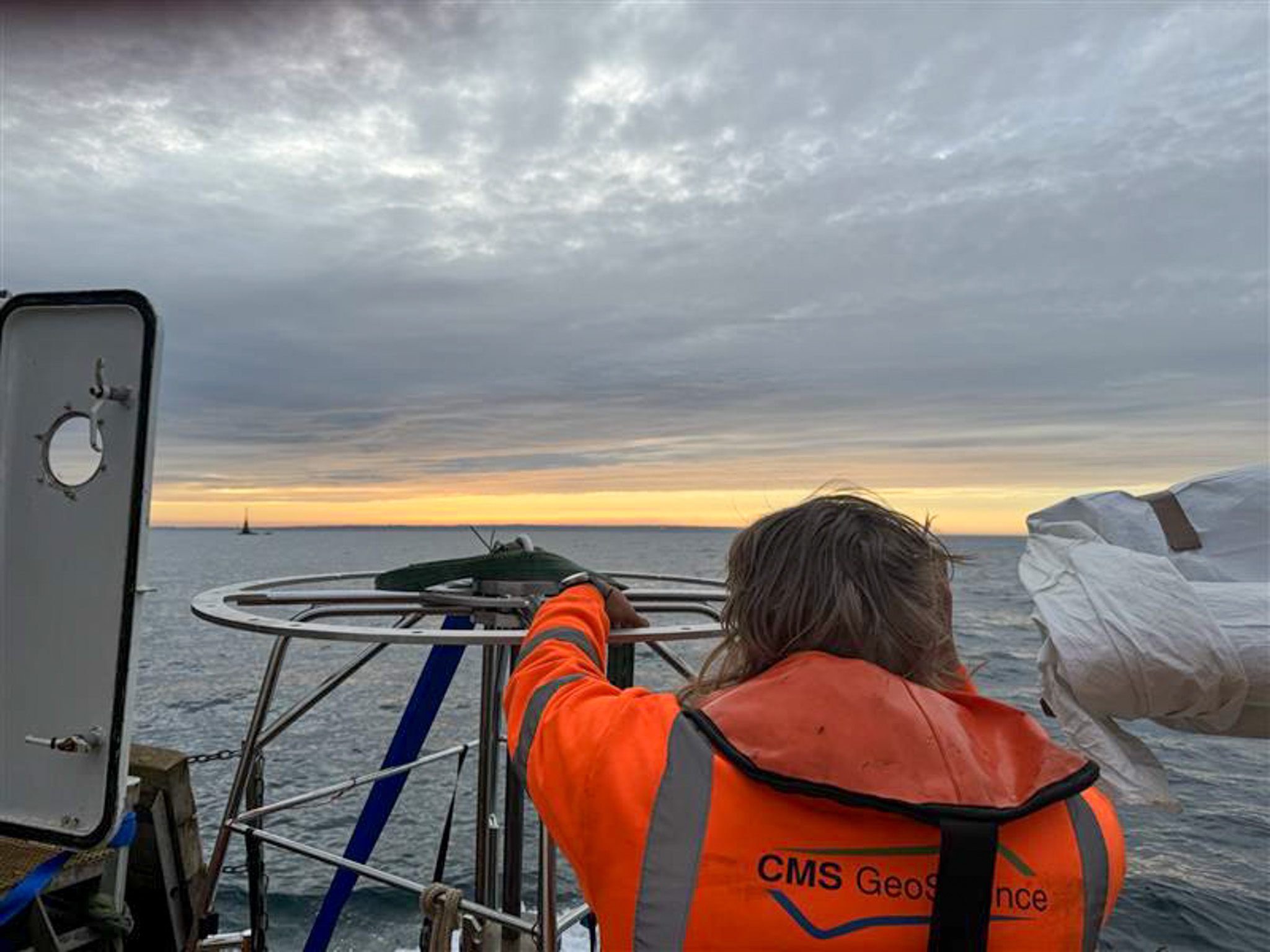
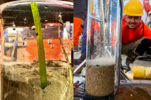 CMs GeoScience Ltd recently partnered with the Blue Marine Foundation, the University of Exeter and Jersey Marine Resources on an exciting project, The Convex Seascape Survey. This initiative is a pioneering collaboration of world-leading scientists working to quantify and understand blue carbon stored in the coastal ocean floor, and the effects of marine life upon it. It will deliver new, reliable open-source data which will educate, inspire and enable informed decisions on ocean use, to harness the power of the sea in the fight against climate change. The role of CMS’s specialised geotechnical team was to collect 55 vibrocores and 8 multicores across various locations in the waters around Jersey.
They collected undisturbed samples of sediment and supernatant water using a multi corer at 8 locations on the south and east of the island. One core from each location was transferred back to shore where the research team could perform eDNA testing. Dr Richard Tennant established a field molecular laboratory that allowed the team to both extrude and subsample the cores, as well as purify and sequence the DNA in Jersey. This data was then taken back to Exeter where they will investigate which flora and fauna are contributing to carbon stocks and determine how they have formed over the past two centuries. As the survey team were able to conduct on-site analysis, the data they generated can be validated once the other cores have been received in Exeter, to better understand the impacts of storage and/or transportation.
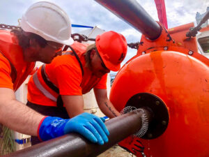 The project also looked at how protection from trawling and dredging activities might affect the capacity of the seabed to accumulate and store organic carbon. Researchers had a particular interest in how this protection affects the biodiversity of seabed habitats, as it is likely that the animals that live around jersey may play an important role in the flux of carbon through these environments.
The CMS team collected cores both inside and outside of the Jersey Marine Protected Area where mobile fishing gear is prohibited. This will allow academics to compare the differences in seabed organic carbon content and biodiversity according to different levels of seabed disturbance. The samples they cored will be analysed alongside short sediment cores of 30-60cm that they survey team gathered by hand using SCUBA.
Researcher, Dr Ben Harris, utilised a range of techniques to measure differences in biodiversity. Baited Remote Underwater Video Systems (BRUVS) were deployed to collect information on the abundance and body size of different fish and highly mobile invertebrate species such as crabs or lobsters. ROV and photo-quadrants were used to quantify the density and species diversity of less mobile animals living on-top of the seabed, these include sponges, ascidians and hydrozoans. The third approach was collecting sediment grabs for counting the biodiversity of animals, like worms and bivalves, living within the sediment itself.
CMS GeoScience worked with Anna Smith and the Convex team to design this survey. Jersey is a challenging place to operate, having the third-largest tidal range in the world with a range of >10m and 5-6 knots. Looking at sediment types as well as potential obstructions and limitations, CMS advised on sample locations to ensure that the needs of the project were met. With more interest in the top layers of sediment, it was decided that the HPC corer would be deployed in 3m mode, with a smaller corer aiming to help mitigate some of the tidal restrictions. After consultation, the project scope was defined as 55 vibrocores, predominantly around the south and east of the island.
Jersey is a busy tourist destination, attracting many small craft, sailing and leisure boat users. This is always a challenge when working close to shore, but particularly trying in such a picturesque location. The team consulted with Jersey Harbour Authorities and local agents to establish a plan that avoided any major maritime events, as well as using moorings and quay space around the island to limit steaming time.
Hayley Santer, the Senior Surveyor on the project, highlighted the need to remain fluid in approach to a project such as this. Each location was assessed and categorised depending on whether they were exposed to weather or tidally restrained. Weather forecasts were changeable and so it was vital that the team acquired the more weather sensitive sites, with contingency plans in place for operations to go ahead depending on the observed sea conditions at the time.
Hayley spoke about the level of preparation needed: ‘To maintain efficiency, and with several tidal locations spread in various bays around Jersey, it was crucial that we worked to minimise time spent waiting on the tide when trying to access more shallow locations.
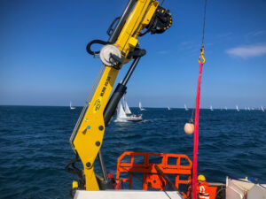 In addition to significant tidal ranges and rocky coastline, many of the reefs were poorly charted. With the team finding that there were large discrepancies in the data, it was important for us to take the additional time to capitalise on rising tides as well as note and mark a safe route into shoal areas, paying particular attention to locations that, while technically deep enough, were enclosed behind prominent, sometimes awash, rock. Using these proven routes, and ensuring we received regularly updated tidal information, enabled real-time assessment of the observed depths both on approach and when were deployed at each location. This also allowed us to establish what depths we could expect on completion of the sampling.
Communication went beyond those involved and extended to local power companies who had seabed assets within our remit. Consultation was key in carving out exclusion zones, with these companies requiring our assurance that any instance of seabed touch-down, be that from a sampler or sound velocity profiler, was logged outside of the reduced cable zones.
We were often operating within busy shipping routes, and St Helier VTW and the Jersey Coastguard were instrumental in reminding other vessels of the requirements of space and safe passing. To add to the intricacies of this project, our team were working over a number of weekends which meant that the increase in recreational club activities added to the difficulties of working in an area where marine traffic was already saturated. Our choice of a smaller, more compact vessel enabled us to work alongside these clubs and societies and we were able to complete the campaign safely with minimal disruption to us and the public’.
The geology around Jersey also presented a specific challenge to the team, with rocky outcrops being exposed by the high tidal range. Extensive planning using tidal and weather forecasts, as well as water depths, enabled the team to maximise working windows.
Owing to the unique tidal movements around the island, Rory Bardner, CMS Marine Geologist, found it interesting to discover such variation in the geology sampled throughout the campaign:
‘Cores recovered deposits ranging from silty sands to coarse gravels, often in proximity, and igneous bedrock was samples in many cases. Using the multi corer to recover undisturbed samples of the shallow seabed gave a real insight into the sediments, marine life and seagrass below us.
Due to the testing required, the cores had to remain at a constant temperature of between 4-5 degrees, which was made more difficult as many of the locations were >4-hour steam away from harbour. By working with the client and the vessel, a solution was found which allowed for onboard chilling facilities, as well as a space to safely operate the vibrocoring system, the multi corer and other equipment. Through creative thinking, the CMS team were able to meet this requirement to guarantee the quality of the samples and the subsequent data.
Mechanical Design Engineer, Jack Foll, reported on the difficulty in operating the geotechnical systems and the performance of the team overall:
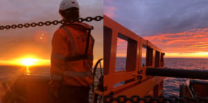
‘There was a great deal of preparation in anticipation for this campaign as we knew we would be working within a demanding environment. The waters in which the team were deployed experiences a tidal height of up to 12m, and this meant that our HPC corer had to operate in 3m to compensate for the strength of the tide. As well as this, we experienced unseasonably inclement weather throughout our time on the island which meant the team had to work within tight windows of opportunity, adding even more to the complexity of the project. We worked to ensure that our systems were tested, checked and serviced prior to commencing the project, and everyone onboard carried out their duties safely and effectively. The extensive planning from all involved meant that the contract was completed without any system breakdowns, and the team operated the equipment well, without incident, despite the many difficulties they faced.’
CMS GeoScience is proud to have played its part in helping researchers to highlight the need to preserve the ecologically, economically, and culturally important marine habitats of the Island, especially when Jersey relies so heavily on the ocean as a resource.
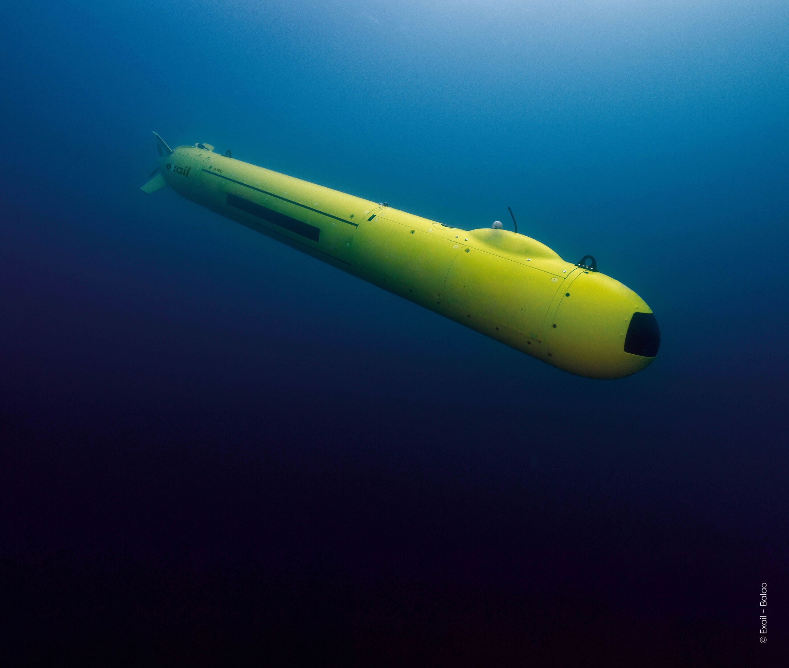
Exail, RTsys and ABYSSA join forces for ocean floor mapping with AUVs
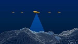 Exail, RTsys, and ABYSSA, announce their strategic partnership in the CARMA (Mineral resources mapping by AUVs swarms) project. Co-funded by Bpifrance under the #France2030 initiative and designed to advance knowledge of great depths, the CARMA project focuses on developing swarms of Autonomous Underwater Vehicles (AUVs) for efficient ocean floor mapping.
This project aims to develop an innovative solution for precise seabed surveying at great depths. The ongoing development involves creating a solution in which a multi-sensor underwater drone capable of diving to 3,000 meters will coordinate multiple AUVs to increase the surface of the exploration area. The research program also includes the development of advanced collaborative navigation, acoustic communications, positioning, and innovative mapping capabilities. CARMA supports the French authorities' strategy to develop extensive deep-sea exploration capacities.
As part of this strategy, Exail will improve the capabilities of its deep-water AUV A18-D to serve as the leading AUV to guide the swarm. Improvements will enable navigation down to 3,000 meters, at close altitude from the seabed over sloped terrains, and to accurately geolocate swarm’s acquired data. RTsys will extend the capabilities of its newly developed AUV COMET-3000 to dive up to 3,000 meters. Multiple units will be provided to act as followers, along with the development of an innovative launch and recovery system for the AUV swarm. ABYSSA will focus on developing exploration strategies for deep-water swarms of AUVS. Additionally, ABYSSA will process the magnetic data collected to map the magnetic anomalies on the seabed.
This project will result in the deployment of an operational demonstrator at sea in 2026, paving the way for future commercial phases. Concurrently, the project will carry out a preliminary study on extending exploration capacity to 6,000 meters depth.
"We are pleased to announce our collaboration with ABYSSA and RTsys in the innovative CARMA project, where we combine our technological expertise” said Catherine Pikovsky, project manager at Exail. “As we push the boundaries of autonomous underwater exploration, we enhance the capabilities of our deep-water AUV A18-D to navigate close to the seabed. Leveraging pack piloting techniques and advanced navigation algorithms, we lead the way towards a precise seabed surveying down to 3,000 meters, reflecting our dedication to innovation and advancing deep-sea exploration.”
“Thanks to this project we have the opportunity to work on the development of an AUV swarm operating at 3,000 meters depth. This allows us to enrich our expertise, innovate in the deep-sea field and demonstrate our swarm capability. The studies conducted thanks to the AUV swarm will provide scientific knowledge and contribute to the inventory of underwater heritage.” said Marine Postec, project manager at RTsys.
“We are defending the principle of the AUVs swarm, winner of the 2015 Global Innovation Competition, because it enables oceanographers to carry out extensive and accurate non-intrusive mapping in deep, little-known areas” said Michel Colinet, Deputy CEO at ABYSSA.