
Planet Ocean Ltd announces the signing of an exclusive distribution agreement with OBSCAPE B.v for the UK and Ireland
We are delighted to announce the signing of an exclusive representation agreement with Dutch manufacturer of Oceanographic, Hydrographic and Meteorological instruments OBSCAPE B.v.
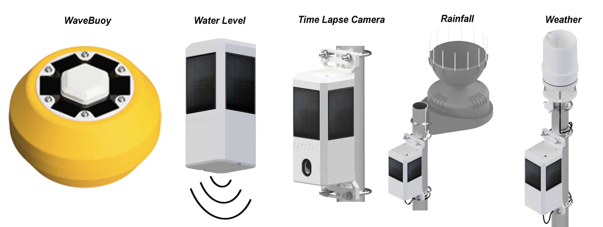
OBSCAPE instruments are based around their very flexible and innovate PTM (Power Telemetry Module) The PTM is at the heart of all OBSCAPE systems. In essence it is a data acquisition and telemetry system that is modular in construct and can be configured with or without some of the features depending upon end user application.
Key features of the PTM are multiple inputs, R-232, SDI-12, RS-485, inbuilt GPS, temperature and humidity for housekeeping, solar regulation/charge control, and a choice of telemetry.
The WaveBuoy for example has both 2G,3G,4G and Iridium satellite. The cellular modem has space for two SIM cards, so you have two networks enabled and the system will switch to the strongest, or to the other if one becomes unavailable. In addition, the system can be set to use both cell and satellite or use satellite as back up.
The PTM is pre-configured for use with the time lapse camera, water level sensor, rain gauge and weather station and of course WaveBuoy. All report directly to the free to use web data portal where your sensors can be networked into a coherent group.
Planet Ocean M.D Terry Sloane commented “We are extremely impressed with the innovative design of the OBSCAPE instruments, as well as their rugged construction, ease of use and end to end capability; sensor – telemetry- data display and archiving.”
Planet Ocean will be providing pre and post-sales support and first level service from their Camberley Surrey base.
For more details about OBSCAPE products contact [email protected] or Visit: www.obscape.com


GeoAcoustics leaves Kongsberg
GeoAcoustics Ltd has returned to independent ownership following divestment from the Norwegian multinational Kongsberg Maritime AS. Kongsberg originally acquired the Company in 2008 and it has been a part of the Sensors & Robotics business area.
Based in Great Yarmouth in the United Kingdom, GeoAcoustics have been manufacturing marine survey equipment for more than 42 years, and it is a world-leading manufacturer of sonar survey systems for engineering, geophysics and Naval survey applications. Principle product lines are swath bathymetry systems for shallow waters, side scan sonars and sub-bottom profilers.
GeoAcoustics’ General Manager Dr Richard Dowdeswell commented “This is an exciting chapter in the history of GeoAcoustics and we are looking forward to expanding our global reach through the introduction of new channel partners as well as bringing new products to market”
Arne Rinnan, Executive Vice President Sensors & Robotics added “We are satisfied with achieving an amicable solution for GeoAcoustics and the team”
As part of the divestment process the parties have entered into a collaboration agreement covering product sales, assembly and manufacturing.
For more information visit: www.geoacoustics.com

New Underwater Robotics Award Announced at SUT's AGM
The new Gwyn Griffiths Underwater Robotics Award was one of the announcements made at The Society for Underwater Technology’s (SUT’s) Annual General Meeting by the new President of Council, Judith Patten MBE.
“SUT’s International Panel on Underwater Robotics is honoured to announce the creation of the Gwyn Griffiths Underwater Robotics Award (GGURA). The award recognises people in the early to mid-stages of their career (and under 40 years old) who have made outstanding contributions to their field in underwater robotics. The award may be for industry/commercial, research and/or creative activity in underwater robotics,” she explained.
The winner will receive £500, a certificate and an engraved award.
Neil Bose, Chair of the Panel on Underwater Robotics stated:
"Members of the Panel on Underwater Robotics were excited by Professor Gwyn Griffiths’ generosity in supporting this award and were especially enthusiastic that it should be an early to mid-career award to encourage the up-and-coming generation of underwater robotics workers in their careers."
Gwyn Griffiths MBE, a Past President of the SUT added:
"As a vibrant, forward-looking learned Society the SUT is at the forefront of encouraging and facilitating international cooperation in Underwater Robotics. From my own career I know that peer-recognition of achievements through an international Award can make a substantial and lasting difference. These have been times for reflection, and by enabling this new Underwater Robotics Award I am delighted to support the innovators of today and tomorrow."

Nominations or applications for a GGURA must consist of the following documents.
- A letter of nomination or application that describes how the candidate meets the criteria. Further information is at sut.org/gwyn-griffiths-underwater-robotics-award-ggura/
- The letter should be no more than 2-pages in length. Supporter(s) of the nomination/ application may add their signature to this letter or supply an email that indicates their support for the candidate
- A 100-word citation or appraisal of the candidate’s research describing their contributions in a way easily understandable to those outside the discipline
- A curriculum vitae
- All applications/nominations to be received by 14 February 2021
Other awards and announcements made at the AGM
Dr John Partridge of Sonardyne was awarded an Honorary Fellowship of the SUT in recognition of his engineering vision and his commitment to supporting the future of the underwater science and technology community. {Note to Editors: the full citation is attached to this release].
Simon Cheeseman, Sector Lead, Wave & Tidal Energy, at the Offshore Renewable Energy (ORE) Catapult was this year’s winner of the Lennard Senior Prize, awarded by SUT’s Marine Renewable Energies Committee (MREC) with its Chairman, Professor John Sharp making the presentation.
Six Members were elected Fellows of the SUT:
- Gareth Wood – Services to OSIG (Offshore Site Investigation & Geotechnics special interest group)
- Tim Carrington – Services to OSIG
- Andrew Benson – Services to OSIG
- Miguel Pacheco Andrade – Services to OSIG
- Andrew Hunt – Service to sustainable offshore energy & safety in diving
- Vahid Walker – Service to North East Branch & support of early career members.
The registration of the first three SUT Chartered Marine Technologists - Tom Bennetts CMarTech and John Houlder CMarTEch both of Sonardyne, and André Rose CMarTech of the International Marine Contractors Association (IMCA) - was also celebrated.
Finding the Empire Windrush and its iconic anchor
Attendees enjoyed an interesting insight into the life, work and future plans of shipwreck hunter, David Mearns introduced by Immediate Past President, Professor Ralph Rayner. Providing funding is secured David will (giving of his time on a pro bono basis) lead the search for the Empire Windrush, which lies up to 3,000m down at the bottom of the Mediterranean, some 23 nautical miles off the coast of Algeria. The aim is to recover the Empire Windrush’s iconic anchor and bring it back to the UK as an alternative monument to acknowledge the contribution of the Windrush Generation and migration in Britain
Portions of the meeting, including David Mearns’ presentation, will appear on the SUT’s website shortly at www.sut.org

UCL Announces This Year’s Winner of The NORBIT Prize
The NORBIT team is honored to support students who will be the future innovators of the Marine Technology industry.
This year, NORBIT UK chose to sponsor an academic prize for a high achieving student at UCL (www.ucl.ac.uk). The academic staff of the Geospatial Science and Hydrographic Surveying course agreed that the NORBIT prize should be awarded to the top student during teachings to have graduated in 2020.
We are excited to congratulate James Gibbons!
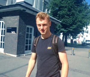
James has a background in Earth Science and an active interest in structural, physical and chemical properties of the subsurface. The Geospatial Science and Hydrographic Surveying course expanded his knowledge of these disciplines whilst also allowing him to “gain significant insight into the uncertainties associated with the digital expression of 3D positional data on and below the Earth's Surface and their significance in Marine Engineering”.
Beyond the technical knowledge James acquired during his time as an MSc student in the CEGE department, he also found the experience of attending UCL enjoyable. He praises the lecturers “several of whom are world leaders in their field”, writing that they “clearly enjoy teaching, getting to know their students and are genuinely enthusiastic for you to succeed”. In addition to the accomplished lecturers, James mentions the “involvement of the Port of London Authority with the Hydrographic elements of the course is also invaluable as it offers genuine insight into a professional hydrographic organisation and a chance to gain practical survey experience”.
As James moves on to his post-graduate life, he hopes to “be able to find a career path whereby I can incorporate and build upon my hydrographic, geophysical and geotechnical knowledge to contribute holistically to Marine infrastructure and renewable energy projects.”
We look forward to seeing what James will go on to achieve!
For further information about UCL please visit: www.ucl.ac.uk
For further information about the Geospatial Sciences (Hydrographic Survey) MSc course at UCL please visit: www.ucl.ac.uk/prospective-students/graduate/taught-degrees/geospatial-scienceshydrographic-surveying-msc
NASA’s Jet Propulsion Laboratories Examine Greenland’s Melting Coastal Glaciers Using Teledyne Marine APEX Profiling Floats
Teledyne Marine announced the recent sale and deployment of three APEX profiling floats to NASA’s Jet Propulsion Laboratory in Southern California. The three floats were equipped with RBR CTD sensors, Short-Burst-Data for communication over the Iridium Satellite Network, and special parachutes for air deployment.
The rise in global sea levels will be a major environmental challenge for the 21st Century. For this reason, it is of increasing importance that we improve our methods and understanding for predicting this process. A recent major initiative to do this has been led by JPL Scientist, Dr. Josh Willis and his team, who are studying the role that the ocean plays in melting Greenland's coastal glaciers. The NASA based initiative, known as 'Oceans Melting Greenland' (OMG), will observe changing water conditions on the continental shelf surrounding Greenland over a six year period. This will also include detailed measurements from the narrow fjords that dot the Greenland coast since these fjords are a critical component in modelling the interaction between the ocean water and the glacial ice.
A potential new tool in this study has been provided by Teledyne Marine in the form of the 'Autonomous Profiling Explorer' (APEX) float. These floats provide a platform for a variety of sensors, drifting with the ocean current while descending and ascending between the surface and some predefined depth, and all the time taking sensor measurements which are then telemetered back to a data-server via satellite. APEX floats can also be deployed by aircraft using parachutes, which makes them ideal for exploring areas that can be difficult to access such as the coast of Greenland.
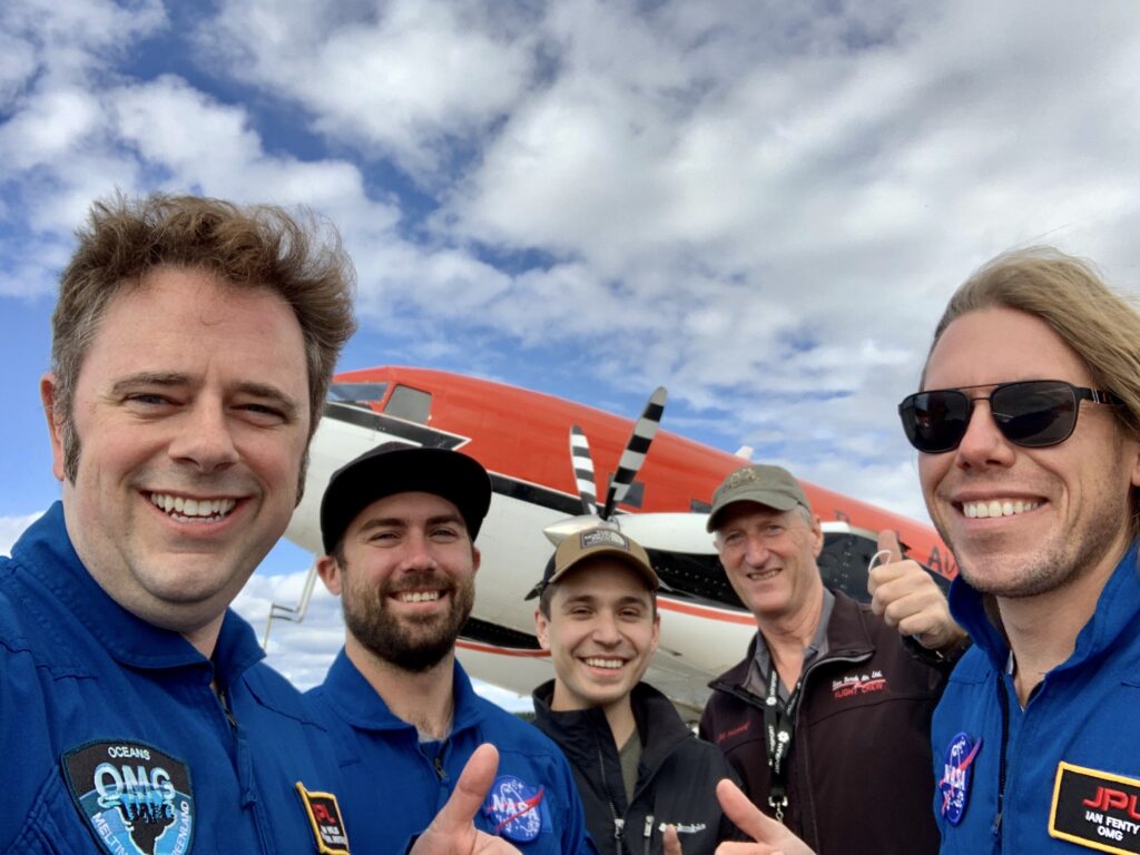
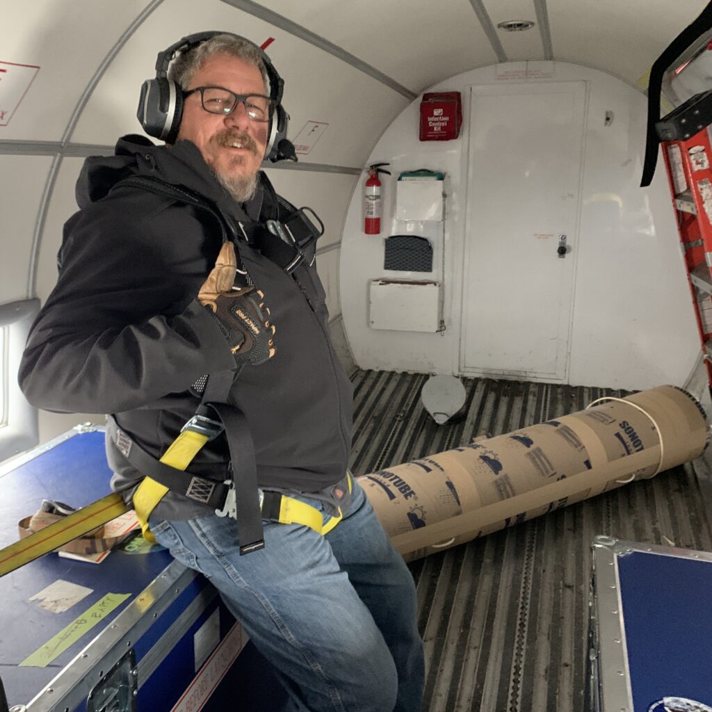
In September of 2020, three APEX floats were deployed using a Basler DC-3 TurboProp aircraft over the continental shelf along the west coast of Greenland as part of the OMG project. These floats had the specific task of measuring water temperature and salinity at different depths on the continental shelf along the coast over a period of a year or more. Dr. Willis and the team at JPL NASA exploited the fact that APEX floats can be configured to sit on the seabed between descending and ascending, which can be used to limit the distances that the floats drift during each cycle. The floats were also configured to avoid attempting to surface when they detected the possibility of ice.
All three floats have stayed within about 15 miles of where they were deployed, meaning that the strategy of parking them on the sea floor has largely worked so far. One float, deployed in Melville Bay was initially unable to surface and transmit data in the ice covered environment, but was finally able to connect to the Iridium satellite system and transmit all data that that had been collected and stored up to that point.
Now that the floats are operational they could potentially continue transmitting data over a winter season or more. For example, in order to extend their lifetime, the profiling cycle times between surfacings has already been increased using commands sent via satellite. Also, with winter approaching in the northern hemisphere, the APEX float ice avoidance feature will become even more important. However, the data collected by these floats should provide important future input for studying the role that the ocean plays in melting coastal glaciers and raising overall sea levels.
The APEX (Autonomous Profiling Explorer) profiling float is an autonomous drifting profiler that acquires water column profile data, such as water conductivity, temperature and pressure, while ascending from a depth of up to 2000 meters. The APEX profiling float also includes the hardware and firmware to support a high level of operator flexibility and multiple functions.
For more information visit www.teledynemarine.com
Aquatec celebrates its 30th anniversary helping the preservation of marine environment
The firm will donate to an ocean-protection non-profit organisation every time its online timeline gets viewed.
Basingstoke-based subsea instrumentation designer and manufacturer Aquatec Group, announces the start of its 31st year in business with a novel online click-and-raise landing page on its website. For every click on its corporate timeline, the company adds an amount up to a fixed sum that will be donated from its own funds to the Marine Conservation Society.
With this action, the firm, established in 1990, commemorates its three decades in the industry creating instruments and services aimed at safeguarding marine mammals, as well as measuring, logging, communicating and interpreting underwater data.
The Marine Conservation Society is well known through their work in protecting the seas around the United Kingdom via the creation of well-managed marine protected areas. It works with fishermen and industry to find more sustainable ways of fishing and with retailers and consumers to buy and choose more sustainable food. In the past, Aquatec has been involved as volunteers in carrying out one of their hundreds of beach cleans.
Andy Smerdon, Aquatec’s MD and founder has said: “This very significant milestone allows us to reflect on our technological efforts to help preserve the Earth’s coastal and ocean environments, protect marine life, and ensure that man-made subsea structures are safe and ecologically sound. As we launch into our fourth decade, we invite members of the subsea community to celebrate 30 years of Aquatec and in return we will do our share in aiding the UK’s leading marine environment organisation.”
For more information visit www.aquatecgroup.com

GEO Business postponed until November 2021
GEO Business – the UK’s largest geospatial event designed for everyone involved in the gathering, storing, processing and delivery of geospatial information – has been rescheduled from May to November for next year.
The show will be deferred from its usual spring dates on 19-20 May and will now take place on 24-25 November 2021 at ExCeL London.
The decision follows the ongoing impact of the coronavirus pandemic and comes after close monitoring of information from the government, as well as consultation with the geospatial community.
Portfolio director Caroline Hobden says: “Although all the signs are positive for a restart for large scale events from Easter, we feel running GEO Business in May could still be a little early. We want to give everyone the best possible chance for a great show, so it’s important we have a clear run into the event.
“We want to make the right decision for our community and having consulted with our exhibitors, visitors and partners, we’ve decided the best action to serve everyone is to push the show back to the autumn for one year.
“We’re disappointed not to be able to bring everyone together as soon as we had hoped. But we are committed to delivering an event in 2021 that provides the community with the most effective opportunities for networking, education, discovery and interaction – and we’re confident that the move to November means we’ll be able to return with the best show possible.
“The good news is that we won’t be letting our traditional spring dates pass without marking the occasion. We’ll be launching a digital offering in May, over our usual dates, featuring webinars, virtual panel discussions and product demonstrations, to provide a platform for the industry to connect.
“We’re also excited to announce that GEO Business will be launching a newsletter in the new year. This monthly newsletter will give the geospatial community an excellent opportunity to share news, communicate about products and services, and stay connected at a vital time for our industry.
“Finally, we’re so grateful for the incredible and continued goodwill and support the industry has shown us during these difficult times. We’re looking forward to working together over the coming months to ensure that GEO Business continues to be the celebration and gathering the geospatial profession deserves and can be proud of. And more than anything, we look forward to seeing you – in person – in November.”
The show will be co-located with Digital Construction Week, the UK’s only event dedicated to digital construction, engineering, design, manufacturing and operation, which will also move from May to 24-25 November 2021.
For more information, please visit www.GeoBusinessShow.com and www.DigitalConstructionWeek.com.
Blue Ocean Marine Services - A New Joint Venture Between Vertech Group & Blue Ocean Monitoring
Specialist maintenance, inspection and access company Vertech Group have entered into a Joint Venture with autonomous technology specialists Blue Ocean Monitoring Pty Ltd to establish Blue Ocean Marine Services (BOMS) focused on the delivery of commercial survey and inspection services.
With the combined experience of both companies, Blue Ocean Marine Services stand as experts in the use of Autonomous Underwater Vehicles (AUV) and a broad range of other technologies to provide site appraisal, regulatory compliance, subsea inspection, and emergency response services.
Vertech Group’s Managing Director, Tom Brennan, said he was looking forward to working closely with the Blue Ocean Marine Services team in the years ahead. “A fundamental part of the group’s success has been investing in and bringing new innovations and technology to the market,” remarked Mr Brennan. “The Blue Ocean Marine Services JV typifies this approach, enables the group to take strides in the next generation of autonomous technology, while also complementing our other subsea specialist businesses in Sonomatic and Geo Oceans.”
Blue Ocean Marine Services, General Manager, Keith Wallace commented that he was greatly looking forward to collaborating with the other subsea divisions within the Vertech Group. “The Vertech Group have a great pedigree when it comes to subsea services, and their culture for innovation makes it the perfect organisation to help us to continuously develop our technology and service offering.”
For further information, please visit www.blue-ocean.com.au or contact us at [email protected]
Ocean Infinity selects Sonardyne for pioneering Armada fleet
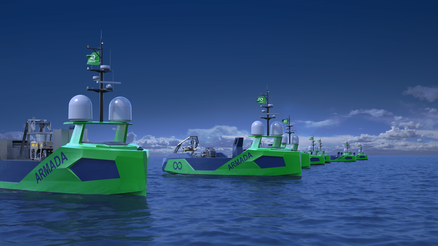
Sonardyne technology has been selected to support the world’s largest and most environmentally sustainable fleet of ocean-going, multi-role robotic vessels, which is being launched by marine robotics company Ocean Infinity.
Sonardyne systems will provide part of Ocean Infinity’s new Armada fleet with key sensor technologies for underwater platform navigation, tracking, control and communications, as well as ensuring uninterrupted surface navigation, even when global navigation satellite system (GNSS) services are degraded or denied.
The Armada fleet will mark a major technological advance, providing sustainable services to all corners of industry from offshore energy, to logistics and transport. The innovative, low-emission robotic fleet that can be launched from any shoreline on the globe was unveiled in February this year (2020), and will initially see 17 bespoke designed state-of-the-art uncrewed vessels added to Ocean Infinity’s existing robotics fleet.
The vessels, initially measuring 21 metres and 36 metres long, will be able to perform offshore data acquisition and intervention in both shallow and deep water operating regions. The vessels will use a range of underwater platforms, including remotely deploying autonomous underwater vehicles (AUVs) and remotely operated vehicles (ROVs).
Sonardyne’s acoustic communication and inertial navigation technologies were chosen to support Armada because of their performance and flexibility across a wide range of water depths and environments, supporting operations across all sectors in even the remotest locations.
The package includes surface and subsea navigation sensors to remotely support deployment, operations and recovery of underwater robotic systems from an uncrewed vessel, from anywhere in the world. That includes being able to accurately track and control multiple robotics systems simultaneously and provide water current profile information, as well as support vessel dynamic positioning during critical phases of an operation.
Uniquely, the systems also provide navigation redundancy in the event of GNSS outages, which could occur while operating in multipath or shadowed environments, such as fjords or near large structures or where signals are deliberately interfered with.
Delivery of Sonardyne equipment for the first wave of Armada fleet vessels will be made by the end of this year. Further deliveries will be made through 2021.
Alan MacDonald, Sales Manager, Sonardyne, says, “Over recent years, we’ve been focussed in Sonardyne on developing the flexible technologies that are required to support the revolution that is taking place in both surface and subsea marine robotics. Consequently, we’re very pleased to be part of Armada’s pioneering vision to deploy robotics at scale. These systems will help a wide variety of industries to reduce how many people they need to send to sea as well as dramatically reduce CO2 emissions, by deploying these smaller, more efficient vessels out.”
Dan Hook, Managing Director, Ocean Infinity, says, “Our expert team of robotics specialists selected Sonardyne as the clear choice for our robotics ships, to provide underwater navigation, tracking, control and communications and that additional layer of positioning security in areas where GNSS signals might be obscured. We look forward to a long-term working relationship with Sonardyne, as we grow our fleet.”
Initially, all of the first tranche of Ocean Infinity’s Armada vessels will be fitted with Sonardyne’s Ranger 2 Ultra-Short BaseLine (USBL) system augmented by the company’s Marine Robotics Pack. This combination provides remote all-in-one tracking, communications and control capability for underwater deployed robotics so that even more operations can now be done from shore.
These robotic vessels will also be fitted with Sonardyne’s industry leading SPRINT-Nav hybrid navigation instrument, to provide continuous, uninterrupted navigational aiding to underpin safe remote operations, even if GNSS service is impaired due to their remote location or nearby infrastructure. In addition the system produces profiled water column data, which is particularly important during the deployment and recovery of subsea robots.
Wideband Sub Mini 6+ tracking transponders and SPRINT-Navs will also be fitted to the ROVs being deployed and operated by the Armada fleet.
Ocean Infinity expects the first Armada vessel to be delivered in 2021 and, along with the remainder of the fleet, will be controlled and operated by experienced mariners via satellite communication from onshore control facilities in Austin, Texas, and Southampton, England.
For more information visit www.sonardyne.com or www.oceaninfinity.com
Benthic Solutions welcomes Matt Cox to the team as Technical Manager
Matt has joined Benthic Solutions as Technical Manager, after four years working at N-Sea Group as the Product Delivery and Innovation Manager. Matt brings a wealth of experience, with onshore and offshore activities being an everyday part of his life for the past 20 years. Matt previously worked for Fugro, STR, N-Sea and UXOControl and is looking forward to further strengthening the already experienced team at Benthic Solutions Ltd, based in Hoveton Norfolk.

For more information visit: www.benthicsolutions.com