

Plymouth home to world’s first 5G ocean-based marine testbed
Plymouth Sound is to be home to the world’s first 5G ocean-based marine testbed, putting the city at the forefront of marine and maritime innovation.
Part of the Marine Business Technology Centre’s (MBTC) testing and proving ground Smart Sound Plymouth, the testbed will benefit from a 5G mobile private network built by Vodafone using Nokia equipment. The network, known as Smart Sound Connect, will enable ultrafast download speeds and low-latency 5G connectivity to support the development of new marine technology.
Eligible businesses will have free access to the testbed to test 5G use cases including advanced applied autonomy, clean propulsion, smart ports, smart shipping, and environmental monitoring using the Internet of Things (IoT).
The full testbed will be available from early 2021. It will also form the basis of a proposed virtualised testing platform, to allow companies to validate ideas and test adjustments in a virtual environment. With few testbeds offering connectivity beyond the shore’s edge, Smart Sound Connect can support use cases that others cannot.
“We’re really making waves here with another world first for Plymouth. It goes without saying we’re incredibly excited to be able to provide this globally significant testbed, which further cements our city’s reputation as the UK’s centre for advanced marine technology development.”
Councillor Tudor Evans, Leader of Plymouth City Council
“Smart Sound is a brilliant initiative from Plymouth City Council that will show just how powerful 5G can be for businesses looking to innovate. 5G can accelerate developments in marine technologies, and this is another area where the UK can be a global leader with the right digital tools and skillset.”
Anne Sheehan, Business Director, Vodafone UK
“With Smart Sound Connect, the MBTC is able to provide a complete innovation service that allows businesses to utilise one of the most high-tech and comprehensive test and proving environments in the world.
“Not only will our clients be able to benefit from the expertise, research capabilities and advanced equipment of our partners, they will also be able to work closely with Vodafone and Nokia to develop 5G solutions specifically for the marine sector.”
Rob Watson, MBTC Director
The MBTC is a £4.5 million European Regional Development Fund (ERDF) supported partnership between Plymouth City Council, Plymouth Marine Laboratory, the University of Plymouth, the University of Exeter and the Marine Biological Association that works to facilitate innovation in the marine and maritime sector. The partnership received £1.8 million in funding from the Heart of the South West Local Enterprise Partnership (HotSW LEP) to develop Smart Sound Connect.
“Smart Sound Connect is an excellent project that we’re investing part of our Growth Deal funding in. We know that Digital and Marine are key sectors to the recovery and future prosperity of the Heart of the South West, and this scheme will further enhance our area’s specialisations in both. Added to that, the MBTC is part of Oceansgate, one of HotSW’s portfolio of Enterprise Zones, offering favourable conditions for business growth.”
Chair of the Heart of the South West LEP Karl Tucker
“Smart Sound Plymouth is firmly established as the leading location in the UK for trials and demonstration of cutting-edge marine technologies. The addition of the Smart Sound connect communications network has created a multifaceted solution unrivalled in the UK and placing Plymouth very firmly on the global stage.”
Dr James Fishwick, Head of Smart Sound Plymouth
“Working in partnership with Vodafone and MBTC on this ‘world-first’ and helping to drive world-leading marine and maritime innovation is an exciting prospect. This ocean-based deployment will highlight all the flexibility and performance advantages that industrial-grade 5G private wireless can bring to organisations that need connectivity in challenging conditions.”
Stephan Litjens, General Manager, Nokia Digital Automation
Vodafone will provide 4G and 5G connectivity using four mobile sites at the inlet, and an additional site offshore. The network will utilise Nokia Digital Automation Cloud (DAC), a digitalisation platform capable of providing high-bandwidth, hyper-fast private networking and edge computing capabilities. A compact, plug-and-play system that comprises network equipment and a cloud-based operation monitoring system, Nokia DAC enables users to securely collect, process and host all generated proprietary data on site.
Smart Sound Connect will build on the research already being supported by the MBTC, which has recently included the launch of the UK’s first sea-going electric ferry and the development of an innovative new method of gathering data about the marine environment.
Find out more about Smart Sound Connect at a free webinar on Wednesday 16 December
Book online now at www.oceansgateplymouth.com/events-schedule
For more information visit www.smartsoundplymouth.co.uk.

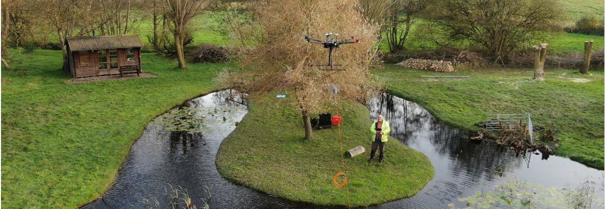
First aerial drone-dipping sensors take off with Valeport
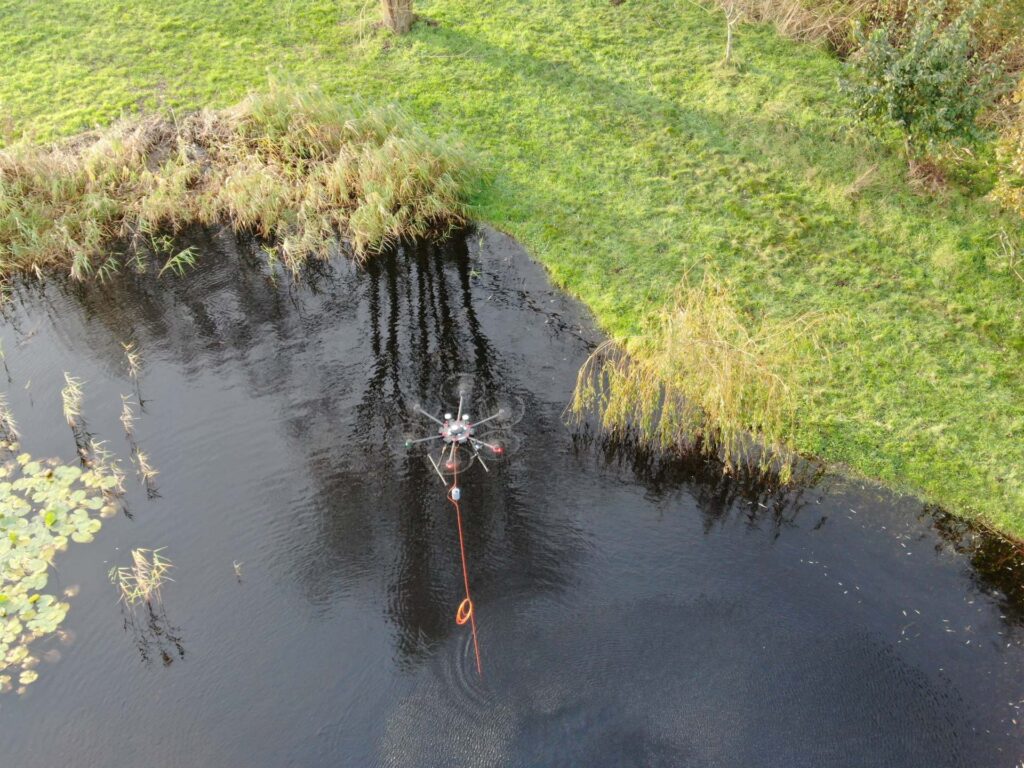
A cutting-edge new system for autonomous airborne hydrographic survey has been launched by THURN Group. The THURN QuickDipTM system of data collection uses aerial drones to carry Valeport sensors on pre-planned survey routes to deliver an efficient and repeatable method of gathering highly accurate survey data from inaccessible or dangerous waters.
UK-based THURN Group developed the innovative QuickDip technology for inland and coastal waterways to offer a range of benefits including: rapid data collection from multiple sites of interest, repeatable map-based surveys to monitor change detection, the ability to safely collect data from difficult-to-access and dangerous waters as well as restricted-access waters, such as reservoirs.
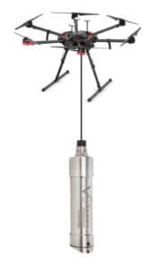
THURN QuickDip integrated drone-based system uses a Valeport sensor, a cable, a rotocopter drone and UgCS SkyHub/True Terraine Following (TTF) hardware - from leading software developer for unmanned aerial systems SPH Engineering. THURN’s integration of hardware and software allows the drone to fly at an accurate fixed height over water using a map-based pre-programmed autonomous survey pattern and dip the Valeport sensor into the water to take readings.
As Tom Hiller, General Manager, THURN Group commented there are many options with the QuickDip technology:
“Using a drone to deploy sensors has distinct advantages over a boat; it is compact as well as easy to transport and deploy. Drones can be used in any location where there is a small area for take-off and landing, near the surveyed water. What makes this new system so exciting for autonomous data collection is a drone’s ability to precisely follow planned survey lines using the map-based interface in UgCS and therefore deliver accurate, repeatable map-based surveys in previously difficult to access waters.
“We’re launching the THURN QuickDip with the miniSVS and Hyperion range of Valeport sensors which are respected for their high levels of accuracy, but this is just the first in an expanding range of drone-dipped sensors for coastal and inland water survey.”
The compact and robust Environmental range of optical sensors from leading oceanographic and hydrographic instrument manufacturer, Valeport, are being offered as part of the QuickDip system, including the Hyperion range of environmental sensors for the measurement of Turbidity, Chlorophyll a, Fluorescein, Rhodamine or Phycocyanin as well as their popular miniSVS and SWiFT SVP.
Valeport’s Head of Sales, Kevin Edwards added:
“THURN’s integrated drone-dipping sensor system offers an exciting step change in autonomous data collection and Valeport is proud to our support for innovation in the survey sector. Although this technology is launched with Valeport’s miniSVS and Hyperion range, it is easy to expand the capability of the system with the addition of other field-swappable Valeport sensors.”
Valeport has supplied the subsea sector for more than 50 years and continues to innovate and lead the way in the design and manufacture of precision instrumentation for the hydrographic and oceanographic communities.
THURN Group provides underwater survey technology, offshore project consulting and training to inland waterway authorities, engineering companies, ports, oil and gas, and renewable clients worldwide.
For more information please contact: www.valeport.co.uk and www.thurngroup.com

OSIL engage with University of Rhode Island on collaborative research project
The University of Rhode Island (URI) had a recent requirement for two oceanographic buoy systems and land-based deck unit for ongoing oceanographic research under the Rhode Island Consortium for Coastal Ecology Assessment Innovation & Modeling (RI-CAIM), a five-year grant program funded by the National Science Foundation (Award #OIA-1655221). Representatives from the University approached leading global data buoy manufacturers Ocean Scientific International Ltd (OSIL) with their specifications, and OSIL are delighted to be providing suitable systems to the project.
Researchers have requested systems that can utilise a new array of sensors and equipment, called the integrated Bay Observatory, that has already been acquired by URI through RI C-AIM. The data from this platform will be sent back to a computer system hosted at URI’s Bay Campus and parsed to a networked database, RI C-AIM’s Rhode Island Data Discovery Center, for real-time or near-real time data display. This database would operate within a suitable software system that would allow users to change settings or trigger samplers remotely (using either programmed interval sampling, or manually triggered by a user). OSIL have an established reputation for providing fully integrated systems that consistently deliver high quality data to the end user in practical formats.
OSIL are providing two of their 1.2m Tern Buoys for the project, tough and durable systems that can withstand the harshest of conditions and are ideal for extended coastal monitoring deployments. The Tern buoy hull design incorporates a stainless steel sub frame with a moon pool for instrument protection, and its modular manufacture makes the buoy easy to ship and assemble on-site following delivery. The buoy frame design has also been modified to allow an autonomous water sampler system to be connected to the bottom of the buoys.
The buoys are to be deployed year-round in Narragansett Bay, while the land-based deck unit is to be housed in a permanent monitoring station set up within a disused lighthouse. All systems will host a range of SeaBird sensors in addition to a full suite of meteorological instruments and GPS tracking fitted to the data buoys.
For further information or sales enquiries please contact: [email protected] or call +44 (0) 2392 488 240.
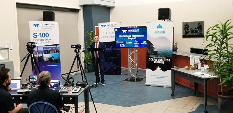
Teledyne CARIS receives Canada’s Ocean Supercluster award through the Accelerated Ocean Solutions Program
The CARIS Cloud Technology Project will break down technical barriers to entry for hydrographic processing and charting in support of remote operations.
Teledyne CARIS, a Teledyne Technologies [NYSE:TDY] company, is pleased to announce significant funding from Canada’s Ocean Supercluster award to develop software for remote operations survey processing. This is in alignment with the company’s leading AI strategy.
Teledyne CARIS’ project aims at three targeted deliverables:
- The enhancement of its desktop-based product line to leverage the cloud to deliver consistent access for global users in every possible circumstance
- Support for remote mapping operations to underpin advancements in ocean robotics
- Infusing its passion for future ocean mappers with access to virtual training through the CARIS Cloud Platform.
The company has partnered with Ocean Floor Geophysics (OFG), a pioneering CARIS customer with vast experience using the company’s software with autonomous vehicles. This real-world experience (and location on Canada’s West Coast) made them an ideal collaborator and provide a national perspective.
In addition to OFG, Teledyne CARIS will be working with other stakeholders to assist on training, including the University of New Brunswick and Memorial Universities Marine Institute. Both universities offer CARIS software as part of their curriculum. Other stakeholders include CIDCO from Quebec and H2i a consultancy from Ottawa specializing in Ocean Mapping strategy.
“We are excited to continue innovating in support of remote operations through the design and execution of the CARIS Cloud Program. Collaborating with Canada’s Ocean Supercluster is something we have been keen to do and through the Accelerated Ocean Solutions Program we have found our platform. This project has special meaning to Teledyne CARIS as a Canadian endeavor with a global impact.”
Andy Hoggarth, VP Sales and Marketing at Teledyne CARIS.
See the full CARIS Cloud Project award announcement from Canada’s Ocean Supercluster here: https://youtu.be/NKXDV1H2LIg
For more information visit: Teledyne CARIS
Valeport strengthens senior team
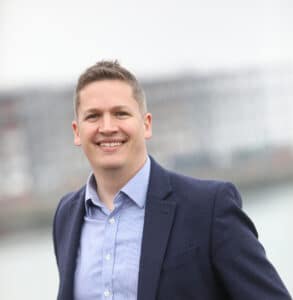
Valeport has strengthened its senior management team with the appointment of a Head of Marketing, as it targets market leadership in the environmental sensors sector.
The internal appointment of former marketing manager, Guy Frankland, to Head of Marketing marks the latest step in the strategic growth plans for Valeport – the UK’s leading oceanographic, hydrographic and hydrometric instrument manufacturer.
With over 20 years experience in strategy, brand and digital marketing, Guy joined Valeport in 2018 and has been responsible for overseeing a comprehensive refresh of the brand that has served the subsea sector for over fifty years, supporting Valeport’s expansion into new markets and delivering new products to customers across a large number of sectors.
Valeport Managing Director Matt Quartley, said: “Guy has been fundamental in helping us shape the business in recent years and appointing someone of Guy’s calibre to our senior team is a key part to helping us continue to implement our plans for Valeport’s growth moving forward.”
Valeport technology is selected by leading subsea, hydrographic, hydrometric, metrological & positioning, oceanographic, ports, harbours & dredging, renewable energy and scientific research organisations worldwide.
For more information visit: www.valeport.co.uk

International collaboration to develop ultra-deep sea sensors begins
This month marks the start of a new international collaboration to better understand the ultra deep-sea through innovative adaptation of sensors to withstand the crushing pressures at depths of down to 11,000 metres.
Funded through the NERC Global Partnerships Seedcorn Fund, the project will bring together experts from the National Oceanography Centre (NOC) with researchers from the newly created centre of excellence for ultra-deep sea research - the Danish Center for Hadal Research (HADAL) at the University of Southern Denmark (SDU), to jointly improve knowledge about the processes governing organic carbon degradation in deep-sea trenches.
The hadal, or hadopelagic zone, is found from a depth of around 6,000 to 11,000 metres (20,000 to 36,000 ft), and is the deepest region of the ocean lying within oceanic trenches. It accounts for nearly half of the ocean's depth range, but has only recently been recognised as potential hotspot for organic carbon turnover and microbial activity. To understand the carbon mineralization and the related biogeochemical processes in hadal sediments is of global importance, as carbon recycling in sediments can have critical implications for ocean chemistry, redox conditions, and nutrient availability, impacting life in the oceans.
The project will support knowledge exchange and a collaborative design between partners to adapt the innovative sensor technology required to study the ocean at these extreme depths. The sensors will be provided by the NOC’s Ocean Technology and Engineering team and rigorously tested in the pressure testing facilities of the Danish Center for Hadal Research before being deployed during joint field work in a deep-sea trench off Japan in 2022.
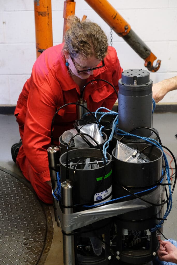
The NOC’s Dr Anna Lichtschlag is leading the project working with NOC research engineer Dr Allison Schaap (pictured below).
For more information visit: www.noc.ac.uk
Innovative NOC project wins funding to support Blue Economy and sustainable energy
A new project being led by the National Oceanography Centre to develop a system to improve the efficiency of offshore renewable energy generation and help develop the Blue Economy has been awarded funding from Innovate UK’s Sustainable Innovation Fund.
Submarine High-fidelity Active-monitoring of Renewable energy Cables (SHARC) aims to improve the operational efficiency of offshore renewable energy generation by addressing failure management of critical subsea infrastructure, in this case submarine cables. Between 2014 and 2017, recorded cable failures across UK sites alone led to a cumulative loss of £227 million, highlighting the importance of innovations to improve cable failure-management strategies.
Reducing these costs will make offshore renewables more competitive and accelerate their uptake, contributing to the UK Government's Clean Growth Strategy and enabling net-zero carbon emissions. Furthermore, COVID-19 has increased the need for remote monitoring of assets. Remote monitoring can be performed in socially distanced settings, removing the need to deploy crews offshore to operate in the tight confines of vessels. This approach is more economically efficient, as it will allow in-service fibre-optics to be remotely accessed. Additionally, it will reduce the health risks to employees by limiting their potential exposure to COVID-19, enabling the offshore renewable energy industry to 'build back better'.
The SHARC project will develop innovative techniques to monitor the condition of cables in real-time, taking into account the combined influence of various marine-environmental and intrinsic cable heating effects. This will result in early detection of potential threats to cables or better prediction of their potential failures, which will enable timely intervention, avoiding large-scale damage and the associated costly downtimes.
To achieve this goal, the NOC is leading a team of world-class experts from the fields of marine geoscience, next-generation distributed fibre optics design and instrumentation, ocean technology and engineering, machine learning & artificial intelligence algorithm design, and exploitation and modelling of dynamic and static cable rating, with the European Marine Energy Centre (EMEC) as the end-user and key stakeholder.
"The SHARC project will develop the capability to accurately monitor and assess the condition of subsea infrastructure that supports offshore renewable energy production in real-time, and has the potential to avert and address potential damage before it’s too late, by which time it becomes incredibly expensive to repair. The societal benefits that SHARC will contribute to are also significant in terms of the more efficient generation of clean, renewable energy, reducing the risk to people operating in this sector, with concurrent monitoring of the precious oceanic environment."
SHARC project lead, Dr Mohammad Belal from the National Oceanography Centre
“The National Oceanography Centre’s SHARC project, along with every initiative Innovate UK has supported through this fund, is an important step forward in driving sustainable economic development.”
Innovate UK Executive Chair, Dr Ian Campbell
For more information please visit: www.noc.ac.uk
Falcon for Swedish Safety and Survey
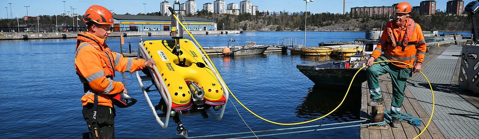
Peab Marin chose a Saab Seaeye Falcon as a multi-functional resource in support of the company’s marine survey, salvage and civil construction operations. The Swedish marine services company says the Falcon will secure a safer working environment for its divers and will be an “excellent tool” for surveying. Importantly for Peab Marin’s wide range of construction and maintenance work the Falcon’s quick and easy deployment with ready systems change and expandable systems options, make it a highly adaptable resource.
Diver Safety
Diver safety is paramount and in hazardous circumstances the Falcon can be deployed to work underwater endlessly and tirelessly. Robert Hedin at Peab describes the important role the Falcon will play in diver safety:
“Some work can offer serious risk for a commercial diver, especially Delta-P situations when the differential pressure between two water columns attempts to equalize, creating tremendous pressure/suction.
It’s a hazard that cannot be downplayed, as in some cases it’s just impossible to reduce the suction in case of emergency.
In situations like this, we prefer to send down the Falcon to either completely replace the diver’s work or in order to make a proper safety assessment. It really helps us to create a safer work environment for our commercial divers.
This has been exclusive to the offshore industry for a long time, and we’re really glad to see the same application moving into the civil inshore industry in Sweden.”
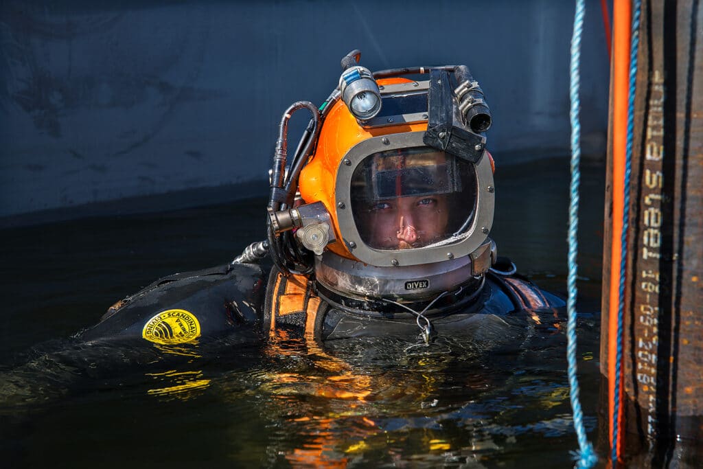
Photo by Peter Steen: The Falcon can make a safety assessment before sending divers down.
Murky Water Working
With Swedish waters notorious for low visibility, typically 0.5m and less, and working in a wide variety of water states from open seas to waterway locks, fitting a Bluetooth multibeam sonar to the Falcon was essential, says Robert Hedin: “It is a must-have for operating an ROV in our underwater environment.”
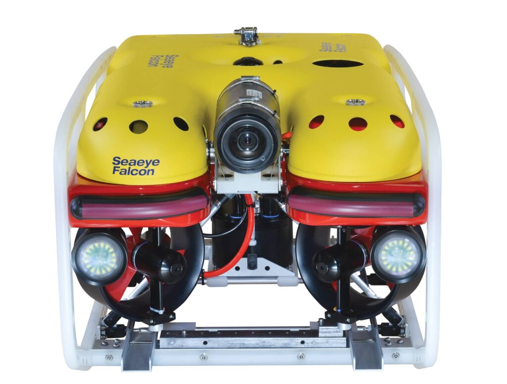
Photo: Saab Seaeye Falcon - A multi-functional resource in support of Peab Marin’s marine survey, salvage and civil construction operations.
Pilots’ Friend
With Peab Marin pilots typically working in challenging conditions, their pilots welcome the precise control, agility and stability of the Falcon when faced with complex environments in turbulent waters and strong currents.
The pilots particularly like the vehicle’s user-friendly interface with its advanced array of functions including customisable graphics and diagnostic pages.
The Falcon’s 20 year success - winning top-in-class world status - comes from its future-flexible, ever-evolving technology package that Saab Seaeye has designed around a compact, powerful, highly manoeuvrable, easy to use vehicle, enhanced with iCON™ intelligent control.
For more information visit: www.saabseaeye.com

BSL completes another successful Pre-Decommissioning Survey
BSL as a subcontractor to N-Sea onboard the Noordhoek Pathfinder has completed another successful pre decommissioning survey for Perenco. As part of a broader scope of work, BSL undertook the pre-decommissioning habitat and environmental baseline survey, including provision of a dedicated sampling winch. Thanks to the collaborative effort and cooperation between all parties, the campaign was completed efficiently and without incident.
BSL is undertaking the laboratory analysis of the samples acquired offshore and subsequent data processing prior to completion and delivery of the environmental habitat and baseline reports.
For more information visit: www.benthicsolutions.com
New Compact Hydrographic System Meets Growing Demand For Shallow-Water ‘Gap-Filler’ Surveys
Hydrographic survey technology provider Subsea Europe Services GmbH has introduced a new compact version of its unique integrated Hydrographic Survey System (iHSS). Called iHSS-Compact, it meets the growing demand for shallow-water ‘gap-filler’ marine surveys and simplifies the acquisition of commercial grade marine data for users of any experience.
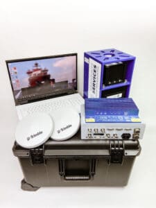 iHSS-Compact leverages Subsea Europe Services’ technology integration expertise to provide a low-cost, turnkey marine survey package for deployment on almost any vessel. Designed for customers seeking an easy to access alternative to commercial survey vessels for on-demand shallow-water projects, the system is delivered in a single, ‘person-portable’ Pelican case for fast deployment and streamlined set up.
Ready now for rental, subscription or purchase, in many cases, iHSS-Compact can be pre-configured and available anywhere in Europe virtually ‘next-day’, with installation and calibration in less than two hours. Practically plug and play, iHSS-Compact includes everything needed to acquire high quality marine data to new IHO S-44 Exclusive Order standards, including an R2 Sonic 2020 wideband multibeam echosounder, I2NS Inertial Navigation System, versatile mounting solution, survey and post-processing notebook, software and cabling. The iHSS-Compact is also available as a dual head system allowing for more than 200 degrees of swath coverage.
“We created the iHSS to simplify marine data acquisition with a lower cost, easier to access solution for when commercial survey vessels are unavailable, too expensive, or too cumbersome for the job at hand,” explains Sören Themann, CEO, Subsea Europe Services GmbH. “The iHSS-Compact is a natural extension of the concept with specific focus on providing a mobile, flexible solution primarily for shallow-water survey projects that need fast access to high-quality marine data acquisition technology.”
For more information visit: www.subsea-europe.com