
Sercel launches new Bluepulse acoustic marine source for seismic acquisition in sensitive areas
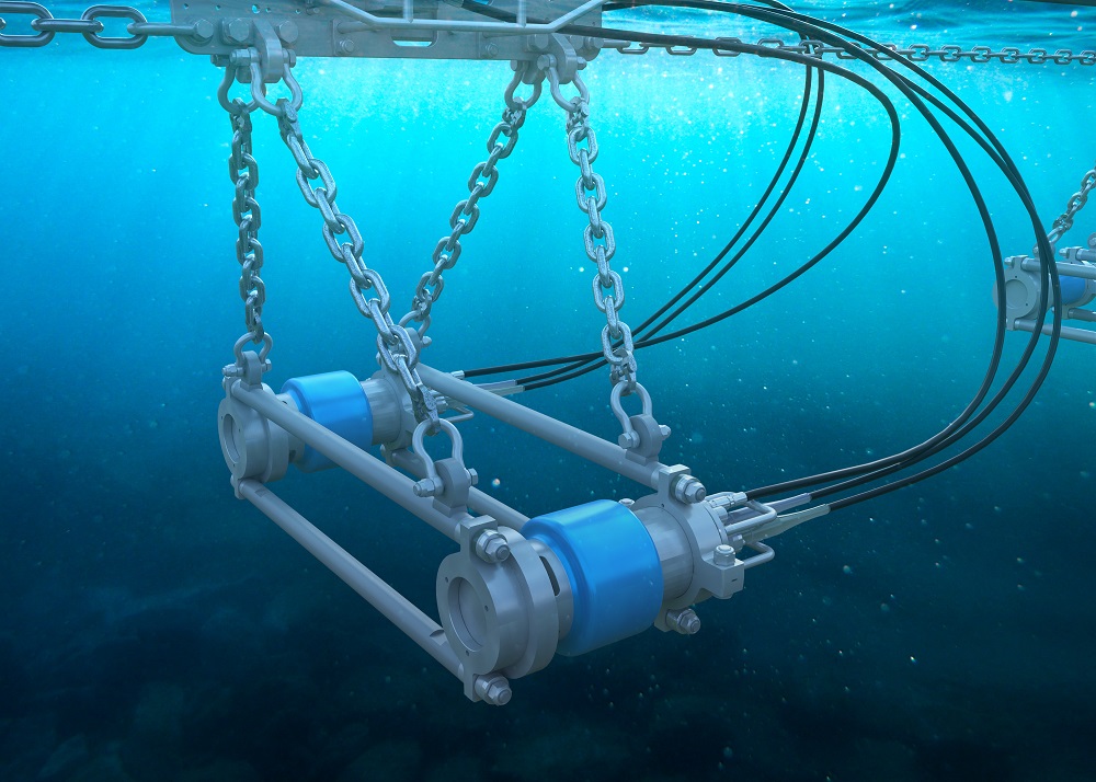
Sercel's new marine acoustic source for seismic acquisition in sensitive areas (image courtesy of Sercel).
Sercel announced today the launch of Bluepulse, an innovative marine acoustic source offering the most advanced frequency control technology on the market. Bluepulse is a purpose-built acoustic source designed to help protect marine wildlife from high-frequency emissions, while maintaining highly accurate and reliable results for seismic acquisition.
Bluepulse is compatible with all existing peripherals making it an easy choice for surveys requiring limited high frequency source emissions. Through intelligent engineering and design, existing G-Source and G-Source II units can be easily upgraded with Bluepulse technology, saving customers up to 40% on the cost of fleet conversions. The new units offer available range options in three different casings, twenty-two different volumes and with two frequency limits (100Hz and 200Hz) to comply with regulatory environmental standards and restrictions. The source array can thus be configured and customized to meet exacting survey requirements.
Emmanuelle Dubu, Sercel CEO, said: “Bluepulse is a perfect example of our continued commitment to providing high-quality data combined with the highest level of environmental responsibility. The ability to upgrade existing units and the wide variety of options also offers the highest flexibility for marine surveys all over the world.”


New global survey calls for greater coordination of seabed mapping activities
A new survey has given a major boost to efforts to map the entire seafloor by the end of the decade. Nearly 800 professionals representing 90 countries shared views on the value of seabed mapping and where activities to map using modern digital methods should be focused, as well as identifying some key challenges that need to be addressed in order to achieve the ambitious goal.
The findings are released as the UN Ocean Decade endorses a range of new global Actions covering activities across the world’s ocean basins. A new Call for Decade Actions is also set to launch today – the second of a series that will be launched every six months as part of the Ocean Decade.
The survey – commissioned by The Nippon Foundation-GEBCO-Seabed 2030 Project and managed by Blue Economy company NLA International – drew responses from across the scientific, academic, philanthropic and business communities, as well as from government and defence officials. Headline findings included:
• 40% of online respondents considered the main benefit of mapping the ocean floor to be ‘to advance scientific understanding of seabed characteristics’, with 11% highlighting the need ‘to monitor environmental challenges over time’.
• Bathymetric data (81.67% of respondents) was the most desired geospatial information, followed by environmental data (69%), oceanographic data (65.33%) and classification of seabed features (63.33%).
• Respondents were interested mostly in water depths less than 200m (33.57%) and greater than 5750m (31.12%).
• An overwhelming majority of respondents (58.31%) would want access to any data sets via an online marine data portal.
The survey aimed to develop a more consolidated global view of seabed mapping needs in order to move towards an agreed list of strategically important priority areas for further action. It also achieved its secondary aim of finding new data that could immediately feed into the emerging global map, with respondents identifying 154 potential sources of new data to be explored. Each new data set collected will help to develop models that can more accurately predict climate and weather patterns, tides, wave action, sediment transport, tsunami wave propagation and underwater geo-hazards.
There was universal recognition from survey respondents for the urgent need to map the world’s seabed, and equally compelling praise and support of the Seabed 2030 project’s objectives. However, some challenges were also identified. Many felt that current survey/environmental strategies and initiatives could do more to align within a more joined-up, coordinated approach. A consistent message emerged that scarce resources are not being used efficiently as they could be as too many programmes are seen to operate in isolation. In particular, seabed mapping programmes run by industry and environmental bodies were identified as not complementing national hydrographic office strategies.
Commenting on the findings, Seabed 2030 Project Director Jamie McMichael-Phillips said:
“We were completely bowled over by the volume and quality of the responses to our survey. The results have provided us with three new areas of value. First of all, it’s great to have identified over 150 new data sources, and our teams are already working to bring that bathymetric data into the master database. Secondly, we now have a previously non-existent base list of areas the global community would like to see surveyed, and the reasons why they feel it is important to do so. This provides us with a really robust platform from which to develop a more targeted list of priority activity areas to help us drive towards our target.
“Of equal importance was the rich level of detail the survey respondents provided in a wide range of additional comments. When viewed collectively, these provide a compelling, bottom-up picture of what more needs to be done – where links may have been overlooked, where partnerships need to be strengthened, where and how new effort needs to be applied in order to have the maximum impact. We look forward to revealing how we will respond to these ideas in due course. I would like to thank every single person who completed the survey, and the many organisations who helped us attract such a fantastic response in order to develop a strong global perspective.”
The survey was supported and promoted by a significant number of international bodies and agencies, examples of which included the Intergovernmental Oceanographic Commission (IOC); Baltic and International Maritime Council (BIMCO); United Kingdom Hydrographic Office (UKHO); and the European Marine Observation and Data Network (EMODnet).
The survey findings will now be converted into a draft global priority list for seabed mapping activities that reflects all maritime sectors and users of seabed bathymetric data. This draft priority list will be shared with the world’s hydrographic, oceanographic and policy agencies in order to move jointly towards an internationally recognised and supported prioritised list for seabed mapping that reflects potential cross-sector environmental, social and economic benefits across all areas.
The survey findings come amid a flurry of high-level global activity for the Seabed 2030 Project, which has been endorsed as an official Action of the UN Ocean Decade. Recently launched initiatives have also included forming partnerships with innovative data-gathering technologies and the signing of a Memorandum of Agreement with the New Zealand Government. The Seabed 2030 Project has already had a significant impact on the amount of the ocean floor that has been mapped to modern standards – steadily progressing the figure from six per cent in 2017 to 20 per cent in 2021.
Manor Renewable Energy selects Teledyne RESON T51 multibeam as part of continued investment in survey department
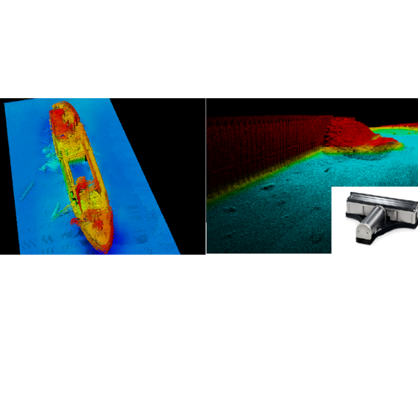
Manor Renewable Energy (MRE) continues its investment in the company’s survey capability with the comprehensive refit of survey equipment onboard the Manor Brunel, MRE’s permanently mobilised survey vessel. The Brunel has undergone a series of engineering upgrades at the Manor Marine yard in Portland, Dorset in addition to the installation of a cutting-edge suite of hydrographic survey technology from Teledyne Marine.
MRE is excited to announce the order with Teledyne Marine for the revolutionary RESON Seabat T51 multibeam echosounder, offering a step change in the acquisition of high-resolution bathymetric data. The order also included an E20 singlebeam echosounder, SVP70 sound velocity probe and an upgrade to the vessel’s Applanix POS MV Wavemaster Inertial Navigation System. The installation of the T51 to take place in December 2021 completes the upgrade to the Manor Brunel.
Alex Richards, Survey Manager at MRE said,
“This investment in the department is a bold statement for the company; the introduction of a high specification, dedicated survey platform to the market will enable MRE to further extend its range of services to the industry.”
“We are delighted that MRE have chosen to partner with Teledyne in order to upgrade their new vessel, the Manor Brunel,” commented Ed Cheesman of Teledyne Marine. “The T51 marks a real advance in multibeam technology offering high resolution data across a wide swath using a dedicated 800kHz array. It is great to see Alex and the team set out from the beginning investing in the right tools to deliver the best results.”
Falcon across Turkey
Turkey’s marine operations company, ARAS Marine, has chosen for its expansive operations the deep-rated Saab Seaeye Falcon as a key underwater robotics resource.
The versatility of the Falcon will support the wide range of projects undertaken by ARAS in both International and Turkish territorial waters.
These projects range from marine construction and offshore supply services, to seismic research support, emergency response and salvage and wreck removal.
Equipped for the wide array of tasks ahead, ARAS’s 1000m depth-rated Falcon comes complete with a fibre optic upgrade, manipulator, soft rope cutter, cameras, Tritech sonar and Applied Acoustics’ USBL system.
ARAS can add further systems any time as the Falcon can handle an array of cameras, sensors, tooling and complex systems typically found on much larger robotic vehicles.
The ease of adding systems comes from the Falcon’s iCON™ intelligent distributed control architecture. Module-focused iCON™ endows each device with its own microprocessor for individual control - a concept that also makes it future-flexible for evolving technologies.
As the world’s top selling robot of its class, the Falcon’s 20-year success comes from being a portable, metre-sized, intelligent, powerful, five-thruster, highly manoeuvrable, multi-tasking, easy to use vehicle, depth rated to 1000 metres.
With a reliability record covering over a million hours underwater, including deep tunnel work, the Falcon can remain stable in turbulent waters and strong currents whilst undertaking both robust and precision tasks.
ARAS see the Falcon as an ideally adaptable resource for their expanding future.
The contract was negotiated through Saab Seaeye’s Turkish distributor, Aspiro.
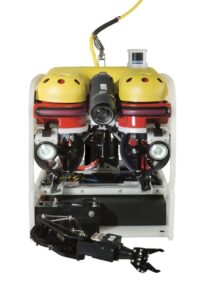
Falcon – the world’s top selling robotic vehicle can be equipped with a wide range of tools, cameras and sensors.
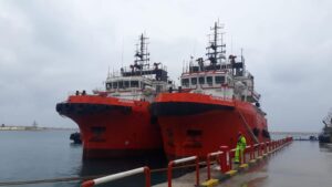
ARAS has a wide array of resources for an extensive range of projects.
Sonardyne Group Limited changes name to Covelya Group Limited
The name change is effective immediately as the organisation positions itself for further growth and appoints Simon Partridge as its inaugural Chairman.
Sonardyne Group Limited, a family-owned global group of companies comprising Chelsea Technologies, EIVA, Sonardyne, Voyis and Wavefront, announced today that it is rebranding as Covelya Group Limited. Alongside the name change, the company announced that Simon Partridge will succeed Ralph Rayner as company Chairman with immediate effect. Ralph will remain on the board in a non-executive capacity. The announcement was made by Covelya Group CEO, Stephen Fasham.
Commenting on the change, Stephen explained:
“Following the restructuring of the group in 2020, the new name and identity gives us the launchpad from which to develop Covelya with a strong identity, culture and purpose.”
Stephen went on to say,
“Covelya’s role will be to continue supporting all our companies to grow and seek opportunities to add to our capability through internal and external investment, in addition to encouraging cross group collaboration. This will allow us to serve our customers better, amplifying our offer so that we become greater than the sum of our parts in all we do.”
Ralph Rayner commented:
“Simon has grown up in the business and has remarkable knowledge of technology, markets and customers across the whole group, making him uniquely placed to take up the Chairmanship. I look forward to working with Simon and Stephen to make the mission outlined by Stephen on behalf of us all, a reality.”
Simon added: “I’m delighted to be taking on the role of Chairman. I’d like to thank Ralph for his unequivocal support and focused leadership over the past 10 years. We’re on an exciting path as we launch Covelya - with Stephen at the helm combined with the leadership team across all the Covelya companies, I have great confidence that we will continue to sustainably grow the company for the next generation.”
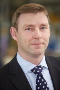

Simon Partridge and Stephen Fasham
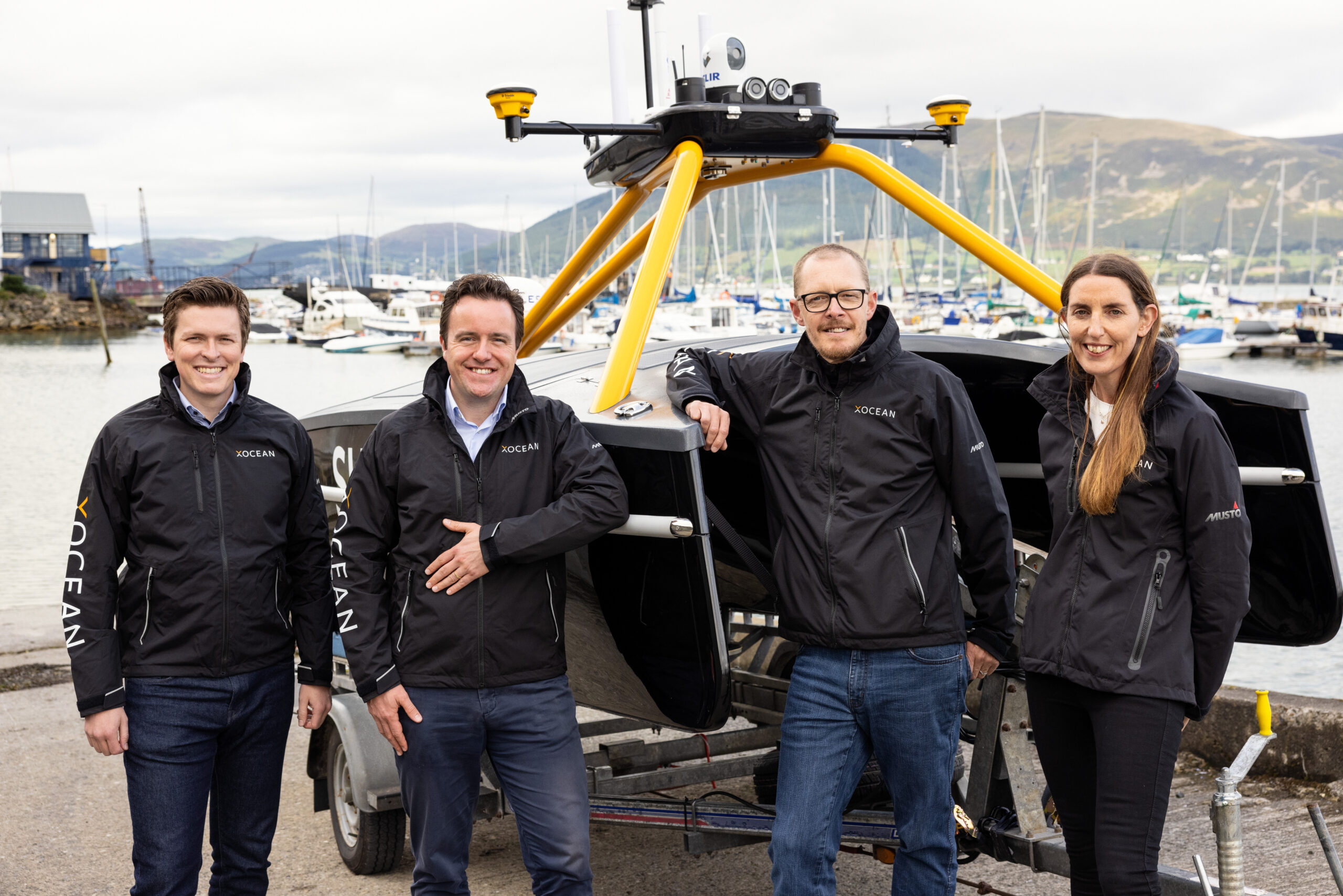
Sustainable ocean data company transforming market with €8m investment and ambitious carbon reduction plans
Irish based international ocean data company, XOCEAN, has received an €8m investment to accelerate its growth and deliver its exciting ambitions. Valued in excess of €100 million, carbon neutral XOCEAN is driving down emissions in the offshore industry and is delivering on its sustainability goal of displacing the emission of one million tons of carbon.
The multi-million-euro investment led by VentureWave Capital, who launched their “Impact Ireland” fund in June 2020, perfectly aligns with XOCEAN’s mission. The fund works with high growth companies to invest and build global ‘technology for good’ that will deliver real societal benefits.
Having tripled its revenue growth for two consecutive years, XOCEAN is no longer just an industry disrupter but a serious contender within the market. The new funding will accelerate their growth, seeing XOCEAN continue to scale up operations. With ambitious plans to increase headcount from over 100 staff to 350 in the next 24 months whilst tripling the size of their fleet to over 60 Uncrewed Surface Vessels (USVs), the business will displace the emission of one million tons of carbon within the next five years alone, whilst simultaneously improving safety by avoiding over five million seafarer exposure hours.
XOCEAN Chief Financial Officer, Karen May, said:
“This really is a milestone for the business, 2021 has been a great year for XOCEAN with really strong revenues and financial performance. We look forward to investing the funds now to accelerate our market growth and retain our leadership position in this new and fast-growing industry.”
The company uses its proprietary marine robotic technology to collect ocean data sustainably across a range of industries including Offshore Wind. Already a key player in the market, XOCEAN has successfully delivered over 100 projects accumulating over 35,000 hours of operation. The business continues to drive the development of new products with an ambitious technology roadmap, which integrates new capabilities whilst maximising the efficiency of the platform and pushing the boundaries of the technology.
With only 5% of the world’s oceans mapped, XOCEAN serves the growing demand for carbon-neutral data collection using in-house developed remotely operated uncrewed vessels. As the offshore wind sector continues to accelerate, XOCEAN's work will contribute to that development, empowering the global shift to renewable energy and enhanced understanding of the oceans.
VentureWave’s Chairman and Managing Partner, Alan Foy, who will join the XOCEAN Board, said: “We are delighted to be working with James and Karen. The ocean data collection market is a major emerging market opportunity with substantial growth forecast. XOCEAN has world class technology that delivers an eco-friendly, safer and more intelligent way of addressing this need. With operations already across four continents, they are well positioned to capture a significant share of that growth.”
XOCEAN’s Founder and CEO James Ives said:
“Our mission is to deliver the data that powers the sustainable development of our oceans. Our aim is to do this in a safe, economic and ultra-low impact way. Today we are delivering this for clients across a range of industries including the renewable energy sector and government agencies across the globe from North America to Europe to Asia-Pacific. We are delighted that Alan and the VentureWave team have chosen to join us on this exciting journey”
Kieran McLoughlin, VentureWave Capital Managing Partner said,
“We are thrilled to partner with another impact-driven business, XOCEAN. The investment will meet a number of the UN’s Sustainable Development Goals including Climate Action and Life Below Water. Together with James and the Management Team, we have set several impact goals for the next few years including displacing the emission of one million tons of carbon and supporting the development of over 100 gigawatts of offshore wind.”
The €8 million Series A investment round, led by VentureWave Capital, included existing XOCEAN shareholders Chris Huskilson and Enterprise Ireland as well as other private investors in Ireland and Canada.
Swathe Services adds GISGRO to their survey solution portfolio
Easy delivery and utilization of survey data adds value to the workflow for surveyors.
For over 17 years, Swathe Services has excelled in supporting surveyors, contractors, ports, harbours, dredging and construction companies to achieve the best possible value from their surveys. Swathe Services provide not only high-end technology but also their expertise in consulting and training services. Whether the survey is carried out on land or under water, Swathe Services offers the best tools for the job.
A common problem for many surveyors is how to efficiently share data with their clients to help them utilise it in their everyday operations. GISGRO’s easy-to-use interface, smart tools and online environment ensure that data is available for all, in one place, at one time, enabling everyone involved to work smarter.
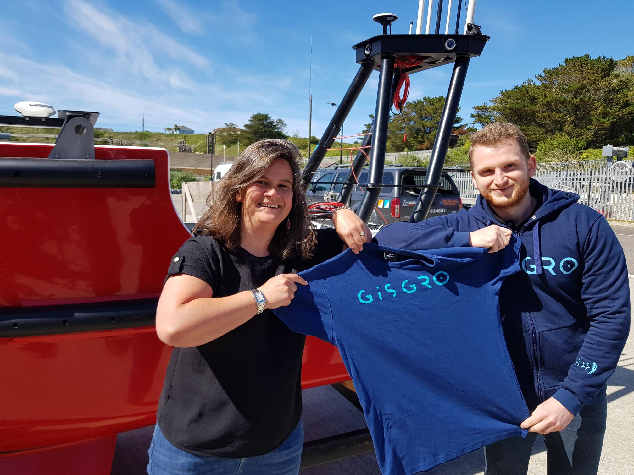
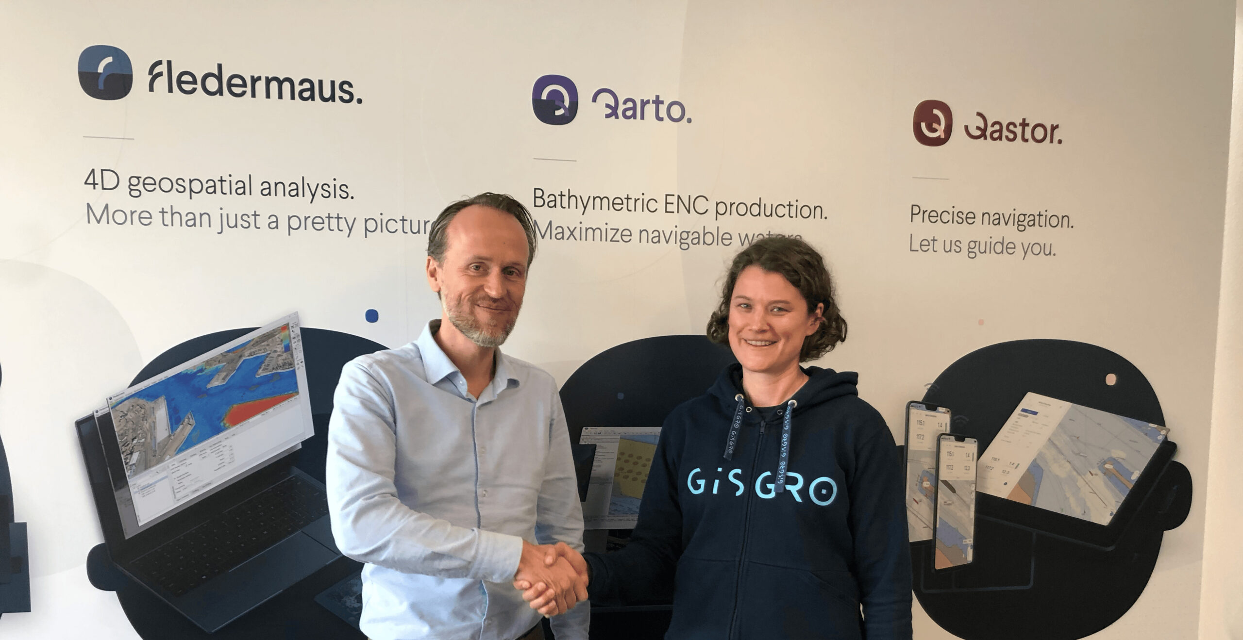
Swathe Services have added GISGRO online platform to their product offering, allowing surveyors to increase the value of their service and assist end customers to work smarter and utilise the data effectively.
“We are proud to add GISGRO to our excellent list of products we provide to the marine survey industry. This software will add huge value to high resolution data”, James Williams, Managing Director at Swathe Services said.
“We are excited to have Swathe Services on board with the mission of increasing the utilization of survey data in ports’ operations. Making digitalisation easier is in the interest of both of us, and the surveying expertise of Swathe Services ensures the data put in GISGRO by their clients will be first-class”, Kirsi Hänninen, CEO of VRT Finland added.
About Swathe Services
Swathe Services is a Hydrographic Survey services company based at Hayle Marine Renewables Business park, Cornwall UK.
They specialise in Hydrographic survey equipment sales and support for the global survey industry. They work with the offshore oil and gas, renewables, environmental and coastal industries.
They offer bespoke or standard packages for any survey requirement. Providing leading-edge survey technology and equipment for sale or hire along with specialist hydrographic personnel, consultancy, training and complete customer support.
About GISGRO
Everyone at GISGRO has experience in the surveying and port industries. Our passion is helping clients find optimal ways to maximize the benefits of smart technology. GISGRO is developed by VRT Finland, a 3D underwater survey pioneer established in 2010 and based in Jyväskylä, Finland.
Contacts
James Williams
Managing Director, Swathe Services
+44(0) 1872 275 642 / [email protected]
Kirsi Hänninen
CEO, VRT Finland / GISGRO
+358 44 031 0760 / [email protected]

MacArtney to launch the new NEXUS 8 multiplexer at Ocean Business 2021
Underwater technology specialists MacArtney are to launch the latest addition to the NEXUS multiplexer family at the biannual Ocean Business 2021 exhibition, held between 12-14 October in Southampton, UK.
Continuing MacArtney's long tradition of developing products in consultation with the marketplace, the NEXUS 8 is the result of considerable customer and end-user input to ensure the product will fit the need, as explained by Lars Jørgensen, Head of Product Management:
"Naturally, we have our own opinion on what a multiplexer should be able to do, but what's more important is what the customer and end-user expects and needs. We specifically wanted customer input on what they wanted from a new generation multiplexer, and their requirements for new, advanced subsea telemetry systems when developing the NEXUS 8."
Tried and trusted
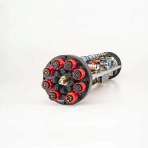
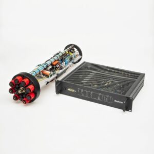
NEXUS 8 is the latest addition to the tried and trusted NEXUS multiplexer family, a range that has consistently gone from strength to strength, designed to provide an efficient link between surface and seabed. This new, future-proofed model is smaller and lighter than not only its predecessor, but also its competitors, specifically designed for environments where space is at a premium and to fit into virtually any existing subsea system.
NEXUS 8 is an HD video and multibeam sonar multiplexer, with ultra-high bandwidth and three full HD video interfaces for up to 3 HD cameras, able to provide real-time monitoring without any latency, and to run instruments and sensors for measurement, surveys, sonar, manipulation and control.
eFuses incorporated
The NEXUS 8 features intelligent programmable eFuses for dynamic performance and to save space. eFuses are ideal for subsea systems, offering flexible, dynamic programming, and avoiding time-consuming and expensive recovery operations for minor repairs.
The future, now
The new NEXUS 8 is specifically designed and developed to meet the market's demands for technology and data acquisition now and in the future. Simply the most advanced, compact and versatile product of its generation.
Launch at Ocean Business 2021
Visit the MacArtney stand B1 at Ocean Business 2021 to see the new, highly versatile, compact, future-proof NEXUS 8, and to hear more about what it can do for you.
Caption: NEXUS 8 meets tomorrow’s demands for technology and data acquisition now

_________________________________________________________________________________
For additional information, please contact Lars Jørgensen, Head of Product Management B.Sc.E.E.,
Tel. +45 7613 2000, e-mail [email protected] or visit the company website.
QPS users receive a shortcut to online data sharing and reporting in GISGRO
The year 2020 gave us a tangible example about the value of online services. Remote working became the new normal, and offices around the world discovered the need for easily accessible information. This also affects the surveying industry; how can we ensure the data we provide is usable anywhere, from workplaces to home offices?
The surveyors are facing the immediate need for updating the working procedures to match the current situation. Increased competition, remote working and digitalization are the drivers for updating the workflows. GISGRO platform offers the surveyor companies an opportunity to easily share survey data online to their clients in an easy-to-understand visual format. Now it is possible for QPS users to share data through GISGRO even more easily than before.
Serving clients better with easy online delivery.
One issue in the surveying industry is the scarce utilization of the survey data by the clients. A surveyor spends a small fortune to the high-end equipment, and hours of work in polishing the data to the highest accuracy. Still, because of the lack of suitable software, the client might not even be able to see the data.
"It takes a lot of effort from a surveyor to collect data, and that is why it makes sense to make the data available in a way that stakeholders can interact with the data themselves. Our goal is that users really interact with the survey data and find insights that way."
GISGRO adds value to the whole supply chain from the surveyor to the utilizer of the data. With the integration the value is gained through a seamless workflow from the surveying and processing software all the way to the client’s laptop, where the survey data actually gets into use.
Changing the hydrographic industry
Cooperation between QPS and GISGRO changes the ways hydrographic data is utilized. The companies share innovative and forward-looking mindset. The challenge of making the most out of survey data is something the clients are just starting to realize.
"The surveyors are making the transition from delivering an end product to just making the data available. This step leads to the insight that you can do more with the data. For example, in GISGRO the survey data can immediately be used to inform other stakeholders and to take action."
QPS software users gain the advantages of online delivery simply by registering to GISGRO as a QPS user and downloading GISGRO Uploader, which enables uploading qpd-files and other supported data formats to GISGRO. If you have QPS Qinsy 9.4 version (or newer), you will have a straight access from Survey Manager to access the GISGRO Uploader for further analysis and sharing to client.
About QPS
For more than 25 years, QPS have been experts in maritime geomatics software and services. QPS is unique in that its solutions encompass the entire workflow, from the surveyor all the way to the pilot. The company’s solutions are used across a variety of industries, including hydrographic surveying, dredging, offshore construction, oil and gas, offshore wind farm support, chart production, and piloting. QPS is headquartered in Zeist, The Netherlands, and has subsidiary offices located in Portsmouth, USA; Fredericton, Canada; and Banbury, UK. QPS is a SAAB Group Company since 2012.
About GISGRO
Everyone at GISGRO has experience in the surveying and port industries. Our passion is helping clients find optimal ways to maximize the benefits of smart technology. GISGRO is developed by VRT Finland, a 3D underwater survey pioneer established in 2010 and based in Jyväskylä, Finland.
GISGRO for Surveyors
GISGRO is a cloud based system that allows surveyors to visualize, analyze and share survey data directly to clients. It’s incredibly easy for the client to use and doesn’t require any downloads, installations, high grade hardware or superfast internet. The clients can utilize the data within GISGRO for managing assets, maintenance and operations.
GISGRO for Ports
GISGRO acts a central hub for important port information, from here data can be accessed, analyzed and shared to all necessary stakeholders. Our easy to use platform ensures everyone has access to the important and accurate data needed to run a port smoothly. Through the use of smart tools, data can easily be utilized for smarter, greener and safer port operations. All in one place available anywhere and at any time.
Contact:
Kirsi Hänninen
CEO, VRT Finland / GISGRO
+358 44 031 0760 / [email protected]
Bureau Veritas delivers Approval in Principle to DriX - an innovative Unmanned Surface Vessel
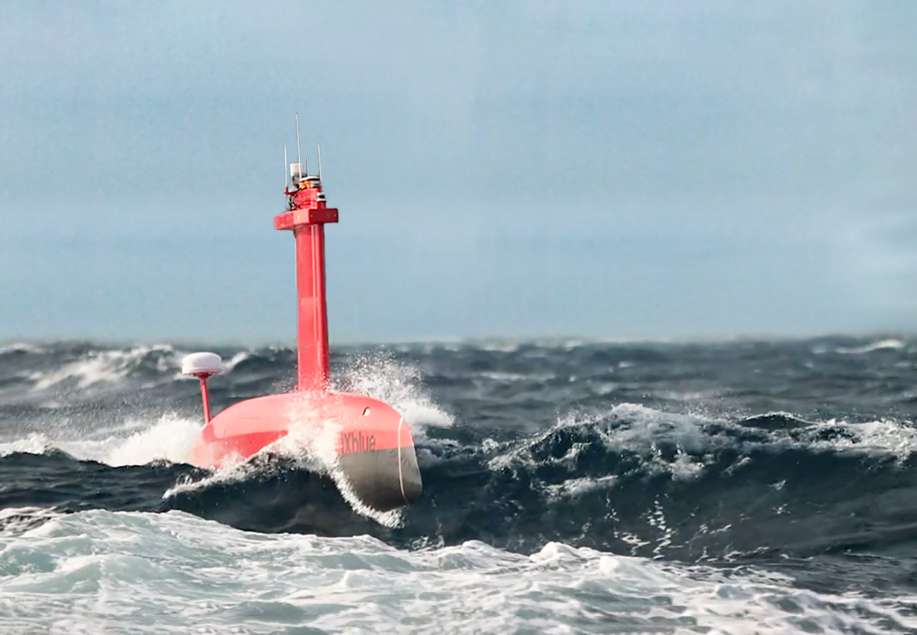
Bureau Veritas (BV), a world leader in testing, inspection, and certification, has delivered an Approval in Principle (AiP) to iXblue, a global high-tech company and a pioneer in the field of maritime autonomy, for its innovative Unmanned Surface Vessel (USV) named DriX. This AiP addresses the safety requirementsof the marine drone, which operates under the novel concept of remotely supervised autonomy.
With a length of 8 metres, DriX is an Unmanned Surface Vehicle (USV) equipped with advanced perception means, including a radar, a lidar and cameras, as well as artificial intelligence, which enable it to adapt to its environment, avoid obstacles and carry out missions autonomously. Designed to support hydrographic and geophysical surveys, water column analysis and subsea positioning operations, DriX has been used by major hydrographic institutes and energy companies worldwide.
Developed by French company iXblue, DriX has been certified by BV for its system architecture, its operational envelope, its construction (Malta Cross certificate for the hull), as well as its autonomy functions. The NI641 “Guidelines for Autonomous shipping” have provided a framework for a thorough analysis of the DriX architecture and its critical functions in a way that is adapted to autonomous marine systems.
In order to support the Approval in Principle, Bureau Veritas Solutions Marine & Offshore (BV Solutions M&O), the technical advisory component of Bureau Veritas Group, conducted a Hazard Identification (HAZID) study, as required by BV NI641. This HAZID study identified and assessed the hazards of Maritime Autonomous Surface Ships (MASS) when unmanned, taking into account the level of automation, direct and remote control, autonomy, area of operation and vessel type and design. BV Solutions M&O also conducted a Failure Mode Effects and Criticality Analysis (FMECA) on critical components previously identified during the HAZID study in order to identify, evaluate and mitigate the effects of essential equipment failure and to improve the reliability of automation systems associated with essential services.
This first certification of an Unmanned Surface Vessel (USV) by BV will help strengthen global acceptance of this technology by supporting operators in their risk analysis and mission planning for USVs deployment. This comes as the USV sector is expanding rapidly, and the acceptance of these novel marine drones depend on the capacity to demonstrate that they are safe to deploy and operate. BV and iXblue have been working in close collaboration to raise the standards and acceptance of USVs.
Stéphane Vannuffelen, Marine Autonomy Technical Director at iXblue, said: “We are convinced that the acceptance of autonomous solutions in the marine ecosystem requires a collaborative approach between manufacturers, class societies and authorities, and this work done with BV goes in that direction. This certification is a major achievement not only for DriX, but for the whole maritime industry, supporting its 4.0 transition.”
Laurent Leblanc, Senior Vice President of Technical & Operations at Bureau Veritas Marine & Offshore, commented: “Smart vessel operations can enable the maritime industry to increase productivity, predictability, and efficiency while reducing operational risk on the water. At BV, we are committed to support innovation with our robust set of standards to enable these new technologies to reach the market and ensure that they are safely implemented.”
To find out more:
- About Bureau Veritas Marine & Offshore, please visit our website.
- To watch videos about DriX, click here.