OceanTools Ltd release the C7-30 High-Definition IP subsea camera
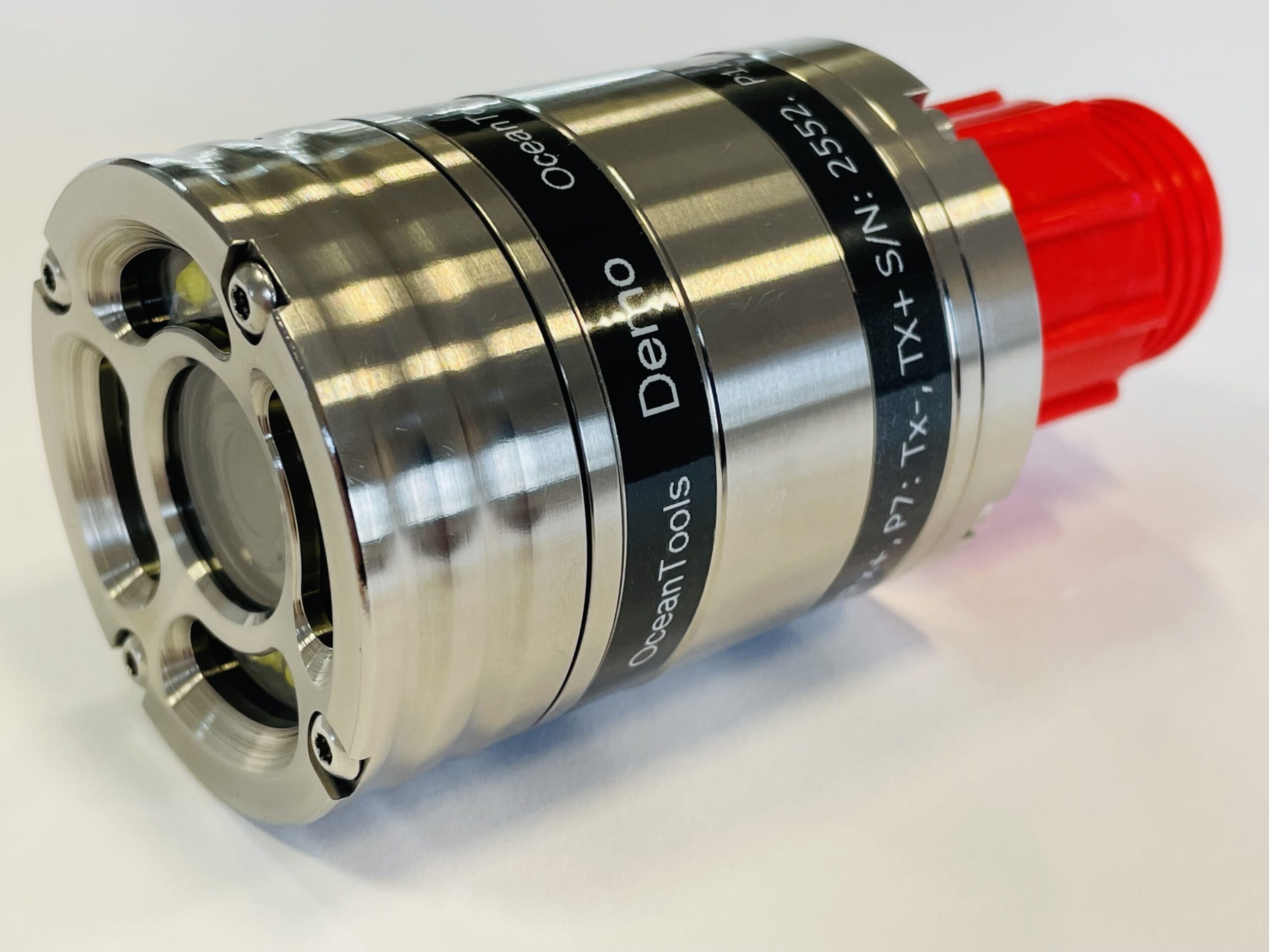
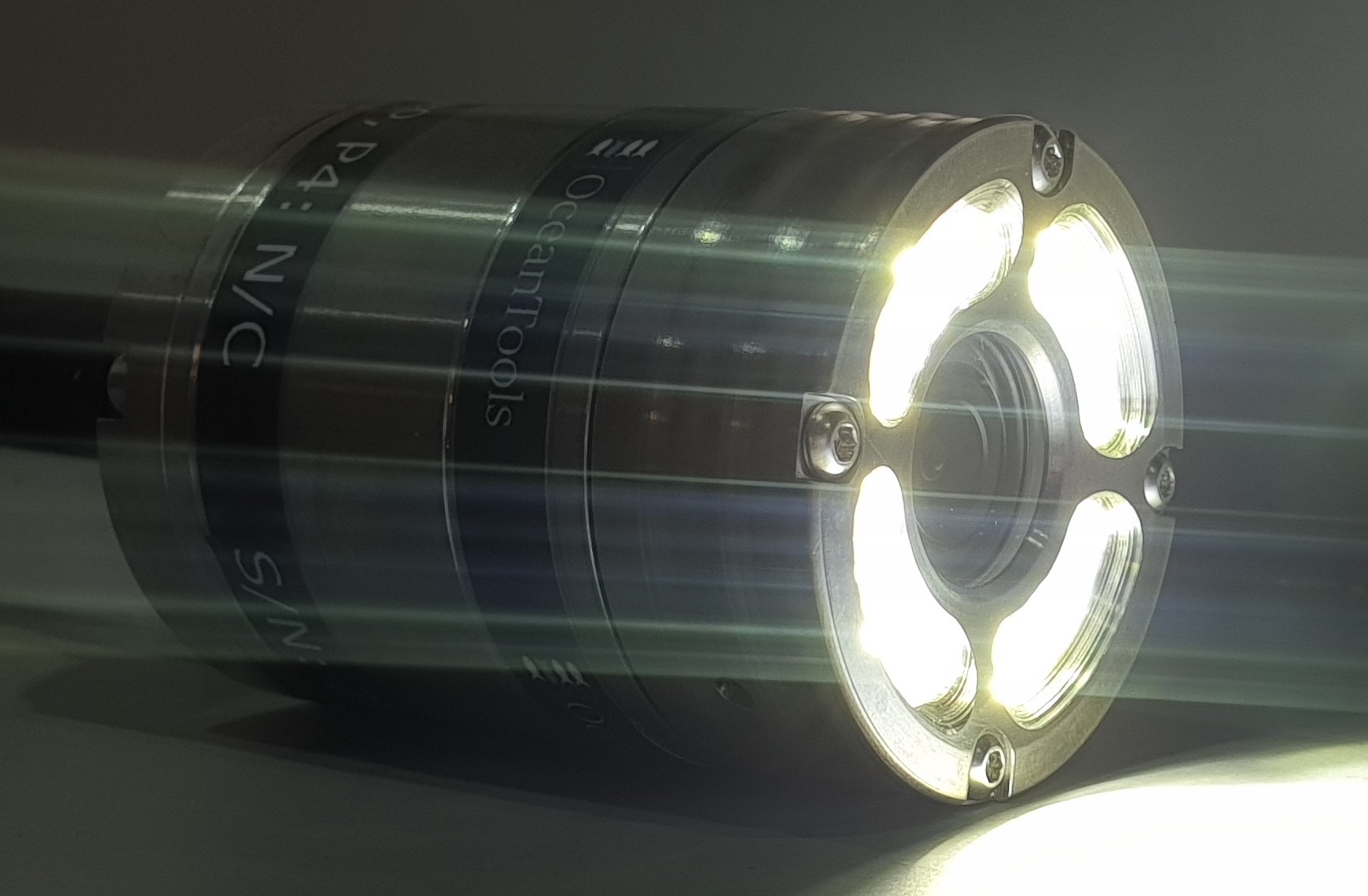
OceanTools Ltd, world-leading underwater technologists based in Aberdeen Scotland, release the C7-30 High-Definition IP subsea camera. Another market first for OceanTools, the C7-30 is a multipurpose IP camera with an integral high-intensity controllable light ring to illuminate the underwater environment and provide clear video footage at depths down to 6000 m. The compact C 7 30 subsea observation camera offers an impressive 2 MP HD over IP video output with a Wide Dynamic Range providing superb video quality under all lighting conditions. The integral light ring has 12 LEDs that can provide a light output of up to 2,250 lumens the intensity of which can be varied by analogue voltage control, power cycling or serial RS 485 control.
Brian Hector, Technical Sales Manager of OceanTools Ltd said “This camera is a market first, offering 2MP HD streaming video with internal lights in a package of only 53mm diameter. I’m looking forward to having this camera on display at Subsea Expo”.
Visit OceanTools Ltd on stand 47 at #SubseaExpo 21-23 February 2023 to learn more about the C7-30 and the full range of underwater cameras, lights, and dye detection equipment.
Kevin Parker, Managing Director of OceanTools said “We are obviously delighted to have sold more than 20 units in the first week this great camera has been on the market. Our customers tell us they are moving away from standard-definition cameras. With this new addition, OceanTools are ideally placed to provide cameras for the changing market."

Terradepth announces commercial launch of Absolute Ocean marine data management platform
Terradepth has announced the official launch of Absolute Ocean (AO), a secure easy-to-use cloud-based geospatial solution providing high-level visualization, analysis, collaboration, and management of all marine data. In addition to offering Absolute Ocean as a software-as-a-service solution, Terradepth leverages the platform to deliver its own marine survey products – including Autonomous Underwater Vehicle (AUV) data – as well as those of third-party ocean data vendors.
Terradepth, a provider of seafloor hydrographic and geophysical survey solutions, developed Absolute Ocean to deliver greater operational efficiencies in marine data delivery and collaboration. Absolute Ocean has been available in beta since early 2022 with several early adopters exercising its functionality. Currently, the solution is being used for projects ranging from environmental monitoring and construction engineering to offshore energy production and telecommunications infrastructure inspection.
“Absolute Ocean breaks open the data silos that have traditionally impeded access to, and collaboration on, vital ocean information,” said Joe Wolfel, CEO of Terradepth. “This fully integrated platform allows marine organizations to manage and archive all of their data sets in one place for enterprise-wide access and global collaboration.”
Absolute Ocean is intuitive, enabling multiple stakeholders, most of whom did not previously have easy access to this data, the ability to easily manage, view, analyze and deliver ocean geospatial information. Absolute Ocean addresses the need for a unified 3D geospatial data platform for secure enterprise-wide data sharing and visualization, as well as regulatory compliance.
“Terradepth’s Absolute Ocean revolutionizes ocean data management,” said Damon Wolfe, President of ECHO81, a premier supplier of underwater survey technology and Terradepth reseller based in Hartwell, Ga. “This easy-to-use interactive interface offers a long-needed solution to managing complex maritime data sets.”
Users can easily and securely upload geospatial data in any format into the secure cloud database directly from Absolute Ocean’s web browser interface. They can then query and visualize the data and perform geospatial analysis. Users can also generate and send hyperlinks that allow other stakeholders to see the exact view and projection on screen for easy collaboration.
A powerful geospatial engine enables users to view marine data and the base map data sets in 2D and 3D, from a variety of perspectives, scales, and viewing angles. Linear distances, profile measurements, and areas of subsurface features can be measured. Data sets can be viewed by themselves, overlaid on each other or with third party base maps, such as NOAA’s Electronic Nautical Charts (ENCs), for analysis.
For hydrographic surveying companies, the platform offers a way to differentiate themselves from competitors through more effective data delivery to their customers.
“The ability to quickly and easily analyze geospatial information helps our surveyors, data processors and project managers make more well-informed data-driven decisions, saving time and resources,” said William Jenkins, S.T. Hudson Engineers’ Vice President.
As one early adopter learned, it can also give customers near real-time access to valuable data.
“We are thrilled with how AO helps us achieve our customer’s goal of mapping the Great Lakes more quickly and efficiently and provide visualized data close to real-time,” says Derek Niles, President and Founder of Orange Force.
Terradepth has populated Absolute Ocean with thousands of publicly available data sets, including side-scan sonar, synthetic aperture sonar, magnetometer grids, multibeam bathymetry, LiDAR, and satellite imagery. Access to pre-loaded data and advanced functionality will be available through a graduated subscription pricing structure.
In addition, the platform serves as a storefront where customers can purchase commercial products from third parties, such as satellite-derived bathymetry from TCarta of Denver.
“The marine industry has been waiting for a solution like this,” said Kyle Goodrich, TCarta President & Founder. "AO gives us a secure and efficient way to instantly deliver updates, visualized files, and raw data to our clients, allowing them to view data and collaborate much more quickly than traditional practices.”
To request a demonstration of Absolute Ocean or learn more about Terradepth, go to terradepth.com.
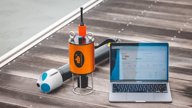
Subnero Wireless Integrated Suite (SWIS) - ADCP edition
Subnero, a Singapore-headquartered company is launching its latest development: Subnero Wireless Integrated Suite (SWIS) - ADCP edition.
Acoustic Doppler Current Profilers or ADCPs are used to measure high-quality underwater current data which is essential for many subsea operations such as coral reef health studies, metocean studies, discharge pattern surveys, ship navigation, subsea construction, inspection, intervention, and decommissioning.
When deploying ADCPs, users are generally presented with two choices to retrieve the data. Either retrieve the device after deployment and download the data or connect the bottom-mounted device to a buoy or a platform using a cable to download the data in real-time. Both these choices are expensive, logistically challenging, prone to data loss or equipment failure and may need additional permits which can increase the overall cost and complexity of the operation.
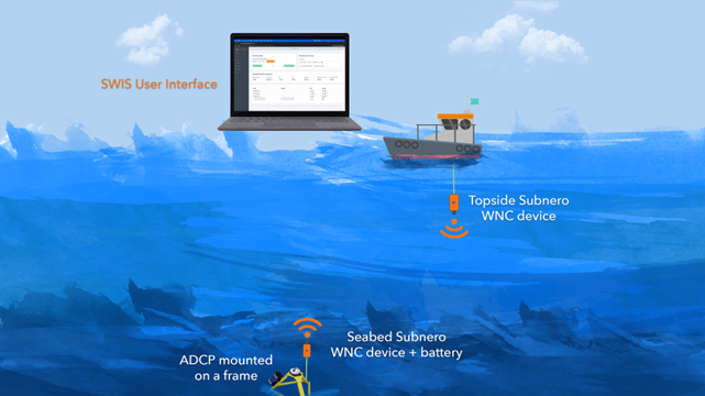
SWIS - ADCP edition provides seamless wireless connectivity to a seabed-mounted ADCP integrated with the Subnero Wireless Network Communication (WNC) series of products.
Users can interact with the remote ADCP through another WNC device deployed from the topside, such as from a boat, buoy, or platform, which can be dynamically configured to provide the best communication performance in the prevailing environment. The topside device can be accessed using a laptop or a tablet.
When connected, you are presented with a modern, intuitive web-based dashboard with all relevant information in one place. In addition to the list of measurement files that you can download, the user interface provides critical information such as the roll and pitch of the sensor, its temperature, battery voltage, etc., to ensure an error-free deployment. A single click allows you to download any file of interest just like you download something from the Internet. You get real-time feedback on the download progress, and you can even modify some of the remote device parameters during a deployment.
But what if the ADCP is configured to generate large amounts of data that an acoustic link cannot support? That is where SWIS makes a real difference.
SWIS features a Content-Aware Data Summarisation or CADS engine that leverages machine learning techniques to generate smart previews of the ADCP data files for a user-selectable date range and compression ratio. Smart previews are of the same format as a regular file generated by the ADCP which you can open using the same ADCP vendor-provided software to seamlessly integrate into your existing workflow.
In addition, SWIS provides smart scheduling capabilities for optimising battery usage, as well as fault tolerance by duplicating the data in both the ADCP as well as the WNC device to ensure data retrieval in the event of an equipment failure. SWIS also supports downloading data from multiple ADCPs deployed in the same area using a single topside unit.
All of these not only make your experience of deploying and managing multiple ADCPs easier but also drive down the costs dramatically by avoiding costly cables or frequent device retrievals, it also makes SWIS an ideal solution for subsea applications that need near-real-time access to current measurements.
After attending a local demonstration, Bob Coutts, Survey Business Development at Bintang Subsea noted “SWIS opens up new possibilities for the efficient and reliable acquisition of subsea sensor data.”
Subnero is constantly working to bring you new features to help you realise your vision of underwater communication and networking.
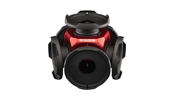
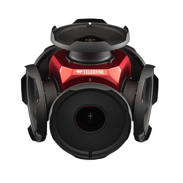
Teledyne announces new Ladybug6 cameras for high accuracy 360-degree spherical image capture
Teledyne FLIR Integrated Imaging Solutions is pleased to announce the all new Ladybug6— the latest addition to its field proven Ladybug series. Ladybug6 is the leading high-resolution camera designed to capture 360-degree spherical images from moving platforms in all-weather conditions. Its industrial grade design and out-of-the-box factory calibration produces 72 Megapixel (MP) images with pixel values that are spatially accurate within +/- 2 mm at 10-meter distance.
“The new Teledyne Ladybug6 is designed for mobile mapping and all-weather inspection projects requiring excellent image quality and high resolution,” said Mike Lee, Senior Product Manager at Teledyne FLIR. “With the addition of Ladybug6, we are now pleased to offer a wider variety of spherical cameras with higher resolutions ranging from 30 MP to 72 MP.”
The new Ladybug6 builds on Teledyne’s machine vision heritage with increased image resolution, enhanced on-board processing, and robust IP67-rated connectors. Building on the field proven Ladybug5+, the Ladybug6 captures, compresses, and transmits 8-bit or 12-bit pixel data delivering outstanding images across a wide range of lighting conditions with excellent color response, low noise, and a high dynamic range. Designed from the ground up to capture images from moving platforms in outdoor environments, the Ladybug6 features a wide operating temperature range (-30° C to 50° C), support for additional Global Navigation Satellite Systems, and trigger control by hardware or software with advanced APIs for complete camera control.
Ladybug6 cameras are engineered to deliver high-accuracy, high-resolution, and dependable results for applications such as HD mapping, asset management, roadside inspection, panoramic street image production for street view, road surveying, heritage scanning, building management, among several others.
Key Features:
- Captures 72 Megapixel images with spatial accuracy of +/- 2 mm at 10-meter distance
- Frame rates of up to 29.9 FPS at 4K resolution, 15 FPS at 72 MP
- Wide operating temperature range of -30° C to 50° C
- IP65 rating with industrial grade IP67 rated connectors
- Support for additional Global Navigation Satellite Systems
- Excellent color response, low noise, and a high dynamic range
- Captures, compresses, and transmits 8-bit or 12-bit pixel data
- Feature rich and user-friendly Ladybug SDK
- All-metal body with 2-year warranty
For more information about Ladybug6 models visit the website.
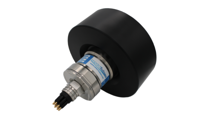
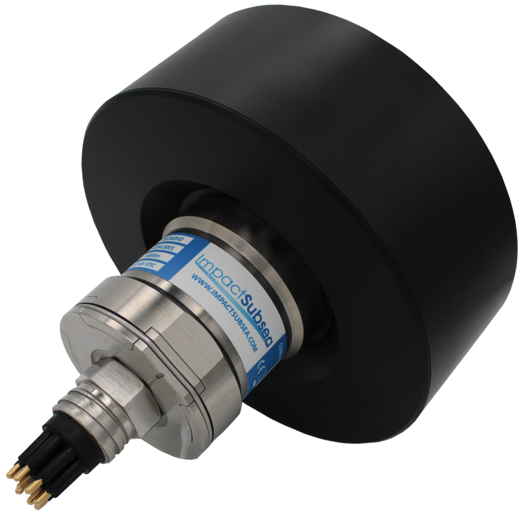
Impact Subsea announces new addition to the ISS360 Sonar range - the ISS360HD
The ISS360HD offers a 1° acoustic angular resolution, 2.5mm range resolution and a distance measurement range in excess of 100 meters/328 feet. The sonar is depth rated to 6,000 meters / 19,685 feet and comes in a very compact form factor.
The ISS360HD has a very wide operational acoustic bandwidth capability; 600 to 900kHz which is fully utilised through CHIRP (Compressed High Intensity Radar Pulse) technology. The wide bandwidth linear CHIRP allows for an excellent range resolution of 2.5mm when using the full bandwidth.
A narrow acoustic beam, combined with a very short range resolution allows for extremely high definition imagery to be produced. This makes the ISS360HD ideal for work class ROV operations with excellent range capability and ability to identify targets in zero visibility. The form factor of the sonar also opens this capability up to even the smallest of observation class ROVs.
In addition to the long range and high resolution capabilities, the ISS360HD benefits from an inductively coupled transducer. This means there are no slip rings within the sonar – so there are no components to wear out and require periodic replacement.
The sonar optionally comes with an integrated pitch and roll sensor, allowing accurate attitude readings to be provided. This is a very useful capability when deploying the sonar using a tripod to ensure level positioning. The integrated pitch and roll sensor is also a useful additional sensor reading for some underwater vehicles.
In terms of connectivity, the ISS360HD benefits from serial (RS232 and RS485) and also ethernet communications. When using ethernet communications, the sonar has been found to scan up to six times faster than other, competing serial only based sonars. This provides a significant benefit when using the sonar for underwater vehicle obstacle avoidance purposes.
The ISS360HD operates with the Impact Subsea seaView V3 software, allowing seamless use alongside the Impact Subsea Altimeter, Depth Sensor, AHRS sensor and FMD system.
For those wishing to use the ISS360HD sonar with an autonomous underwater vehicle, a Software Development Kit is freely available to allow direct integration of the sonar.
To learn more about the ISS360HD, please click here.
New solution from Teledyne Geospatial delivers survey-grade lidar point clouds from UAV platforms
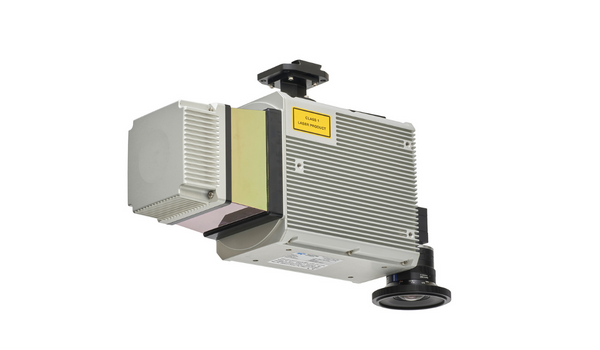
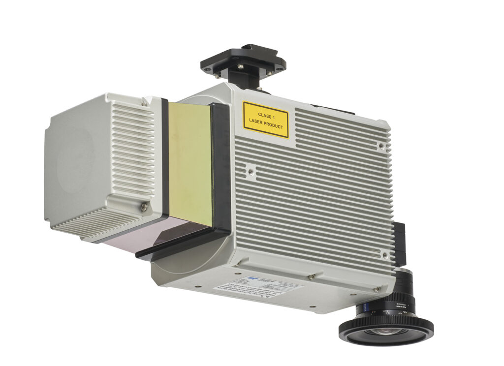
Teledyne Geospatial announces the Optech CLS-A, a new survey-grade UAV lidar and camera system. The Optech CLS-A enables the highest quality surveying and inspection applications where the tight integration of a powerful, narrow beam divergence laser, high accuracy IMU, calibrated camera and powerful post-processing software provide for efficient wide area collection at the allowable regulation limits for UAV operation.
The Optech CLS-A integrates the CL-360XR lidar scanner with its industry leading 0.3-mrad beam divergence, 360-deg field of view, and survey-grade precision and accuracy. The CL-360XR enables the collection of topographic lidar data from 120m agl or higher through vegetated and varied elevation terrain. The lidar is paired with a calibrated 80-degree field of view digital global shutter camera that enables colorization and high-resolution inspection. Data collected with Optech CLS-A, ALTM Galaxy, and Lynx systems can be simultaneously processed through a common workflow within Optech LMS Professional.
The CLS-A can be easily integrated onto a variety of UAV platforms depending upon the user’s preference. The integration can be completed with as little as power, an isolated mechanical mount, and a GNSS Antenna. The CLS-A is engineered to deliver high quality results for applications such as hard-surface engineering surveys, electricity vegetation management, topographic surveys, corridor monitoring, roads/pavement, railway, forestry, construction, mining, and archeology.
“We are very excited to announce Teledyne Geospatial’s first lidar solution that delivers survey-grade data from a UAV platform. The Optech CLS-A fits effortlessly into ALTM Galaxy and Lynx post-processing workflows to meet the most stringent data quality requirements,” commented Mark Treiber, Product Manager, Autonomous Solutions at Teledyne Optech.
Teledyne Geospatial unifies the hardware and software expertise of both Teledyne CARIS and Teledyne Optech. The new group provides customers with innovative integrated solutions. Offerings include turnkey systems, lidar and sonar integrated workflows and a range of systems and solutions that support holistic, precision data collection.
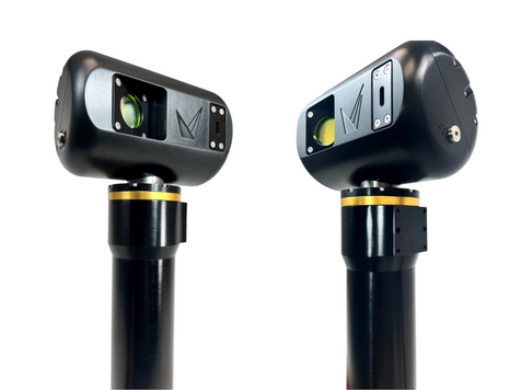
Voyis Imaging Inc. releases the revolutionary Insight Nano Compact Laser Scanner
Voyis Imaging Inc. (Voyis) has been a pioneer of subsea inspection technology, commercializing the first underwater laser scanner, the ULS-100. This product has been proven in surveys worldwide, producing quantitative analysis and actionable results in the most challenging environments.
With over a decade of successful projects, Voyis has decided to fuse customers’ feedback with the latest sensor technologies to deliver the next generation compact underwater laser scanning product – with higher data resolution, faster data capture, and greater control than ever before. Voyis is pleased to release the latest model in the Insight laser scanner family, the new Insight Nano.
The Insight Nano has a compact and robust design capable of generating high-resolution 3D modelling in the most difficult-to-reach places, whether the target is on the ocean floor or in a municipal water pipeline.
The Insight Nano provides operators with a complete visual understanding with dimensional accuracy for confident decision making in every inspection environment.
The Insight Nano is the pinnacle of compact 3D laser scanning without requiring any auxiliary sensors and capable of continuous high-speed 360-degree scanning. This robust sensor integrates seamlessly with ROVs and Crawlers, enabling its use in areas humans would otherwise be unable to reach.
“Remote and rugged environments need remarkable solutions. Solutions that expand your survey capabilities and empower you to reduce uncertainty and make decisions with the best possible data.”
Capable of generating point clouds with a sub-millimetre resolution in real-time, the Insight Nano is an essential tool for customers requiring immediate results. Point cloud models generated by the Insight Nano will enable operators to perform predictive maintenance by creating accurate Digital Twins of subsea assets. In addition, it will offer peace of mind by providing a deeper understanding of the current state of your critical infrastructure.
The revolutionary Insight Nano includes four (4) times greater resolution than its predecessor, with 2064 data points per laser line, offering the world’s highest resolution compact laser scanner.
An essential tool for inspections and surveys that require confident decision making in confined spaces, some applications include:
Ocean Science:
• Coral Monitoring
• Flume Tank/Sediment Transport
• Marine Archeology/Artifacts
Offshore Energy:
• Localized As-Build Inspection
• Internal Mono Pile Inspection – Wind Turbine
• Internal I-Tube Inspection
• Localized Metrology
Defence:
• Localized/Confined Vessel Inspection
Civil Infrastructure:
• Municipal Pipe/Tunnel Inspection
• Confined Tank or Reservoir Inspection
• Hydroelectric Dam Turbine Inspection or Localized As-builds
• Nuclear Spent Fuel Bay or Intake Tunnel Inspections
Eliminate the guesswork with the highest resolution 3D models empowering customers to make confident decisions. Reimagine your underwater survey capabilities and illuminate the unknown.
OceanTools release their new L6 Subsea Light
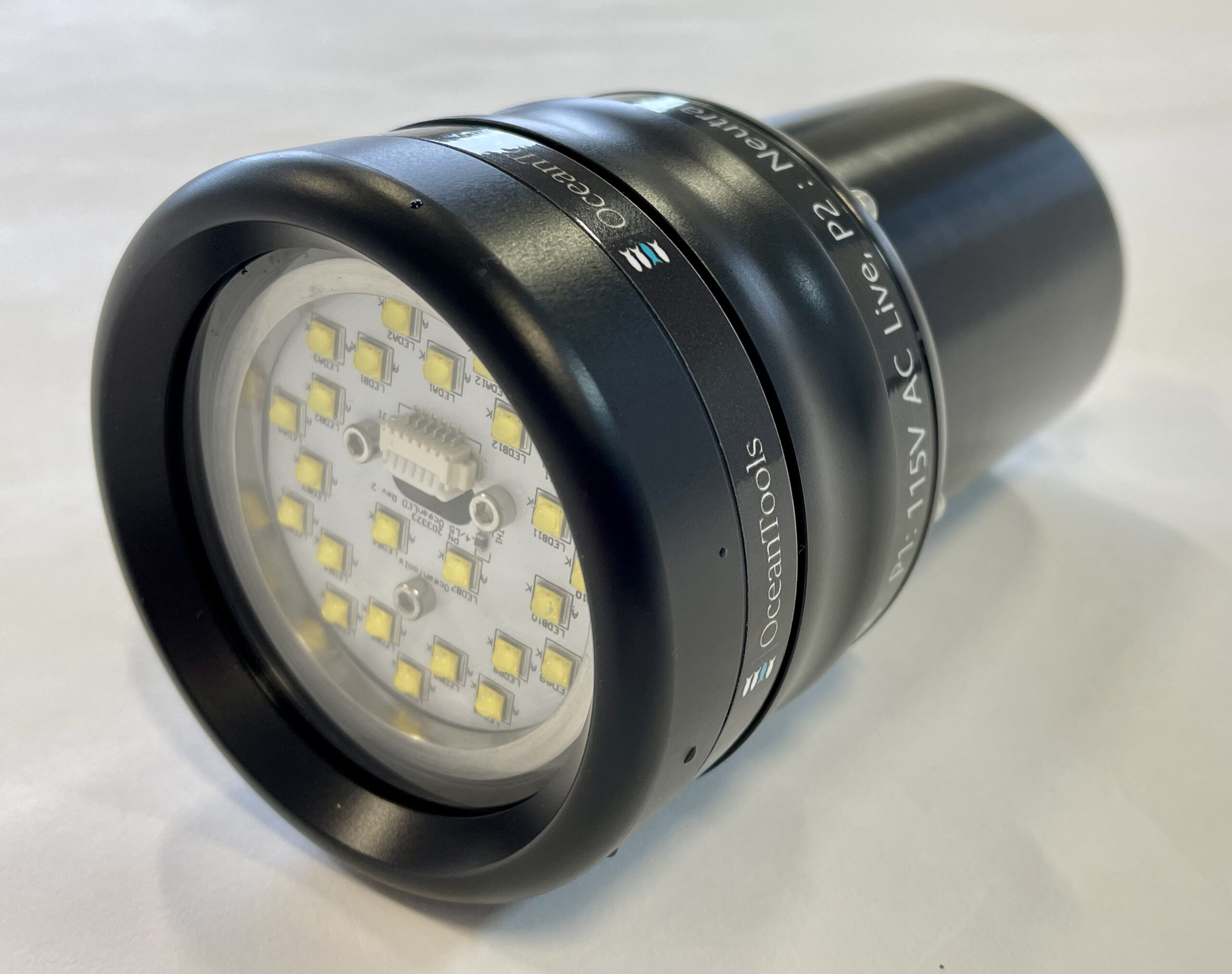
OceanTools, global supplier of underwater technology, add another AC lamp to their range of industry leading subsea lighting.
Available as either a floodlight or a spotlight the L6 lamp has been designed to be used on underwater vehicles and installations with a 120VAC/DC supply. The lamp offers up to 10,000 lumens of illumination with flicker free dimming using either RS232, RS485 or analogue control and a range of colour temperature options. Depending on the operating depth requirement, the L6 is available in Anodised Aluminium (4000m rated) or Titanium (8000m)
Brian Hector (Technical Sales Manager) at OceanTools, said:
“Product development at OceanTools is always customer led, we already have an order for multiple lamps in production for a global leader in offshore engineering projects to be fitted on their fleet of ROV’s”.
The L6 Subsea LED lamp is the latest addition to the OceanTools extensive range of pioneering underwater technology which includes not only lighting but also market leading DyeTection Systems and Subsea Cameras.
For more information on the L6 LED Subsea Lamp, click here.
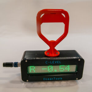
New C-Level Subsea Digital Display
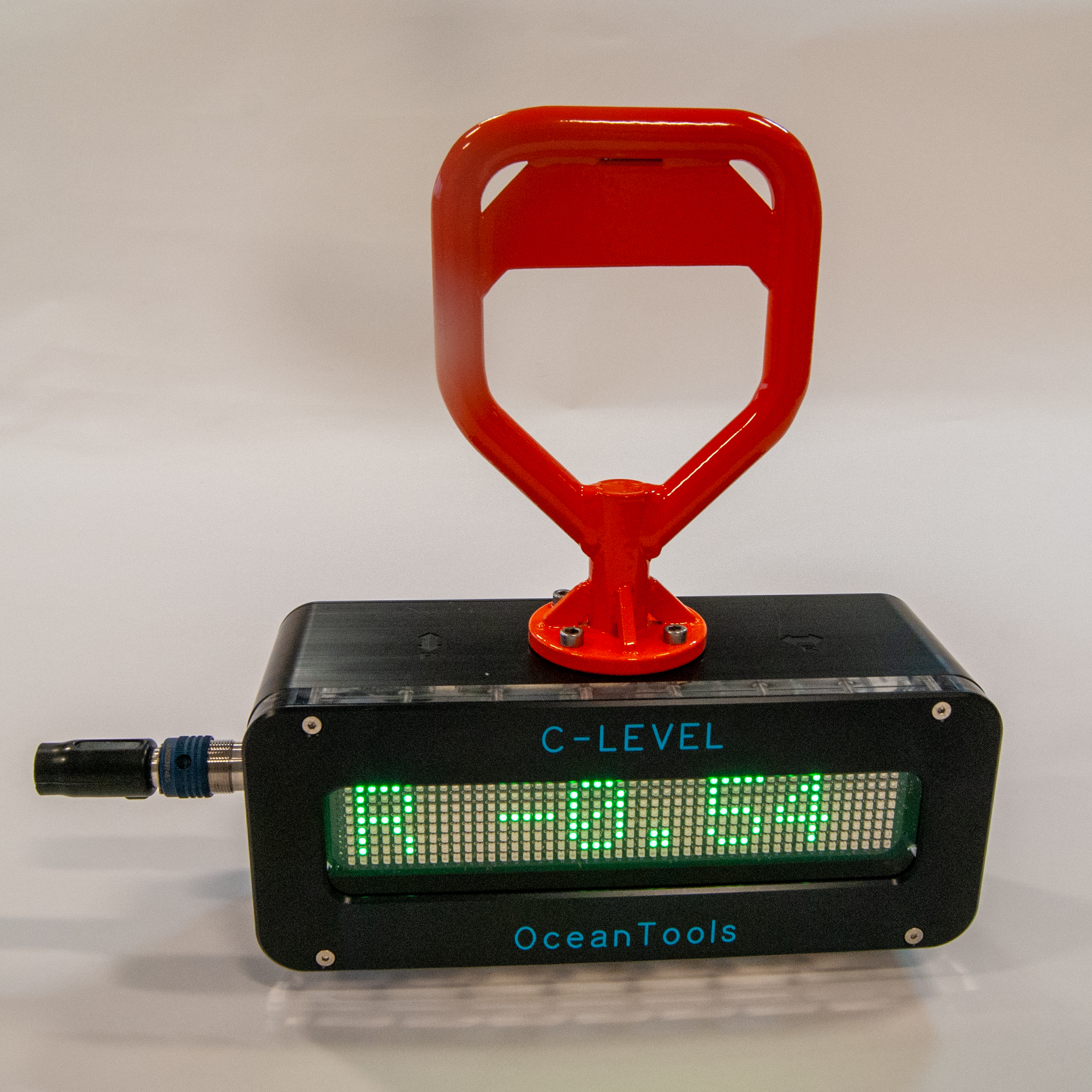
OceanTools, global supplier of underwater technology, launch the new C-Level Subsea Digital Display adding to their extensive industry leading range of high specification subsea technology.
The C-Level is an ROV or diver deployed digital level that may be used to measure and display the inclination angle of underwater structures or mooring lines. An integrated inclination measurement and display unit, it combines the functionality of an OceanDISP subsea display and OceanTILT precision attitude sensor. The measured angle is shown in real time on a high visibility LED matrix display.
Building on the success of the DISTIL display and tilt sensor, it has a 300m depth rated acetal housing with anodized aluminium front plate and acrylic window. The unit has an integral 3.6Ah rechargeable battery pack, which is ample to power it for a full working day.
Custom handle options are available to aide deployment by ROV or diver. Mounting block guides can be fitted to the base to allow it to sit on a mooring chain or wire and measure the angle of the mooring, with a magnet base option also available.
Brian Hector (Technical Sales Manager) at OceanTools, said:
“We are delighted with the design of our C-Level as it utilises tried and tested technologies already used in other products. We have developed the product in response to customer requirements in a wide range of subsea engineering applications and we are confident that these can be fulfilled by the C-Level”
The C-Level can be deployed in any subsea engineering project requiring a high level of accuracy including construction, maintenance and decommissioning.
The C-Level Subsea Digital Display is the latest addition to the extensive range of pioneering underwater technology including our market leading DyeTection Systems and Subsea Cameras and Lights.

Outland Technology introduces CON-3700 - Video system and communicator in one
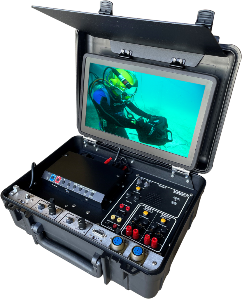
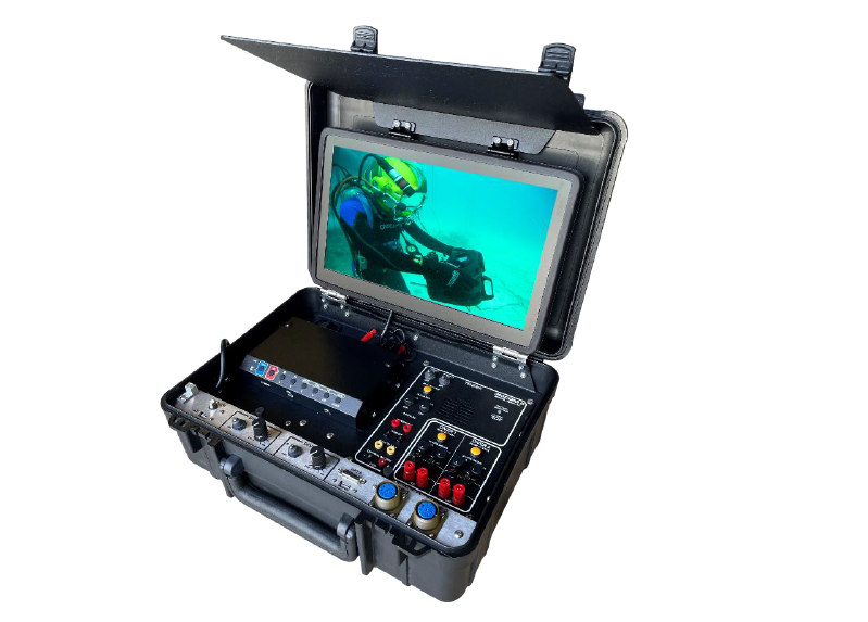
Slidell, LA (July 1, 2022) – Just last year, Outland Technology released the innovative, high-definition, dual diver, CON-3500 console. This spawned excitement between Outland Technology and Amron International to partner up and push the boundaries even farther. Together, they are proud to announce the next innovation, the CON-3700 console. Engineering at its finest, it consolidates the Outland video and light system with the Amron communicator into a single, compact case, while continuing to provide industry leading quality and reliability.
“Typically, the Amron communicator would be an additional piece of equipment required for the dive team,” remarked Scott Ritchie, Amron VP of Engineering and Manufacturing. “The operator would have an Amron communicator sitting next to Outland’s video and light console as two, discrete pieces of equipment.”
Outland and Amron have been working together for decades now. However, this was the first real collaboration of the engineering teams. “We had been kicking around the ifor quite some time,” said Outland President, Jeffrey Mayfield. “It was impressive to see the engineering teams collaborate to build an all-in-one console without significantly increasing the size of the Outland video system or sacrificing functionally. It truly is the best of both products.”
Available options will include a smart camera controller with dive timer, tender headset, and more.
Please visit our website for additional info: http://www.outlandtech.com