
Fugro helps NOAA update nautical charts in Alaska for improved maritime safety and commerce
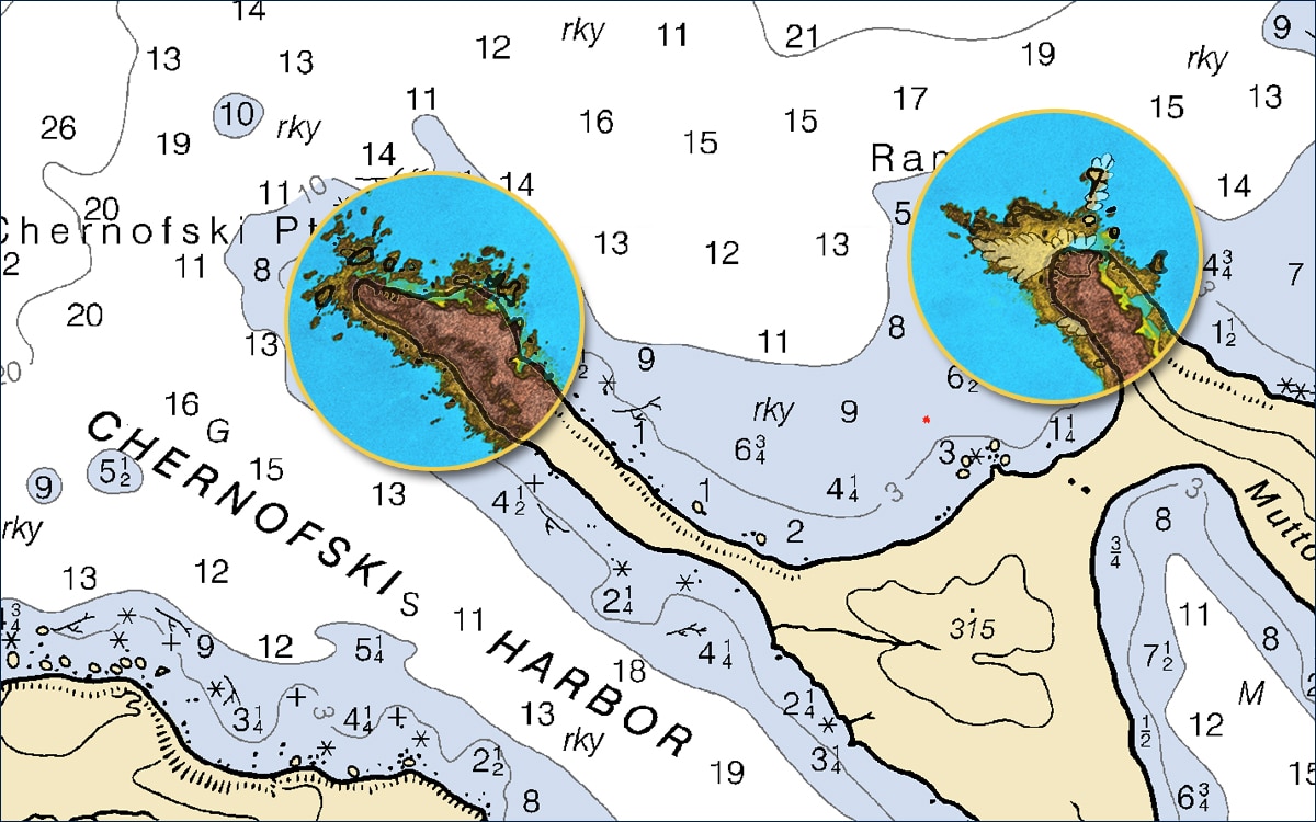
Fugro has completed fieldwork on a hydrographic survey project for the US National Oceanic and Atmospheric Administration (NOAA) to update nautical charts off the northern coast of Unimak Island, Alaska. Located in the Bering Sea, the island supports multiple fisheries, a major transit route, and at sea cargo transfers. Existing charts in the region do not meet current navigational needs, with data in some cases predating the 1940s. Fugro is helping NOAA address these data deficiencies with new, high resolution bathymetry over five sites totalling approximately 1700 km2. These Geo-data will be used to produce new nautical charts, making marine navigation safer and more efficient.
The new bathymetry was acquired from two multibeam-echosounder-equipped survey vessels, one focused on nearshore waters, the other on deeper waters located farther offshore. To plan the more challenging nearshore surveys, Fugro employed its SatRecon® service, which combines satellite imagery and proprietary processing techniques for the identification of potential unmapped hazards such as shipwrecks and rock outcrops. In addition to improving the safety of crew, equipment and the environment, identifying these hazards also increased Geo-data acquisition efficiency, allowing crews to survey the nearshore waters at a faster rate than would have otherwise been possible.
“It was great to work for NOAA in Alaska this summer, and we are really happy with the way our SatRecon service helped progress the nearshore survey operations,” said Mark MacDonald, Hydrography Director for Fugro in the Americas. “Since the mid-1970s, Fugro has been successfully mapping the seafloor in the state, including many years of nautical charting updates for NOAA, starting in 1998. We understand the operational challenges associated with working in remote parts of Alaska, and were pleased to apply innovative solutions on this project, unlocking insights from Geo data for a safer and more sustainable ocean economy.”
More information www.fugro.com

Greensea Launches EOD Workspace Simulator
Simulator replicates subsea environments for training
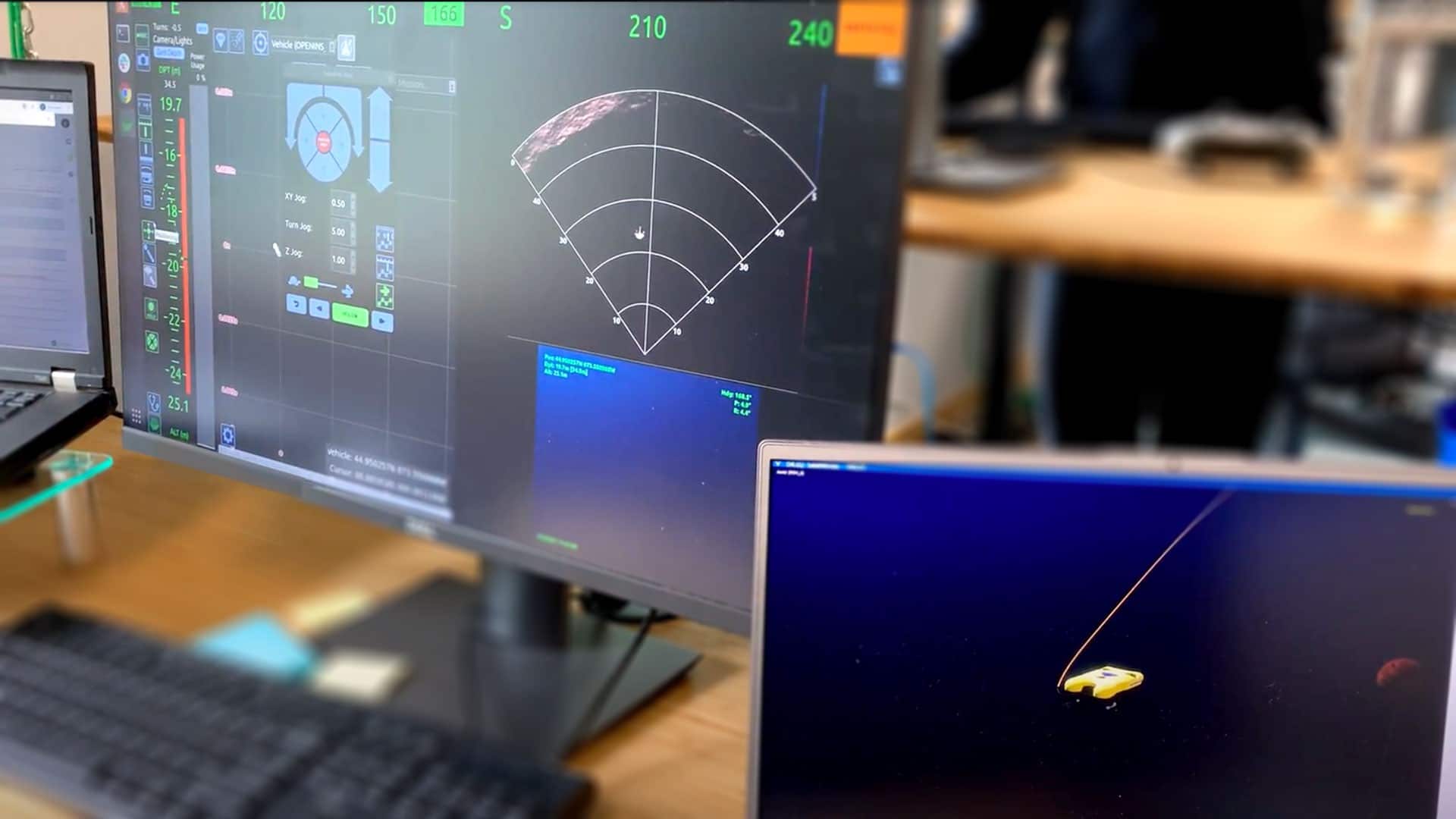
Greensea Systems, creator of EOD Workspace, the software and control solution for military EOD operations, has launched EOD Workspace Simulator. The new simulator, created in partnership with GRi Simulations, incorporates a physics engine based on actual subsea vehicle models which provides the realism needed to prepare operators, technicians, and other subject matter experts to be successful in critical real-world subsea environments when using EOD Workspace in the field. EOD Workspace Simulator will be offered for sale to military groups actively using EOD Workspace.
“Operators using the simulator are flying EOD Workspace and the system is working exactly like it would if they were flying a real ROV. It’s an amazing real life environment that allows more operators to train, in more locations and, since it can be done independently of vehicle availability, training can be done more often. It all leads to better preparedness,” says Ben Kinnaman, Greensea CEO. “One of the hardest things about training on an ROV is the fact that the operator has zero situational awareness and has to learn how to understand and control the vehicle using only sonar and video visuals. With the simulator, new operators and trainers get an inwater view of what’s happening as the operator responds to sonar and video visuals. Operators get to practice in a low stress classroom environment, ensuring that these skills are solidified.”
Simulator environments can replicate actual CONOPS allowing users to practice and train on missions with EOD Workspace. Supervisors can specify starting coordinates as well as environmental conditions such as time of day, surface conditions, current, and turbidity. Shipping with 10 (ten) mine targets that are placed throughout the simulated scene, operators will develop proficiency reading sonar and detecting objects. Additional target types and scenes will be available on a subscription basis. Additional information can be found at: https://greensea.com/eod-workspace-simulator/
ABOUT GREENSEA SYSTEMS, INC.
Greensea is the creator of OPENSEA, an open architecture software platform, and is a world leader in navigation and autonomy technology for marine robotics. Greensea develops software and hardware that revolutionizes the working relationship between people and machines. They are known for innovative and powerful technology designed for in-the-field success by a team of industry-experienced engineers driven to help customers get their job done. Since opening in Richmond, Vermont in 2006, the company has successfully delivered more than 1500 OPENSEA-based systems to the manned and unmanned maritime industry. Greensea directly supports several military programs with products, training, and technology development, including Explosive Ordnance Disposal using miniature marine robotics, Special Operations Forces combat diving, and ship hull robotics. Greensea also provides OPENSEA software products and services to Original Equipment Manufacturers and leading developers and integrators throughout the marine industry. To learn more, visit www.greensea.com, email [email protected], connect on Linkedin, or call us at +1.802.434.6080.
Seabed 2030 announces new partnership with the UK Hydrographic Office and Teledyne CARIS on the occasion of World Hydrography Day
The Nippon Foundation-GEBCO Seabed 2030 Project has entered a technical cooperation agreement with the UK Hydrographic Office (UKHO), a world-leading centre for hydrography specialising in marine geospatial data, and Teledyne CARIS, the leading developer of marine mapping software. The Memorandum of Understanding – announced on the first World Hydrography Day to fall within the UN Decade of Ocean Science for Sustainable Development – will see the parties work together to advance the effort associated with producing the definitive map of the seafloor by the year 2030.
The announcement also coincides with the release of the latest GEBCO Grid figure – with 20.6 per cent of the world’s entire seabed now mapped. When Seabed 2030 was launched in 2017, only six per cent of the oceans had been mapped to modern standards. The latest figure has seen a growth of 1.6 per cent from last year’s data – an increase equating to around half the size of USA.
Seabed 2030 is a collaborative project between The Nippon Foundation and GEBCO to inspire the complete mapping of the world's ocean by 2030, and to compile all bathymetric data into the freely available GEBCO Ocean Map. GEBCO is a joint project of the International Hydrographic Organization (IHO) and the Intergovernmental Oceanographic Commission (IOC), and is the only organisation with a mandate to map the entire ocean floor.
The UK Hydrographic Office (UKHO) is a world-leading centre for hydrography, specialising in marine geospatial data, from seabed to surface, to help others make best use of the marine environment. This includes partnerships with governments and researchers to support the sustainable growth of the Blue Economy and the protection of our oceans. UKHO also make this data available through their portfolio of ADMIRALTY Maritime Data Solutions – which include a world-leading range of navigational products that can be found on over 90% of ships trading internationally.
For over 40 years, Teledyne CARIS has been the leader in the development of hydrographic and marine geospatial software. Its flagship Hydrographic Production Database (HPD) is used extensively by the UKHO to produce its charts. Once of Teledyne CARIS's newest products - CARIS Onboard360™ - is a near real-time and autonomous data acquisition and processing package.
Commenting on the MOU, Seabed 2030 Project Director Jamie McMichael-Phillips said: "Seabed 2030 is delighted to announce this new partnership with UKHO and Teledyne CARIS on the occasion of World Hydrography Day. As we enter the newly-launched UN Decade, but also final decade of Seabed 2030, we remain humbly aware of what we have yet to achieve - just under 80 per cent of the world's seabed still to be mapped.
“Last year’s GEBCO Grid saw an increase of four per cent – this was made possible due to significant contributions of existing bathymetric data. Whilst this year’s growth is commendable in light of the global pandemic, it should act as a testament to the value of collaborative working to achieve our end goal, which is ultimately for the benefit of humanity.
“As we enter this final stretch, we call on everybody to get involved and contribute to our efforts. Together, we can make better use of the world’s oceans in a sustainable way. I am confident we will reach our goal as international collaboration grows.”
As part of the new agreement, the three organisations will use a new AI tool developed by Teledyne CARIS and the UKHO as part of their ADMIRALTY Maritime Data Solutions portfolio. The AI-Based Bathymetry Data Noise Cleaning Capability is thought to benefit Seabed 2030 by providing processing efficiency of incoming multibeam bathymetry dataset typical of the type to be received by the Project.
Michel Stanier, Executive Vice-President and General Manager of Teledyne CARIS commented: “We are very pleased to be supporting this project with AI technology. Seabed 2030 represents an opportunity for a unique collaboration whereby new AI methods are being developed and delivered to help solve the data processing bottlenecks created by the huge quantities of data needed to map the world’s oceans over the next decade.”
Peter Sparkes, Chief Executive at the UK Hydrographic Office commented: “We are extremely excited to enter this new partnership with Teledyne CARIS and The Nippon Foundation-GEBCO Seabed 2030 Project.
“Seabed mapping data plays a vital role in supporting maritime trade, the protection of our oceans and the fight against climate change – by keeping mariners safe and supporting sustainable development. Through use of this new capability, we hope to significantly reduce the time it takes to process this foundational data from days to hours – allowing us to build our understanding of the world’s oceans at a greater pace.
“We believe that collaborations like these can help to build a better future for all, so the UKHO will continue to build on this partnership and work with others across the maritime community to support safe, secure and thriving oceans.”
All data collected and shared with the Seabed 2030 Project is included in the GEBCO global grid – the most complete bathymetric dataset of the world’s ocean floor.
For more detailed information on The Nippon Foundation-GEBCO Seabed 2030 Project, please visit: seabed2030.org.
Rovco and PanGeo Subsea join forces to offer innovative 3D O&M and Survey solutions
Leading O&M and Survey Services supplier, partners with advanced sub-seabed 3D Acoustic Imaging solutions provider.
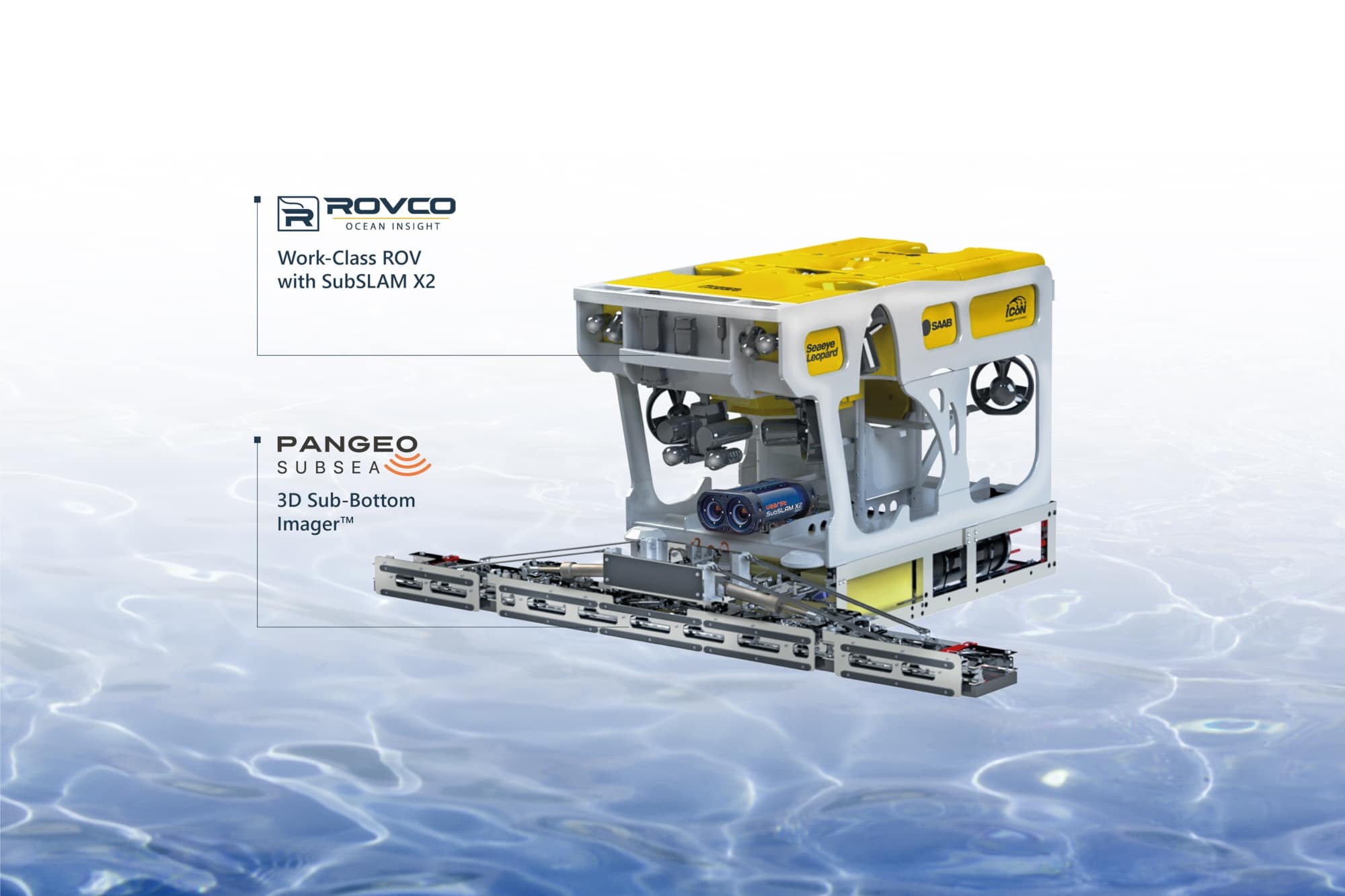
Rovco and PanGeo Subsea announces the formation of a powerful collaboration, designed to combine their respective areas of expertise to capture and provide early insight into changing subsea component and environmental conditions that may lead to wider problems or failures without planned intervention. This collaboration is born in response to the offshore energy market’s growing need for a prompt and detailed understanding of the performance of subsea infrastructure such as anodes, CPS, scour, cable burial and the effect of marine growth during the Operations & Maintenance (O&M) lifecycle.
This powerful combination fuses Rovco’s offshore O&M and hydrographic survey expertise, the SubSLAM X2 Intelligent Data Collection System, and PanGeo’s 3D Sub-Bottom Imager™ technology to deliver full 3D images of subsea assets – both above and below the seabed.
The offering allows owners and operators an efficient combination of industry-leading technologies to create reference models of critical components, providing an easy and intuitive way to keep track of their assets conditions within the design limitations of the OEMs and Engineering authorities original specifications. By combining the PanGeo SBI, SubSLAM and a host of ROV deployed tools, owners and operators are offered a single sourced solution to inform the condition of their jackets, monopiles and interconnecting cables plus protection systems, in a solution that can be deployed whilst the assets are still operating and energized (HVAC or HVDC).
“Technology solutions are what is enabling the sector to move forward at pace. De-risking and future-proofing offshore operations and investments with verifiable data.” Simon Miller, Managing Director for Rovco says. “The scope of what the Rovco-PanGeo collaboration can offer is impressive, ranging from as-built verification, to cable depth-of-burial, archaeological investigations, UXO analysis, structural asset inspections and much more.”
“We are excited to be entering into this working partnership with Rovco”, says Moya Cahill, PanGeo’s CEO. “Marrying up our respective equipment and technology to deliver a full comprehensive solution for clients adds value to the industry while supporting offshore regulations for O&M.”
For more details and to get a quote for O&M and survey services, please contact the Rovco sales team at [email protected] or PanGeo’s sales team at [email protected]
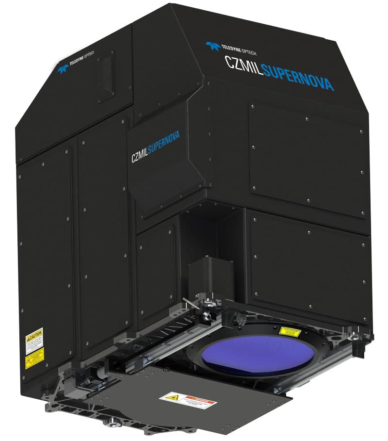
Teledyne Optech launches CZMIL SuperNova, a full geospatial bathymetric lidar solution with industry-leading depth penetration
The CZMIL SuperNova is powered by Teledyne CARIS processing software for creation of seamless topo/bathy data products
Teledyne Optech and Teledyne CARIS, both Teledyne Technologies [NYSE:TDY] companies and global leaders in advanced lidar sensors and marine mapping software, announce their next generation bathymetric lidar, the CZMIL SuperNova.
The CZMIL SuperNova boasts the best depth performance and the highest green laser point density in its class. Introducing SmartSpacing technology for even and efficient point spacing, real-time processing capability for reduced post-processing time and configurable modes for maximizing performance in different water environments, the SuperNova provides a wide range of inputs for climate change modelling and is Ideal for inland water environments, base mapping for coastal zones and shoreline.
To complete the solution, Teledyne CARIS has integrated its BASE Editor software for seamless data processing capacity. Leveraging AI techniques for land/water discrimination and noise classification the CZMIL SuperNova bathymetric solution effectively delivers on marketplace demands for efficiencies in the processing workflow.
CZMIL SuperNova Product Manager Jennifer Aitken explained: “CZMIL SuperNova builds on over 30 years of experience with airborne green laser bathymetry. The ability to configure the system on-the-fly and optimize data collection for local conditions has significant benefit. We are getting plenty of signal at 600 meters altitude and even higher, so our coverage area is increasing without sacrificing depth penetration.”
For more information visit www.teledyneoptech.com/en/products/airborne-survey/czmil-supernova/
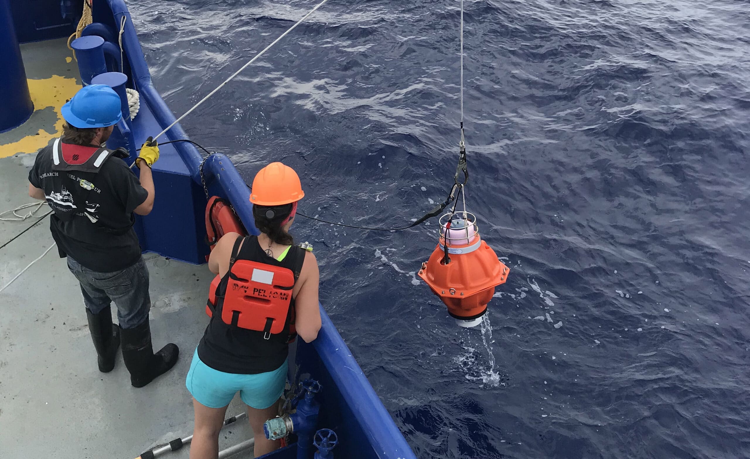
Major Gulf Loop Current study using Sonardyne’s PIES completes
Oceanographic instrumentation developed by Sonardyne to monitor ocean currents has been acquired by the University of Rhode Island following its successful use in a US$2 million project in the US Gulf of Mexico.
The project, led by the University of Rhode Island (URI), saw an array of specialist sensors, including Sonardyne’s Pressure Inverted Echo Sounders (PIES), deployed for two years, to monitor the hugely disruptive Gulf Loop Current.
Sonardyne’s PIES were installed in waters down to 3,500 m depth early in 2019, to help better understand the current. Following successful wireless acoustic data harvesting campaigns from the instruments in 2019 and 2020, their deployment was extended to the end of May, this year.
Funding for the project, from the US National Academy of Sciences (NAS), was also extended, allowing URI to purchase the Sonardyne PIES used on the project outright, as well as a Dunker 6 telemetry transceiver, for wireless data harvesting from the instruments when they are on the seafloor. This will allow URI to use the instruments on its future projects.
The Gulf Loop Current system is a highly energetic ocean circulation feature that influences all ocean processes in the Gulf and is characterised by disruptive Loop Eddy events that have serious impacts on a wide range of human and natural activities, from oil exploration to coastal eco-systems. However, knowledge of its underlying dynamics has been limited, leading to this study, led by Kathleen Donohue, Project Director and Professor of Oceanography at URI.
PIES work by transmitting an acoustic pulse from an instrument on the seabed upwards. The pulse is reflected off the water-air boundary at the sea surface and returns back down to the seabed where it is detected by the PIES. This enables an exact measurement of the two way signal travel time to be calculated. At the same instant, an accurate measurement of depth is made using highly precise internal pressure sensors.
Combining data from an array of PIES instruments and near bottom current meters with historic water profile data can be used to calculate currents throughout the full water column over an extended area – in this case totalling over 50,000 sq km. For this project, Sonardyne enhanced the instruments with an integrated single point current meter, tethered above the units, leading to a modified designation as CPIES.
Randy Watts, Professor of Oceanography at URI, says, “The ability to receive the full time series of measurements plus engineering-performance checks via acoustic telemetry in 2019 and 2020 shows that the data are of high quality. The impressively low battery drain meant we could leave the CPIES untouched on the sea floor for the duration of our experiment. With the additional funding, we were also able to extend our observational window to nearly two years. This is important because each Loop Current Eddy formation is unique.”
“The Loop Current encounters different pre-existing eddies and different bottom topography in different locations with different inflow from the Caribbean and different wind fields,” says Professor Donohue. “These events inside the ocean are dynamically analogous to ‘weather’ and ‘storms’ in the atmosphere – and every bit as varied. Observing these many events and observing the full water column is highly valuable information to guide the forecast models.”
“Looking to the future, the telemetry capabilities of Sonardyne’s CPIES offer us an established way to collect the data at more frequent time intervals using an uncrewed surface vehicle (USV) and report it ashore to enable real-time forecasting of the entire Gulf of Mexico Loop Current System,” adds Professor Watts.
Geraint West, Business Development Manager – Oceanographic, at Sonardyne, says, “URI have long been recognised as a leading proponent of using PIES to undertake large scale studies of ocean currents. Our collaboration with them has consequently taken our PIES technology to a new level, which we’re pleased to see being used in this important study. We look forward to continuing our close relationship with URI, including supporting more autonomous harvesting of their data.”
URI’s LCS study is being funded by the US National Academies of Sciences, Engineering and Medicine’s Gulf Research Programme, which was founded in 2013, as part of the legal settlements with companies involved in the 2010 Deepwater Horizon oil spill. The long-term objective is to improve forecasts of the Loop Current in order to increase the safety of operations in the Gulf.
For more information, please visit: www.sonardyne.com

CSignum announces completion of real-world testing for innovative solution as part of carbon trust's floating wind project supported by Scottish government funding
CSignum Ltd., the global leader in smart communications solutions, subsea asset digitization, and actionable insights for ocean industries; announced today the testing of the prototype solution developed with Tfl Marine as part of the Floating Wind Technology Accelerator Competition (FLW TAC) was successful. TfI have developed a unique Sea Spring to reduce snatch and fatigue loads on floating offshore wind structures. The Sea Spring incorporates CSignum’s HydroFi low frequency subsea wireless communication system which enables real-time autonomous full life fatigue monitoring. The TfI Sea Spring design includes piezoelectric ceramics embedded within the system to generate power for the CSignum wireless monitoring system. The tests, involving the TfI Sea Spring and CSignum HydroFi technology, took place under simulated real-world load conditions at Exeter University’s DMaC test rig. Funded by the Scottish Government and managed through the Carbon Trust’s Floating Wind Joint Industry Project (FLW JIP), the FLW TAC awarded enabled CSignum and TfI Marine to manufacture and test their prototype solution to overcome the challenges of monitoring and inspection of mooring lines which have negatively impacted the commercialization of floating offshore wind.
Today’s CSignum announcement comes as Scotland prepares to host COP26 later this year and the Carbon Trust publishes the results of the floating wind technology development projects. In March 2020, CSignum and TfI Marine were recognized for their proof of concept: a solution which integrates mooring load sensing, power generation and wireless subsea communications into an existing spring to enable autonomous full life fatigue monitoring. Incorporating monitoring equipment into the mooring line spring reduces the need for physical inspection of mooring lines and enables a risk-based approach to monitoring. The spring also acts as a dampener on mooring lines and the monitoring equipment is powered by movement of the spring, using a piezo-electric generator, which removes the need for an external power source.
CSignum provided the low frequency wireless communications solution known as HydroFi technology, which uses variable low frequency and ultra-low power consumption for subsea and bi-directional data transmission through the water-air boundary. HydroFi technology connects to most subsea sensors using standard communications interfaces. In this instance, the transmitter and data logger are below the water, integrated onto the spring, which is attached to the mooring line, automatically transmitting to a receiver mounted on the wind-turbine floating platform. HydroFi technology sends data more consistently and reliably in turbid, low visibility and choppy waters than other wireless solutions or fault-prone cable systems.
Hannah Evans, Manager, Carbon Trust said: “We are really pleased to see the progress CSignum and TfI Marine have made in developing their novel mooring line monitoring system over the last year. This project has demonstrated the value of international collaboration between Scotland and Ireland to develop new technologies, and address challenges faced by the floating wind industry both in managing mooring line loads and monitoring mooring lines safely and cost effectively. We look forward to seeing this technology progress.”
“Existing load measurement solutions normally consist of a wired strain gauge on a load pin somewhere on the mooring line and wherever you place that pin, it is susceptible to failure,” said Noel Halloran CEO at TfI Marine. “The TfI Sea Spring provides CSignum with the ideal mounting platform for their technology, which provides real time-data transmissions on strain loads, battery life and power supply.”
“We worked closely with TfI in their labs to test the feasibility of the integration of the CSignum HydroFi Modem with the Sea Spring and then fabricated and tested a proof of concept under simulated real-world load conditions at Exeter University’s DMaC test rig and the University of College Cork’s LIR National Ocean Test Facility,” said Richard Adams, Sales Director, at CSignum. “Now, instead of operators having to do costly maintenance on mooring lines and receiving infrequent updates on their operation status, we can let them see the actual data in real time, so they know when maintenance or replacement is warranted, reducing OPEX and driving down the cost of energy.”
“We are honored to have received this recognition from the Carbon Trust and the FWP JIP,” said Chris Brooks, CEO of CSignum. “We aim to listen to the needs of the industries we serve and are proud that we have co-developed a practical solution for wind farm operators. This is a real-world example which underscores our mission: to provide dynamic data transmission for ocean monitoring, enable data-driven environmental management and accelerate sustainable ocean development.”
For more information, please visit: www.csignum.com
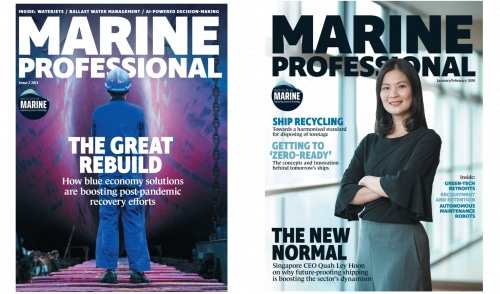
IMarEST provides wider access to Marine Professional insights
The Institute of Marine Engineering, Science & Technology is providing greater access to its leading publication, Marine Professional, through a new subscription offer for libraries and organisations which allows all users on their network to gain access to the magazine.
This wider access aims to support the professional development of those working in the marine industry worldwide. The magazine aims provide an in-depth analysis of emerging issues and enhance understanding of the complex intersections between the maritime, offshore and science agendas.
"Marine Professional is an excellent collage of the mix of technical and commercial problems the profession now faces and the solutions currently on offer and records of history and how we might learn from them. It is written and well presented for easy reading. I really enjoy it from end to end and am reassured by the hope it gives for the maritime future." IMarEST Fellow & Chartered Engineer, Royal Navy.
Marine Professional is the IMarEST’s membership magazine and is available in print and online to individuals, organisations and institutions.
With a strong news analysis focus, each issue looks at the trends emerging within the marine sector and aims to enhance understanding of the complex technical intersections between the maritime, offshore and science agendas.
For more information, please visit: www.imarest.org
Teledyne Marine are recruiting a Technical OEM Sales Manager
US-CA-Poway | US-NH-Portsmouth | US-MA-N. Falmouth
Company Overview
Position Summary and Responsibilities
The Technical Sales Manager identifies and sells our products, services, and solutions into the key OEM customers in the United States and Canada. The primary role of this position is to capture sales for Teledyne Marine products, both directly and through distributors. The Technical Sales Manager has a strong awareness of Teledyne Marine product offerings and applications to be able to sell the proper solution to the customer.
Essential Duties and Responsibilities
include the following. Other duties may be assigned.
- Build and maintain an active pipeline in a CRM, such as Salesforce, to exceed orders and sales targets on a quarterly and annual basis.
- Provide accurate booking forecasts and keep up-to-date customer and pipeline records.
- Interests the client in purchasing products, negotiates a price, and completes the sale, which includes preparing standard quotations, following-up for sale capture, etc.
- Establishes new accounts by identifying potential customers; planning and organizing sales call schedule.
- Establish, manage, and enhance relationships with key customers.
- Actively manage the channels and establish new ones as appropriate; ensure they are fully engaged, optimized and driven to succeed.
- Participate in developing and implementing sales strategy including plans and programs to maximize market penetration of product line including new market entry, both direct and through channel partners.
- Arrange and hold technical seminars, product presentations and customer demonstrations both direct and through channel partners.
- Understand customer requirements and suggest appropriate sensor and platform integrations and solutions.
- Helps to build and maintain a library of application notes for the product line.
- Forecast sales volume, process sales orders, maintains the sales and customer contact databases.
- Responsible for ensuring that the pricing and discount policy is adhered to and maintained within the authorized limits.
- Discover Teledyne non-standard sales opportunities and participate in the selling process in collaboration with product management.
- Remain informed of competitor status, products, advantages and weaknesses.
- Plans and performs technical pre-sales field demonstrations.
- Assists in the definition of technical and application scope for new product programs.
- Maintains professional and technical knowledge by attending educational workshops; reviewing professional publications; establishing personal networks; participating in professional societies.
Qualifications
To perform this job successfully, an individual must be able to perform each essential duty satisfactorily. The requirements listed below are representative of the knowledge, skill, and/or ability required. Reasonable accommodations may be made to enable individuals with disabilities to perform the essential functions.
Education and/or Experience
Bachelor's degree in science, engineering or related field and five (5) years of technical sales experience; or equivalent combination of education and experience.
- Sales experience within a technical market segment/industry required.
- The ability to successfully complete a strategic selling course (Action Selling, Miller Heiman or equivalent).
- Excellent English oral and written language skills.
- Proven problem-solving capabilities and resourcefulness.
- Up to 50% travel with ability to conduct business independently and professionally both domestically and internationally throughout sales territory.
- Ability to perform product demonstrations and technical training.
- MS Office and CRM skills, preferably Salesforce.
Citizenship Requirements
Teledyne is an Affirmative Action/Equal Opportunity Employer
2G Robotics announces new name (Voyis) and leadership team
Leading subsea laser and imaging provider 2G Robotics has rebranded to Voyis and confirmed a new leadership team.
Over the last 10+ years, 2G Robotics has made a significant impact across the ocean sector by commercializing the first subsea dynamic laser scanner and deploying it across countless platforms and projects worldwide. In the last 18 months there has been significant change at the company, including an acquisition by Sonardyne Group and a leadership transition. This provided 2GR Robotics the perfect opportunity to redefine their brand and reintroduce themselves as Voyis (Voyis Imaging Inc.).
The name Voyis stems from the word voyage, more specifically a voyage into the darkness. The name is also inspired by the essence of the industry – discovery and exploration.
Chris Gilson, acting General Manager of 2G Robotics, has been confirmed to the position of CEO. Gilson was one of the original employees and joined 2G Robotics in 2013 as the Lead Mechanical Engineer, before transitioning to the role of Product Development Manager. He will be supported by the new management team including Luke Richardson, VP Sales and Marketing, and Adam Riese, VP Engineering & Operations. Gilson says, “We are extremely proud of what our team has accomplished, and wanted a new and exciting brand that better reflects our vision and passion as we enter the next stage of our journey. It's an exciting time for us and we are more focused than ever on pushing the limits of subsea optical technology to better understand the oceans and illuminate the unknown.”
The rebrand has also brought new names to core product lines that better align with their mission: enabling every subsea vehicle to see the depths like we see the surface. The well-known ULS line of underwater laser scanners are now named the Insight Laser Scanners, and a new line of Perception ROV skids was introduced.
For more information, please visit: voyis.com/2grobotics-is-now-voyis-rebrand