Exail, RTsys and ABYSSA join forces for ocean floor mapping with AUVs
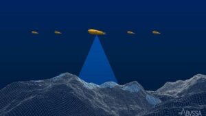 Exail, RTsys, and ABYSSA, announce their strategic partnership in the CARMA (Mineral resources mapping by AUVs swarms) project. Co-funded by Bpifrance under the #France2030 initiative and designed to advance knowledge of great depths, the CARMA project focuses on developing swarms of Autonomous Underwater Vehicles (AUVs) for efficient ocean floor mapping.
This project aims to develop an innovative solution for precise seabed surveying at great depths. The ongoing development involves creating a solution in which a multi-sensor underwater drone capable of diving to 3,000 meters will coordinate multiple AUVs to increase the surface of the exploration area. The research program also includes the development of advanced collaborative navigation, acoustic communications, positioning, and innovative mapping capabilities. CARMA supports the French authorities' strategy to develop extensive deep-sea exploration capacities.
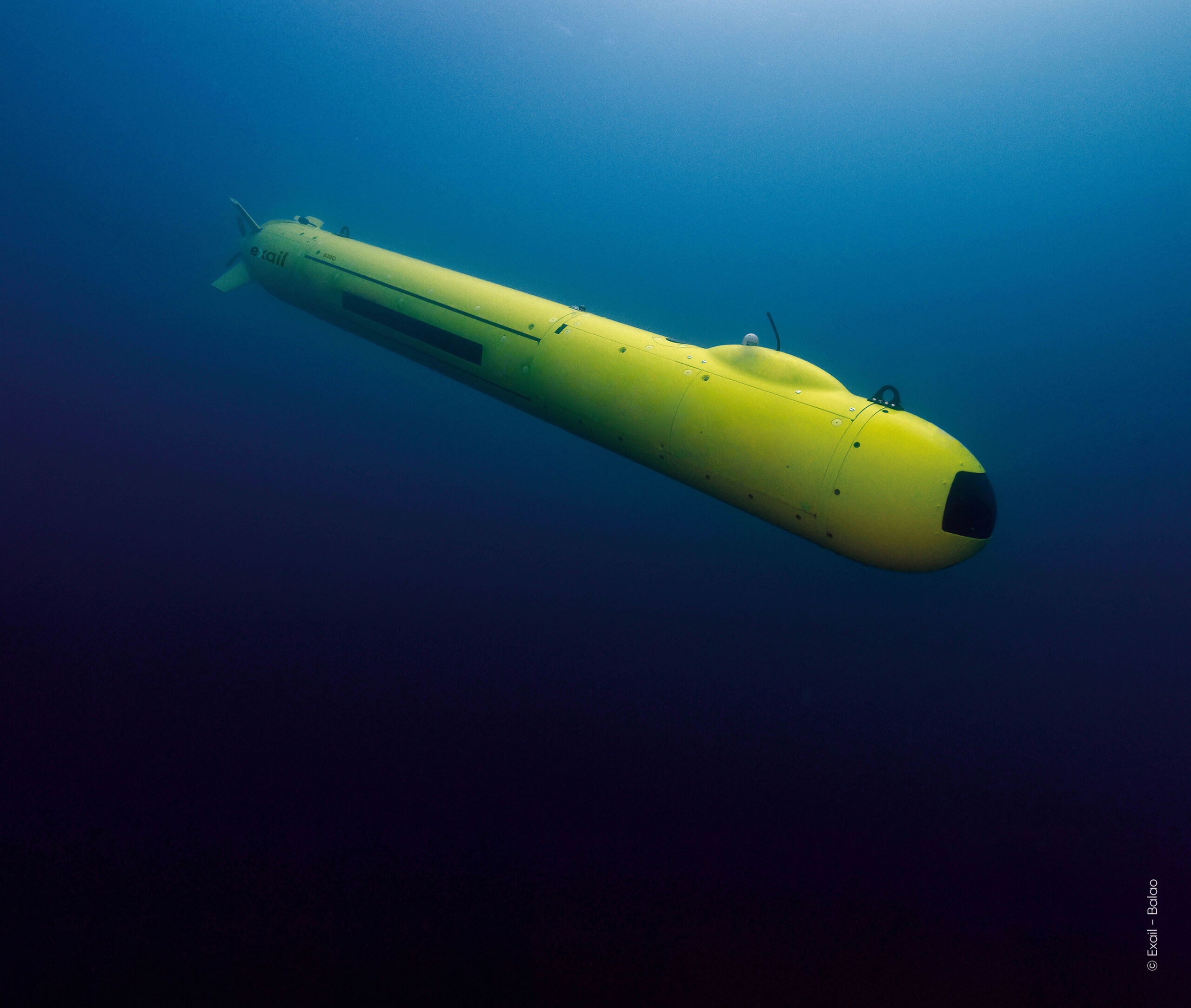
As part of this strategy, Exail will improve the capabilities of its deep-water AUV A18-D to serve as the leading AUV to guide the swarm. Improvements will enable navigation down to 3,000 meters, at close altitude from the seabed over sloped terrains, and to accurately geolocate swarm’s acquired data. RTsys will extend the capabilities of its newly developed AUV COMET-3000 to dive up to 3,000 meters. Multiple units will be provided to act as followers, along with the development of an innovative launch and recovery system for the AUV swarm. ABYSSA will focus on developing exploration strategies for deep-water swarms of AUVS. Additionally, ABYSSA will process the magnetic data collected to map the magnetic anomalies on the seabed.
This project will result in the deployment of an operational demonstrator at sea in 2026, paving the way for future commercial phases. Concurrently, the project will carry out a preliminary study on extending exploration capacity to 6,000 meters depth.
"We are pleased to announce our collaboration with ABYSSA and RTsys in the innovative CARMA project, where we combine our technological expertise” said Catherine Pikovsky, project manager at Exail. “As we push the boundaries of autonomous underwater exploration, we enhance the capabilities of our deep-water AUV A18-D to navigate close to the seabed. Leveraging pack piloting techniques and advanced navigation algorithms, we lead the way towards a precise seabed surveying down to 3,000 meters, reflecting our dedication to innovation and advancing deep-sea exploration.”
“Thanks to this project we have the opportunity to work on the development of an AUV swarm operating at 3,000 meters depth. This allows us to enrich our expertise, innovate in the deep-sea field and demonstrate our swarm capability. The studies conducted thanks to the AUV swarm will provide scientific knowledge and contribute to the inventory of underwater heritage.” said Marine Postec, project manager at RTsys.
“We are defending the principle of the AUVs swarm, winner of the 2015 Global Innovation Competition, because it enables oceanographers to carry out extensive and accurate non-intrusive mapping in deep, little-known areas” said Michel Colinet, Deputy CEO at ABYSSA.

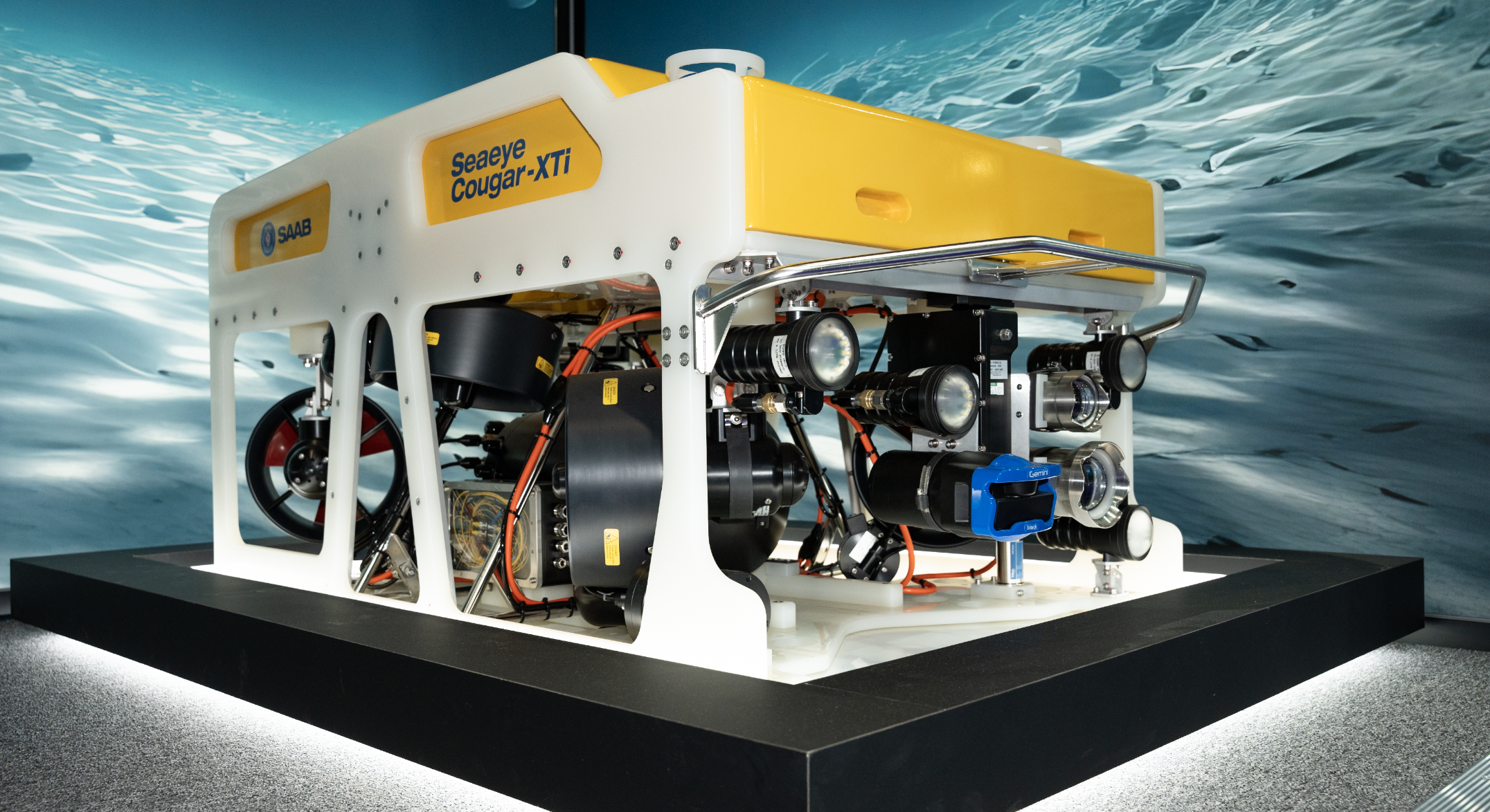
HBC Group, a leading provider of offshore inspection services, has recently purchased Saab’s Seaeye Cougar-XTi, a state-of-the-art remotely operated vehicle (ROV) known for its advanced capabilities
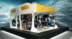 Saab’s Seaeye Cougar-XTi stood out due to its remarkable carrying capacity, a crucial factor for HBC Group's operations. The Cougar-XTi is a highly flexible and extremely powerful electric ROV, depth rated to 2000m. The ROV is fitted with six 500 Volt, DC thrusters that provide exceptional thrust for stable vehicle operations in high current environments.
These features allow the transport of survey equipment that was previously too large for HBC Group’s existing ROVs, catering to the specific needs of clients, particularly those in offshore wind farms.
The versatility of the Cougar-XTi extends to carrying specialised tools for hydrographics and geophysical services. HBC Group utilises PMAC Group’s system for cathodic protection measurements, and the manipulator arms play a crucial role in non-destructive testing.
Christian Eilersen, CEO at HBC Group Said:
“We are thrilled to elevate our offshore inspection capabilities with the Seaeye Cougar-XTi. This advanced ROV enables us to meet the unique needs of our clients in offshore wind farms, and its addition to our fleet reflects our ongoing commitment to excellence and innovation in the field of offshore inspections.”
Looking ahead, HBC Group plans to deploy the Cougar-XTi for daily inspections, allowing them to bid on tenders that were previously inaccessible due to payload constraints. The order/capability is expected to open new avenues for the company in the offshore wind sector.
Jon Roberston, Managing Director at Saab Seaeye said:
“We're thrilled to empower HBC Group with the advanced Seaeye Cougar-XTi. This sale underscores our commitment to delivering top-tier equipment, redefining standards for efficiency and reliability in offshore operations.”
In addition to the Cougar-XTi, HBC Group highlighted the success of its previous ROV purchase with Saab, the Seaeye Tiger. The company noted its reliability and higher uptime compared to previous ROVs. The Tiger has played a crucial role in recent inspections on offshore wind farms in Denmark, the UK, and Germany, particularly in waveform inspections.
The addition of the Cougar-XTi to HBC Group's fleet signifies the company's commitment to staying at the forefront of technology in the offshore inspection services sector.
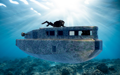
Robosys unveils first-in-class subsea AI-supported navigation and vessel control solution, following a significant contract win for a fleet of Advanced Swimmer Delivery Vehicles
The UK maritime innovator, Robosys Automation, has unveiled its new subsea advanced navigation and vessel control solution following its announcement that the business has
secured a significant contract with an undisclosed international customer for a fleet of Swimmer Delivery Vehicles.
The first-in-class Advanced Swimmer Delivery Vehicles (ASDVs) will feature Robosys’ Voyager AI-supported advanced navigation and vessel control systems, enabling critical navigational and enhanced decision-aided support to the crew.
The ASDVs will safely and comfortably enable dive units to be transported to and from remote and challenging locations. Operating in three modes, surface, semi-submerged and submerged, initially the ASDVs will be crewed, with decision-aided navigational support.
Following completion of their initial project, the ASDVs will be upgraded in a phased roll-out to feature an autonomous mode allowing autonomous self-navigation, a return to base and loiter facility whether operating on the surface or subsea.
Once the ASDVs are upgraded they will be able to be remotely operated and monitored from a mothership, Ground Control Centre (GCC), or from a Remote Operation Centre (ROC).
Voyager AI is a world-leading maritime artificial intelligence (AI) software both developed and supplied by Robosys Automation. Operators benefit from decision-aided autonomous operations with collision and obstacle avoidance as well as anti-grounding enabling safe passage, combined with AI reasoning, being crucial when operating in challenging subsea and surface waterborne environments.
Aditya Nawab, CEO of Robosys Automation, which is headquartered at the National Oceanography Centre in Southampton, UK comments, “We are delighted to unveil Robosys’ new
subsea autonomous navigation and vessel control solution. Robosys is already regarded as a leader in its advanced maritime autonomy provision to surface vessels of all types and sizes, therefore it was only natural to provide subsea solutions when further developing Voyager AI. It is an exciting time, whilst also reassuring to know that we are helping to support safer and smarter (and cleaner) seas.”
The new first-in-class fleet of Advanced Swimmer Delivery Vehicles will be launched in Spring
2025.
Discover more at www.robosysautomation.com
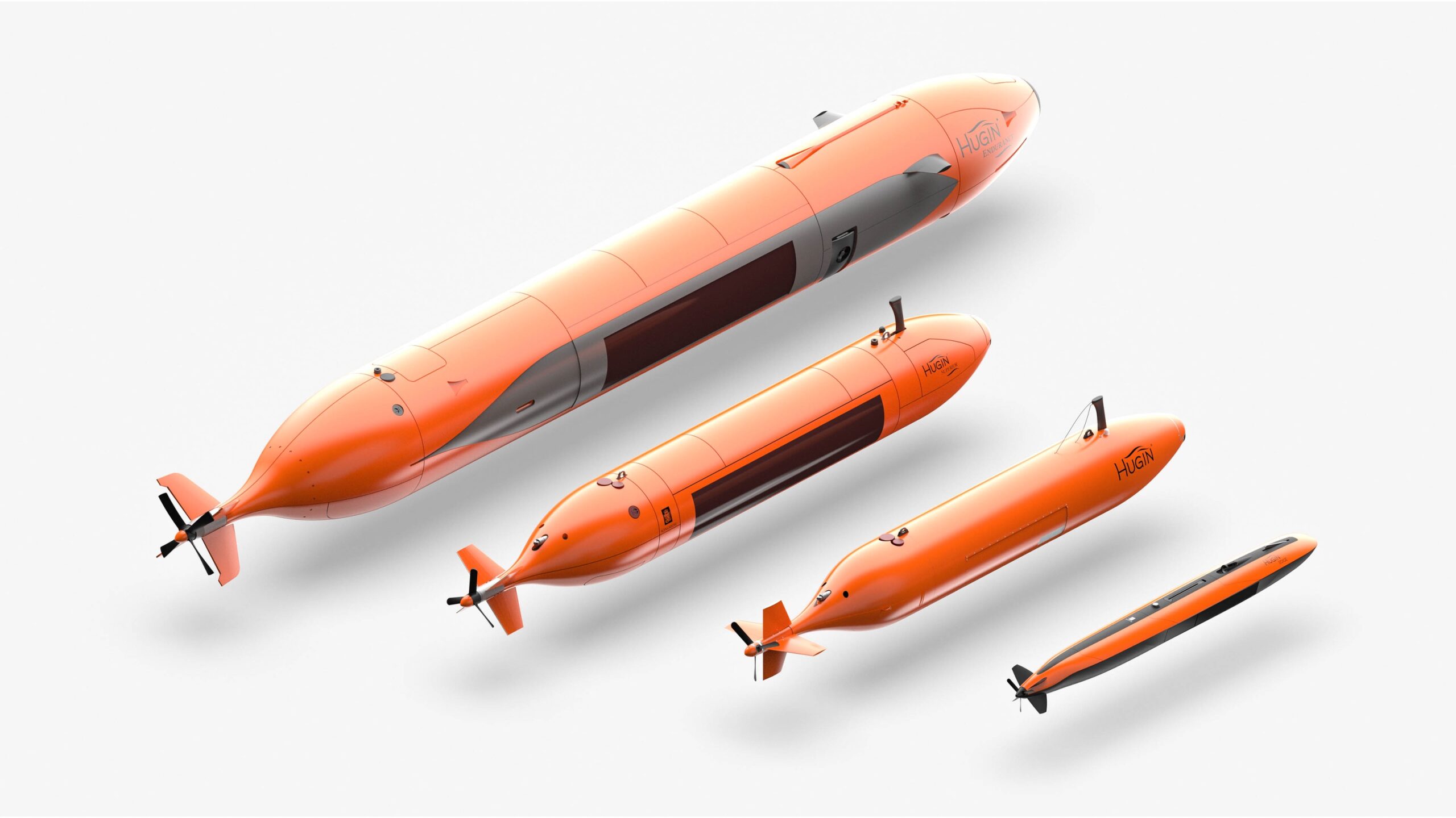
KONGSBERG Discovery successfully completed in-water demonstrations of the HUGIN Autonomous Underwater Vehicle
.... as part of the commercial evaluation of Large Diameter Unmanned Underwater Vehicle systems by the Defense Innovation Unit (DIU) and the U.S. Navy. It was announced in January this year that Kongsberg Discovery was awarded a contract with the Defense Innovation Unit (DIU) to rapidly deliver HUGIN Autonomous Underwater Vehicle (AUV) capabilities for the U.S. Military. In April a delegation from the U.S came to Horten in Norway for a comprehensive week-long demonstration. It provided the opportunity to showcase systems that reflect Kongsberg’s unmatched and proven AUV technology developed over the last 30 years.
A complete tour at sea and on shore
Topics included operations, design philosophy, systems approach, sensors, batteries, navigation, autonomy, manufacturing, physical vehicle portfolio, and hands-on familiarization of our user interfaces.
“I am extremely pleased with the visit and demonstrations we held for the team sent by DIU and the U.S. Navy. The visitors were provided a unique opportunity to both see in-water capabilities and shoreside sessions to introduce Kongsberg’s experience in the deep water AUV space. It was terrific to have the DIU and U.S. Navy team visit and allow us to show off our own amazing team and world renowned HUGIN AUVs. We are honored to be a part of the U.S. Navy’s LDUUV effort and are excited to receive additional feedback. Our business model is tightly intertwined with our customers, and we get better through them,” said Espen Henriksen, Executive Vice President Uncrewed Platforms Division.
Designed for dual use
Kongsberg produces three models that fall into the LDUUV category as defined by U.S. Navy. The newest and most capable of those is HUGIN Endurance. While the new AUV incorporates many of the industry-leading capabilities found in previous HUGIN vehicles, to enable long-term unsupported missions, new advancements had to be made, including greater redundancy, a new autonomous mission management system, greater situational awareness, and the ability to deal with a wide range of varying water density. Vice President of Sales, Rich Patterson, Uncrewed Platforms Division explains that the market for AUV’s has changed over the last few years.
“Our HUGIN AUVs were always designed for dual use purposes. In the early years of the program our user base tended to be primarily in the commercial market. In the last few years, we have seen a shift in the marketplace with increasing demand from the defense space as our AUV technology became more mature and were demonstrated to have extremely high reliability. We have seen this demand only increase as the global geopolitical situation continues to become more unstable. What truly sets us apart is that our continued development has resulted in systems that have the capabilities to meet many naval requirements ‘out of the box’,” he said.
Increased attention from defense
Today there are 12 navies using HUGIN in real world missions such as IPoE (Intelligence Preparation of the Operational Environment), MCM (Mine Counter Measure), SSW (Subsea and Seabed Warfare), and seafloor mapping operations.
“We are excited to bring our many years of AUV experience in support of the U.S. military and look forward to closely partnering with DIU and the U.S. Navy to support making their LDUUV program a reality,” Mr. Patterson continued.
HUGIN Endurance – a game changer
Since the start of the HUGIN program, Kongsberg has delivered more than 100 HUGIN AUV systems globally for both commercial and government customers.
The HUGIN family of AUVs include multiple contenders for the LDUUV market. Of these, HUGIN Endurance, launched in 2021, is the largest member of Kongsberg Discovery’s HUGIN family of AUVs. In addition to Kongsberg’s standard compliment of mapping sensors, this vehicle includes a large configurable volume that can be used to carry a mixture of batteries and custom payloads as needed. The system is designed to allow autonomous operations directly from shore, and with a full complement of batteries, it can spend up to 15 days at sea, traveling up to 2200 km (1200 nm).

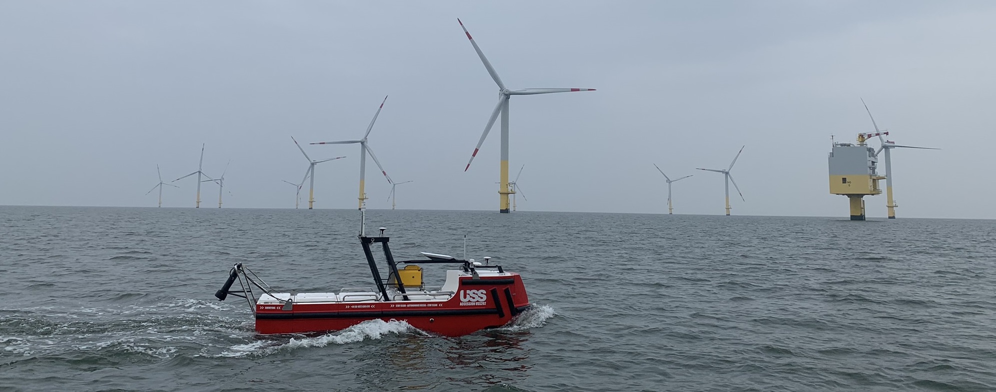
Unmanned Survey Solutions and Stehr Consulting Ltd Announce Pioneering ‘Unlocking the Potential for Mini-MASS in UK Waters’ Project
Unmanned Survey Solutions (USS), in close collaboration with Stehr Consulting Ltd, is excited to announce the launch of the groundbreaking project ‘Unlocking the Potential for ‘Mini-MASS’ in UK Waters.’ This innovative initiative, funded by Innovate UK under the Launchpad: Marine and Maritime in the Great South West - R1 MFA competition, aims to revolutionise the smaller Marine Autonomous Surface Ship (MASS) market.
Our partnership with Stehr Consulting Ltd brings together a wealth of technical expertise and extensive experience, making this collaboration the perfect fit to address a significant regulatory and certification challenges hindering the widespread adoption of smaller Uncrewed Surface Vessels (USVs) in UK waters.
The recent updates to the Workboat Code Edition 3 (WBC3) by the Maritime and Coastguard Agency (MCA) represent a major step forward, incorporating provisions for Remotely Operated Unmanned Vessels (ROUVs). However, WBC3 predominantly focuses on larger, higher-risk vessels within the sub 24m market, overlooking the unique characteristics and lower risk associated with ‘Mini-MASS.’ As a result, the current requirements present significant challenges for these smaller vessels, creating a barrier to innovation.
This project aims to break down these barriers by providing a comprehensive open-source report and templates that meticulously analyse WBC3 requirements. These analyses will identify requirements that are:
- Valid in the context of demonstrating safety for ‘Mini-MASS’.
- Partially valid.
- Not valid in the context of demonstrating safety for ‘Mini-MASS’.
For requirements in the latter two categories, the project aims to produce generate generic template safety argument patterns, streamlining the certification process for ‘Mini-MASS’ vessels and informing future policy development.
Building on the foundational work of the Surface Autonomy Subgroup of the Future Autonomous at Sea Technologies (FAST) Cluster, the largest marine autonomy cluster in the UK, this project aspires to minimise certification burdens while maintaining safety standards. James Williams, CEO of USS, and chair of the subgroup has championed engagement with the Department for Transport (DfT) and the MCA on 'Mini-MASS’ matters. The results of this project are expected to unlock the potential of ‘Mini-MASS’ in UK waters, catalysing business growth, and fostering innovation and economic development in the Southwest’s maritime sector.
USS is committed to driving innovation and economic growth through initiatives like these. We look forward to the transformative impact this project will have on the marine and maritime industry.
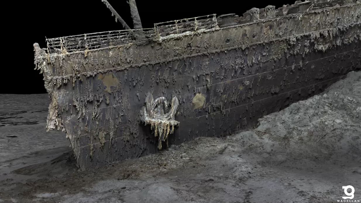
Illuminating The Unknown, the Making of the RMS Titanic Digital Twin
One year after Magellan’s public release of this incredible expedition, we shed some light on the making of the RMS Titanic Digital Twin.
Voyis, a leading provider of advanced underwater imaging systems in Waterloo, Canada, joined forces with subsea technology partners Sonardyne and EIVA to provide sensor systems to Magellan for their groundbreaking survey that captured the first complete Digital Twin of the RMS Titanic wreck site. This collaborative effort has resulted in an extraordinary scaled digital twin of the entire bow and stern of the famous wreck, along with the surrounding debris field, enabling researchers and scientists to start to re-explore the vessel with the greatest level of detail ever recorded. This 3D model showcases the site as if the ocean had been drained away, offering a snapshot in time of this iconic historical asset before it degrades beyond recognition (Magellan Digital Twin). The survey was completely non-intrusive thanks to Magellan’s deep water survey expertise, inhouse cameras systems, proven mapping equipment and Voyis’ long range optical systems. This offered a sustainable way to further understand the conditions of the Titanic without compromising the wreck or surrounding ecosystem.
The Titanic, resting at a depth of approximately 3,800 meters (12,500 feet) in the Atlantic Ocean off the coast of Newfoundland, Canada, has long been a subject of fascination and mystery since its tragic sinking in 1912. The aim of this ambitious project was to shed new light on the circumstances surrounding the disaster and utilize cutting-edge underwater optical technology to record the current state of this iconic wreck.
In summer 2022, Magellan Ltd, a leading deep-sea mapping and survey company, was provided with Voyis’ underwater imaging sensors to complement their own systems and conduct the extensive optical survey.
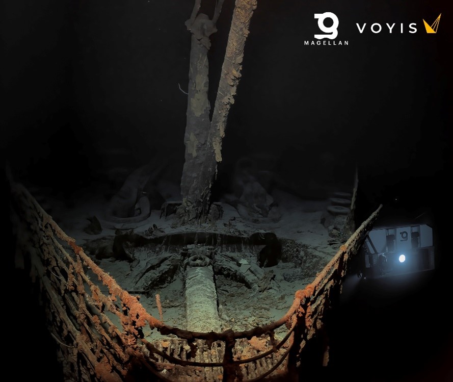
Figure 1: Image captured with Voyis Observer & Nova subsea imaging system. Reproduced with kind permission from Magellan.
Voyis’ Observer Subsea Cameras and Nova LEDs Illuminate Every Aspect of the Wreck
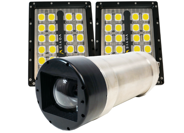
Voyis provided its state-of-the-art Observer & Nova subsea imaging system in support of this endeavour. With an actively cooled high-dynamic range camera and more than ½ million lumens of flash lighting, this setup enabled the best possible colour images of the wreck. Over 700,000 images were reliably captured during the multi-day survey of the region, recording millimetric details of every aspect of the site. At 3,800m below the sea, the Observer Pro delivered clear, accurate images that were automatically corrected for both colour & lighting. This delivered the image quality and consistency needed to produce Magellan’s seamless Digital Twin that you see today. This resolution and colour accuracy, powered by Voyis’ proprietary True Colour correction, has never been deployed on a wreck of this size, and was key in removing the blue and green hues that are typical in subsea optical survey. This precise visual data formed the foundation for generating the comprehensive 3D model of the entire ship, an immense processing undertaking by Magellan. Voyis is now able to release some of the colour corrected original images in full resolution.
In addition to the Observer & Nova, Magellan also trialled a Voyis Insight Pro laser system to scan the wreck and debris field. The Insight Pro underwater laser scanner may provide researchers with the quantitative capability to directly measure even the smallest features. The laser model can complement the image-based Digital Twin to help further understand the rate of degradation of the historic site and measure the profile and scour on the feature-limited seabed. Voyis is also sharing limited exports from the laser model.
 Critical Support from Covelya Group: Sonardyne and EIVA
Delivering fantastic images and an accurate 3D model requires more than great cameras, and trail laser scanners. Precise and accurate positioning throughout the survey is essential to ensure that complete coverage is achieved and to provide an accurate flight path for 3D model processing. As a renowned provider of innovative underwater positioning and navigation technologies, Sonardyne supplied Long BaseLine (LBL) equipment and an acoustically aided SPRINT-Nav Hybrid Navigator. Sonardyne and Magellan have worked extensively together to develop and refine these systems since Magellan invested in SPRINT-Nav across its fleet of 6k rated work class ROVs, with the result that the advanced INS/DVL/LBL technology ensured reliable and robust subsea navigation in the challenging operating conditions at the Titanic site.
Also critical to mission success is real-time feedback to the surveyors at the surface, and here EIVA, a sister company to Voyis and Sonardyne, contributed its advanced navigation and survey software capabilities to the project. EIVA’s NaviSuite software solutions facilitated the efficient collection and visualization of the vast amount of image and navigation data collected during the survey.
Unveiling New Insights into the Titanic's History
This sensor package offered to Magellan’s project by Voyis, Sonardyne, and EIVA represents a significant milestone in underwater innovation. Magellan’s unprecedented reconstruction of the Titanic has demonstrated the ability to generate incredibly accurate models of our oceans, allowing us all to see the depths like we see the surface. It is Voyis’ hope that this new technology will drive evidence-based research and a deeper understanding of not only this historic tragedy but offer tools to future explorers that unlock more of the ocean’s secrets without the need to disturb the environment. The findings from this project have the potential to reshape our knowledge of the Titanic’s sinking, bringing us closer to solving the lingering questions surrounding the event.
As leaders in their respective fields in underwater technology, Voyis, Sonardyne, and EIVA remain committed to pushing the boundaries of subsea exploration by advancing the sensors that make it all possible. By combining their technology with Magellan’s experience, deep water capability, assets and Intellectual Property, these companies have together achieved a significant milestone in underwater archaeology and ocean exploration.
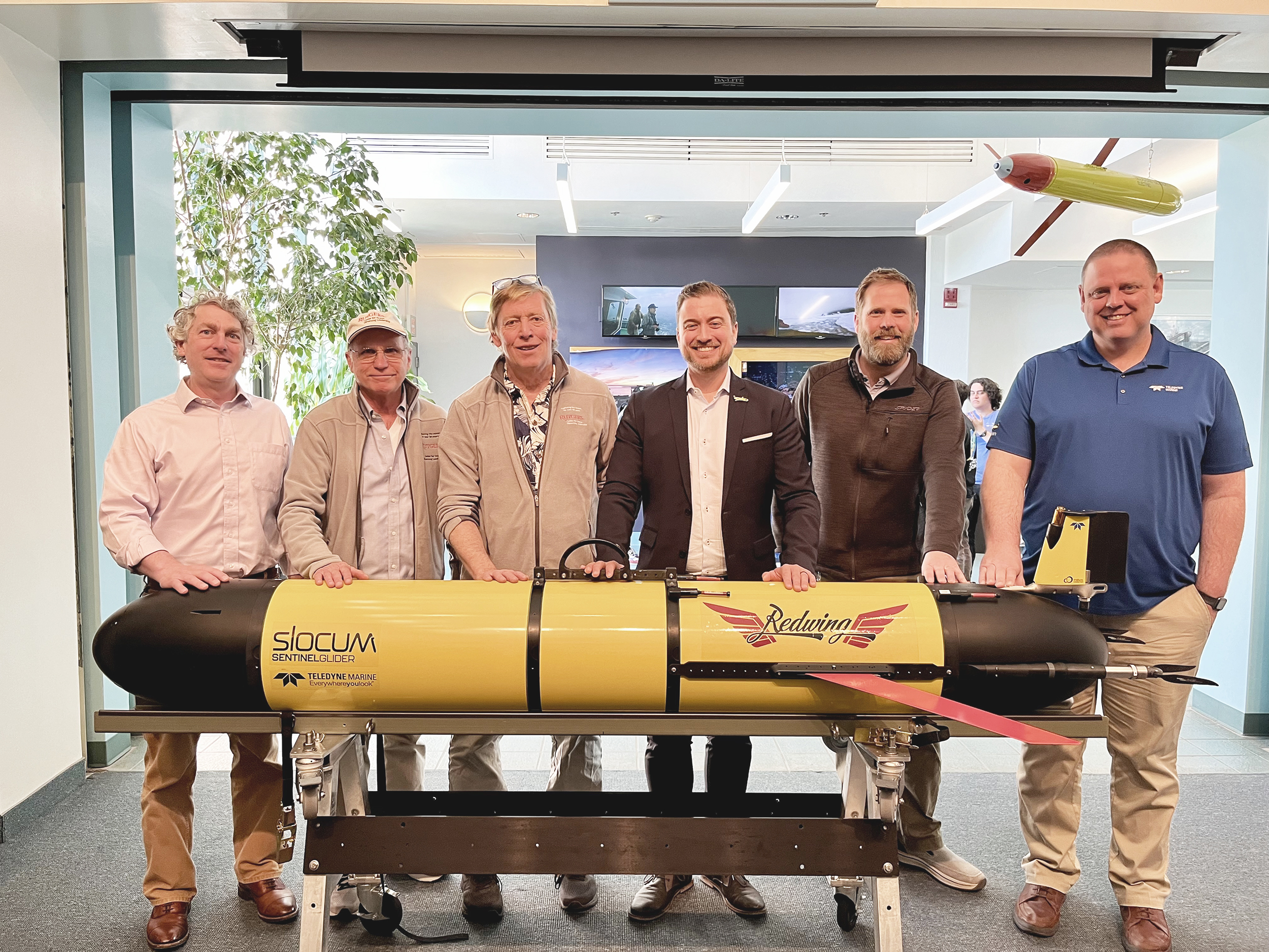
The Sentinel Mission: Charting new paths in ocean exploration
Rutgers University and Teledyne Webb Research unveiled The Sentinel Mission in a remarkable display of academic and technological collaboration. This unprecedented initiative marks the beginning of an ambitious journey as Teledyne’s Slocum Sentinel Glider, “Redwing,” (Research & Education Doug Webb Inter-National Glider) prepares for a historic round-the-world flight. Redwing is an acronym for “Research & Education Doug Webb Inter-National Glider”. The mission is further strengthened by the involvement of NOAA, the Marine Technology Society, and the UN Ocean Decade.
The event, which took place at Rutgers University on April 23, 2024, showcased the intricate planning and resilient partnership behind The Sentinel Mission. The Redwing glider, embodying the intersection of Research and Education, pays homage to Doug Webb, a pioneer of autonomous underwater technology. The glider stands not only as an innovative piece of machinery but also as a symbol of global research unity and exploration.
The event commenced with remarks from Jonathan Holloway, the 21st president of Rutgers, along with several esteemed faculty members, each sharing their encouragement and support of this mission. Teledyne Marine staff members, Clayton Jones, Senior Director of Technology and Shea Quinn, Slocum Glider Product Line Manager, provided insight into the history of Slocum gliders and how this mission will affect the future of ocean science.
A highlight of the event was the christening of the glider, “Redwing,” with seawater from Cape Cod, signifying its readiness for its summer 2024 launch. Attendees witnessed a blend of time-honored maritime tradition with cutting-edge innovation.
A cohort of Rutgers’ brightest undergraduate students presented the mission's flight path. Their extensive planning encompassed considerations for ocean currents, water conditions, and other environmental variables. These presentations highlighted the exceptional educational experiences at Rutgers, exemplifying the university’s dedication to hands-on, impactful learning.
Insights from international partners integral to the mission’s global scope further enriched the event. With each presentation, the essence of collaborative spirit and international cooperation became clearer, setting the stage for a truly global expedition.
The day's activities culminated with a closer look at the Sentinel Glider, showcasing its capabilities compared to standard models. The academic community, including master's students and faculty, engaged in fruitful discussions about sensor integrations and future research applications.
The Sentinel Mission’s anticipated launch in the summer of 2024 will contribute to our understanding of the oceans and serve as an inspiring testament to the power of academic-industry partnerships and the indomitable human spirit of discovery.

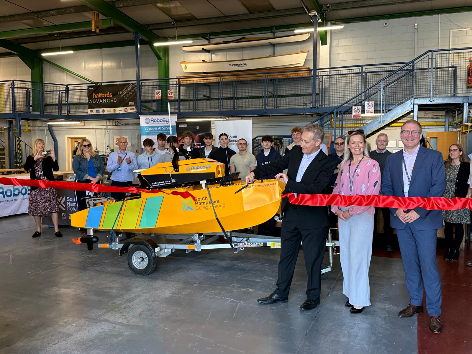
Pioneering South Hampshire College Group launches new Digital Training Vessel for public educational spearheading of new and innovative maritime skills
South Hampshire College Group (SHCG), a large and newly merged college group, that brings together three Further Education colleges from Southampton, Eastleigh and Fareham has taken delivery of a pioneering resource to meet the needs of new and emerging skills in the Solent region, through the acquisition of a state-of-the-art Digital Training Vessel.
Believed a first for further education in the UK, the new Digital Training Vessel (DTV) is an Unmanned Surface Vessel (USV) which will support an ambitious new Further Education curriculum for both SHCG’s Centre of Excellence in Engineering, Manufacturing and Advanced Skills Training (CEMAST) in Lee-on-the-Solent near Fareham, and SHCG’s specialist Marine Skills Centre located by the River Itchen, Southampton.
USVs are popular with industry and research bodies for surveying, patrolling, and search and rescue duties, as they have many benefits including zero emissions, lower operating costs, anti-fatigue, consistent routing, and are safer.
The new Digital Training Vessel USV is controlled remotely from either a shore-based mission control centre, or onboard a mothership, through digital remote operations, with optional AI (artificial intelligence) decision-aided support.
The SHCG Digital Training Vessel will contribute to supporting learning across new and innovative maritime skills, which will help to address the sector’s skills shortage and regional social employment challenges.
The skillsets required for USV Remote Operators combine digital, marine engineering, marine electrical, systems engineering, net zero understanding and navigational knowledge, which until recently were unavailable as a single career pathway. Through a new curriculum being rolled out this coming academic year, students from across traditionally distinct faculty areas will gain invaluable experience, knowledge, and skills to raise awareness of the maritime sector as a viable career option in which to progress.
The acquisition of the Digital Training Vessel was secured through a funding award by the Local Skills Improvement Fund (LSIF), as part of the Group’s focus on pioneering the education of innovative skills and as a contributor in delivering the Solent’s Local Skills Improvement Plan (LSIP).
Other innovative educational assets recently unveiled by SHCG and LSIP include TECH:TRUCK, a collaborative mobile educational and technological roadshow shared between seven local education providers, and SHCG’s new multi-million pound Department for Education funded Institute of Technology (IoT) at CEMAST, the only IoT offering a specific Higher National Certificate in Robotics and Mechatronics.
Naomi Smith, LSIF Programme Director comments, “South Hampshire College Group is a pioneer in identifying new and emerging skill requirements. Maritime has been identified in the Solent Local Skills Improvement Plan as a key area of focus, particularly in digital skills and where traditional roles overlap with new, such as marine engineering and vessel operations.”
She continues, “South Hampshire College Group works with local industry leaders to ensure the skills, qualifications and progression routes provide further opportunities for our students to create better futures. In addition, providing public educational training resources such as the Digital Training Vessel is key to encouraging social mobility as it enables access to all.”
The Digital Training Vessel project is entirely British, with the USV built by HydroSurv based in Plymouth, together with its vessel control systems, including maritime autonomy and remote-control operations, provided by Robosys Automation based in Southampton.
The launch of the DTV was held at South Hampshire College Group’s Marine Skills Centre in Woolston, near Southampton, UK, where maritime students and representatives from academia and industry were in attendance.
The launch event was also an opportunity to showcase the broad range of technical skills and career pathways available within the maritime sector and was a pivotal catalyst in bringing together multidiscipline curriculum areas for students. The USV showcased its capabilities on the water, with guests experiencing remote operations firsthand.
DTV “Trio” Collaboration Project Lead, Nigel Lee, CSO of Robosys Automation, which also provided the vessel control systems and autonomous operations for the USV comments, “Today is a landmark moment for the maritime industry, as demand for trained operatives in this specialism is rapidly increasing, both across USVs and also larger vessels including uncrewed and lean-crewed ships. Having this advanced Digital Training Vessel as a Further Educational resource broadens the catchment opportunities, thus satisfying the very real skillset shortage in the maritime sector, whilst creating a consistent level of learning.”
The event welcomed representation from the UK’s Marine Robotics Innovation Centre, Hampshire Chamber of Commerce, National Oceanography Centre, Robosys Automation, Landau Marine, South Hampshire College Group, Solent Local Skills Improvement Plan, South Coast Institute of Technology, amongst others from supporting associations and industry.
The Digital Training Vessel will enter service for September’s intake of students.
Share your innovations - The call for abstract submissions is almost over for The Marine Measurement Forum (MMF)
The 66th Marine Measurement Forum will be hosted by the National Oceanography Centre, Southampton, on June 19th 2024.
The Marine Measurement Forum (MMF) is a series of one-day, non-profit events that has been running since 1983. It provides excellent opportunities for networking and the informal exchange of ideas, knowledge, techniques, and developments across an extensive range of marine scientific measurement activities.
During an MMF ‘day’ a series of short presentations on diverse marine measurement topics are interspersed with refreshment breaks that offer delegates the chance to network with like-minded colleagues.
Attendees typically include scientists, surveyors, engineers, and business people from various organisations, including research centres, academia, manufacturers, defence organisations, survey companies, consultancies, monitoring authorities, dredging companies, port authorities, energy companies, and trade associations.
CLick here to submit an abstract to present.
Please note Abstract Submission will close at midday on Friday, 24 May 2024
Registration to attend the event is £45.00 per person. This includes access to the meeting, refreshments and a working lunch. Click here to register to attend.
RS Aqua invents innovative anomaly detection and acoustic data labelling software
RS Aqua is proud to announce a significant update to the MARLIN project. In collaboration with the University of Southampton, and supported by funding from Innovate UK, the MARLIN project is set to deliver several new technologies including a web application that can detect unusual underwater noise using machine learning, cloud connectivity and an intelligent network of underwater sensors.
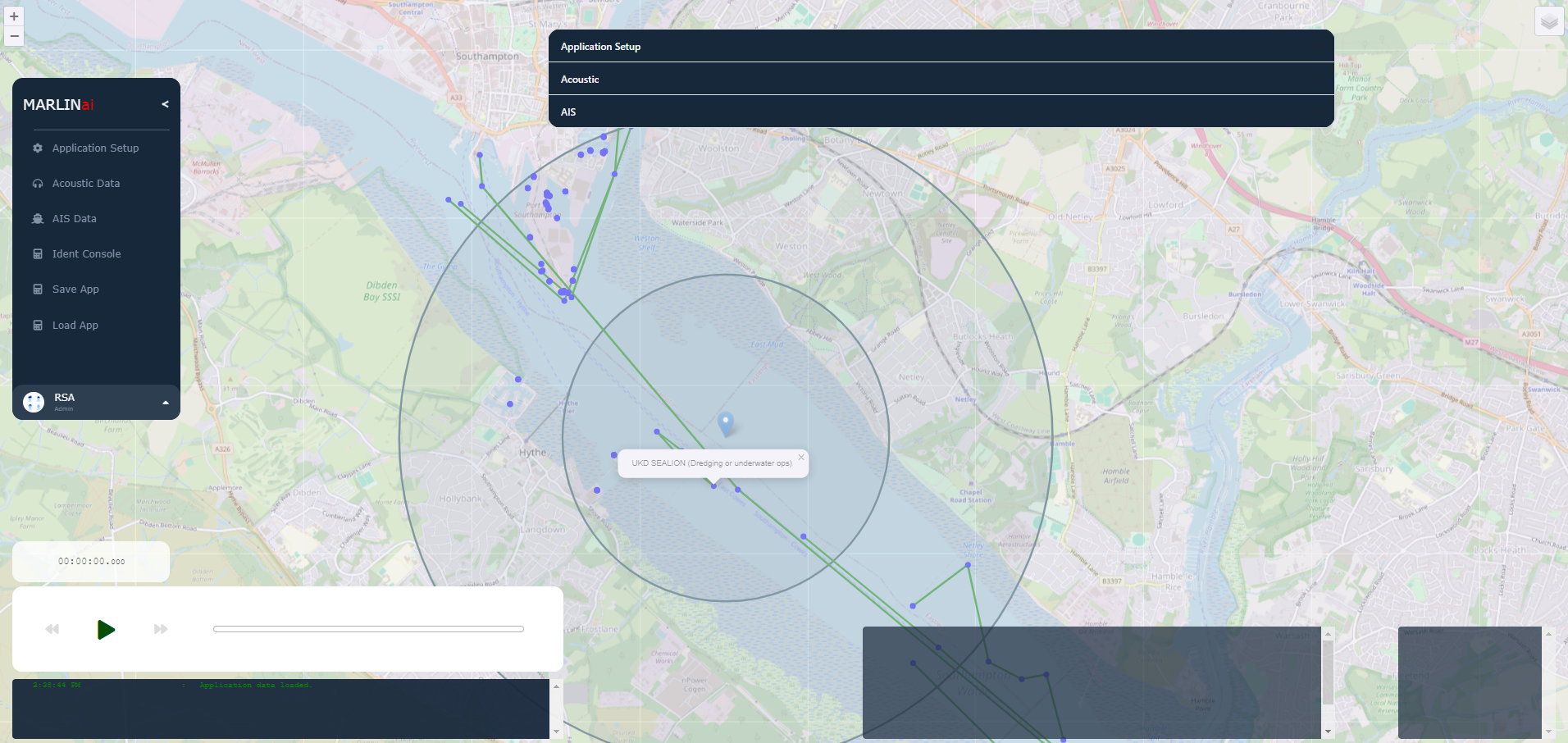
The latest development in the MARLIN project is the successful creation of a software application that allows us to correlate historical automatic identification system (AIS) data and underwater noise signatures. By automatically linking acoustic signatures to individual vessels, this innovative software enables real-time visualisation of data on a geographic information system (GIS) platform and acoustic data labelling.
Demonstrating the new technology at the Underwater Sound Forum on 18th April 2024, Dr. Ryan Mowat, Director of Innovation at RS Aqua, elaborates on the significance of this advancement: "The new MARLIN software application represents a shift in ocean monitoring technology. For the first time, we can identify potentially illegal vessel activity in real-time using underwater noise. This capability will enhance our understanding of ocean ecosystems and strengthen efforts to combat unregulated fishing."
This classification technology in the MARLIN project marks a crucial milestone in ocean conservation efforts. By utilising labelled acoustic data from vessels, we have the potential to identify and track illegal, unreported and unregulated (IUU) fishing activity, contributing to the protection of marine biodiversity and the sustainability of our oceans. The MARLIN team are now adding Al algorithms to the software application to automate the detection of IUU fishing.
Martin Stemp, Managing Director at RS Aqua, adds: "We are thrilled to continue our collaboration with Innovate UK and the University of Southampton in driving forward the MARLIN project, and we are confident that these advancements will have a profound impact on ocean monitoring, security and conservation efforts worldwide."