
MacArtney’s innovative technology helps preserve and document ancient underwater sites
Take a virtual dive into a 2500-year-old shipwreck via the prototype underwater surveillance system, NOUS – which relies on MacArtney’s underwater pluggable electrical SubConn® connectors for its steady performance.
The Peristera shipwreck, off the Greek island of Alonnisos in the Aegean Sea, is described as ‘the Parthenon of shipwrecks’. It is located in the largest marine protected area in Europe and named after the small, almost deserted island close to where it was discovered. When this wooden vessel sank in the late 5th century BC, it took its cargo with it – which included some 4,000 amphorae, or characteristic Greek and Roman two-handled wine jars.
Until now, this excellently preserved, ancient shipwreck has been strictly off-limits to divers of any kind. The Greek Ministry of Culture has prohibited diving, including snorkelling, to any of the country’s underwater archaeological sites to protect them from looters. The dilemma for many historians and scientists has been: how can we preserve these ancient sites while still allowing people to appreciate their unique treasures?
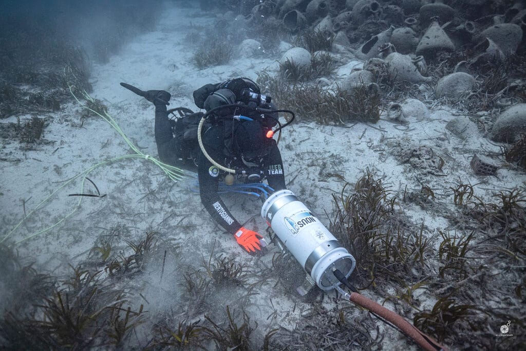
A new prototype may have the answer. The underwater surveillance system, NOUS, has already enabled the public to enjoy the Peristera ‘underwater museum’ via real-time video while also protecting it for future generations. And after the success of the pilot project, the hope is that similar systems can now be applied at other underwater preservation sites.
SubConn® delivers an uninterrupted connection
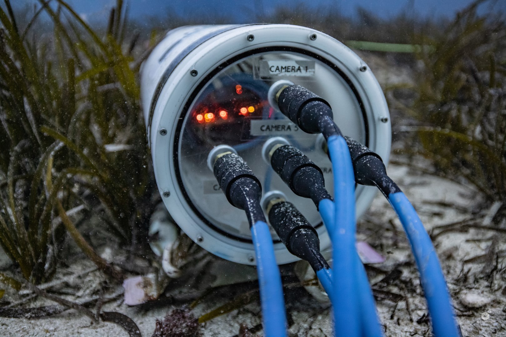
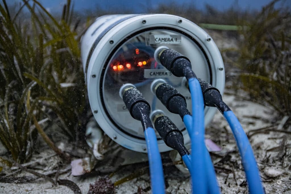
MacArtney provided assistance and cooperation throughout the process, particularly its internal sales department, which recommended and singled out the needed OptoLink and SubConn® connectors, including cabling, for the optimum result. The underwater pluggable electrical SubConn® connectors combine signal and power, enabling the steady performance of the underwater camera, video and lighting systems installed on-site.
The underwater surveillance system, or NOUS (meaning ‘mind’ or ‘intelligence’ in Greek), is a prototype capable of continuous monitoring an underwater area of interest using AI (artificial intelligence). This eliminates the need for a human operator to perform tasks like object detection, image classification, etc.
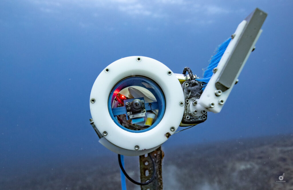
The system works on a machine-learned algorithm that can recognise any intruder and send an alarm. It provides real-time video of the wreck site, streamed via five underwater cameras (currently, only one is available to the public, with the other four reserved for scientists).
Other features of the prototype, powered by solar energy, include recognition software and luminosity-triggered lens wipers to unclog debris.
The team
NOUS is the brainchild of Dr George Papalambrou (professor of power propulsion at the National Technical University of Athens), Mr Kostas Katsioulis (dive officer/diver training, information technology) and Mr Vasilis Mentogiannis (engineer/commercial diver).
The team have 25 years of experience in marine work and are some of the founders of the KORSEAI – Institute of Historical and Archaeological Research in the archipelago of Fourni. The potential of this tiny archipelago in the East Aegean Sea between Samos and Ikaria is immense in terms of historical research. Dubbed ‘the ancient shipwreck capital of the world’, 22 shipwrecks have been discovered in the waters around the small islands, dating from 700 BC all the way up to the 16th century.
Some of Dr. Papalambrous’ students from the National Technical University assisted in the pilot project by helping to gather evidence of the system’s effectiveness together with the value of deploying such a system.
Culmination of two years’ work
Two years of brainstorming and hard work, including the idea phase, the building of prototypes and introduction to the Greek Ministry of Culture, finally culminated in the acceptance and funding of the uNdersea visiOn sUrveillance System, or ‘NOUS’ for short. The system has been designed from scratch and functions as a state-of-the-art surveillance system, which not only safeguards subsea antiquities but also has the ability to recognise and record marine species.
Dr George Papalambrou and Mr Vasilis Mentogiannis agree that MacArtney’s assistance has been invaluable:
“We are grateful for the assistance and guidance we received from MacArtney. Our idea and system needs were fully understood and supplied with the fit-for-purpose solution. The system has worked successfully for a year now, and we believe the use of the SubConn® underwater connectors guarantees stability, enabling us to make our prototype a ‘product’ available for more ancient wreck sites in Greece and the marine/diving industry in general.”
Scope of supply
- SubConn® Circular series, 8 pins
- SubConn® Ethernet
- Cables
- OptoLink fibre optic connectors
Hans-Jørgen Hansen, Sales Director Ocean Science, MacArtney is thrilled to be a part of such an important project, as he explains:
“We, at MacArtney, are extremely pleased to be able to help protect a site of cultural heritage. This solution gives the entire world access to see and to follow – but not to touch. What’s more, it provides residents of Greece in particular with an insight into what the institute and the marine biologists attached to it are doing at a local level to preserve finds of cultural, historical value.”
_________________________________________________________________________________
For additional information, please contact Hans-Jørgen Hansen, Sales Director Ocean Science,
Tel. +45 7613 2000, e-mail [email protected] or visit the company website.
Caption: SubConn® underwater pluggable electrical connectors secure a steady virtual dive into shipwreck.


SubSeaSail awarded a Dept. of Energy SBIR Phase 1 grant
SubSeaSail, LLC (SSS) has been awarded a Small Business Innovation Research (SBIR) Phase 1 grant from the Department of Energy (DoE) Water Power Technologies Office (WPTO). It was one of twelve companies selected from nine different states, based on their proposals and ability to impact the future of marine energy.
The SubSeaSail one-year grant is for $206,500 which will be used to create a low-cost, user-friendly environmental monitoring vessel for offshore marine energy sites. The vessel will be designed to work on the surface and continue to monitor and measure when submerged down to 30 meters. The vessel will be based on the company’s patented semi-submersible, monohull design and incorporate a unique SSS developed Passive Acoustic Array to monitor underwater soundscapes and 3rd party magnetometers to measure electro-magnetic fields generated by in-water hydrokinetic installations. The ability to autonomously provide near and far field monitoring from a 100% renewable energy vessel that can sail to locations, maintain position, submerge for periods of time to listen/measure/monitor, return to the surface to monitor while re-charging batteries, transmit data, and remain at sea for extended periods for a fraction of the cost of other systems will be unique. This configuration will also have a variety of additional applications across academia, government, military and the private sector.
About SubSeaSail LLC:
SSS is a 4-year-old, San Diego-based BlueTech company with a mission to develop 100% energy harvesting, innovative, disruptively affordable, long-duration (1+ month) platforms & sensors. SSS is developing three lines of business products: 1) monohull, semi-submersible observation vessels; 2) multi-hull, surface cargo vessels; and 3) unique sensors ideally suited for these vessels including rigid Passive Acoustic Monitoring (PAM) Arrays and a weather station. SubSeaSail vessels are “Designed for Simplicity” and backed by multiple patents including a monohull sailing vessel with the hull below the waterline and a passive wingsail control mechanism that provides autonomous management of the sail without any lines, pulleys, or electronics. This results in a revolutionary vessel design with low drag/wake and minimal detection (acoustic, IR, radar, visual) signature. Designed for long duration and persistent missions, a servo is the only electro-mechanical device required to sail.
For more information, please contact Michael Jones, Managing Partner of SubSeaSail at [email protected].
Kraken Signs Contract with Major Energy Company for Underwater Asset Inspection and Provides SeaVision® Update
ST. JOHN’S, NEWFOUNDLAND, July 15, 2021 /GLOBE NEWSWIRE/ — Kraken Robotics Inc. (TSX-V: PNG, OTCQB: KRKNF), Canada’s Ocean Company™, is pleased to announce several positive updates relating to the Company’s SeaVision® laser scanner developments and growth in its Robotics as a Service (Raas) offering. Kraken’s SeaVision® 3D laser scanner technology will be used in the Company’s RaaS offering focused on three primary markets: mooring chain inspections, ship hull inspection, and offshore wind farm inspection. After several years of development and numerous trials and technology demos , Kraken expects to ramp significant RaaS revenue from SeaVision® laser inspection contracts. Notable updates are as follows:
- Kraken recently signed a contract with a major international energy company to provide detailed underwater inspection of the customer’s subsea assets. Under the contract, Kraken’s SeaVision® 3D laser scanner will be used to conduct underwater inspection of an umbilical termination assembly to acquire metrology data on tubing within the internal structure. The work will be performed in Q4 of this year in a West African country. The customer’s name and the contract amount cannot be disclosed due to confidentiality reasons.
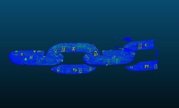
- Kraken recently completed extensive trials on Kraken‘s SeaVision® based Mooring Chain Inspection Tool (MCIT) (see Figures 1 and 2 below for sample results). Combining the award winning SeaVision® technology with Kraken developed state-of-the-art deep learning object detection and 3D form matching technology, SeaVision® MCIT will enable a time efficient and contactless inspection. Kraken recently finished test runs in a tank facility using six links of a fully documented and analysed mooring chain. The trials objectively showed that Kraken’s MCIT software system can track and measure diameters within the required measurement envelope. As a result, Kraken expects to move forward to readying the system for the first test deployment later this year with a goal to ramping a mooring chain inspection service offering in 2022.
- Kraken recently completed a successful offshore mooring chain inspection campaign with a major Brazilian energy company. Kraken is expected to offer ongoing support for diver-less underwater asset inspection in the Brazilian offshore energy market leveraging the SeaVision® Following this successful campaign, Kraken expects to expand its SeaVision® mooring chain inspection service offering to additional international clients in 2022, including certification with an internationally recognized regulatory agency
Management Comments
Karl Kenny, Kraken President and CEO said, “The offshore mooring market was valued at over US$ 1 Billion in 2020 and is expected to grow at a 3.7 % CAGR from 2021 to 2026 according to industry analyst, Market Study Report LLC. The largest market segment is offshore oil & gas FPSOs, accounting for over 2,000 km of mooring chains. There is also growing demand from offshore wind platforms. Kraken’s SeaVision® MCIT tool provides a substitute to the conventional mechanical caliper used today for dimensional measurements resulting in a faster, objective, safer and contact-free measurement that reduces the number of offshore campaign days. This can save customers millions of dollars in operational costs and CO2 emissions associated with vessel operations and can provide significant improvement in asset integrity assurance. After several years of technology development, trials, and paid demos, Kraken expects to ramp up and globally deploy a mooring chain inspection service offering in 2022.”
Figure 1: 3D Point Cloud of Mooring Chain Segment produced in real-time during Kraken’s recent SeaVision testing
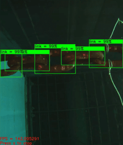
Figure 2: Kraken’s Mooring Chain Tracker leverages Deep Learning for detecting and tracking individual chain links during testing
(See video at https://www.youtube.com/watch?v=IBnvbLmmEHs)
LINKS
SOCIAL MEDIA
LinkedIn: www.linkedin.com/company/krakenrobotics
Twitter: www.twitter.com/krakenrobotics
Facebook: www.facebook.com/krakenroboticsinc
YouTube: www.youtube.com/channel/UCEMyaMQnneTeIr71HYgrT2A
Instagram: www.instagram.com/krakenrobotics
ABOUT KRAKEN ROBOTICS INC.
Kraken Robotics Inc. (TSX.V:PNG) (OTCQB: KRKNF) is a marine technology company dedicated to the production and sale of software-centric sensors, subsea batteries and thrusters, and underwater robotic systems. The company is headquartered in Newfoundland with offices in Canada, U.S., Germany, Denmark, and Brazil. Kraken is ranked as a Top 100 marine technology company by Marine Technology Reporter.
For further information, please contact:
Joe MacKay, Chief Financial Officer
(416) 303-0605
[email protected]
Greg Reid, Chief Operating Officer
(416) 818-9822
[email protected]
Sean Peasgood, Investor Relations
(647) 955-1274
[email protected]

Dr. Janelle Hrycik Joins Teledyne RD Instruments Inside Sales Team
Teledyne Marine is pleased to announce that Dr. Janelle Hrycik has joined their inside sales team to support the sale and service of Teledyne RD Instruments full line of acoustic Doppler products. Dr. Hrycik previously served as an instructor of marine biology at Unity College, located in Maine, and brings with her a Ph.D. in Biological Oceanography from Dalhousie University in Halifax, Nova Scotia. Her past research is related to the sustainable management of commercially valuable and endangered species, the mitigation of the threat of invasive species, the prediction of species response to climate change, and the evaluation of contaminants, such as microplastics, oil, and wastewater.
Her strong scientific background will be especially helpful to customers working in the fields of marine biology, fisheries, and coastal management.
Dr Hrycik shares: “I look forward to the opportunity to combine my background knowledge with dedicated customer service to provide Teledyne Marine customers with complete solutions. I am excited to join such a collaborative, growth-oriented team!”
 ABOUT TELEDYNE MARINE
Teledyne Marine is a group of leading-edge subsea technology companies that are part of Teledyne Technologies Incorporated. Through acquisitions and collaboration, Teledyne Marine has evolved into an industry powerhouse, bringing Imaging, Instruments, Interconnect, Seismic, and Vehicle technology together to provide total solutions to our customers. teledynemarine.com

MBES cannot be IHO compliant, and here is why
MBES and the IHO SP44 Standards for Hydrographic Surveys
The International Hydrographic Organisation, based in Monaco, published the 6th edition of Special Publication No 44 Standards for Hydrographic Surveys in March 2020. SP44 sets forth the minimum standards for survey accuracy.
Multibeam echosounders have been well established as standard equipment for hydrographic surveys. In that regard, SP44 is specific to hydrographic surveying — it contains nothing specific to multibeam echosounders. Instead, SP44 is a standard developed by the IHO ‘to help improve the safety of navigation.’ SP44 concerns itself with depth accuracy. However, a multibeam echosounder does not measure depth; it measures a range and bearing to the seafloor.
‘To be fully compliant with an S-44 Order, a hydrographic survey must comply with all bathymetric and feature detection requirements for that order and with all the other requirements for the same order, where applicable.’ (IHO standard for Hydrographic Surveys (SP-44) 6th edition March 2020, pg 12, International Hydrographic Bureau., Monaco)
When a manufacturer states that a multibeam echosounder meets IHO SP44 or a client states a multibeam echosounder must meet IHO SP44 on a project, they may not understand the specifics of IHO SP44. SP44 looks at the total survey system.
What is the survey system comprised of (at a minimum)?
- Proper survey vessel
- Positioning system
- Motion sensor
a. Aligned with axes of vessel
b. Heave bandwidth adjusted properly - Heading sensor
a. Aligned with the centerline of the vessel - Multibeam echosounder
a. Properly mounted; if on a pole, there is no flexing or vibration
b. Properly calibrated (Patch test)
c. Operated properly - Sound velocity profiler
a. Calibrated
b. Sufficient casts - Tide gauge
a. Proximity to the survey area - Offset measurements
a. Surveyed in using land survey techniques preferred - Data collection and processing software
a. Software set up correctly, including timing control
b. Software tools/windows enabled for quality control - Skilled surveyors
As the list above shows, the multibeam is approximately 1/10 of the entire survey system, as used in IHO SP44. The depth computation relies on the other 9/10 of the survey system along with the multibeam echosounder. The multibeam echosounder provides a range and bearing to points on the seafloor. The data collection/processing software receives the range and bearing data along with position, heading, and motion data makes offset adjustments, and applies refraction corrections and tidal corrections to produce a depth. However, as an example, if the multibeam is mounted using a bamboo pole that wobbles, no matter how good that multibeam might be, no matter how good the other sensors are, the range and bearing data would be inaccurate due to pole wobble. Or, if the sound velocity profiler is out of calibration, the refraction corrections would be inaccurate, causing erroneous depths. These few considerations illustrate how the entire survey system must be evaluated for IHO SP44 order survey compliance.
Compliance with IHO SP44 Exclusive or Special Order (or Order 1a, 1b, or 2) can be proven for a survey system comprised of a multibeam echosounder by performing a set IHO survey for that specific vessel and that specific survey system and setup. However, changing any component would invalidate compliance.
Another aspect of the IHO SP44 standards is the horizontal uncertainty (2ẟ) that is allowed: 1 meter. If the IHO standard allows for a horizontal position error of this magnitude, how accurately is the depth positioned on the seafloor?
Feature Detection: IHO SP44 Exclusive Order calls for the system to detect a 0.5-meter cubic feature. What the IHO SP44 does not state, however, is what constitutes detection. How many soundings determine detection?
There are other survey standards that better address the modern-day multibeam survey, such as the LINZ produced Contract Specifications for Hydrographic Surveys (Version 1.3; 2016).
The main point is that there are many components in a survey system, and it is the survey system that will determine compliance with IHO SP44 survey order specifications. One component of the survey system cannot be singled out, such as the multibeam echosounder.
When installed following the instructions from the R2Sonic manual and used with the I2NS and Sound Velocity options offered by R2Sonic, the Sonic series not only meets but exceeds SP44 requirements.
MTS and SUT Launch Marine Technologist Professional Certification Programmes
WASHINGTON, DC and LONDON, UK — Beginning this month, the Marine Technology Society (MTS) and the Society for Underwater Technology (SUT) will launch three professional certification programmes for marine technologists and technicians. These programmes serve as a passport for job mobility and create new opportunities for MTS and SUT members.
The Institute of Marine Engineering, Science and Technology (IMarEST) has licensed MTS and SUT to offer their members the opportunity to apply for registration as Chartered Marine Technologist (CMarTech), Registered Marine Technologist (RMarTech), and Marine Technician (MarTech). IMarEST has a Royal Charter in the United Kingdom and can add suitably qualified and experienced applicants to these registers.
“Becoming professionally registered recognises experience and competence beyond academic qualifications and shows a commitment to integrity and a responsibility for the wider public in your work. Because ongoing reflection is central to maintaining your place on the register, the process builds a more self-aware and sophisticated workforce. Gaining Technician, Registered, or Chartered status is a universally recognised mark of expertise which places the individual within a respected circle of professionals and helps strengthen their influence. Those at this level work to high ethical standards and it gives both peers and the wider community trust and confidence in their work,” explained Gwynne Lewis, Chief Executive, Institute of Marine Engineering, Science & Technology (IMarEST).
“The CMarTech, RMarTech, and MarTech professional registers will advance the marine technology workforce which will benefit the sustainability of our ocean and the blue economy for many years to come,” said Zdenka Willis, President of MTS. “We thank SUT and the IMarEST for their partnership in these programs, and we look forward to recognizing our members who complete them.”
MTS Past President Rick Spinrad added, “The CMarTech, RMarTech, and MarTech professional registers are globally respected and provide substantial value to our industry. In achieving the registration, our members will advance the trajectory of their careers and positively impact ocean technology. The synergy of the IMarEST, MTS, and SUT along with the success of the pilot program brought us to this day, and we encourage members in all marine science positions to apply.”
SUT President, Judith Patten, said, “I wholeheartedly echo Zdenka’s and Rick’s views. This is a crucial step in the SUT’s history. As a learned society, furthering the education of scientists and technologists to maintain high standards in marine science and technology is one of the published aims of the SUT. Launching this initiative enforces our society’s commitment to helping our technologist and technician members fulfil their potential. Not only do we welcome the first tranche of programmes but, on behalf of our scientific members, we look forward to the addition of CMarSci and RMarSci registers later in the year. Working with the IMarEST and MTS like this not only helps individual members, but also ensures we fulfil another of our aims – to maintain high standards in marine science and technology.
“Equally, we are proud of what our Perth Branch has achieved working with Engineers Australia and look forward to news of Australian members successfully achieving their Chartered accreditation.”
SUT and Engineers Australia have completed the work required to make Chartered accreditation in the area of practice of subsea engineering possible at three levels: Chartered Professional Engineer, CPEng, Chartered Engineering Technologist, and CEngT, Chartered Engineering Associate, CEngA.
Application now open
Apply now through the MTS and SUT websites. Detailed information, a FAQ sheet, and applications for CMarTech, RMarTech, and MarTech are available online at www.mtsociety.org and www.sut.org.
MTS and SUT plan to launch two additional certifications, Chartered Marine Scientist (CMarSci) and Registered Marine Scientist (RMarSci), licensed by the IMarEST, in October 2021.
Learn More and Apply Today
MTS Contact:
Kathleen Herndon, [email protected]
SUT Contact:
Cheryl Burgess, [email protected]
UK Hydrographic Office announces new tender opportunity for lidar survey of The Cayman Islands
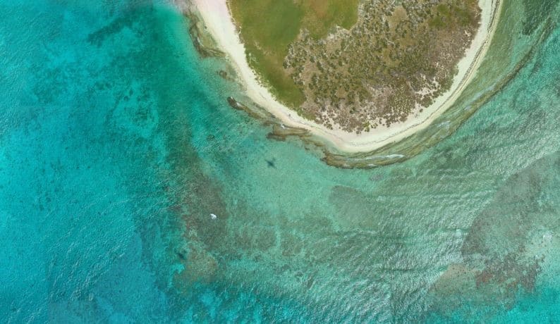
The UKHO is looking to commission a Lidar survey of the Cayman Islands and its surrounding waters. This work will form part of our Overseas Territories Seabed Mapping Programme, through which the UKHO collects valuable data to assist in updating navigational charts and publications, while supporting the management and protection of the marine environment. Through their hydrographic programmes so far, they have commissioned 28 surveys and mapped 19,000km2 of seabed to support coastal states across the globe.
For more details on the tender and details on how to register your interest, please visit: https://lnkd.in/eZZQXhu
A first for Fugro as SpaceStar™ satellite positioning service heads into space
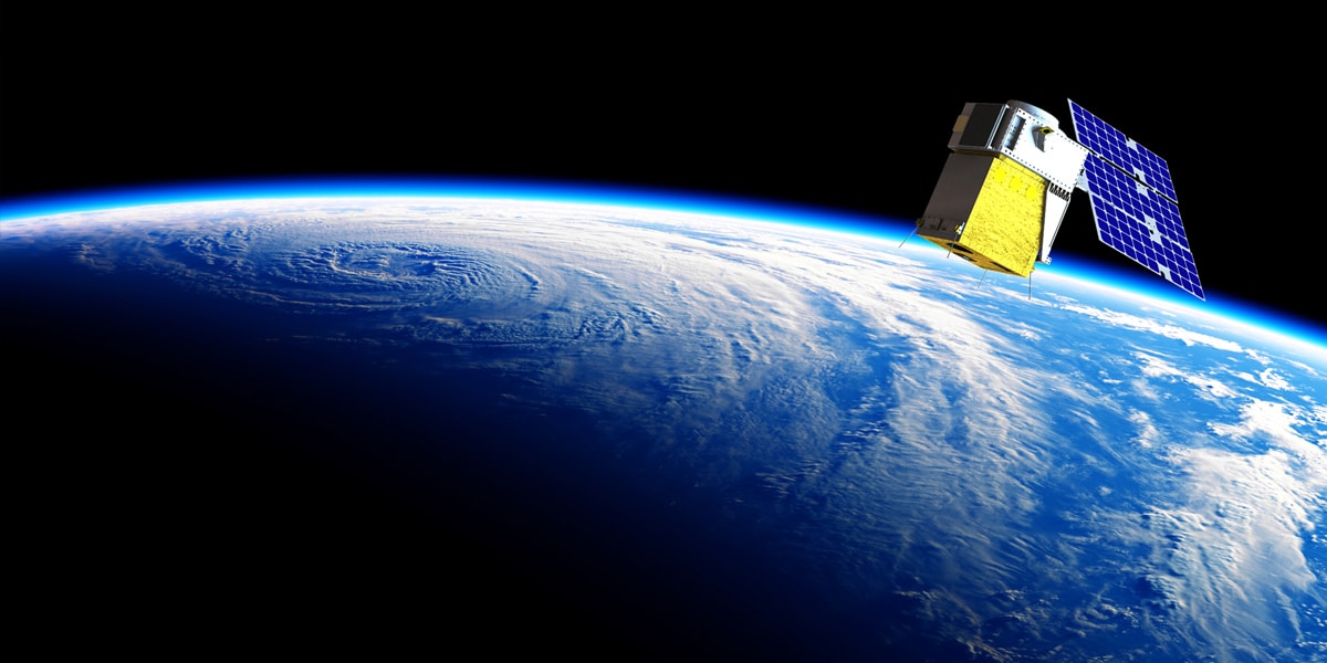
Fugro’s SpaceStar™ GNSS Precise Point Positioning (PPP) service is providing essential high-accuracy positioning in space for the first time. Loft Orbital, which flies and operates customer payloads on its YAM series of small satellites, launched their YAM-2 satellite, the first in space to be equipped with Fugro’s SpaceStar next-generation positioning technology, on 30 June into a 525 km sun-synchronous orbit from Cape Canaveral in Florida onboard a SpaceX Falcon 9 rocket.
SpaceStar is using PPP to deliver high-accuracy sub-decimetre onboard positioning in real time during YAM-2’s low earth orbit (LEO) operations. Fugro’s proprietary positioning software is integrated into YAM-2 and employs state-of-the-art technology to receive precise GNSS real-time orbit and clock corrections from geostationary satellites. Highly accurate positioning in LEO is becoming increasingly important for earth observation applications, safe constellations management, and space debris collision avoidance.
“We’re especially excited to demonstrate this new functionality,” said Loft Orbital CTO, Pieter van Duijn. “Fugro’s SpaceStar service is something that can really help not only Loft Orbital’s missions but also be of interest to the wider application of space situational awareness and safety.”
Daan Scheer, Fugro’s Satellite Positioning Commercial Manager, said: “We are extremely proud to be providing our real-time PPP service to the YAM-2 small satellite. We’ve been able to bring this innovative product to market thanks to our close cooperation with Loft Orbital and we’re looking forward to completing a successful in-orbit demonstration mission. The accuracy of our SpaceStar position service is not only contributing to our purpose of a safe and liveable world but, by facilitating safer navigation in space, even beyond!”
End
For more information
Daan Scheer [email protected]
Seabed 2030 announces new partnership with the UK Hydrographic Office and Teledyne CARIS on the occasion of World Hydrography Day
The Nippon Foundation-GEBCO Seabed 2030 Project has entered a technical cooperation agreement with the UK Hydrographic Office (UKHO), a world-leading centre for hydrography specialising in marine geospatial data, and Teledyne CARIS, the leading developer of marine mapping software. The Memorandum of Understanding – announced on the first World Hydrography Day to fall within the UN Decade of Ocean Science for Sustainable Development – will see the parties work together to advance the effort associated with producing the definitive map of the seafloor by the year 2030.
The announcement also coincides with the release of the latest GEBCO Grid figure – with 20.6 per cent of the world’s entire seabed now mapped. When Seabed 2030 was launched in 2017, only six per cent of the oceans had been mapped to modern standards. The latest figure has seen a growth of 1.6 per cent from last year’s data – an increase equating to around half the size of USA.
Seabed 2030 is a collaborative project between The Nippon Foundation and GEBCO to inspire the complete mapping of the world's ocean by 2030, and to compile all bathymetric data into the freely available GEBCO Ocean Map. GEBCO is a joint project of the International Hydrographic Organization (IHO) and the Intergovernmental Oceanographic Commission (IOC), and is the only organisation with a mandate to map the entire ocean floor.
The UK Hydrographic Office (UKHO) is a world-leading centre for hydrography, specialising in marine geospatial data, from seabed to surface, to help others make best use of the marine environment. This includes partnerships with governments and researchers to support the sustainable growth of the Blue Economy and the protection of our oceans. UKHO also make this data available through their portfolio of ADMIRALTY Maritime Data Solutions – which include a world-leading range of navigational products that can be found on over 90% of ships trading internationally.
For over 40 years, Teledyne CARIS has been the leader in the development of hydrographic and marine geospatial software. Its flagship Hydrographic Production Database (HPD) is used extensively by the UKHO to produce its charts. Once of Teledyne CARIS's newest products - CARIS Onboard360™ - is a near real-time and autonomous data acquisition and processing package.
Commenting on the MOU, Seabed 2030 Project Director Jamie McMichael-Phillips said: "Seabed 2030 is delighted to announce this new partnership with UKHO and Teledyne CARIS on the occasion of World Hydrography Day. As we enter the newly-launched UN Decade, but also final decade of Seabed 2030, we remain humbly aware of what we have yet to achieve - just under 80 per cent of the world's seabed still to be mapped.
“Last year’s GEBCO Grid saw an increase of four per cent – this was made possible due to significant contributions of existing bathymetric data. Whilst this year’s growth is commendable in light of the global pandemic, it should act as a testament to the value of collaborative working to achieve our end goal, which is ultimately for the benefit of humanity.
“As we enter this final stretch, we call on everybody to get involved and contribute to our efforts. Together, we can make better use of the world’s oceans in a sustainable way. I am confident we will reach our goal as international collaboration grows.”
As part of the new agreement, the three organisations will use a new AI tool developed by Teledyne CARIS and the UKHO as part of their ADMIRALTY Maritime Data Solutions portfolio. The AI-Based Bathymetry Data Noise Cleaning Capability is thought to benefit Seabed 2030 by providing processing efficiency of incoming multibeam bathymetry dataset typical of the type to be received by the Project.
Michel Stanier, Executive Vice-President and General Manager of Teledyne CARIS commented: “We are very pleased to be supporting this project with AI technology. Seabed 2030 represents an opportunity for a unique collaboration whereby new AI methods are being developed and delivered to help solve the data processing bottlenecks created by the huge quantities of data needed to map the world’s oceans over the next decade.”
Peter Sparkes, Chief Executive at the UK Hydrographic Office commented: “We are extremely excited to enter this new partnership with Teledyne CARIS and The Nippon Foundation-GEBCO Seabed 2030 Project.
“Seabed mapping data plays a vital role in supporting maritime trade, the protection of our oceans and the fight against climate change – by keeping mariners safe and supporting sustainable development. Through use of this new capability, we hope to significantly reduce the time it takes to process this foundational data from days to hours – allowing us to build our understanding of the world’s oceans at a greater pace.
“We believe that collaborations like these can help to build a better future for all, so the UKHO will continue to build on this partnership and work with others across the maritime community to support safe, secure and thriving oceans.”
All data collected and shared with the Seabed 2030 Project is included in the GEBCO global grid – the most complete bathymetric dataset of the world’s ocean floor.
For more detailed information on The Nippon Foundation-GEBCO Seabed 2030 Project, please visit: seabed2030.org.

Rovco and PanGeo Subsea join forces to offer innovative 3D O&M and Survey solutions
Leading O&M and Survey Services supplier, partners with advanced sub-seabed 3D Acoustic Imaging solutions provider.
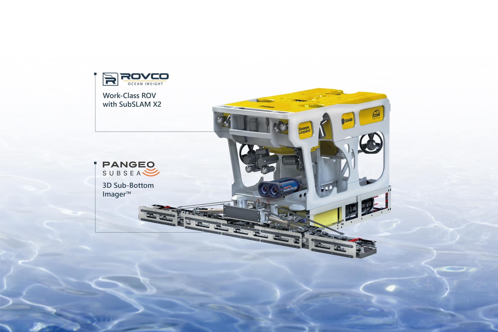
Rovco and PanGeo Subsea announces the formation of a powerful collaboration, designed to combine their respective areas of expertise to capture and provide early insight into changing subsea component and environmental conditions that may lead to wider problems or failures without planned intervention. This collaboration is born in response to the offshore energy market’s growing need for a prompt and detailed understanding of the performance of subsea infrastructure such as anodes, CPS, scour, cable burial and the effect of marine growth during the Operations & Maintenance (O&M) lifecycle.
This powerful combination fuses Rovco’s offshore O&M and hydrographic survey expertise, the SubSLAM X2 Intelligent Data Collection System, and PanGeo’s 3D Sub-Bottom Imager™ technology to deliver full 3D images of subsea assets – both above and below the seabed.
The offering allows owners and operators an efficient combination of industry-leading technologies to create reference models of critical components, providing an easy and intuitive way to keep track of their assets conditions within the design limitations of the OEMs and Engineering authorities original specifications. By combining the PanGeo SBI, SubSLAM and a host of ROV deployed tools, owners and operators are offered a single sourced solution to inform the condition of their jackets, monopiles and interconnecting cables plus protection systems, in a solution that can be deployed whilst the assets are still operating and energized (HVAC or HVDC).
“Technology solutions are what is enabling the sector to move forward at pace. De-risking and future-proofing offshore operations and investments with verifiable data.” Simon Miller, Managing Director for Rovco says. “The scope of what the Rovco-PanGeo collaboration can offer is impressive, ranging from as-built verification, to cable depth-of-burial, archaeological investigations, UXO analysis, structural asset inspections and much more.”
“We are excited to be entering into this working partnership with Rovco”, says Moya Cahill, PanGeo’s CEO. “Marrying up our respective equipment and technology to deliver a full comprehensive solution for clients adds value to the industry while supporting offshore regulations for O&M.”
For more details and to get a quote for O&M and survey services, please contact the Rovco sales team at [email protected] or PanGeo’s sales team at [email protected]