
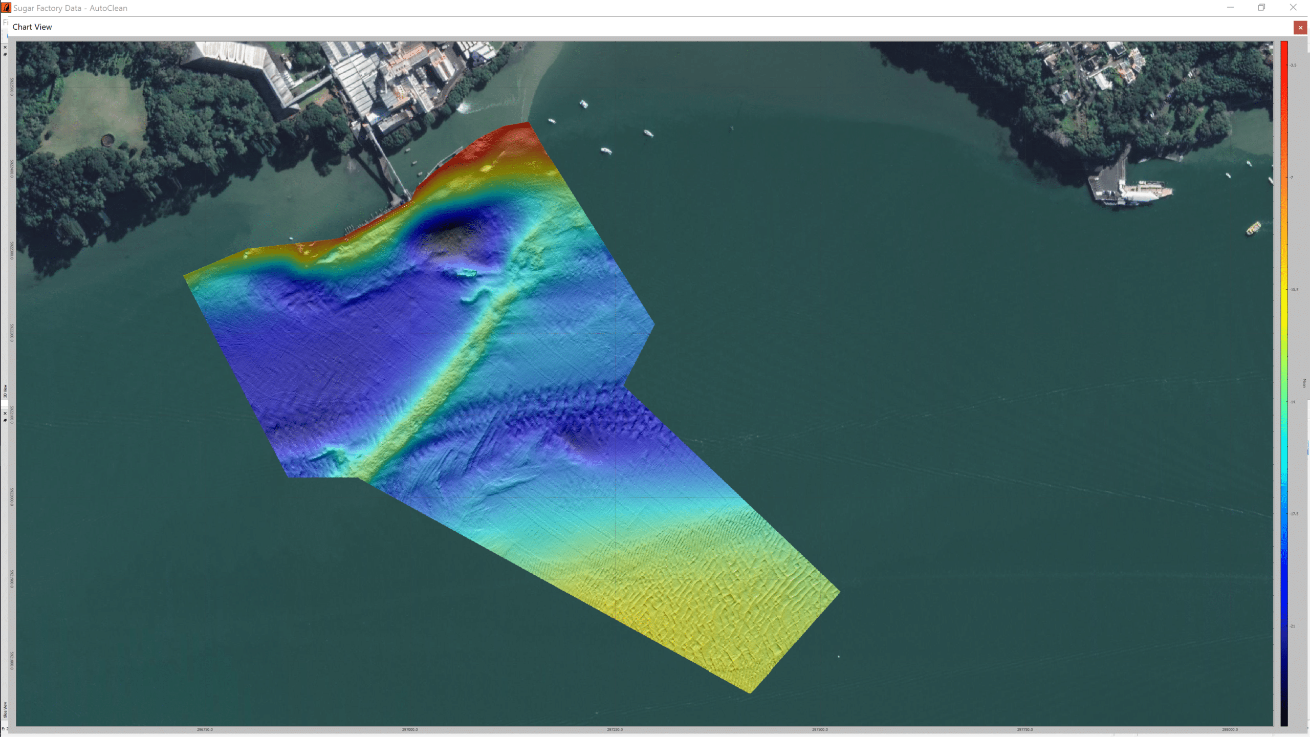
TCarta Delivers Satellite-Derived Bathymetry to NOAA for U.S. Coastal Mapping Pilot
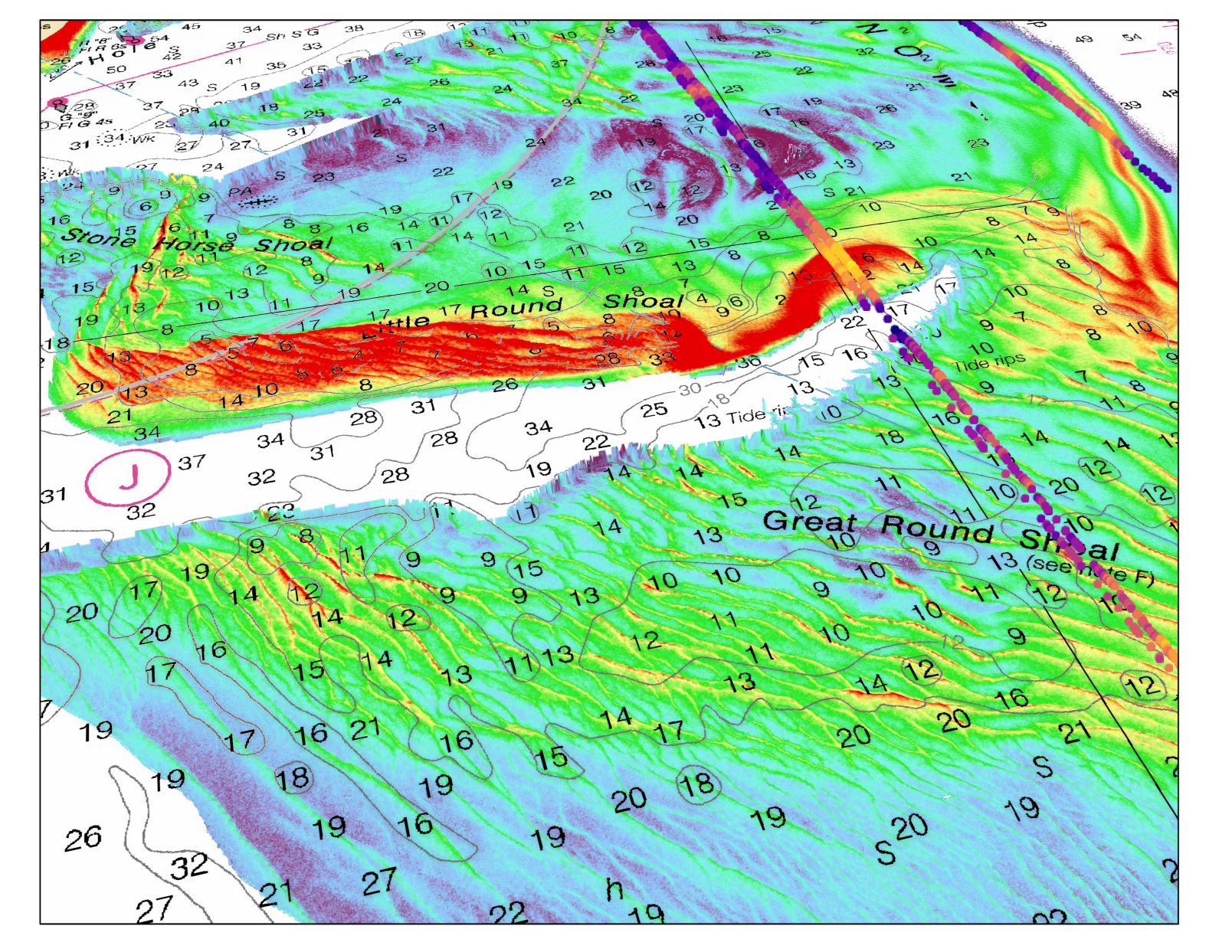
TCarta Marine, a global provider of marine geospatial products, has supplied the National Oceanic and Atmospheric Administration (NOAA) with satellite-derived bathymetry (SDB) validated by green laser altimeter data from the NASA ICESat-2 satellite for two U.S. shallow-water coastal areas.
TCarta was the subcontractor on the prime contract awarded to Woolpert, an international geospatial firm headquartered in Dayton, Ohio.
The NOAA pilot focused on two shallow-water regions that were 3,000 square kilometers in total area - one in the Green Bay area of western Lake Michigan and the other around Cape Cod and Nantucket Sound. Both areas experience natural forces that alter the underwater terrain faster than traditional bathymetric surveys can be completed.
SDB is being considered as a fast and inexpensive alternative for such coastal zones. A primary advantage of SDB is that orbiting satellites can be tasked to collect up-to-date imagery, with bathymetric measurements derived to create end products in a matter of days.
TCarta created products in the two project pilot areas to enable NOAA to test the use of SDB in shallow coastal zones. This provided updated bathymetry and infilled data gaps from traditional bathymetric measurement technologies, such as airborne lidar or marine sonar. The pilot was conducted jointly by NOAA’s Office of Coast Survey and National Geodetic Survey’s Remote Sensing Division. The SDB data sets measured the seafloor to a depth of 20-25 meters, with validation using ICESat-2.
"The integration of ICESat2 bathymetry with satellite imagery derived bathymetry is a powerful combination to increase accuracy," said RDML Shepard Smith, the recently retired Director of NOAA's Office of Coast Survey. "It holds the potential to dramatically improve our ability to monitor change in dynamic coastal waters and allow us to map remote areas for the first time."
“The enhanced SDB product validated with ICESat-2 data created for this pilot results directly from our research under the National Science Foundation SBIR program,” said TCarta President Kyle Goodrich.
In late 2019, TCarta received Phase 2 Small Business Innovation Research (SBIR) grant to commercialize next-generation SDB measurement technologies. ICESat-2 (Ice, Cloud & land Elevation Satellite) space-based laser data was included in the research following the satellite’s launch in 2018.
For more information, please visit: www.tcarta.com

Go-ahead for Marine Technology Cooperation
Federal ministry of economics and energy funds research project for fully autonomous deep-sea applications to protect people and the environment.
The German Federal Ministry for Economic Affairs and Energy is providing 12 million euros as part of the Maritime Research Program for the development of a novel autonomous submersible robotics system that will enable autonomous monitoring of underwater installations in the deep sea with a significantly reduced carbon footprint.
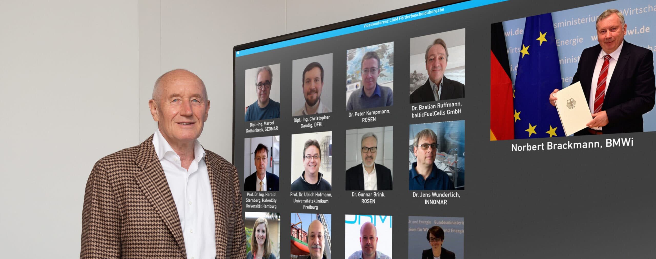
Norbert Brackmann, member of the German Bundestag and the German government's coordinator for the maritime industry, presented the funding decision to the nine participants in the CIAM ("Cooperative Development of a Comprehensive Integrated Autonomous Underwater Monitoring Solution") project during an online event on April 30.
Brackmann commented:
“I am pleased to be able to give the go-ahead today for a new marine technology project that is not only an example of the maritime industry's high innovative strength, but is also characterized by good cooperation between small and large companies, renowned universities and research institutions. As a future and growth industry, the maritime sector is actively shaping the maritime energy transition and investing in research and development. The future CIAM vehicles, which are expected to achieve particularly long mission durations, be deep-sea capable and yet relatively light, will be a step forward for German marine technology. With such innovative technologies for pipeline and submarine cable inspection, we are also strengthening our position on the world market.”
As part of the project unmanned submersible robotic systems with unprecedented autonomy will be developed and build, without the need for costly support vessels. These will monitor underwater assets and infrastructure such as oil and gas pipelines, hydrogen lines, renewable energy power cables, and telecommunications cables, and help prevent damage to these assets.
Governments and businesses worldwide see the oceans as a driver of future economic development with great potential for innovation and economic growth. In this regard, autonomous underwater vehicles (AUVs) are an important component of expected future market developments for a variety of underwater applications.
The CIAM project aims to solve a key problem of unmanned submersible vehicles: namely, that AUVs have so far required large, costly support vessels, in addition to high risks associated with flooding the AUVs and retrieving them from the sea again. To date, in addition to the availability of skilled personnel, the availability of suitable vessels and AUVs has been a challenge, especially in urgent operational and emergency situations. Maritime applications also typically require a global presence. Therefore, flexible systems that can be deployed quickly and flexibly in any weather and sea state are needed, possibly with air cargo capability.
The CIAM approach aims to solve these challenges in a new class of unmanned submersible robotic systems controlled by artificial intelligence. These should be able to achieve particularly long mission durations and ranges, enable fully autonomous coast-to-coast operations, be capable of deep-sea operations and still be relatively light.
Hermann Rosen, President of the ROSEN Group, added:
“The permanently high investments we have made so far in in-line inspection of onshore and offshore pipelines, broad manufacturing capability, system competence and, for some years now, also in our own AUV development, demonstrate our commitment and ambition to become a national champion and world market leader for autonomous underwater applications in this business field as well. In this context, we are very pleased to receive government support, which together with our partners should help us to achieve comparable international competitive conditions.”
In addition to ROSEN, the consortium includes three other renowned universities, two research organizations and three technical experts from Rostock, Schwerin and Karlsruhe as project partners. Dr. Gunnar Brink, Head of Global Market Strategy for Subsea Asset Integrity at the ROSEN Group, coordinates the project consortium and is proud to be part of the team: “Especially in the last weeks and months of project preparation, it was a pleasure for me to see how much the partners in this project have grown together. We know each other. The partners have been carefully selected. Each project partner has the will to contribute to the success of the project with their individual contribution, in order to ultimately establish themselves at the top of the global competition in this business field.”
The Maritime Research Program is part of the maritime research strategy, which provides incentives for research and development to support the German maritime industry in tapping growth potential and strengthening its international competitiveness. In addition, the program serves to support the industry in developing sustainable technologies, in securing and expanding competitiveness, and in identifying climate and environmentally compatible solutions. The special interest lies in the creation and safeguarding of high-quality maritime jobs as well as in the improvement of maritime value creation in Germany.
The ROSEN Group is a leading global service provider for in-line inspections of pipelines. It initiated the CIAM project and will manage it responsibly. ROSEN defines itself as “empowered by technology”, as a company that provides sophisticated services worldwide with application of the latest technologies in harsh environments to protect people and the environment.
This project will advance the inspection of subsea assets, push the boundaries of deep learning applications and certainly reduce the carbon footprint.
For more information, please visit: www.rosen-group.com
WASSP and SBG Systems to partner for WASSP’s new version of its world’s most cost-effective multibeam sonar
New WASSP S3r Multibeam Sonar
The new WASSP S3r is one of the world’s most cost-effective, professional survey and mapping multibeam sounder solutions. It combines data from a multibeam sounder transducer with 224 beams covering 120° degrees swath port-to-starboard along with position, heading, and motion to create an accurate bathymetric map of underwater features for various survey situations and environmental conditions. WASSP S3r is able to survey area up to 10 times faster than a single-beam sounder.
With the very high requirements hydrographic surveying has for accuracy, WASSP needed a solution for RTK + INS that could allow the sounder to create accurately positioned 3D bathymetric representations of the seafloor, down to centimeter accuracy with minimal passes. This demand combined with the complexities of tide, and boat movement mean that in order to get usable position and motion data, a dual antenna system was required. The company made multiple test scenarios from which the SBG Ellipse-D inertial navigation system came out as the best choice based on accuracy of consecutive test mapping.
“We required a cost-effective and high-precision position and motion solution. It needed to be able to combine with our WASSP multibeam technology so we could meet the high level of accuracy our customers expect” explains Bart Slingerland, Product Owner at WASSP.
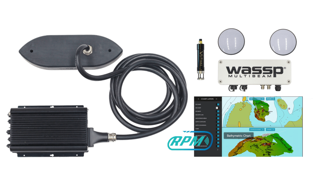
WASSP has also incorporated the Ellipse-D into its S3Pr portable survey package where size, weight, and cost were also key factors in the final solution. The SBG Ellipse-D was able to fit into a covered housing that allows quick setup on small vessels and interface with the WASSP DRX processing unit and CDX software.
Ellipse-D, The Smallest RTK INS on the Market
The new Ellipse-D has been launched in June 2020. This miniature Inertial Navigation System (INS) provides RTK position, 0.05° attitude, and dual antenna heading. It also outputs a 5cm heave, that adjusts automatically to the wave period. This sensor is designed to be easily integrated into marine projects thanks to compatibility with numerous industry standards (TSS1, PASHR, INDYN protocols). Ellipse is the smallest heave sensor at this level of performance, and the OEM version allows the tightest integrations. “We are very proud to be part of WASSP S3r and S3Pr. WASSP innovative solutions makes multibeam sonar technology available to the largest professionals” to conclude Thibault Bonnevie, CEO of SBG Systems.
For more information, please visit: www.sbg-systems.com

Chelsea Technologies Announces Research Partnership with Ground-Breaking Transatlantic Research Project ‘Mayflower’
Chelsea have been selected as a research partner to an international effort led by marine research organization Promare and will deploy a ground-breaking next generation multi-parameter algae sensor aboard the unmanned Mayflower Autonomous Ship when it embarks on its historic transatlantic voyage from Plymouth, UK, to Plymouth, Massachusetts in May.
The 15-meter vessel is designed to provide scientists with a flexible and cost-effective platform for collecting critical data about the health of the ocean and further the technological development of marine autonomous systems. The AI navigation suite has been trained to recognise other marine traffic and obstructions using over 1 million real-life training images.
Joining a global consortium of partners including the lead technology and science partner IBM, Chelsea will be collecting multi-parameter fluorescence measurements from the vessel throughout the hazardous ocean crossing.
The 6-channel sensor, which is not currently available for general release, will continuously measure 4 algal pigments under test conditions, with 2 environmental fluorescence corrections integrated within a single, compact sensor housing. The data collected is expected to provide new insights into primary productivity and ocean health in the North Atlantic.
The probe will be mounted on board the autonomous vessel and will operate via a specially designed flow chamber. The sensor will be operated continuously throughout the voyage, providing valuable data on primary productivity and phytoplankton health.
Metrics gathered on the voyage will help the Chelsea development team evaluate the sonde for general manufacture. Once the technology is assessed, the sensor has the potential to provide significant new capabilities to many service applications. In addition to algae, the multi-parameter sonde may be available in hydrocarbon and tryptophan-like fluorescence variants.
Why measure multiple algal pigments?
Different algal species have different induction spectra depending on their specific pigment composition.
The Chelsea payload will measure 4 different wavelengths, designed to excite different algal pigments. This allows many different types of photosynthesizing organisms to be detected, including red algae, diatoms and cyanobacteria. Studying the relative concentrations of each pigment can provide information on the amount and type of species present within the algal community.
For more information, please visit: www.chelsea.co.uk
AMSSI - Agora for Maritime and Submarine Sustainable Innovations
Alcatel Submarine Networks, iXblue and SeaOwl announce they are joining forces to develop partnerships around innovative technologies dedicated to environmental protection underwater.
Following several months of fruitful discussions and dialogue, several French players have announced the creation of the AMSSI (Agora for Maritime & Submarine Sustainable Innovations):
- Alcatel Submarine Networks (ASN) - world leader in the procurement of submarine telecommunication cable systems
- iXblue - global high-tech company recognized worldwide for its advanced technologies in the fields of maritime autonomy, inertial navigation, subsea positioning and subsea imagery
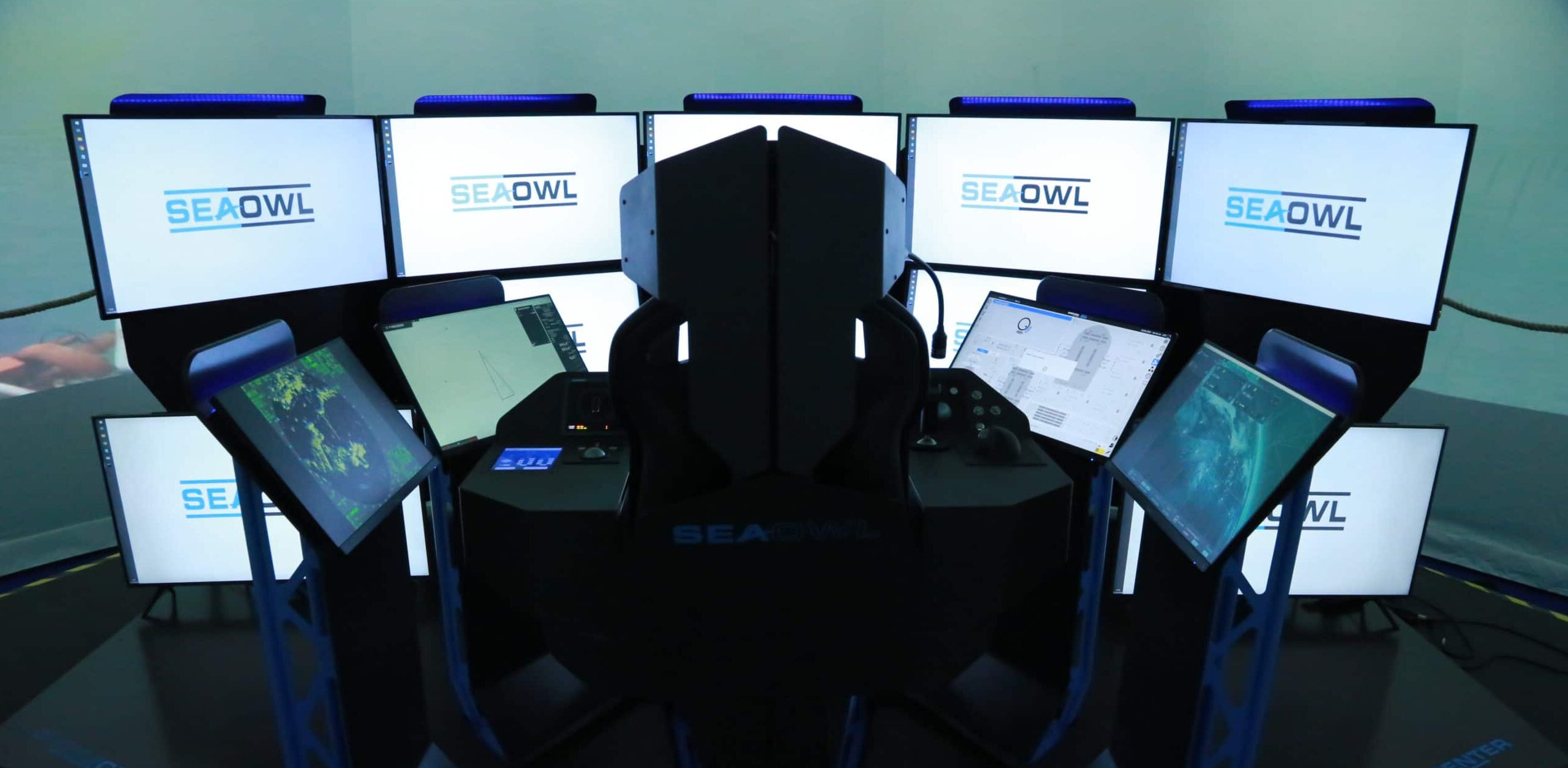
- SeaOwl - international maritime services operator, pioneer in the implementation of drone-based maritime services
These 3 companies are today the core of AMSSI; new French and European members will shortly join them to accelerate the emergence of new innovative projects.
Innovation, R&D and industrial projects
This partnership aims to be a French innovation cluster where members share a desire to combine their know-how and technologies with the objective of bringing to life concrete and innovative industrial projects in the maritime and underwater fields, as well as in the fight against climate change. AMSSI will promote R&D, innovation and French know-how.
AMSSI has a proactive approach towards the concretisation and implementation of the various technologies developed through its members' R&D programmes, leading to the industrial deployment of its projects.
An ecosystem and concrete projects
By combining the expertise of its members, AMSSI will continue to develop an ecosystem cap
able of meeting major technological challenges and building an effective and relevant community for maritime technologies and services.
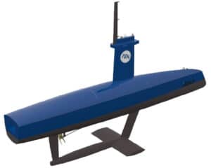
Among the developments involving the most advanced technologies of its partners, member companies are already working on an innovative project: the development of a remotely operated hydrographic surface vessel, i.e. a drone capable of carrying out long-distance survey missions.
Other projects related to climate change and marine digitalisation are also being studied.
For more information, please visit: www.asn.com
Teledyne Webb Research Incorporates JASCO-made OceanObservers on Slocum Gliders
Teledyne Marine is pleased to announce the availability of the JASCO-made OceanObserver™ system on Teledyne Webb Research’s Slocum Glider Autonomous Vehicles. This latest addition to the Slocum Glider sensor suite adds key capabilities to the already versatile Slocum Glider platform.
OceanObserver™ is an intelligent passive-acoustic, multi-sensor system capable of in-situ, near-real-time underwater sound detection and measurements. The Observer records the underwater sounds and detects marine mammal calls from species of interest, quantifies ambient and anthropogenic noise, and derives other information of interest. Acoustic detections and measurements are sent to stakeholders in near-real-time.
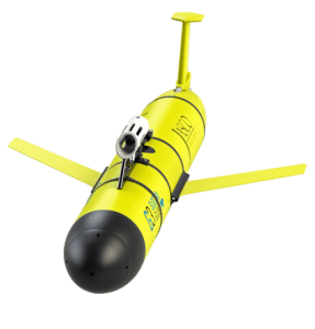
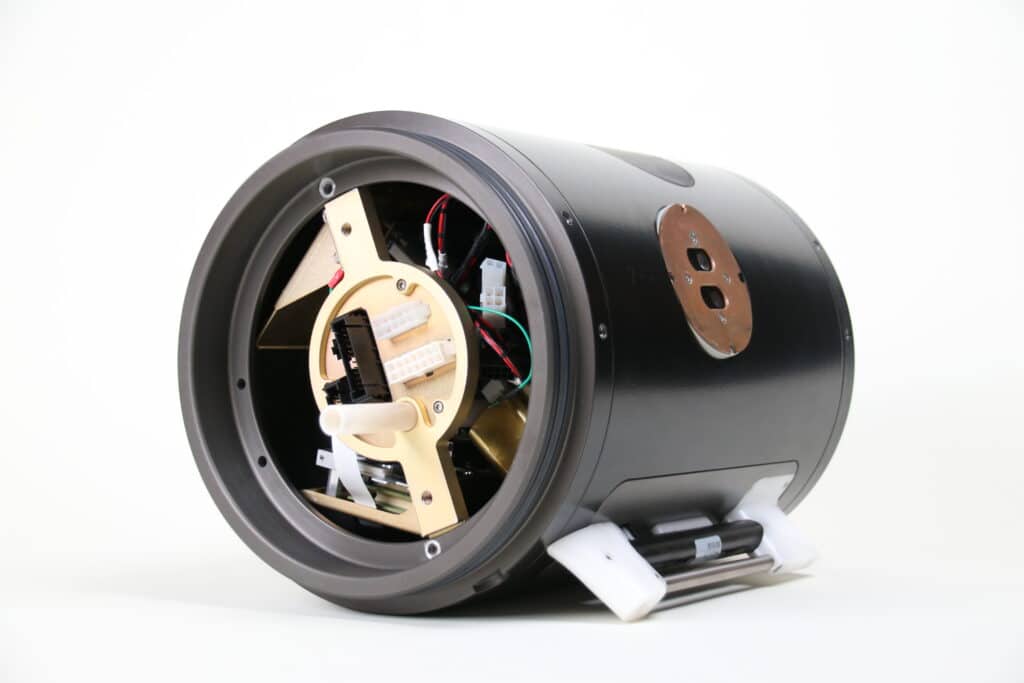
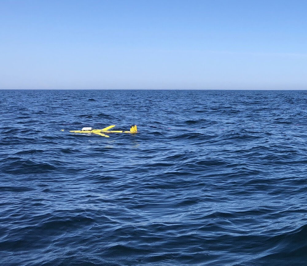
Slocum Gliders outfitted with OceanObservers and CTDs can also provide in-situ measurements of sound velocity profiles and ambient noise. Together, CTD and ambient measurements improve sonar sensor performance prediction and vulnerability assessment. The combined system is capable of monitoring in any sea state over extended periods of time.
Recent sales include universities and navies. OceanObservers are being used by academics to support marine mammal science and mitigation measures, autonomous vehicle navigation research and the development of new detection, classification and localization techniques. Naval customers are using Slocum’s for marine mammal mitigation and measuring Sound Velocity Profiles & ambient noise variability over long deployment periods. Ocean ambient noise is affected by weather, waves, and shipping traffic.
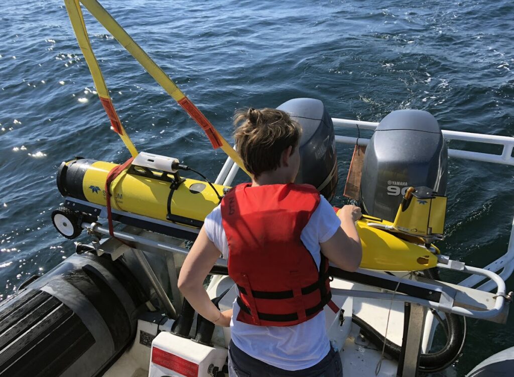
The Slocum glider is buoyancy driven to enable long range and duration remote water column observation for academic, military, and commercial applications. The Slocum Glider can be deployed and recovered from any size vessel with minimal time on station. Once the Slocum glider is deployed, it can easily be controlled from anywhere in the world through the use of web based piloting tools. This allows fleets of gliders to be operated remotely with minimal personnel and infrastructure.
Slocum gliders are modular, allowing for rapid sensor reconfiguration to respond to emergency conditions or situations. Over 40 sensors and other options are available to address a wide variety of ocean conditions and sampling requirements.
For more information, please visit: www.teledynemarine.com

New Business Development Manager joins Swathe Services
Swathe Services are very pleased to announce the appointment of Kerry Beckwith as their new Business Development Manager.
After achieving a BSc in Hydrography at the University of Plymouth, Kerry spent 15 years working offshore on a wide range of projects and seagoing vessels gaining extensive operational experience. She then returned to the UK as a Training Centre Manager/Technical Author, providing support for some of the latest marine systems and processes.
Tasked with contacting new and existing companies to introduce the integrated support solutions offered by Swathe Services, Kerry plans to drive the business forward to greater heights. Swathe Services’ flexible approach means they deliver the right solution to their customers needs, first time, every time.
With a keen interest in technology, Kerry is eager to see how the new autonomy and Artificial Intelligence (AI) processes coming to the market will affect the role of surveying. Kerry will also provide advice and consultancy to Swathe Services’ sister company, Unmanned Survey Solutions. Their vision is to become a leading supplier of innovative systems combining unmanned, air, surface and underwater technologies for seamless integration and operation.
Kerry says “I have received such a warm welcome in my first week from the team and I am very much looking forward to the exciting opportunities presented by working within the Swathe Group.”
For more information, please visit: www.swathe-services.com
Dynautics goes the extra mile for Chinese market
Dynautics is a pioneering provider of intelligent technology for unmanned marine missions worldwide. We have had a strong distribution partnership with the Beijing Oceaneco Technology Company (BOT) for over 10 years now, providing our AUV Sim simulation solutions for their customers in the uncrewed underwater vehicle (UUV) research and development sector.
Here we examine some of the factors that have contributed to this successful, long-term partnership.
Complex design challenges
Researchers and developers in the academic and commercial markets require effective simulation tools that aid the complex task of designing an uncrewed underwater vehicle (UUV). The Dynautics AUV Sim is a proven simulation software suite that enables designers to overcome power budget management challenges, maximise endurance, provide accurate guidance and make the right propulsion design decisions as well as ensure efficient payload transportation for their UUV designs.
When design iterations can be modelled, tested and modified without the safety risk and expense of scale or full-size models and test tanks, the development cycle is shortened and the road to achieving a commercially viable and successful solution becomes safer, faster and more cost-effective. In 2019 this was clearly demonstrated on a Phantom AUV project where AUV Sim was used to deliver several AUVs to the US Navy in record time – just 100 days from order to delivery.
Flexible marketing & training solutions
To support BOT with their own sales process, we adapted one of our promotional videos to replace the English subtitles with Chinese, enabling BOT to reach their target customers with a clear value message. This localised content initiative secured a rise in sales/enquiries of around 200% for BOT.
BOT General Manager, Dr Alan Zhang commented: “Our customers really engaged with the simulation software video. When the dialogue was translated, they could fully understand the value of the simulation tool. It has really opened up the market for us.”
Remote training and online walk-through sessions have also played an important role in securing sustained business in the sector for BOT. Simulation software can be exceptionally difficult to master, due to the complexities of simulation itself. To further support BOT, the UK-based Dynautics team provides regular, live, online training sessions for their customers to familiarise them with the functionality and kick start the design process. The same training also supports BOT’s sales managers in their own conversations with customers and new prospects.
Software & hardware support
BOT customers have also recently purchased several AUV Simbox products. The AUV Simbox enhances the functionality of the software only AUV Sim solution by including the hardware elements, in this case the Underwater MicroSPECTRE and interface units. This gives the AUV developer everything they need to create both a virtual and actual environment to test and trial their designs.

Dynautics AUV Simbox
AUV Simbox has proved to be an enormously powerful and practical tool. The kit, which contains the simulator software, a SPECTRE autopilot module, RCW front-end Remote Control Workstation (RCW) software, a GENIE analogue and digital interface as well as power supplies and cables, saves time by enabling the testing of the MicroSPECTRE firmware before it is installed in a real prototype.
Dr Zhang explained, “The AUV Simbox has everything our clients need, conveniently packaged in a robust carry case. It has helped our customers to achieve a dramatic reduction in development time, and I can’t emphasize enough how important that is in terms of reaching a successful mission conclusion. Access to water tanks or lakes is expensive, so if the design can be tested and adapted via simulations prior to water trials then that represents a real saving of resources”.
Dynautics firmly believes in the power of logic, precision and scientific integrity to deliver strong commercial results. Our hands-on approach and focus on our clients’ needs first and foremost ensures that we develop fit-for-purpose solutions that meet the demands of our customer, and subsequently their clients. Dynautics is a trusted technology partner to clients across the maritime sector, including offshore energy, mining, oceanography, marine transport and defence and security.
For more information on their range of simulation solutions, please visit: https://www.dynautics.com/products-unmanned-surface-vehicle/marine-simulators/
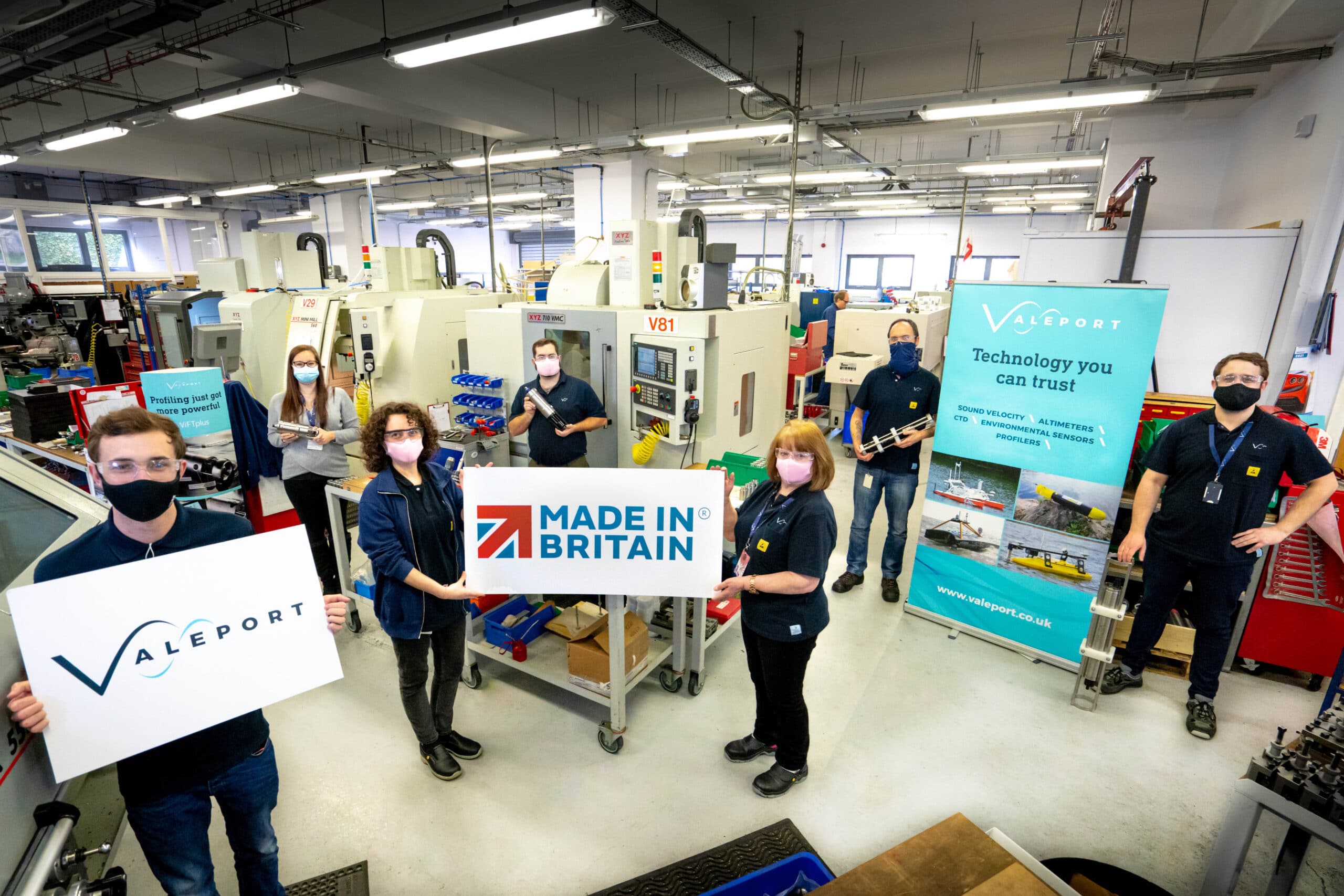
Marine tech firm achieves Made In Britain status
Valeport, a global leader in underwater measuring equipment, has achieved the internationally recognised Made In Britain accreditation for its range of innovative marine solutions that are developed, designed and manufactured at its UK headquarters in Totnes, Devon.
The independent, family-owned business, which employees more than 90 people from state-of-the art facilities on the River Dart, designs and supplies precision sensors and probes to a worldwide customer base that includes: environmental, energy, construction, dredging, engineering, scientific research and military sectors.
The Made In Britain accolade is part of an initiative to support and promote British manufacturing. Valeport will now use the Made in Britain registered mark of quality on their products, the mark is recognised as the ultimate stamp of British provenance and seen as an international seal of excellence domestically and worldwide.
Matt Quartley, Valeport managing director commented: “The Made In Britain status promotes our passion for British manufacturing, our commitment to quality and maintaining production here in the UK. We also believe it highlights the quality of our products and expertise gained from over 50 years of British manufacturing expertise.”
Valeport retains all aspects of developing and manufacturing processes in-house, an approach which means they have total control over every stage of the manufacturing process and can guarantee the quality and consistency of their products. The company’s riverside premises house all the facilities for designing, CNC machining, environmental testing, assembly, calibration and servicing for all Valeport products. With a global network of 72 distributors in over 54 countries, Valeport exports almost 80% of its outputs.
Valeport joins a select group of manufacturers who are permitted to use the Made In Britain status and coveted quality mark.
For more information on Valeport visit: www.valeport.co.uk
Water powered Sabertooth cuts CO2
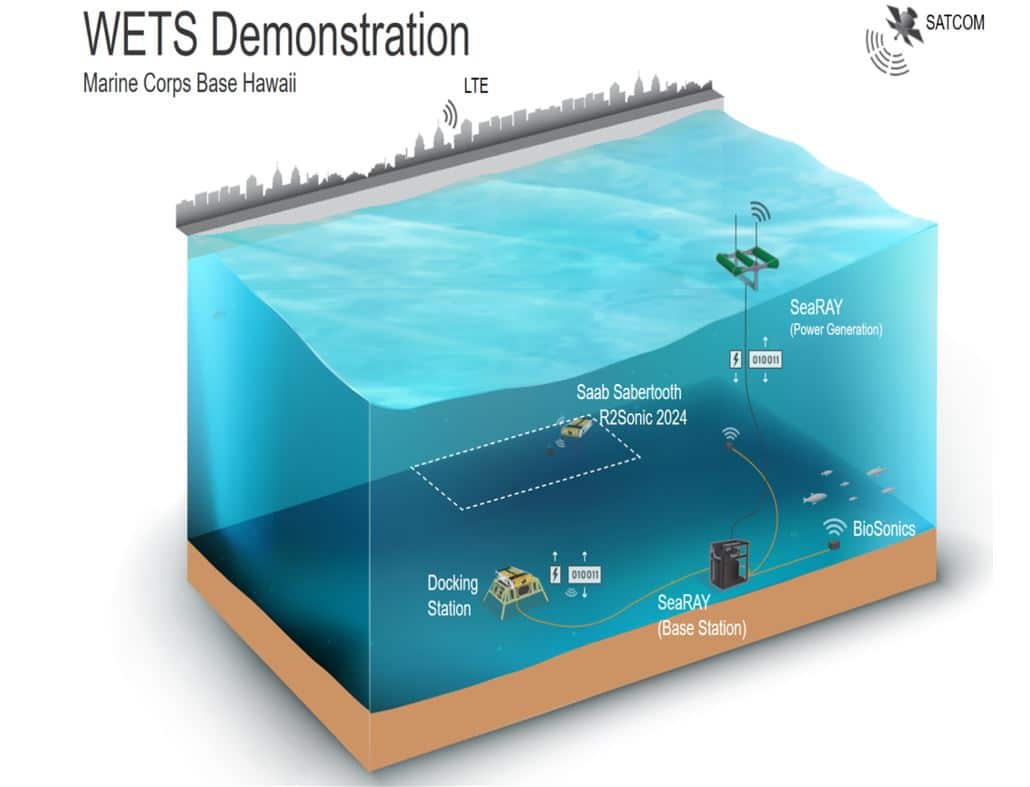
Converted energy from waves powering a Saab Seaeye Sabertooth autonomous vehicle operating in seabed residency mode is a major renewable energy breakthrough.
Significant savings in support vessel costs and CO2 emissions will result.
Pioneering the concept is C-Power’s SeaRAY Autonomous Offshore Power System (AOPS), which provides offshore power, energy storage, and real-time data communications for resident marine systems.
Trials of the Sabertooth residency concept will take place at the U.S. Navy’s Wave Energy Test Site (WETS) in Hawaii and last 20 days. The SeaRAY AOPS and other static assets will remain deployed for six months.
The Sabertooth, owned by Hibbard Inshore, and operated on behalf of C-Power, will repeatedly patrol pre-programmed areas to collect data, before returning to an underwater docking station for cloud upload and battery recharge.
Included in the studies will be seabed analysis, fish densities, infrastructure monitoring and water-column data gathering.
Many sectors will benefit
Many underwater sectors are seen to benefit from this innovative emission-free concept, including marine science and research, defence and security, aquaculture, and offshore energy.
The trials come in partnership with the U.S. Department of Energy’s Water Power Technologies Office, together with the National Renewable Energy Laboratory and the U.S. Navy.
In particular, testing of the SeaRAY AOPS is included in the Navy’s Coastal Trident 2021 program, which is the largest port and maritime security undertaking in the nation.
For the Navy, the conventional difficulty in conducting underwater infrastructure surveys leaves critical infrastructure vulnerable to sabotage and intelligence gathering threats in this hidden environment. Frequently refreshed high-definition sensor data can alert remote operators to possible intruder activity.
Operating the Sabertooth will demonstrate that subsea residence enables a sustained presence to secure underwater port infrastructure and its ability to support efforts to protect shipping against underwater explosive devices.
For the trials, the Sabertooth will be equipped with an R2Sonic Sonic 2024 multibeam echosounder, 2G Robotics ULS-500 PRO Laser Scanner and camera, and the ASL AZFP 70,120 & 200 kHz Acoustic Zooplankton Fish Profiler.
Uniquely Hovering
The success of the multi-role, 3000m rated Saab Seaeye Sabertooth comes from it being the world’s only roaming and hovering system that can operate in both fully autonomous (AUV) and tethered (ROV) modes, enabling fully flexible dual operations from a single platform.
Hibbard will deploy the Sabertooth for other significant projects this year including research at Lake Michigan by the National Oceanic and Atmospheric Administration (NOAA) concerning the invasive zebra mussel that adversely impacts the U.S. Great Lakes Region at a cost of $500million a year.
For more information, please visit: www.saabseaeye.com