FET to supply work-class ROV to UK Ministry of Defence
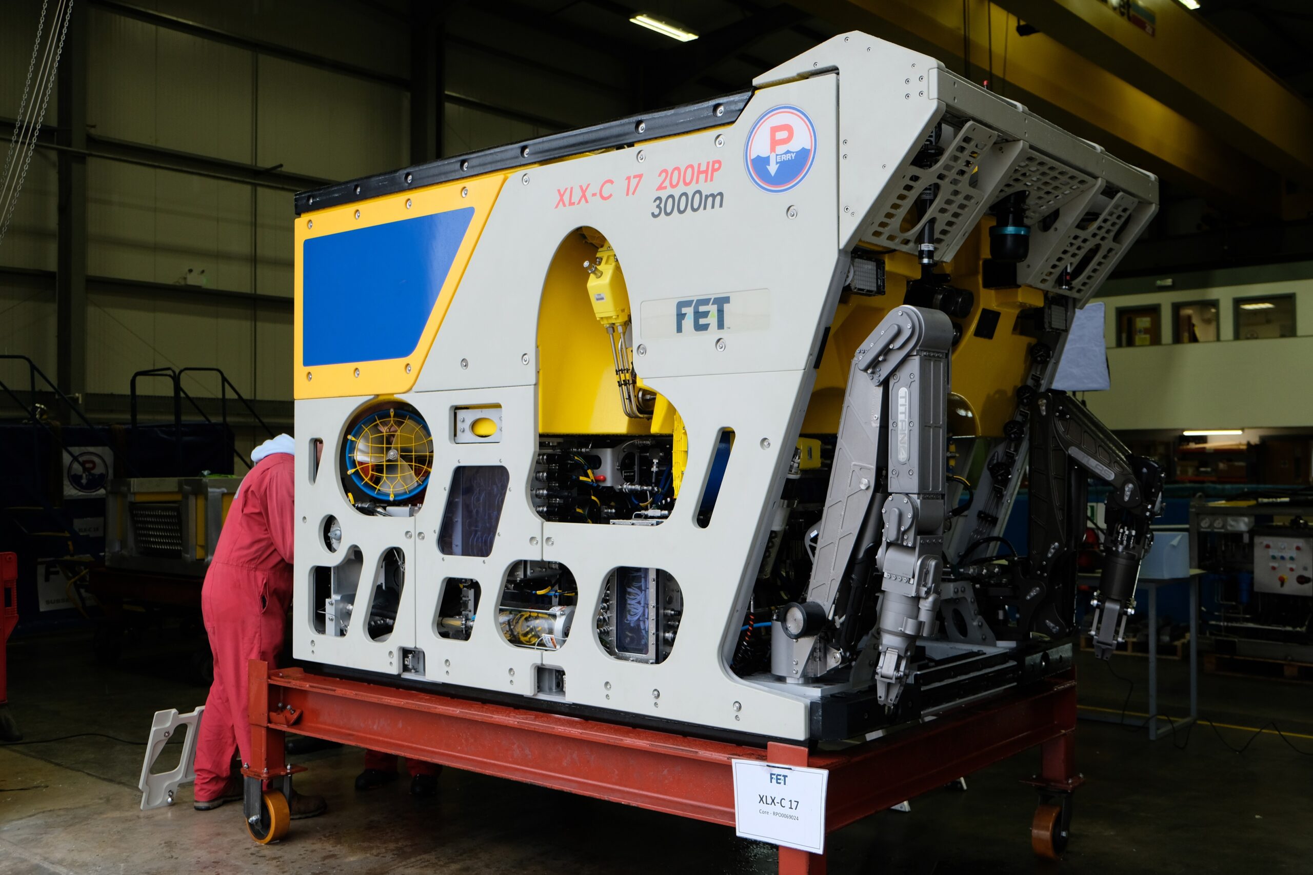
The subsea product line of Forum Energy Technologies has secured a contract from the UK Ministry of Defence Salvage and Marine Operations (SALMO) team to supply a work class remotely operated vehicle (ROV).
The system has been acquired by SALMO following an Urgent Capability Requirement (UCR) from its customer, which was announced in May. The ROV will complement and increase the existing UK Defence salvage capabilities managed by SALMO and will be used to support salvage and wreck surveys.
The XLX-C Work class ROV was manufactured at FET’s UK facility at Kirkbymoorside, North Yorkshire, and will be delivered this year.
The contract includes a two-year support solution, warranty and spares package, vessel integration and sea trials support, a training package and the potential for upgrades and additions.
Kevin Taylor, FET’s Vice President Operations - Subsea, said: “We are extremely pleased that our XLX-C ROV has been chosen to support the SALMO team’s customer. The ROV is one of the most versatile models on the market and has the capabilities required for the tasks that it will undertake for the SALMO team. We look forward to delivering the system on time later this year.”
Kristin Pearson, SALMO Project Manager, said: “A momentous amount of work has gone into preparing what has been a complex contract in a very short time. The project team have pulled together and demonstrated a holistic and agile route to procurement. It was a great feeling to sign the contract and move us into the next stage”.
FET has previously supplied ROVs and submarine rescue vehicles to major Asian navies and built emergency life support store (ELSS) pods for the Hellenic Navy. Its products are suited across the underwater industry applications, including in defence, traditional and sustainable energy, telecommunications, mining, aquaculture and academia.

Miros expands ocean insights offering to offshore sectors
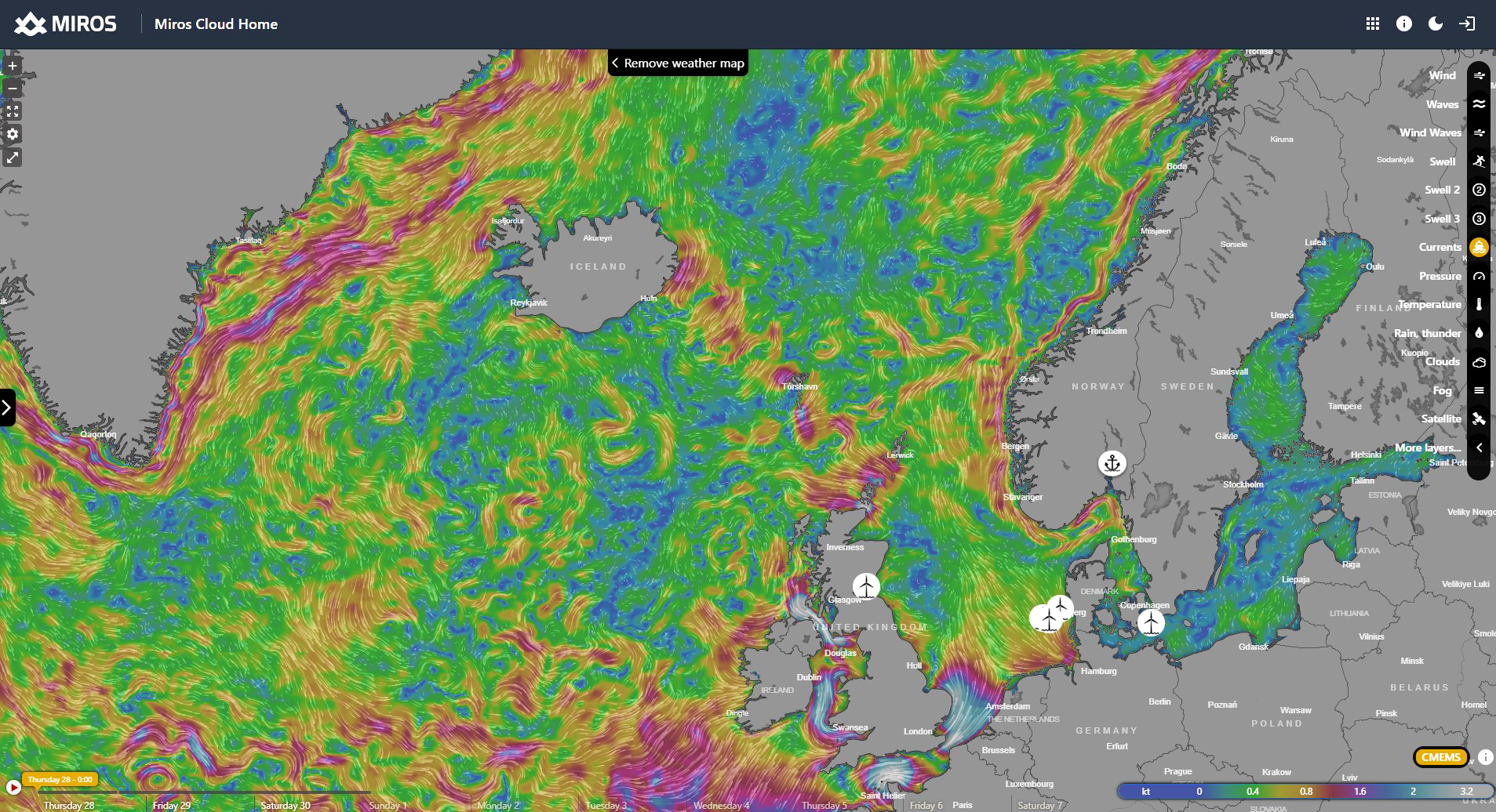
Global ocean insights specialist Miros has advanced its offering to the maritime sector by integrating weather forecast layers into its Miros Cloud Home solution (miros.app).
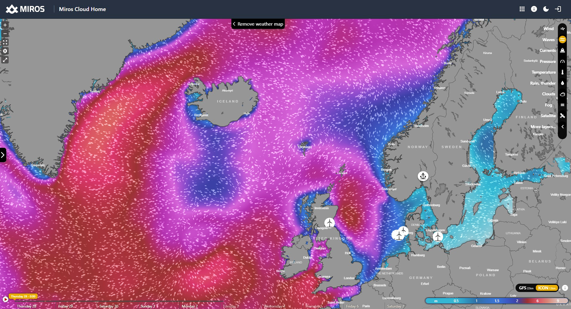
The new version of Miros Cloud Home incorporates popular weather forecasting conditions from Windy with its proprietary accurate real-time wave, current, and weather measurements - bridging the gap between actual measurements and weather projections. The innovative solution offers maritime professionals access to an extensive range of forecast map layers visually animated on a global scale to customise their user experience and receive valuable insights into current and future weather conditions.
Weather conditions significantly impact the daily operations at sea and maintenance of the offshore equipment. By integrating forecast data with real-time measurements in one single application, maritime professionals can make decisions based on a holistic understanding of the situation without switching between many applications. This results in the optimisation of offshore activities, increased safety, and an improvement in project efficiency.
The platform provides 17 interactive map layers that allow users to visualise factors such as wind, waves, and currents, utilising various forecast models. Using an interactive menu, users can access short-term or long-term predictions up to 10 days of future conditions to explore how these are likely to evolve.
Aurelia Paraschiv, Miros’ IoT product manager, said: “The update to our offering in Miros Cloud Home supports daily offshore operations because it empowers users not only to plan ahead based on forecast predictions but also to make timely decisions by staying informed with the real-time sea state and weather conditions. With both datasets now under one umbrella, decision-makers are instantly granted a holistic view of offshore conditions.
“This synergy to weather visualisation data ensures that planning for activities can be conducted safely and efficiently, facilitating a reduction in maintenance time and cancelled trips.”
Miros is continuing to support operators by developing increasingly sophisticated technologies that navigate challenges, optimise operations, and prioritise safety in the offshore environment.
The Miros Cloud Home provides decision-makers across offshore operations, offshore wind, oil and gas, ports, and coastal and shipping sectors with powerful and intuitive applications to make informed decisions and revolutionise how people interact with wave and weather information.
Marine robot fleets set to revolutionise ocean exploration
A fleet of marine robots that can tackle complex offshore tasks, part of a recently completed, groundbreaking project funded by Innovate UK, is poised to change approaches to ocean exploration.
Autonomous marine systems are being developed and deployed in increasing numbers. However, as maritime operations become ever more complex and expensive, and installed energy infrastructure increases in scale and distance from shore, there is a rapidly emerging need for more sophisticated multi-platform capabilities.
Squads of Adaptive Robots (SoAR), a 2-year collaborative research and development initiative was led by the developer of ecoSUB AUVs, Planet Ocean. The project kicked off in September 2021 and culminated this summer with full system testing at Smart Sound Plymouth on England’s south coast.
The SoAR team’s aim was to demonstrate how large-scale survey and exploration missions can be achieved by going beyond the limitations of individual AUVs. Industry partners Planet Ocean, Sonardyne International and HydroSurv worked alongside the National Oceanography Centre (NOC), Royal Holloway University and the Offshore Renewable Energy (ORE) Catapult to develop advanced AI-driven mission planning, communications protocols for fleet coordination and significant improvements in underwater navigation and communications technology.
Open-water trials successfully showcased co-ordinated missions designed, monitored and adapted in real-time by an intelligent “Autonomy Engine”. The trials involving several surface and underwater autonomous systems, with mission management conducted from a remote shore-based command and control facility. The trials simulated an offshore windfarm concession survey mission informed by a comprehensive business case analysis by the team at ORE Catapult.
SoAR has led to the introduction of several technological innovations, including advanced AI-driven mission planning, open-source communications protocols for heterogenous fleet coordination and a range of new and enhanced platform capabilities for both surface and sub-surface systems. The variety of small form factor robotic platforms involved in the project represented some of the best innovation in UK ocean robotics to date.
The SoAR concept is adaptable to various applications but strategically tailored to address the specific needs of the offshore wind sector, developing an approach that will offer new operating paradigms and substantial long term cost savings for offshore asset construction and maintenance compared to conventional methods.
The Technology
The fleet-level autonomy engine developed by Royal Holloway, University of London serves as the mission’s central nervous system, making real-time decisions and replanning when necessary due to factors such as inaccurate mission execution, vehicle faults, changing in the operating environment, or the addition and removal of stations. The division of labour enabled by this approach showed significant promise in productivity gains made possible by robotics and AI.
The SoAR Communications Backbone, developed and released by the team at the NOC addresses the absence of standardised interfaces and communication protocols. It acts as a central messaging system which enables interoperability between the fleet-level autonomy engine, each vehicle-specific command and control system, and any other sub-system requiring bi-directional communication. This is key to allowing the seamless introduction of different platforms and sub-systems in diverse combinations to suit a wide range of mission objectives.
For the trial, Sonardyne provided inter-medium communications via its AvTrak 6 Nano acoustic transceivers fitted to each AUV. This enabled simultaneous USBL tracking via a surface vessel and robust telemetry for AUV-to-vessel and AUV-to-AVU communications.
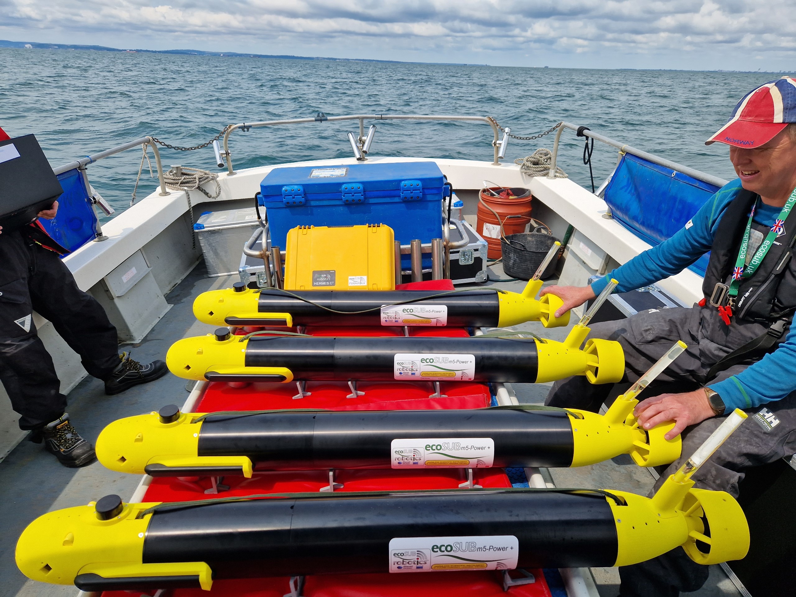
ecoSUB AUVs represent a significant advancement in affordable and versatile ocean science robotics. Equipped with the capability to deploy a wide range of advanced sensors including high-quality side scan sonar systems, DVL, acoustic communications and a range of science payloads, these budget-friendly AUVs cross various sectors and application use cases. A small swarm of four ecoSUB AUVs, each fitted with a Sonardyne AvTrak 6 Nano acoustic transceiver, played a crucial role in rapidly assessing the underwater environment and conducting preliminary evaluations to identify targets of interest.
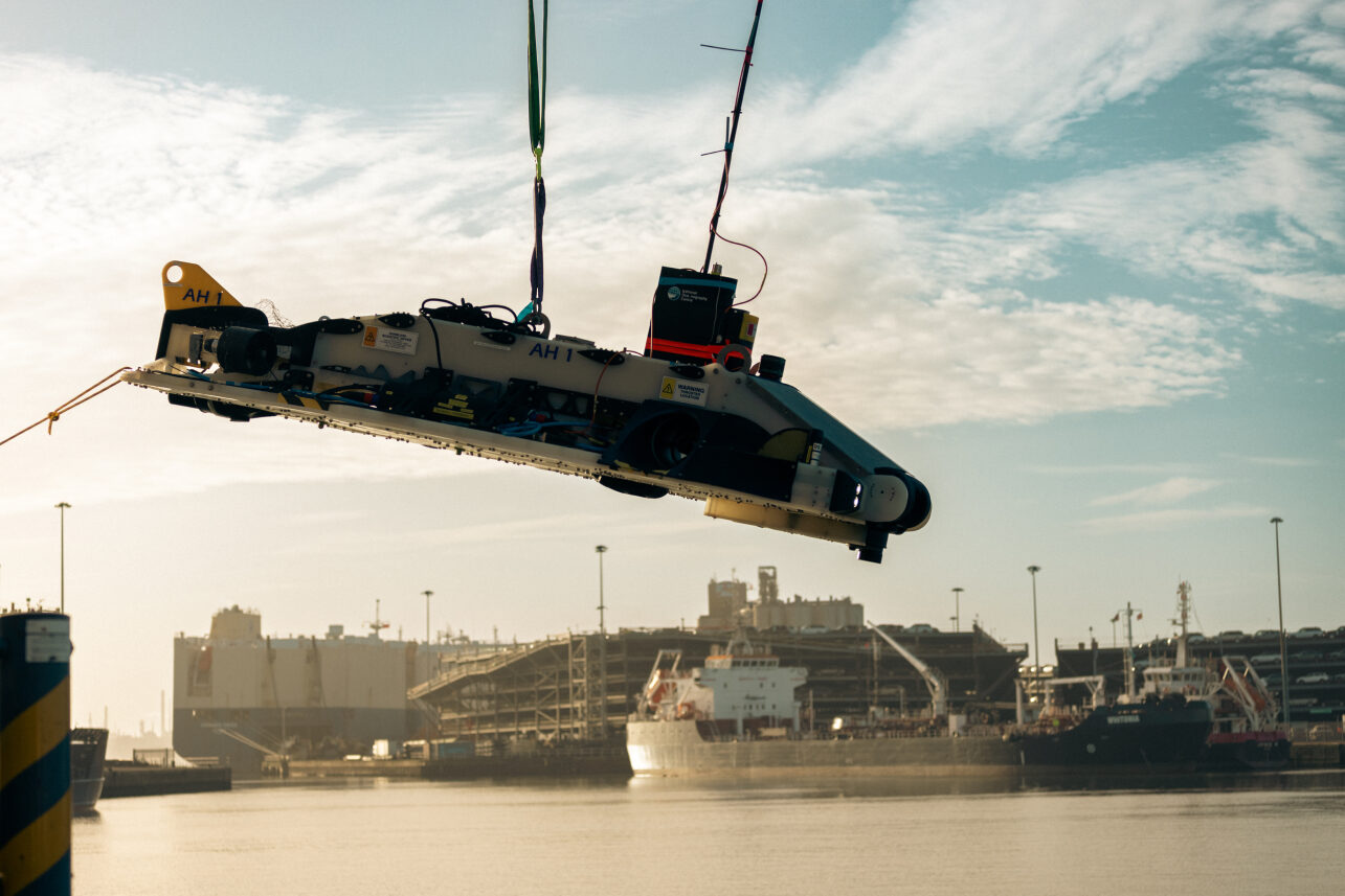
Auto-Hover 1 (AH1), owned and operated by NOC, represents the state-of-the art in hover-capable AUV platforms. Equipped with six thrusters, AH1 is capable of exceptional precision in maintaining station and navigating vertically within the water column. With advanced sensing capabilities, and also fitted with an AvTrak transceiver, AH1 was dedicated to close inspection tasks, enabling intricate and comprehensive examination of identified targets.
HydroSurv’s innovative long-endurance USV, the REAV-60 was purpose designed and built for operations Beyond Visual Line of Sight (BVLoS). Central to its use case is versatility across a wide array of offshore survey and inspection needs, whilst aligning with incoming regulatory requirements.
Sonardyne’s REAV-60 USV ‘Decibel’ assumed a pivotal role, serving as a crucial communications gateway to the AUV swarm. It was fitted with an HPT 3000 transceiver, and running their well-established Ranger-2 software on its topside facilitating inter-medium communication and providing navigation support to the AUVs. Decibel was also equipped with various communications devices including 4G/LTE and Iridium satellite communication systems to enable communications between subsea, surface and the Autonomy Engine.
The deployed SoAR fleet was managed and control from HydroSurv’s shore-based Remote Operations Centre in Exeter, using 4G/LTE and Iridium communications.
Job Advert: EIVA hiring for Technical Sales / Business Development Manager
Do you have experience selling software solutions for the offshore and shallow water engineering and survey industries? If yes, you may be one of the team members EIVA is looking for to help continue growing its activities worldwide as part of the sales and business development team!
You will be joining EIVA’s international network of locations, and the position will not require being based at EIVA headquarters in Denmark. Consequently, EIVA welcomes applications from candidates based in the UK, Germany, Denmark, Romania or Singapore.
Duties and responsibilities
As technical sales manager you will be focusing on:
- Achieving sales order intake by taking over on and fostering a mix of existing accounts and new sales territory
- Responding to RFP and tenders
- Developing and executing sales plans within your assigned area of responsibility in collaboration with the relevant stakeholders in EIVA, subject to sales and KPI targets
- Contributing to the production of information on EIVA’s products (news items, case studies, website pages, videos, etc)
- Representing EIVA at exhibitions, conferences and other events
The ideal candidate…
- Understands solutions in the industry – for example through a degree in engineering or equivalent work experience
- Has a strong sales track record from positions with other players in the industry
- Has a commercial, growth-oriented focus and a hunger to chase and close new business, through a passion for tasks related to the sale and promotion of technical products
- Has an established network in the industry
Job Advert: UK Hydrographic Office (UKHO) hiring for Hydrographic Survey Delivery Manager
Hydrographic Survey Delivery Manager
Location: Taunton, South West
Salary: £52,645 pa
A Recruitment and Retention Allowance (RRA) of £7,000 per annum is included in the figure above.
Hours: Full time, flexible working
Contract: Permanent
If you offer experience as a hydrographic surveyor and want to develop your skills and continue your professional development, this is an exciting opportunity to play a key role in the Bathymetric Team at the UK Hydrographic Office.
About the UK Hydrographic Office (UKHO)
The UKHO are a world-leading centre for hydrography, specialising in marine geospatial data to support safe, secure and thriving oceans. It fulfils the UK government’s Safety of Life at Sea obligations and is relied upon by defence users, government and global shipping.
The role
As Survey Delivery Manager, you will manage the Scientific Analysis Group’s involvement in hydrographic programmes and services that are delivered by the UKHO.
The UKHO are keen to support your continuing professional development. This could include training and opportunities to support advancement through the Hydrographic Professional Accreditation Scheme (HPAS) as well as through the UKHO Career Level Framework, which can lead to affiliation with IMarEST.
About you
The UKHO are looking for candidates who are accredited to HPAS Level 1 or Ø who have (or will have) successfully completed a CAT A or CAT B hydrographic education. Candidates without this may be considered if they have equivalent education and hydrographic surveying experience.
Click here for a full job description, including the assessment criteria.
Closing date: Monday 13th November 2023.
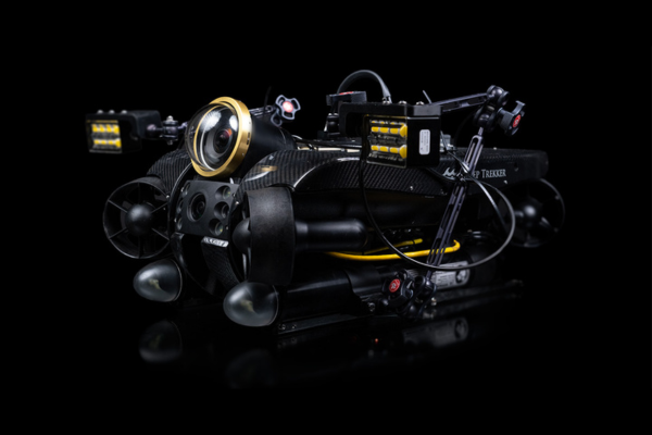
Discovery Camera and REVOLUTION ROV: Canadian integration triumph
Two Canadian underwater technology powerhouses, Voyis and Deep Trekker, have joined forces to achieve an exceptional integration: the successful fusion of Voyis' cutting-edge Discovery camera with Deep Trekker's REVOLUTION ROV (Remote Operating Vehicle). This landmark collaboration showcases the prowess of Canadian innovation and ingenuity, propelling the field of underwater surveys and inspections into an unprecedented era of advancement.
Deep Trekker's REVOLUTION ROV stands as a testament to Canadian engineering excellence. This robust underwater vehicle, designed to conquer the most unforgiving aquatic conditions, boasts unparalleled stability and maneuverability. With a unique rotating head facilitating optimal positioning of attachments such as imaging sonar and grabbers, the REVOLUTION ROV is poised to excel across a spectrum of tasks. Capable of descending to depths of up to 305 meters, the ROV employs six powerful thrusters for precise control in both vertical and lateral movements, even in challenging currents. This adaptable thruster configuration not only ensures stability but also fine-tuned adjustments during inspections and surveys. Its rugged construction, featuring a carbon fiber shell, anodized aluminum, stainless steel body, and sapphire lens cover, underscores its durability and reliability.
Voyis' Discovery Cameras, enhanced by the Nova Mini Lights, bring a new dimension to underwater exploration. These cutting-edge cameras capture 4K video with minimal latency while simultaneously generating high-resolution still images and IMU data. The resulting assets can be processed through edge computing to produce intricate 3D models. These capabilities find applications in intelligent ROV piloting and comprehensive inspections. The cameras produce clear stills suitable for advanced machine vision and 3D modeling, complemented by real-time image enhancement, an ultra-wide field of view (130°x130°), and distortion correction for comprehensive situational awareness. Designed with compactness in mind and incorporating integrated lights, along with DDS data architecture and ROS2 support, the cameras streamline vehicle integration, particularly for autonomy-driven applications.
A New Era in Underwater Exploration
The collaboration between Voyis and Deep Trekker was tested and proven successful during trials in Tobermory, Ontario. Both teams worked together to achieve this success and test the ROV capabilities for piloting and inspection, with the Discovery Camera.
By seamlessly integrating the Discovery Camera with the REVOLUTION ROV, professionals gain access to a suite of unparalleled tools for underwater surveys, inspections, and explorations. The amalgamation of the REVOLUTION ROV's ruggedness and maneuverability with the Discovery Camera's imaging precision and increased situational awareness opens new horizons for industries spanning marine research, aquaculture, defense and security, infrastructure inspection, and offshore energy asset inspection.
"We are excited to achieve this successful integration with Deep Trekker's REVOLUTION ROV, representing a significant stride in Canadian technology collaboration," said Chris Gilson, CEO at Voyis. "Together, we are pushing the limits of imaging technology and creating solutions that empower professionals to navigate and explore the underwater world with unmatched clarity."
Sam Macdonald, Managing Director at Deep Trekker, echoed this sentiment: "The seamless integration of Voyis' Discovery camera with our REVOLUTION ROV signifies a new chapter in underwater exploration. This harmonious blend of leading-edge technologies will reshape how professionals navigate and inspect underwater environments."
The combined efforts of Voyis and Deep Trekker herald a new era in underwater exploration and inspection, reflecting the excellence of Canadian innovation. With the successful integration of the Discovery Camera and REVOLUTION ROV, professionals can anticipate elevated capabilities, heightened precision, and transformative insights that will redefine industries dependent on precise underwater data.
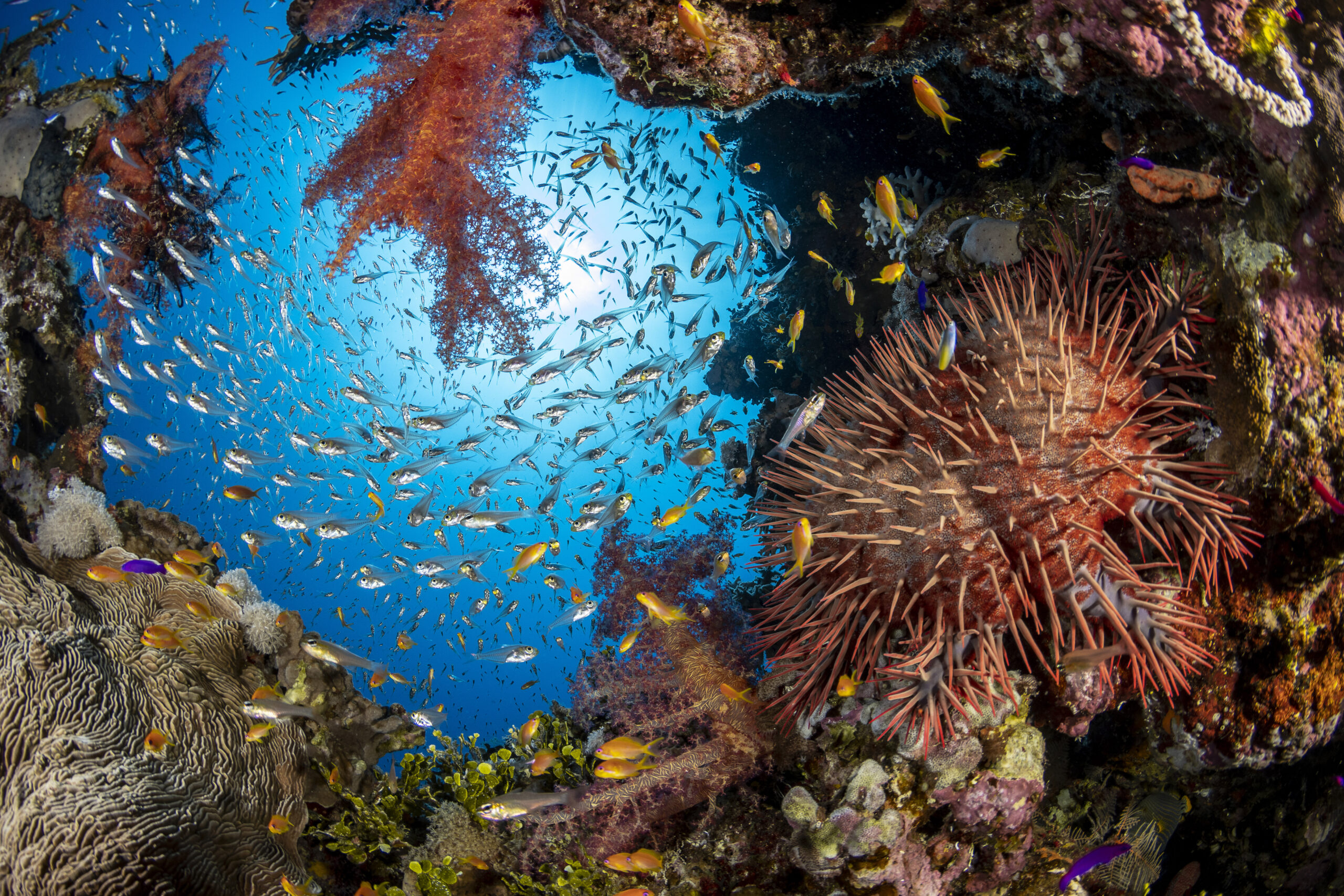
Ocean Census engages UNEP-WCMC data expertise in groundbreaking ocean discovery initiative
In a significant move to reveal the mysteries of the deep, Ocean Census is joining forces with the UN Environment Programme World Conservation Monitoring Centre (UNEP-WCMC). This strategic alliance will merge UNEP-WCMC's unparalleled data expertise with Ocean Census's ambitious scientific, exploration and conservation goals.
Launched by The Nippon Foundation and Nekton in April 2023, Ocean Census has set an ambitious target to discover 100,000 new marine species in the next decade. Through its global partner network, the initiative will generate open-access data for scientists, governments, decision-makers and the general public, fostering a collective understanding of marine biodiversity and promoting its sustainable and equitable conservation.
Although it’s estimated that between 1-2 million species inhabit our ocean, little more than 10-25% have been documented. Ocean Census is collaborating with partners from various sectors to bridge this knowledge gap. By leveraging state-of-the-art technologies such as DNA sequencing, high-resolution imaging and machine learning, the initiative will conduct a series of global expeditions to discover ocean life and gather new insights on marine ecosystems and biodiversity. A growing network of international taxonomists will then classify and describe these discoveries.
Ocean Census has already undertaken two pioneering expeditions with partners in the Barents Sea and in Johnston Atoll, Pacific Ocean and will soon embark on two major flagship expeditions, the first of dozens being planned.
UNEP-WCMC, a global leader in biodiversity knowledge, will support the management of the huge amount of data that will be generated during these expeditions, assisting in the development of a cloud-based system to store this knowledge.
Doing so provides a wealth of information to scientists, policymakers, the private sector and civil society. This work will draw from and contribute to ongoing efforts to document life in the ocean, in order to inspire philanthropists, governments, policymakers, businesses, scientists, the media and civil society, and encourage much-needed action to preserve and protect this fragile habitat.
Rowana Walton, Programme Officer in UNEP-WCMC’s Nature Restored team, emphasises “Our ocean is fundamental to life on Earth, yet the life it contains is being impacted and lost at an alarming rate. We need to act quickly to safeguard the wonders of the ocean for future generations, but we cannot protect what we don’t know exists. This project will significantly advance our understanding of ocean species such as sponges, which are relatively understudied despite the important role they play structuring habitats in shallow and deep waters.”
Ocean Census, with its diverse array of partners including scientific institutions, government entities, and media outlets, epitomises collaborative effort. The Nippon Foundation of Japan, a private, non-profit foundation for social innovation, and marine research charity Nekton, a UK-based marine science and conservation institute, are coordinating partner activities along with funding and managing the Ocean Census Science Network, species discovery, expeditions, and public and policy engagement activities.
Oliver Steeds, OBE, Director of Ocean Census, adds ‘‘Collaborating hand-in-hand with UNEP-WCMC underscores our commitment to establishing an openly accessible and equitable data system at the heart of Ocean Census. Together, we're not just exploring the ocean; we're ensuring that every discovery, every data point, can help inform the protection and sustainable governance of ocean life for generations to come.”
Charity PADI Aware Foundation, education agency Encounter Edu, and the Oceanographic Magazine are involved in the communication of the project, while institutions such as Wellcome Sanger Institute, Schmidt Ocean Institute, Oxford Nanopore Technologies, World Register of Marine Species, Monaco Explorations, Minderoo Foundation and the Ocean Exploration Trust are among the scientific research and expedition partners.
Seabed 2030 and SEABER announce new partnership advancing ocean exploration
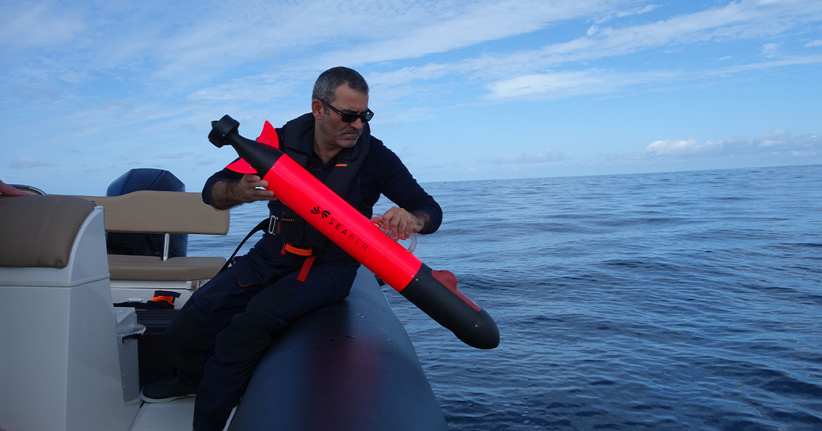
The Nippon Foundation-GEBCO Seabed 2030 Project has entered into a new partnership with SEABER, a French-based company that designs and manufactures autonomous underwater vehicles (AUVs) for research and commercial oceanographic applications. The two parties will work together in support of the global effort to achieve a complete map of the entire ocean floor.
Seabed 2030 is a collaborative project between The Nippon Foundation and GEBCO to inspire the complete mapping of the world’s ocean by 2030 and to compile all bathymetric data into the freely available GEBCO Ocean Map – it is also a formally endorsed Decade Action of the UN Ocean Decade. GEBCO is a joint programme of the International Hydrographic Organization (IHO) and the Intergovernmental Oceanographic Commission (IOC), and is the only organisation with a mandate to map the entire ocean floor.
Established in 2020, SEABER is the sole European company entirely dedicated to micro-AUVs capable of navigating depths of up to 300 metres and operating autonomously for eight to ten hours. The YUCO micro-AUV is designed for extensive use across the entire continental shelf and is equipped to carry various scientific instruments. Thanks to its accessibility, user-friendly interface, and an affordable pricing strategy, the YUCO has swiftly become a favoured tool within the oceanographic research community. Specifically, it serves as a complementary resource for ocean observation, extending the capabilities of traditional vessel-based manual measurements and fixed observatories with its micro-AUV technology.
This partnership brings together Seabed 2030's dedication to advancing the comprehensive mapping of the ocean, together with SEABER's technological developments and expertise in underwater exploration.
“Identifying technology gaps in bathymetric mapping and encouraging innovation in these areas is key to Seabed 2030’s mission,” commented Project Director Jamie McMichael-Phillips. “It’s a pleasure to welcome SEABER to our growing network of partners, and their range of AUVs will no doubt be invaluable in supporting our goal as they’re deployed on various missions.”
“Like Seabed 2030, we believe that everyone has a part to play in this journey of ocean discovery,” said Vidal Texeira, co-Founder and CEO of SEABER. “As such, we’re committed to building AUVs that are more affordable and accessible, while maintaining their reliability and efficiency.
“We look forward to collaborating with Seabed 2030 in a partnership that will greatly advance our understanding of the ocean.”
All data collected and shared with the Seabed 2030 project is included in the free and publicly available GEBCO global grid.
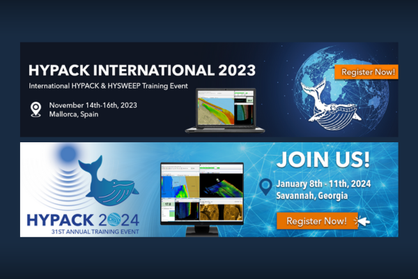
HYPACK announce two upcoming training events
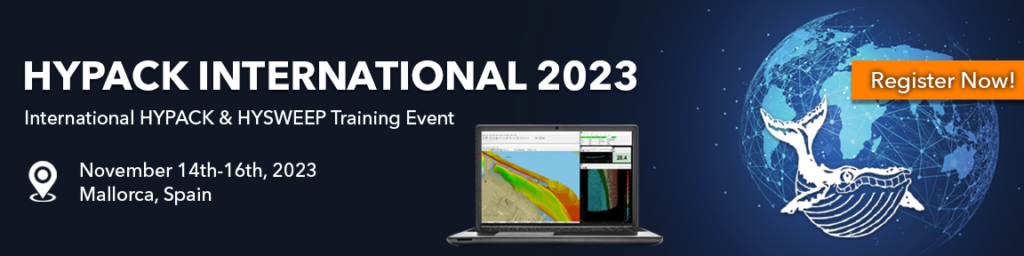
HYPACK International 2023 Training
November 14th-16th, 2023
Mallorca, Spain
Join us for our 1st HYPACK International Training Event on November 14th-16th, 2023 in Mallorca, Spain! The training will take place at the Meliá Palma Bay and will offer instruction on the newest features of HYPACK® 2023 and updates since the release. There will be a focus on HYPACK® and HYSWEEP® software for single beam, multibeam, lidar, and side scan. This training will be given in English. By attending, you will have exclusive access to all of our live training sessions and the ability to network with attendees and HYPACK employees. The last day to register is November 8th, 2023. This training is limited to 100 attendees, so make sure to reserve your seat now!
Click here to register and learn more about the event.
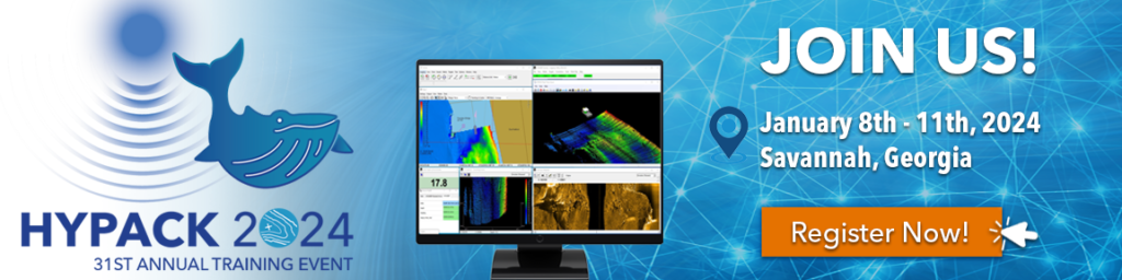
HYPACK 2024 Training Event
January 8th-11th, 2024
Savannah, Georgia USA
www.hypack2024.com
HYPACK 2024 | Join us for our 31st annual HYPACK Training Event on January 8th-11th, 2024 in Savannah, Georgia, USA. This training will offer instruction on the newest features of HYPACK® 2024 and training in HYPACK®, HYSWEEP® and DREDGEPACK® software. By attending you will have exclusive access to all of our live training sessions and the ability to network with attendees and exhibitors. We are also excited to announce that attendees will be able to see HYPACK in action from a live streamed demo at the hotel.
Click here to register and learn more about the event.

Underwater living: Deep dive site to become £100m research hub
DEEP, an ocean technology and exploration company, is investing £100m in the former National Diving and Activity Centre (NDAC) in Tidenham, Gloucestershire.
It says its aim is for a "permanent human presence" under oceans from 2027. The quarry will also be used to test out equipment like submersibles.
DEEP said the Tidenham site, which covers 50 acres, will be a "core part of a regional ecosystem in the South West of England" for development exercises for the company and others.
Steve Etherton, DEEP President, said: "We need to preserve the oceans. To do that we need to understand them.
"Through our innovative technology DEEP will enable scientists to operate at depth for extended periods of time and we hope, in some small way, will contribute to our understanding of this life-giving environment."
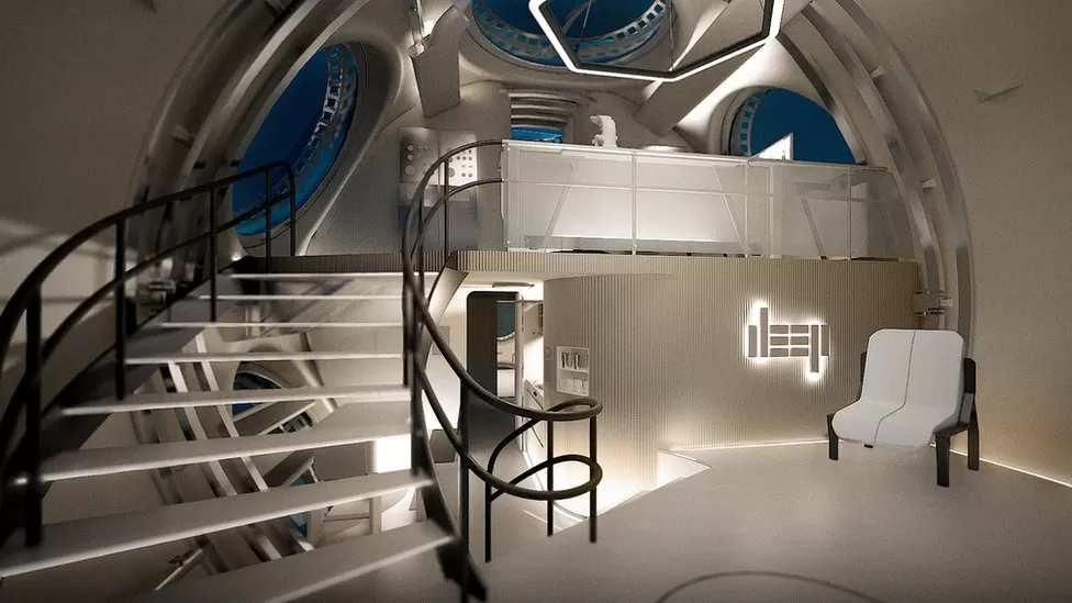
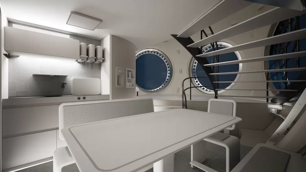
The company said it initially wants to develop technology that will allow scientists to live underwater at depths of up to 200m for up to 28 days at a time.
The company says it wants to develop "habitats" which could allow humans to live under the oceans.
The Tidenham location was selected because of the "unique cluster of relevant marine-engineering, diving, hyperbaric and submersible expertise, and links with the wider UK commercial and technical diving industry," it added.
When consulted over the plans, Forest of Dean District Council was told DEEP wanted to employ 100 people.
'Just the beginning'
The site had originally opened as the NDAC in 2003 and offered a range of above-ground activities but was best known for its many underwater attractions, installed at a range of depths down to 76m.
The quarry's maximum depth of 80m made the location popular not only with recreational scuba divers but also with technical, free and military divers.
But the site closed permanently last year, following enforced periods of inactivity during the Covid-19 pandemic.
Developing the site at Tidenham is "just the beginning" the company said.
DEEP believes it will have established a system of "semi-permanent" underwater human habitats by 2027.
Mike Shackleford, President, Global Services of DEEP said: "DEEP's facilities already house our prototyping and pre-production capabilities as well as advanced material testing infrastructure not found elsewhere in the UK, and this is just the beginning."
The company said it hoped the Tidenham campus would be "fully operational" by 2027.